Summit and upper flanks
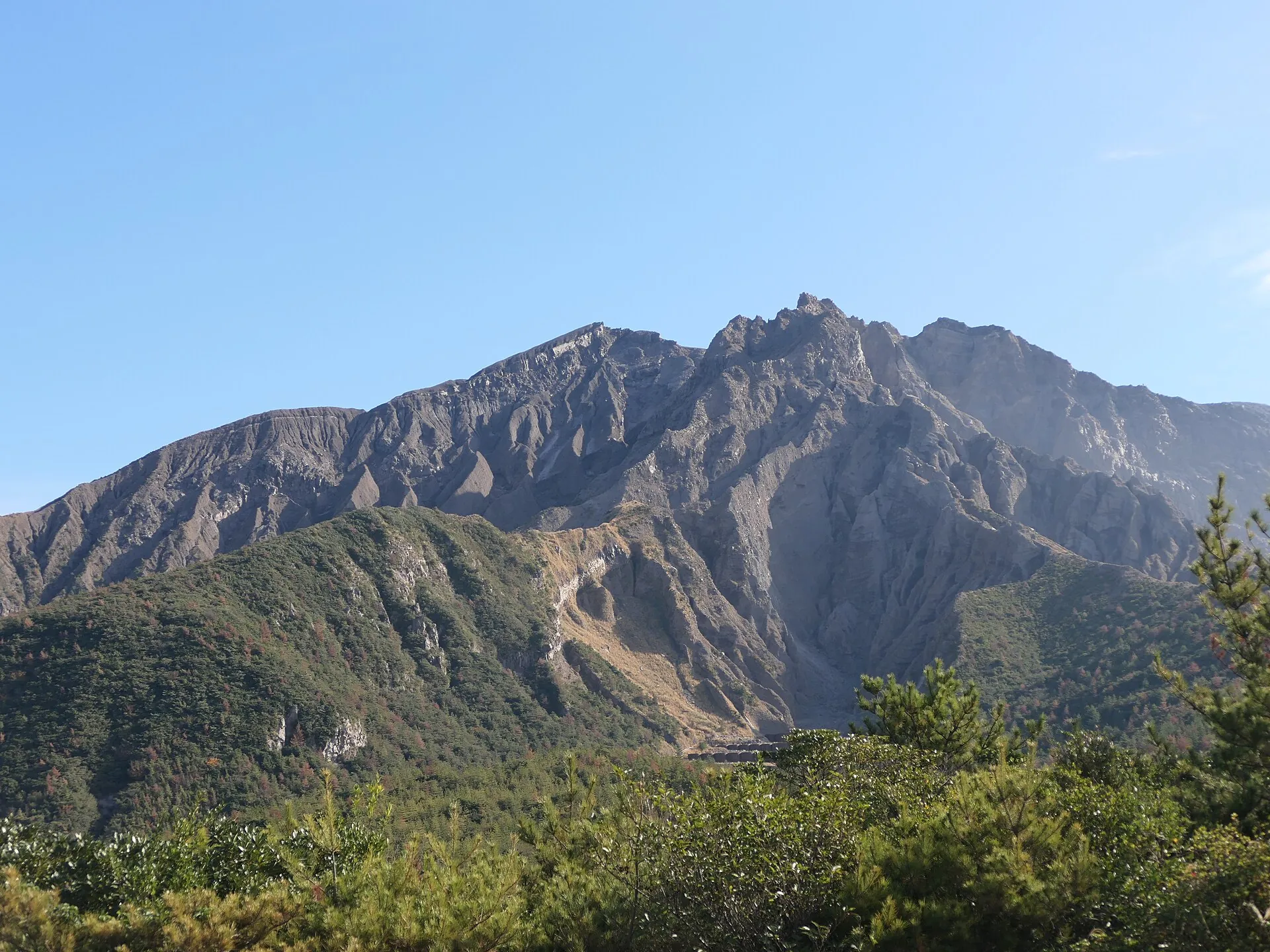
Minamidake (1,040 m) and Kitadake (1,117 m) are closed – not since 2022, but for decades. Inside the zone the JMA warns of ballistic blocks and pyroclastic flows; after heavy rain, mudflows are added to the list.
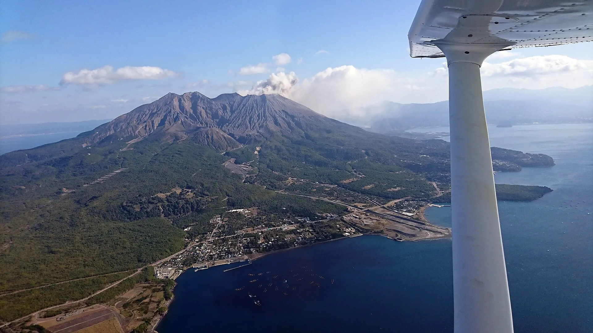
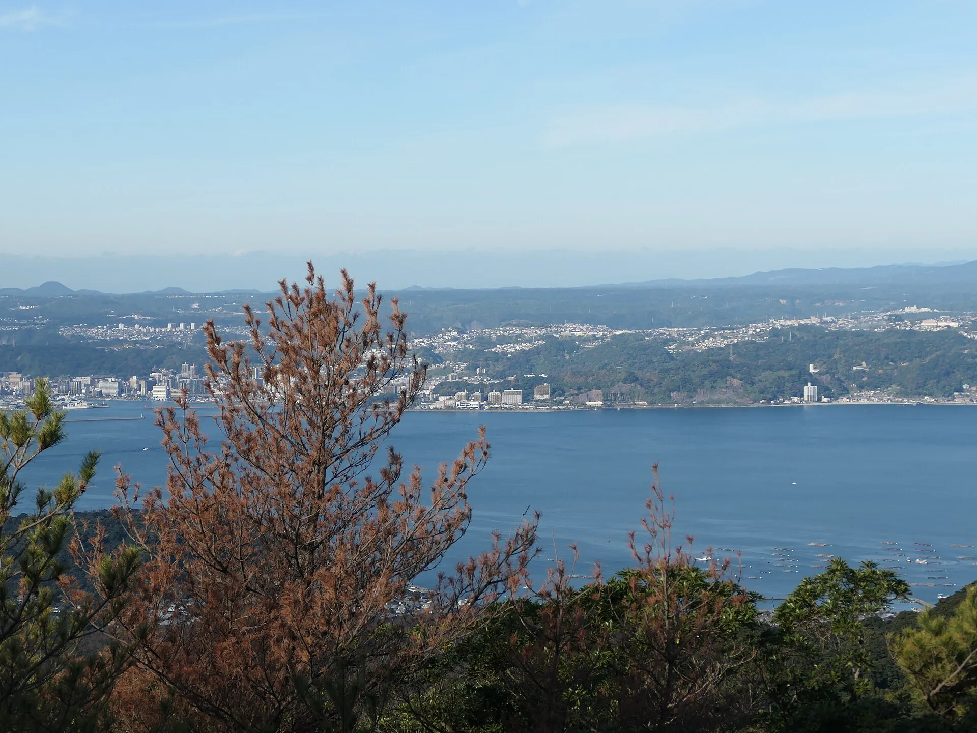
In the morning it faces the city – four kilometers of water, nothing more.
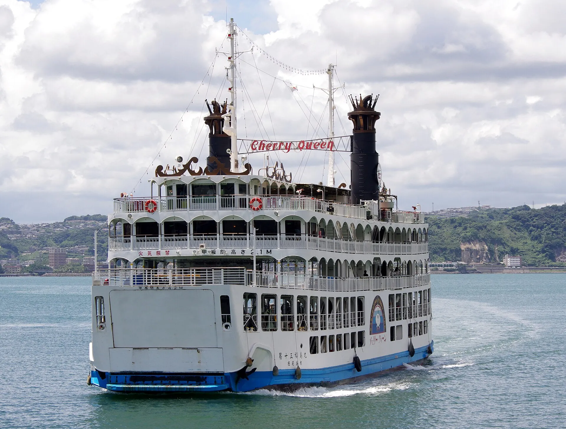
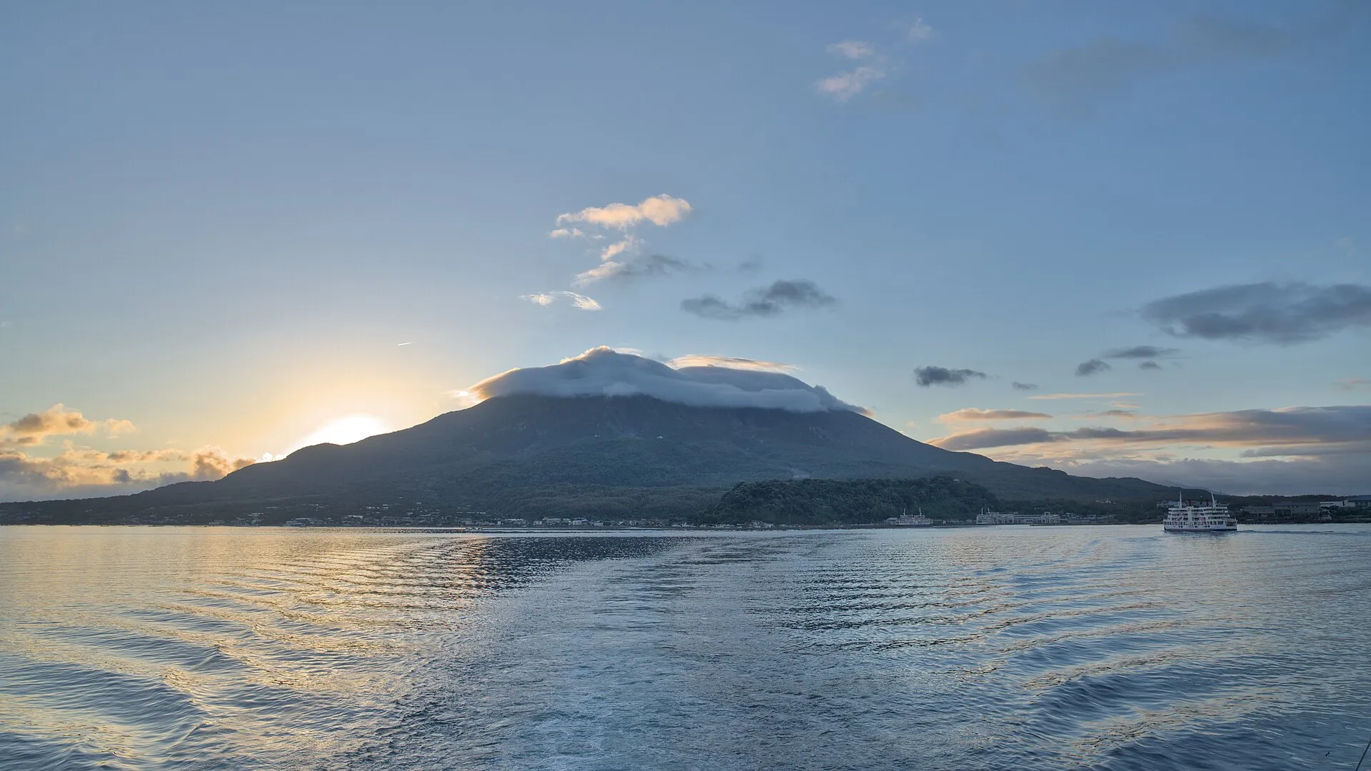
The ferry runs every 15 minutes and costs ¥250. It is also the island's means of evacuation.
At Yunohira the road ends: 373 meters, and nobody has been allowed higher for decades.
Scroll –
across the bay to the viewpoint
The Japan Meteorological Agency has kept Sakurajima at Alert Level 3 of 5 without a break since 27 July 2022: “do not approach the volcano”, with an exclusion zone of about two kilometers around the Minamidake and Showa craters. For visitors that does not mean closed. It means the summit is off limits and everything else is open. People live on the peninsula, the ferry runs every 15 minutes, and the viewpoints cost nothing.
Minamidake (1,040 m) and Kitadake (1,117 m) are closed – not since 2022, but for decades. Inside the zone the JMA warns of ballistic blocks and pyroclastic flows; after heavy rain, mudflows are added to the list.
The highest point on the island you are allowed to reach, at the 4th station of Kitadake. It looks onto the crater, the lava of 1914 and across the bay to Kagoshima. About 40 minutes from the port on the Island View Bus, 30 parking spaces, shops 9 am–5 pm.
15 minutes, every 15–20 minutes during the day, no reservation. Eruptions do not stop it – it is the island's evacuation route. Only typhoons and storms do. Since 1 October 2025 there are no departures between midnight and 4 am.
The Sakurajima Visitor Center at Nagisa Park is free, open daily 9 am–5 pm, with a cinema room, models of the big eruptions and live monitoring data. Next to it lies a 100-meter foot bath – also free; bring a towel.

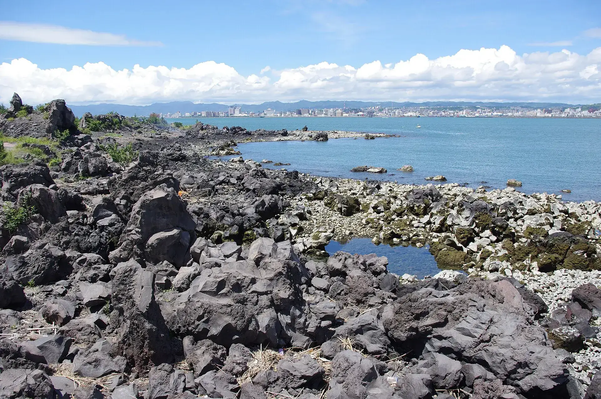
Photo: ブルーノ・プラス · CC BY-SA 4.0
Sakurajima is one of Japan's most active volcanoes – and a district of Kagoshima. You board the ferry by the aquarium, ride for 15 minutes, and step out onto a peninsula where radishes grow, buses run and concrete shelters stand along the roads.
From the port it is five minutes to Nagisa Park: a free foot bath, a hundred meters long, fed from a spring a thousand meters down. Behind it starts the lava trail, three kilometers across the field of 1914 to the Karasujima viewpoint – black, sharp-edged blocks with pines between them, and the towers of Kagoshima on the far shore. The Island View Bus circles the western half every 30 minutes and ends at Yunohira.
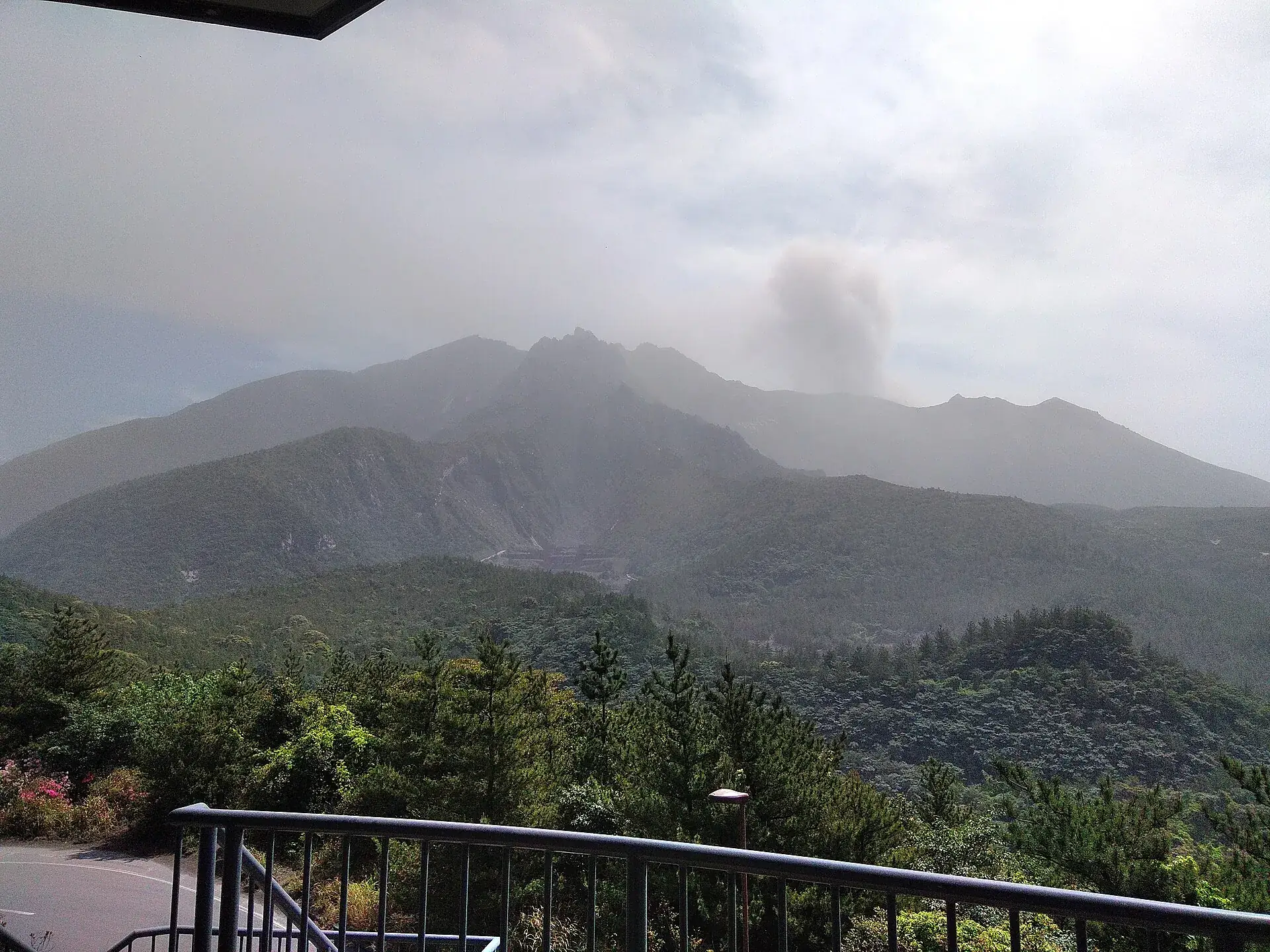
Small eruptions happen almost daily; the JMA counted seventeen between 18 and 21 September 2026 alone. What you usually see is a gray plume, and at night sometimes a glow above Minamidake. Whether anything shows on the day of your visit is up to the mountain – and whether the ash falls on the city or on the Osumi side is up to the wind.
Affiliate links to GetYourGuide: if you book, we earn a commission and the price stays the same. Prices and ratings as of 22 September 2026. The selection is thin here: only three listings carry Sakurajima in the title, the rest are Kagoshima city tours. No tour goes to the summit – that is banned. If you go on your own, the ferry (¥250) and an Island View day pass (¥500) keep you under ¥1,000. Prices were collected in euros.
At Sakurajima, Level 3 is the normal state, not an exception. The rules are aimed less at climbers than at people standing below when something happens above.
The exclusion zone of about two kilometers around the Minamidake and Showa craters lies in uninhabited upland. Entering it is prohibited under disaster prevention law, enforced with barriers, signs and police. Every visitor site is at least 2.5 km away.
The island has 32 concrete shelters against falling blocks, along roads and at viewpoints, plus 20 waiting halls at 20 evacuation harbors. The four-language boards at the port show where the nearest one is – take a moment when you get off.
Mask or cloth over mouth and nose, glasses instead of contact lenses, a hat and an umbrella. Locals carry the umbrella against ash, not rain. Protect cameras and electronics. The JMA publishes a daily ash forecast.
Only at Alert Level 4 do the authorities prepare to evacuate residential areas, and at Level 5 they do it – by ferry or overland to Tarumizu. It has happened once: on 24 July 2022, when blocks flew 2.4 km. Three days later the level was back at 3.
| Ferry Kagoshima – Sakurajima, adults · children ¥130 · infants free | ¥250 (about US$1.70) |
| Ferry, car under 3 m / 3–4 m / 4–5 m, one way including driver | ¥1,280 / 1,700 / 2,350 (about US$9 / 12 / 16) |
| Ferry, bicycle / moped up to 125 cc / motorcycle up to 750 cc / above | ¥160 / 330 / 480 / 640 |
| Island View Bus, single ride · day pass ¥500 (children ¥120 / ¥250) | ¥230 (about US$1.60) |
| CUTE day pass: city buses, tram, City View, Island View and the ferry · children ¥700 | ¥1,400 (about US$10) |
| CUTE pass for two days · children ¥1,050 | ¥2,100 (about US$14) |
| Visitor center, Yunohira, Arimura, the Kurokami torii, the foot bath at Nagisa Park | free |

Photo: Hyppolyte de Saint-Rambert · CC BY 4.0
From Kagoshima-Chuo it is tram, ferry and bus – about 40 minutes in all to Sakurajima port. On the peninsula itself there is no way up, only a ring road of 36 kilometers (22 miles) and the Island View Bus loop.
| Sakurajima ferry · Kagoshima port → Sakurajima port, about 15 minutes | ¥250 for adults, ¥130 for children, cars from ¥1,280 including the driver. First departure 4:00 am from Sakurajima and 4:30 am from Kagoshima, last at 11:00 and 11:30 pm; every 15–20 minutes during the day, every 30–60 in the evening. Nothing runs between midnight and 3:59 am, a change made on 1 October 2025. No reservations; at night the city keeps a crewed vessel ready for ambulances. |
| Island View Bus · loop around the western half, 12 stops | ¥230 per ride, ¥500 for a day pass, included in the CUTE card. From the port about every 30 minutes between 9:30 am and 4:30 pm; a full loop takes 55–60 minutes, Yunohira about 40. It stops at the visitor center and the Karasujima and Akamizu viewpoints. When roads close after an ejection, Yunohira is the first stop to be dropped. |
| Lava trail from Nagisa Park · 3 km (1.9 miles), about 1 hour one way | Free and level, across the lava field of the 1914 Taisho eruption to the Karasujima viewpoint; one of “Japan's 100 finest walking paths”. No shade – go early or late in summer, and wear firm shoes because of the sharp lava. |
| Car or rental bike · ring road 36 km, 2–3 hours with stops | The Arimura lava viewpoint is 17–20 minutes by car (a 1 km loop through the 1946 lava field, where you often hear the crater rumble), the buried torii at Kurokami about 30 minutes. The visitor center advises against cycling up to Yunohira because it is too steep; Arimura takes about 1.5 hours by bike. Return by ferry or overland via Tarumizu. |

Photo: Jakub Hałun · CC BY-SA 4.0
Japan's largest eruption of the 20th century produced 1.58 cubic kilometers of magma, killed 58 people, injured 112 and destroyed about 2,140 houses. The lava closed the strait to the east: since then Sakurajima has not been an island but part of the Osumi Peninsula.
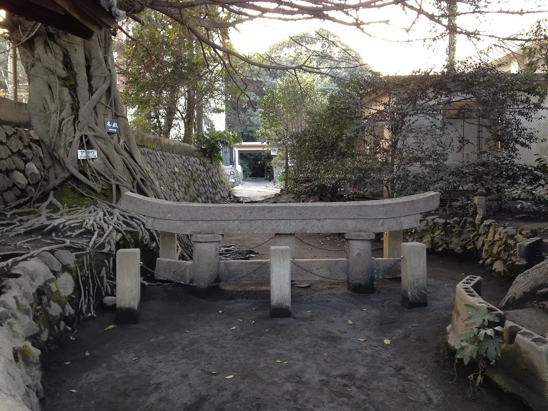
At Kurokami the three-meter gate of the Haragosha shrine sank into pumice and ash in a single day, until only the top crossbeam was left above ground. The village head forbade digging it out, as a reminder. It has been a prefectural natural monument since 1958 and now stands beside the middle school, thirty minutes by car from the port.
The Showa eruption followed in 1946, its lava reaching the coast in May; the Arimura viewpoint sits on that field today. The summit crater of Minamidake has been working without a break since 1955, joined at times by the Showa crater since 2006. In the record years from 2009 to 2011 the JMA counted 545 to 994 explosions a year; in 2025 there were 361 eruptions, twelve of them with columns above 3,000 meters.

Photo: そらみみ · CC BY-SA 3.0
Without a car: From Kagoshima-Chūō (Shinkansen station) on tram line 2 to Suizokukan-guchi (about 15 minutes) and 5 minutes on foot to the ferry terminal, or on the Kagoshima City View bus to Sakurajima Sanbashi. Ferry 15 minutes, then the Island View Bus. The CUTE pass covers tram, City View, ferry and Island View (¥1,400), so it pays off from the second bus ride. From Kagoshima Airport, limousine bus to Kagoshima-Chūō/Tenmonkan (about 40–50 minutes).
By car: Car on the ferry (from ¥1,280 one way, entry via the car line at Kagoshima port, no reservation) or overland: Sakurajima has been joined to the Ōsumi Peninsula since 1914; from Kagoshima around the bay about 1.5 hours. Parking at the Sakurajima ferry terminal, visitor center, Nagisa Park, Yunohira (30 spaces), Arimura and Kurokami. Paid parking garage at the Kagoshima terminal.
Fall to spring (October–April): clear air, cool temperatures, and in the winter half-year the wind mostly blows east – the ash then falls on the Ōsumi side, not on Kagoshima and the western half with Yunohira. In summer (June–September) the wind turns southwest, Kagoshima and the west side get ash, plus heat, the rainy season in June and typhoons until October. For eruption photos, wait at Yunohira or Arimura in the evening: nighttime glow at Minamidake is often visible under a clear sky. In the morning check the JMA ashfall forecast and the wind. After heavy rain watch for lahar warnings along the stream beds.

Photo: Hyppolyte de Saint-Rambert · CC BY 4.0
Yes. As of 23 September 2026 Alert Level 3 applies with a 2 km exclusion zone around the craters – the normal state since July 2022. The ferry, the Island View Bus, the visitor center, Yunohira, Arimura and the Kurokami torii are all accessible. Only at Level 4 or 5 would residential areas be cleared.
No, climbing is banned. The highest accessible point is the Yunohira observatory at 373 meters, at the 4th station of Kitadake – about 40 minutes from the port on the Island View Bus, or reachable by car.
¥250 for adults and ¥130 for children, one way; a car costs ¥1,280 to ¥2,350 including the driver depending on length, a bicycle ¥160. You pay in cash, by credit card or with an IC card, and there are no reservations. The ferry is included in the CUTE day pass (¥1,400).
On the Island View Bus, about every 30 minutes from the port via the visitor center, Karasujima, Akamizu and Yunohira – ¥230 per ride, ¥500 for a day pass, just under an hour per loop. For Arimura and Kurokami take the local bus toward Tarumizu, or a car or rental bike.
Small eruptions happen almost daily and are harmless for visitors outside the 2 km zone. If material is ejected or an alarm sounds: get into a building or one of the 32 concrete shelters and follow instructions. In a major event people leave through the 20 evacuation harbors by ship or overland to Tarumizu; the signs are in four languages.
October to April: clear air, comfortable temperatures, and the winter wind usually carries the ash east, away from Kagoshima and Yunohira. In summer it falls on the city and the western side, and the rainy season in June and typhoons into October come on top. In the evening a glow above Minamidake is often visible.
Every 15–20 minutes during the day, every 30–60 minutes in the evening, crossing 15 minutes. First departure 4:00 am from Sakurajima and 4:30 am from Kagoshima, last 11:00 and 11:30 pm. Since 1 October 2025 there is no ferry at night between midnight and 4 am.
Mask or cloth over mouth and nose, glasses instead of contact lenses, umbrella and hat, protect cameras and electronics. In Kagoshima the city collects ash in yellow “kokuhai” bags and sweeps the streets with sweeper trucks. The JMA publishes a daily ashfall forecast.
In the open area the risk is low: all tourist facilities are at least 2.5 km from the craters, and shelters stand along roads and at viewpoints. Real risks are ash for the airways, blocks in unusually strong explosions (in 2022 they flew 2.4 km) and lahars after heavy rain.
Very. The ferry ride is short, the visitor center free and hands-on, the footbath a hit, and the bus saves walking. Children pay ¥130 on the ferry, one preschooler per adult rides free. Pack a mask for the little ones in case of ash.
Half a day is enough for the ferry, visitor center, footbath and the bus loop to Yunohira. If you want Arimura, the Kurokami torii and the island loop too, plan the whole day – best with a car or rental bike and the return at sunset.
Sources · accessed on 22 September 2026