Volcano·Guide
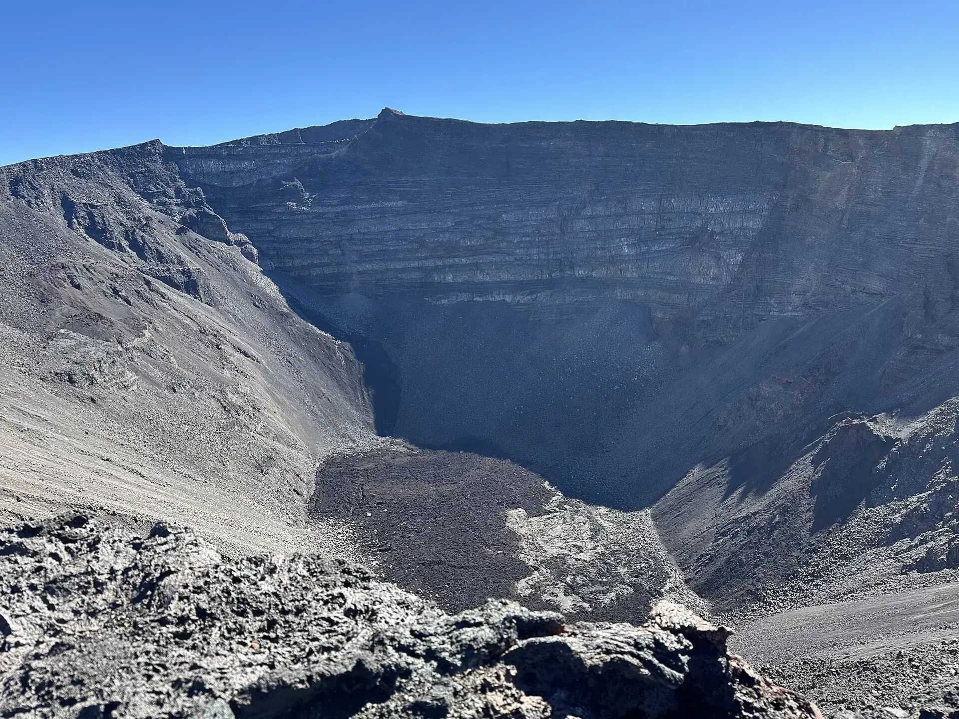
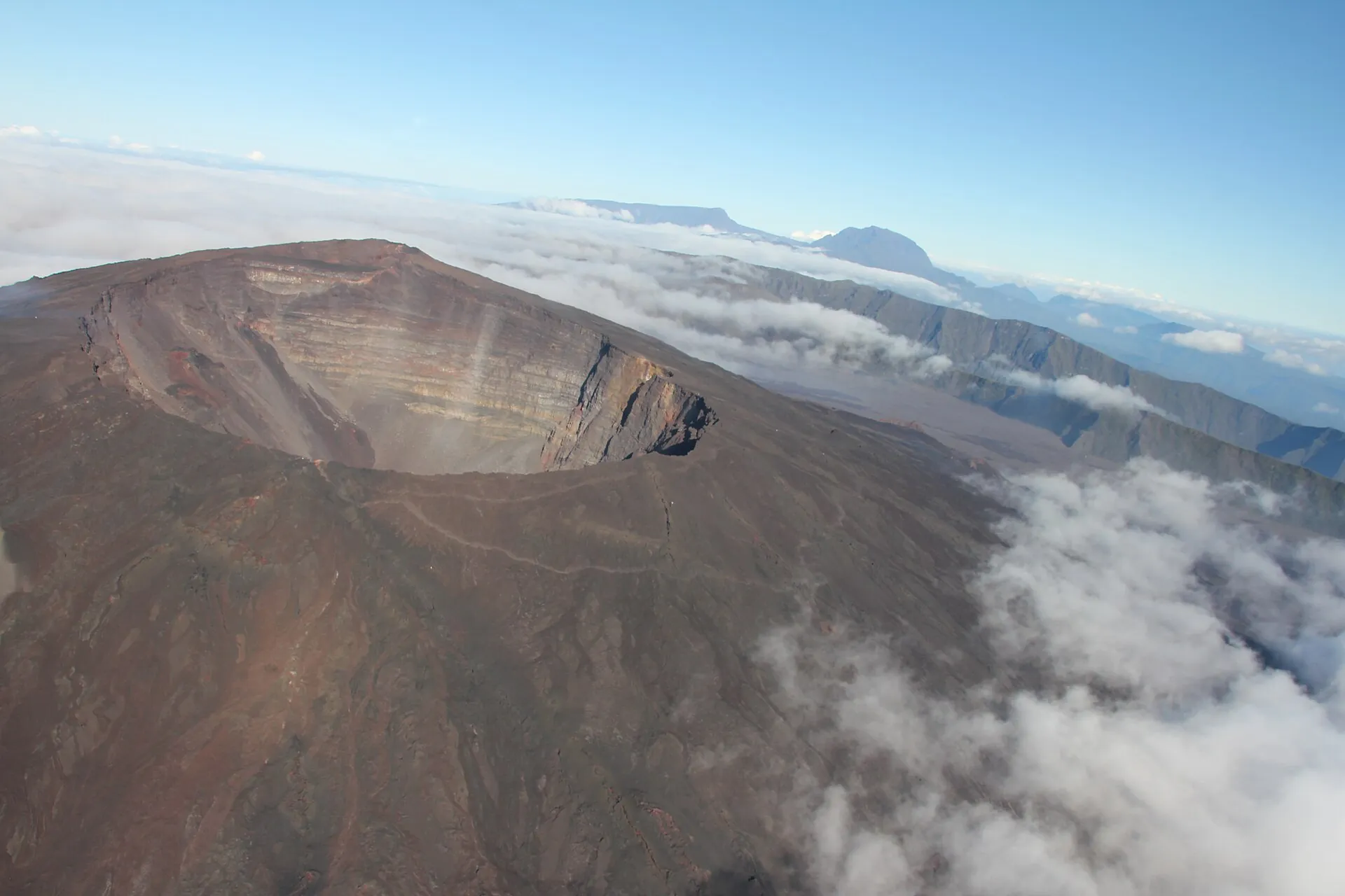
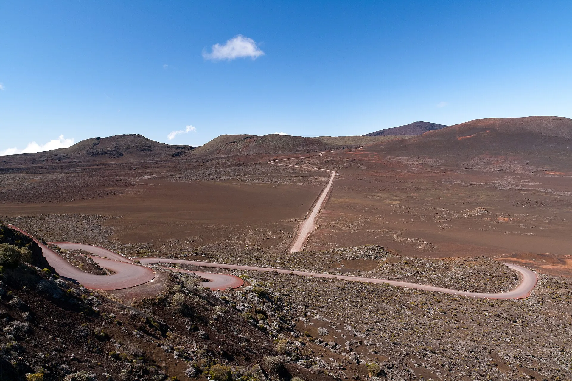
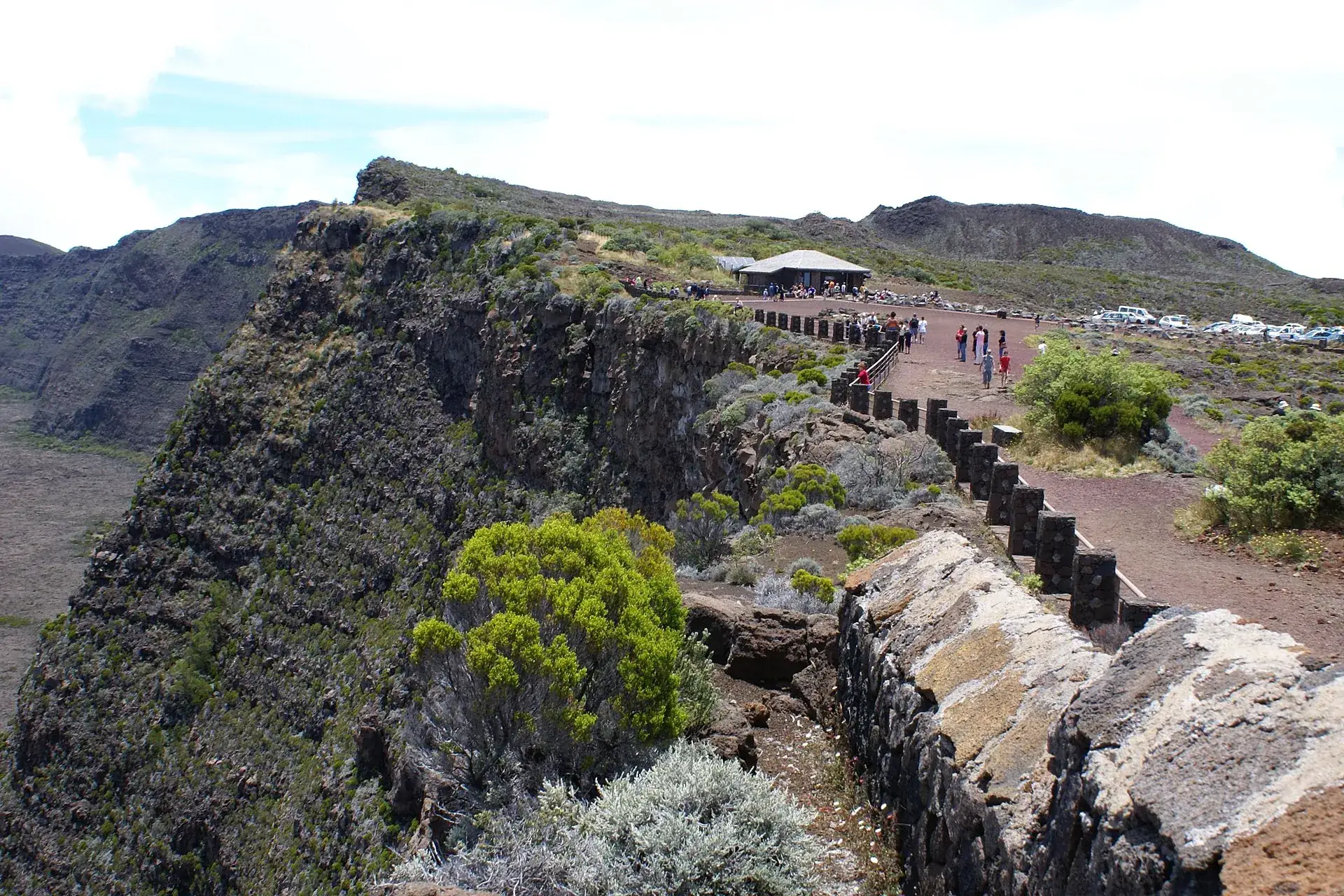
The Route forestière du Volcan winding across the reddish-brown Plaine des Sables on Réunion The viewpoint at Pas de Bellecombe-Jacob with its wall and visitors on the edge of the Rempart, the parking lot behind Looking into the Dolomieu crater of Piton de la Fournaise: vertical, layered walls, the gray crater floor far below

Piton de la Fournaise

The Route du Volcan crosses the Plaine des Sables: 25 km (15 miles) of switchbacks, red ash, not a tree.

The road ends at Pas de Bellecombe. Below lies the Enclos – 13 by 9 km (8 by 5.6 miles) of lava.

Six kilometers on, the Dolomieu: a hole 350 m (1,150 ft) deep since the collapse of 2007.

Scroll –
down into the Enclos

As of 23 September 2026'Vigilance' phase: the Enclos is open – on two trails

Piton de la Fournaise is one of the most active volcanoes on Earth: 46 eruptions since 1998, the latest from 13 February to 12 April 2026, when lava crossed the coastal road RN2 and reached the sea. Since 7 May 2026 the vigilance phase of the ORSEC plan has applied again: the upper Enclos can be walked on two marked trails, without a ticket, without a guide. But the OVPF observatory keeps measuring inflation of the summit – the mountain is under pressure, and a return to 'alerte' is possible at any time. Then the gate is shut.

Open
2trails

Upper Enclos: Dolomieu and Cratère Caubet

Released under arrêté no. 2026-627: Pas de Bellecombe – Formica Léo – access trail to the observation point on the north rim of the Dolomieu, and Formica Léo – Sentier Rivals – Cratère Caubet. Leaving the white markings is prohibited.

parking lot, gate, trailsfree
Closed
3closures

Sentier Kapor, lava platform, Dolomieu loop

The Sentier Kapor has been under lava since 2026 and is closed. The new 8.5-hectare (21-acre) lava platform at the sea is off limits. Walking around the Dolomieu has been permanently prohibited since the 2007 collapse – the rims break away.

Caubet – Belvédère section closed for years
Open
RN2

Lower Enclos: Route des Laves, lava tubes

The coastal road RN2 through the Grand Brûlé has been open to traffic again since 28 May 2026. The lava tubes of 2004 and 2007 and the northern edge of the 2026 lava can be reached via the Sentier des Laves.

tube tours charge a feefree
Sources: press release of the prefecture of La Réunion, 7 May 2026 (return to the vigilance phase, arrêté préfectoral no. 2026-627); OVPF-IPGP daily bulletin of 21 September 2026 (no eruption, 34 shallow and 6 deep earthquakes, continued inflation); ONF trail map; La 1ère, 7 May 2026. Current phase: prefecture press releases · daily state of the volcano: OVPF bulletin.
  1. 28 Nov 2025Vigilance

    After two and a half years of quiet, the prefect declares the 'vigilance' phase again; intrusions on 5 December and 1 January each bring a brief Alerte 1.

  2. 18–20 Jan 2026Short eruption

    33 hours on the north flank near Piton Jacob, Alerte 2-1, Enclos closed.

  3. 13 Feb – 12 Apr 202660-day eruption

    Eruption on the south-southeast flank. Alerte 2-2 on 12 March, the RN2 is closed; at 8:02 a.m. on 13 March the lava crosses the road, on 16 March it reaches the sea. 30–37 million m³ of lava, 8.5 hectares (21 acres) of new land.

  4. 7 May 2026Back to vigilance

    The Enclos partly reopens: two trails in the upper part, lava tubes and the Sentier des Laves below. On 28 May the RN2 is open to traffic again.

  5. 23 Sep 2026Today

    No eruption, but continued inflation at the summit (OVPF bulletin of 21 September 2026). The trails are open – as long as the prefecture does not close them.

Hikers on the rough gratons lava in the Enclos Fouqué, behind them the Rempart and a sea of clouds over Réunion
In the Enclos: six kilometers of lava to the crater, and the clouds come from below.

Photo: Olaf2 · CC BY-SA 4.0

The experienceDown more than 500 steps into a sea of lava

The parking lot sits at 2,311 m (7,582 ft) on the edge of a wall. At seven in the morning it is 4 °C (39 °F) here, and down in the Enclos the day begins: a caldera 13 by 9 km (8 by 5.6 miles) in which almost everything this volcano does takes place – 98 percent of its eruptions stay inside it.

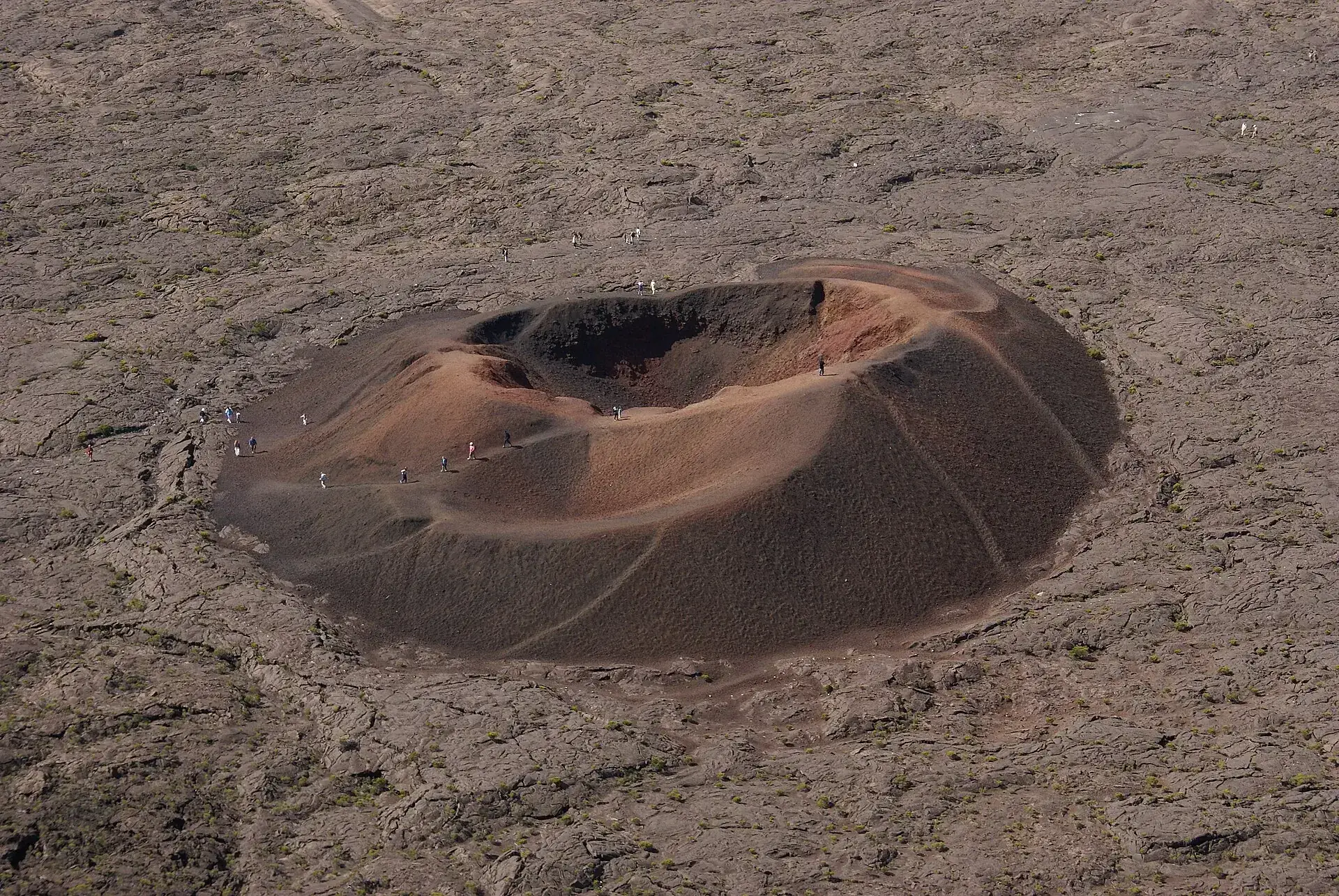
First 550 m along the Rempart, then the gate, then the stairway: more than 500 steps down the wall. At the bottom stands Formica Léo, a red double cone so small and perfect it looks placed there. You walk around it, not up it – the park asks you not to, the erosion is too great.

After that there is no trail, only white paint marks on the lava. They lead to where the Chapelle de Rosemont stood until 2018, a lava shelter that a flow covered. Then it is about 3.5 km (2.2 miles) of steady climbing over gratons: rough, sharp-edged, hollow-sounding. No shade, no water, no phone signal.

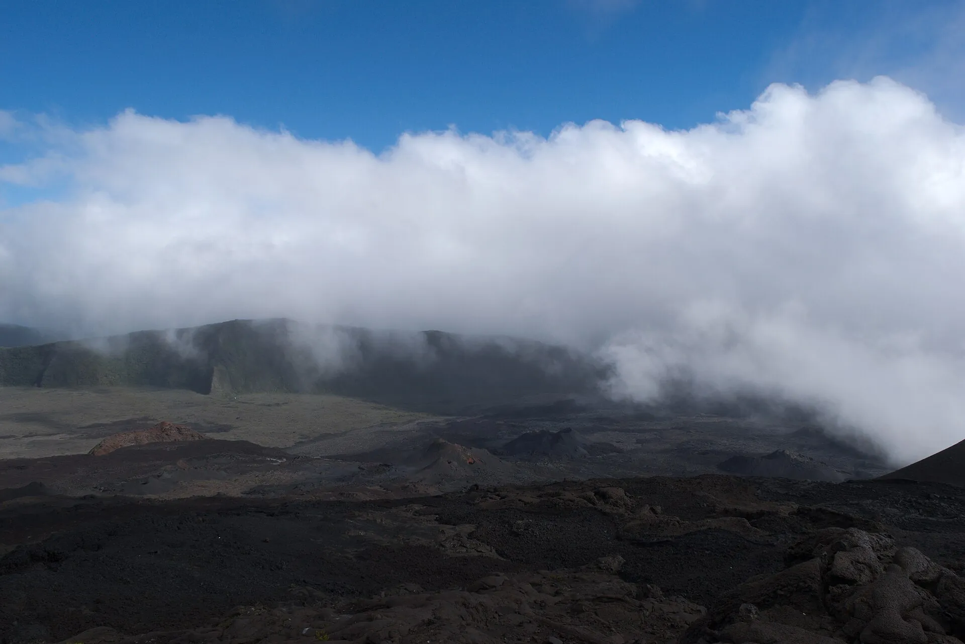
The observation point on the north rim of the Dolomieu is at 2,483 m (8,146 ft). The crater is a kilometer long, 750 m wide and, since the collapse of April 2007, about 350 m (1,150 ft) deep; the white lines along the rim are meant seriously. Arrive late and you see none of it: around midday the trade wind brings the clouds up from the sea, and the Enclos is in fog within minutes. That is why you are at the parking lot at seven – and the stairway comes again at the end, this time uphill.

Affiliate links to GetYourGuide: if you book, we earn a commission and the price stays the same. Prices and ratings as of 22 September 2026. A guide is not required on the open trails. Guided hikes do not enter the Enclos during an 'alerte' – ask the operator beforehand where they go instead.

The rulesNo ticket, no guide – but the prefect decides

Access to the Enclos depends on the phases of the ORSEC plan 'Piton de la Fournaise'. The prefect of La Réunion triggers them on the basis of OVPF data, the ONF shuts the gate, the gendarmerie and mountain rescue clear the Enclos. Four phases you need to know.

Now
1

Vigilance

Eruption possible within days to weeks. Access to the upper Enclos only on the marked trails maintained by the ONF; leaving the markings is prohibited. In force since 7 May 2026.

Enclos closed
2

Alerte 1

Magma is rising, an eruption is possible within minutes or hours. The entire Enclos – upper and lower part, Grandes Pentes – is closed and cleared. Most recently on 1 January 2026 after a seismic crisis at 4:47 a.m.

Enclos closed
3

Alerte 2-1 and 2-2

Eruption under way. 2-1: inside the Enclos with no particular danger, RN2 open. 2-2: lava threatens infrastructure – declared on 12 March 2026 when the flow was less than 700 m (2,300 ft) from the RN2; road closed between PR 78 and PK 82, exclusion zone at sea.

Reopening
4

Sauvegarde

Eruption over. After surveys by the OVPF and the ONF, the Enclos is reopened step by step – in 2026 that took from 12 April to 7 May.

What it costs · as of 09/2026
Enclos Fouqué, Pas de Bellecombe-Jacob parking lot, all trailsfree
Cité du Volcan in Bourg-Murat, adults · reduced (children 4–12, students, over 65) €6 · under 4 free€9
Cité du Volcan, 4D cinema supplement€2
Helicopter flight over the Enclos, Plaine des Sables and craters, 25–55 minutes (operator prices)€205–365
Bus Car Jaune S2 Saint-Pierre – Bourg-Murat, short trip (approximate)about €2
Sources: prefecture press releases of 2 July 2023, 1 January 2026, 18 January 2026, 12 March 2026 and 7 May 2026 (definition of the phases); museesreunion.fr (Cité du Volcan, prices and hours); Hélilagon, Corail Hélicoptères, Mafate Hélicoptères (flight prices 09/2026). The full text of the ORSEC plan was not available; the 'Alerte 2-3' and 'Sauvegarde' levels are described only by tourism portals. The prefecture names no fines; private guides mention up to €750 – not officially documented.
Formica Léo, a small red double cinder cone in the middle of the gray lava field of the Enclos Fouqué, tiny hikers at its edge
Formica Léo, 20 minutes from the gate: the short version – and the cone you are asked not to climb.

Photo: B.navez · CC BY-SA 3.0

Ways upTo the Dolomieu, to Formica Léo, to Cratère Caubet – or into the air

All trails start at the Pas de Bellecombe-Jacob parking lot. The national park's figures are the most reliable; tourism portals reckon a little shorter.

The options · as of 09/2026
Ascension du cratère Dolomieu (PR 9, white markings) – 550 m along the Rempart, gate, stairway with more than 500 steps, Formica Léo, former site of the Chapelle de Rosemont, then 3.5 km (2.2 miles) over gratons lava to the observation point on the north rim (about 2,483 m / 8,146 ft); same way back. National park: 12.8 km (8 miles), 596 m (1,955 ft) of climbing, 'assez difficile'6 hours · free
Formica Léo (short version) – from the gate down the stairway to the red cinder cone (about 2,202 m / 7,224 ft), about 1.5 km (1 mile) each way; back up the same stairway. Doable with younger children20 minutes each way · free
Sentier Rivals to Cratère Caubet – south from Formica Léo; the Caubet – Belvédère sur Château Fort section remains closed. Released under arrêté no. 2026-627free
Helicopter flight – from Pierrefonds (Saint-Pierre) or Saint-Gilles/L'Éperon over the Enclos, Plaine des Sables and into the Dolomieu; during an eruption only with prefecture approval. Hélilagon 45 min €319, 55 min €364; Corail 45 min €320; Mafate Hélicoptères 25–30 min €20525–55 minutes · €205–365
A dense bank of cloud pushing over the edge of the Rempart into the Enclos Fouqué, the dark lava field below
This is what the Enclos looks like around midday. Start at seven and you are already on the way back.

Photo: Auregann · CC BY-SA 4.0

Good to knowGetting there, best time, tips

Getting there

Without a car: No bus runs to Pas de Bellecombe. Car Jaune line S2 (Saint-Pierre – Les Plaines – Saint-Benoît) stops in Bourg-Murat at the Cité/Maison du Volcan, travel time from Gare de Saint-Pierre around 40–55 minutes, fare around €2–5 depending on the route; Carsud T12 serves Plaine des Cafres and the start of the Route forestière hourly (not on Sundays, 5:30 a.m.–6:30 p.m.). From Bourg-Murat, 25 km (15.5 miles) of road remain to the parking lot – only by rental car, taxi or tour.

By car: From the RN3 in Bourg-Murat, turn onto the Route forestière du Volcan (RF5) at the Cité du Volcan: 25 km (15.5 miles), around 45 minutes in tight hairpin bends via Nez de Bœuf (2,136 m / 7,008 ft), Pas des Sables (2,350 m / 7,710 ft) and the Plaine des Sables to the parking lot Pas de Bellecombe-Jacob (2,311 m / 7,582 ft; approx. 100–150 spaces, free, toilets, relais with drinks and snacks). A normal car is sufficient; the track across the Plaine des Sables is partly rough. Driving off the road is prohibited (park rule: motor vehicles only on classified roads, parking only in designated spaces). On eruption days the crowds are enormous – then traffic is controlled by the Gendarmerie and the municipality of Le Tampon.

  • From Saint-Pierre · approx. 1 h 30 (RN3 approx. 40 min according to bus travel time, RF5 approx. 45 min)
    RN3 to Bourg-Murat (Le Tampon / Plaine des Cafres), then RF5 Route du Volcan (25 km / 15.5 miles)
  • From Saint-Denis · approx. 2 h 15
    RN2 to Saint-Benoît, RN3 via Plaine des Palmistes to Bourg-Murat, then RF5
  • From Saint-Gilles-les-Bains · approx. 2 h
    Route des Tamarins/RN1 to Saint-Pierre, RN3 to Bourg-Murat, RF5

Best time to go

Dry season May to November (southern winter): little rain, reliable trade wind, but cold – Météo-France gives daytime highs around 14 °C and night values around 4–5 °C for Bellecombe-Jacob, frost already occurs in the Plaine des Cafres. Even in the dry season it rains a lot on the volcano's eastern flanks. Time of day matters more than the month: the Parc national advises starting at 7 a.m., because around midday clouds, rain or, under clear skies, heat set in; in the early morning the Enclos is most likely to be clear. January to March is the rainy and cyclone season, April and December are transition months. Anyone who wants to see lava cannot plan for it – eruptions announce themselves days to weeks in advance ('vigilance'), but that is exactly why the Enclos is then closed.

Who it suits

Children
Up to Formica Léo (20 minutes from the gate) feasible even for younger children, though with over 500 steps back up. The full Dolomieu hike (12.8 km / 8 miles, 6 h, 600 m / 1,970 ft of elevation gain, no shade) is only suitable for experienced school-age children; the Parc national explicitly urges warm clothing for children.
Minimum age
none prescribed; helicopter: toddlers under 2 fly free with Hélilagon
Fitness
Parc national: 'assez difficile' – long but technically easy hike over rough gratons lava; the staircase at the Rempart is the steepest part, uphill at the very end of the day.
Altitude
Between 2,200 and 2,500 m (7,200–8,200 ft) – usually unproblematic for healthy people, but adjust breathing and pace.
Wheelchair
Viewpoint with orientation table at the parking lot yes; Enclos no (staircase).
Dogs
In the core of the Parc national de La Réunion, dogs are generally allowed; according to park rules, leashes are mandatory only in the Roche Écrite massif. No specific dog rule for the Enclos was found; on the staircase and the sharp-edged lava, dogs are in any case badly placed.
Clothing
Layering: in the morning at Pas de Bellecombe 4–5 °C, during the day in the Enclos under clear skies heat and extreme UV radiation, then fog and icy wind. Windbreaker, hat, sun hat, sunglasses, sunscreen, rain protection, 1.5–2 liters of water, headlamp, charged phone with map.
Footwear
Sturdy hiking boots with a grippy sole; gratons lava is sharp and slippery, sneakers are not enough.

Tips you will need on site

  • Check two pages the evening before: the OVPF daily bulletin and the prefecture's press releases (or the ONF trail map). If it says 'Alerte', the gate is closed – then plan for Piton Bert or the Route des Laves.
  • Be at the parking lot at 7 a.m.: the Parc national recommends exactly that, because the Enclos fogs up around midday; besides, the 100–150 parking spaces fill up early on weekends.
  • White markings are the only orientation in the lava field – no shortcuts, do not leave tissues behind (they look like markings), do not cross the white boundary lines at the crater rims.
  • The staircase comes at the end: over 500 steps uphill after 12 km (7.5 miles) – save strength and water for it.
  • Four seasons in one day: 4 °C in the morning, burning sun in the Enclos, fog and wind in the afternoon. Windbreaker, hat, sun hat, sunscreen, rain protection.
  • Expect no cell phone reception in the Enclos; map or GPX offline, headlamp in case it gets late. Descending at night is advised against by mountain rescue and guidebooks.
  • Anyone who wants to see lava flowing needs luck and flexibility: under 'Alerte 2' you can only get to the viewpoints on the Rempart (Piton Bert), for coastal flows to the barriers on the RN2; drones are then prohibited.
  • Foggy day? The Cité du Volcan in Bourg-Murat (daily 9 a.m.–6 p.m., €9) and the Route des Laves on the east coast work in any weather.

A short history

  • The massif is around 530,000 years old; the Enclos Fouqué (about 13 × 9 km / 8 × 5.6 miles, walls 100–400 m / 330–1,310 ft high) formed through several collapses, the present cone around 4,700 years ago; 98% of eruptions stay within the Enclos.
  • 1768: expedition under Governor Guillaume Léonard de Bellecombe; the enslaved man Jacob is the first to climb over the Rempart wall into the Enclos – for six pieces of cloth. In 1791 the Dolomieu crater collapses.
  • 1977: lava runs through Piton Sainte-Rose and around the church of Notre-Dame-des-Laves; the consequence is the founding of the OVPF observatory (1979). 1986: flows at Le Tremblet destroy eight houses.
  • 2 April–1 May 2007: 'eruption of the century' with around 120 million m³ of lava; the Dolomieu floor subsides by about 330–350 m (1,080–1,150 ft), the RN2 lies in places under 60 m (200 ft) of lava and stays closed for seven months; Le Tremblet gets a new black beach.
  • 2007 national park, 2010 UNESCO World Heritage 'Pitons, cirques et remparts'. 11 September 2016: a new cinder cone is named 'Piton Jacob'; in 2019 Sainte-Rose renames the pass Pas de Bellecombe-Jacob (council decision 4 May, inauguration 28 August 2019).
  • 13 July 2018: lava covers the Chapelle de Rosemont, the trail to the Dolomieu is re-marked. 10–22 April 2021: two young men who wanted to see the ongoing eruption are found dead in the Enclos.
  • 2 July–10 August 2023: eruption on the east flank; then two and a half years of quiet, on 20 June 2025 the prefect even lifts the 'vigilance' phase. 5 August 2025: rockfall on the staircase at Pas de Bellecombe, Enclos closed until 13 August 2025.
  • 28 November 2025: 'vigilance' again; intrusions on 5 December 2025 and 1 January 2026 (each Alerte 1). 18–20 January 2026: short eruption on the north flank. 13 February–12 April 2026: 60-day eruption on the south-southeast flank, lava crosses the RN2 on 13 March and reaches the sea on 16 March; 8.5 ha of new land. 7 May 2026: return to 'vigilance', Enclos partly open again; 28 May 2026: RN2 open to traffic again.
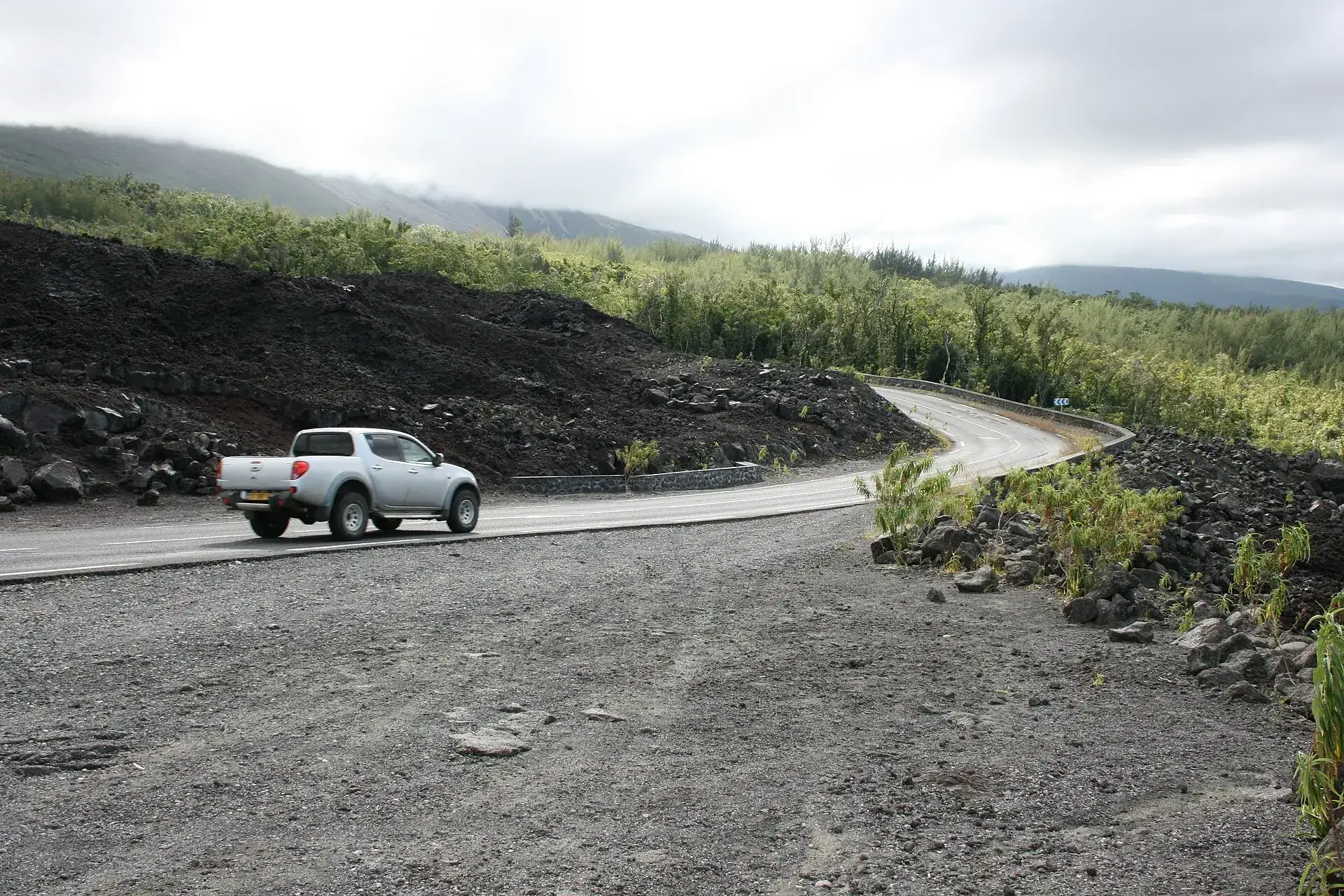
The Route des Laves (RN2) in the Grand Brûlé: a pickup on the road between black lava and young green on the slope
The RN2 between Sainte-Rose and Saint-Philippe: crossed by lava seven times, most recently in March 2026. Open again since 28 May.

Photo: Thierry Caro · CC BY-SA 3.0

When it eruptsSeeing lava: only during an 'alerte' – and only from the edge

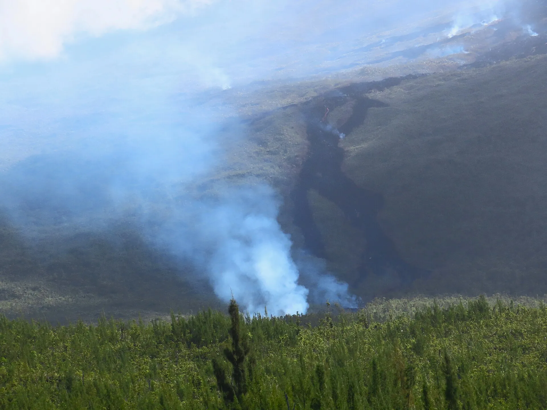
If you want glowing lava, you cannot plan for it. Eruptions announce themselves days to weeks ahead, and that is exactly when the Enclos is closed. The eruption can be watched from Piton Bert on the Rempart, about an hour's walk from Pas de Bellecombe, or – when flows reach the coast – from the roadblocks on the RN2 in the Grand Brûlé. That is how it was in February and March 2026: glow over the south flank at night, smoke over the forest by day, then lava across the road and into the sea. Drones are banned across the whole sector during an eruption.

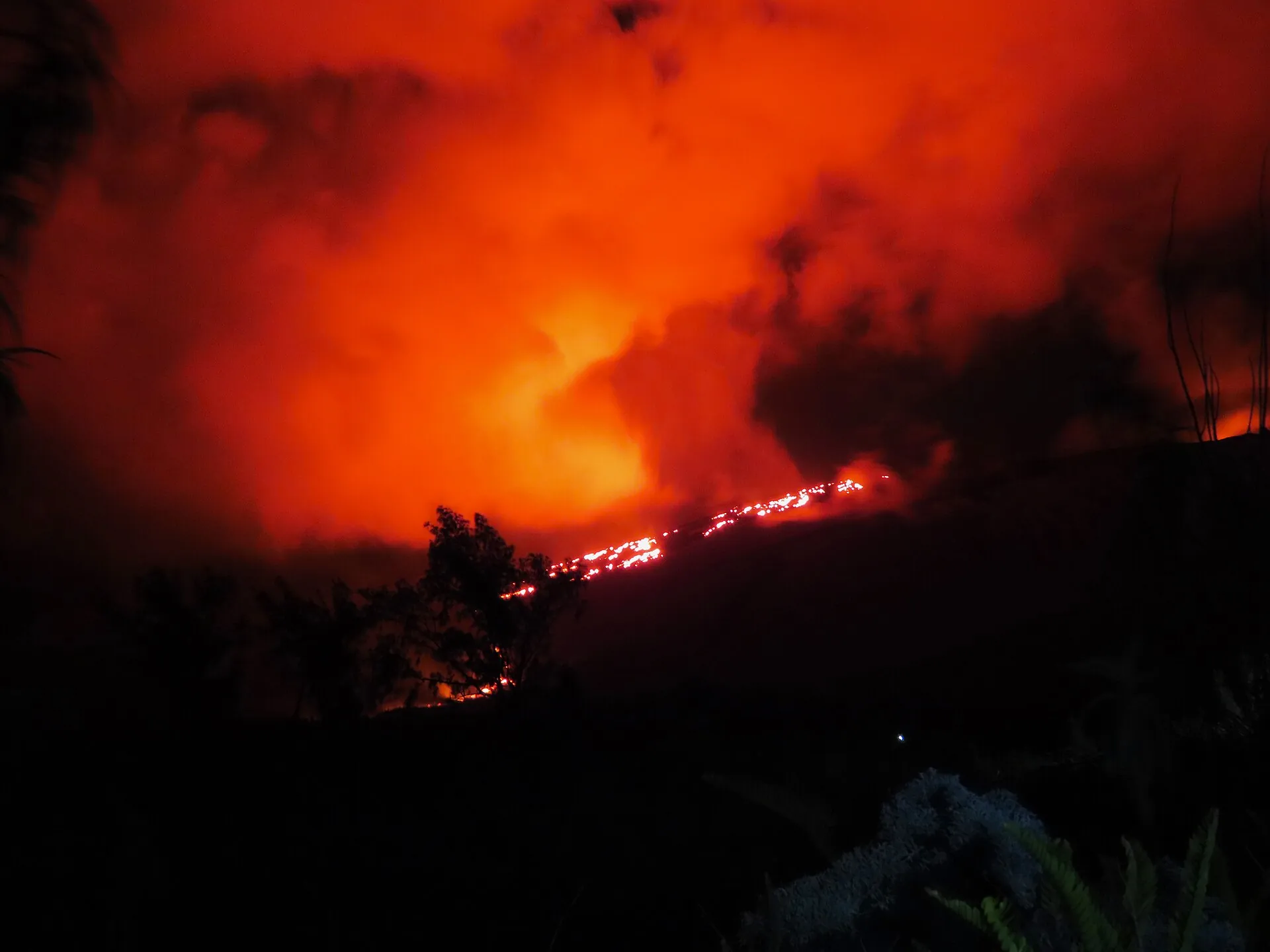
Night shot of the February 2026 eruption of Piton de la Fournaise: red glow over the slope, a glowing line of flowing lava, trees in silhouette
February 2026, from the edge of the Enclos: the glow of the south flank. Nobody got closer – the Enclos was shut.

Photo: Rémih · CC BY-SA 4.0

The March 2026 lava flow as a dark swath through the forest of the Grand Brûlé, smoke rising in several places
March 2026: the flow through the Grand Brûlé shortly before it reached the RN2. For the first time since 2007 the road lay under lava.

Photo: Rémih · CC BY-SA 4.0

From aboveHelicopter flights and excursions from the coast

The view into the Dolomieu without 500 steps: sightseeing flights leave from Saint-Pierre and Saint-Gilles, mostly in the morning when visibility is best. Without a rental car, a day tour from the west coast gets you to Pas de Bellecombe.

Affiliate links to GetYourGuide: if you book, we earn a commission and the price stays the same. Prices and ratings as of 22 September 2026. During an eruption every flight needs prefecture approval; in cloud the operators reschedule.

Aerial view of the summit of Piton de la Fournaise: the cone with the collapsed Dolomieu crater above a sea of clouds, Piton des Neiges behind
From the helicopter you see what stays hidden from the ground: the whole Dolomieu – and Piton des Neiges behind it.

Photo: Pouyot · CC BY-SA 4.0

Outdated onlineWhat other sites get wrong

“The Enclos is always open, you just have to get there early.”
Access depends on the ORSEC phase. Since 28 November 2025 'vigilance' has applied almost continuously, with trails mandatory, and from 13 February to 7 May 2026 the Enclos was completely closed.
“Three trails lead to the Dolomieu, including the Sentier Kapor.”
The Sentier Kapor was covered by the 2026 lava and has been closed since 7 May 2026. Only the two routes via Formica Léo are open.
“You can walk around the Dolomieu crater.”
Since the 2007 collapse the trail ends at the observation point on the north side. The loop is not open, and the rims break away.
“The last eruption was in 2023.”
Out of date. From 13 February to 12 April 2026 lava flowed across the RN2 and into the sea; before that there was a short eruption from 18 to 20 January 2026.
“A guide is mandatory.”
No. On the open trails anyone may walk alone. The prefecture's press releases mention no guide requirement; guides are optional.
“The hike takes three to four hours.”
The national park gives 12.8 km (8 miles), 596 m (1,955 ft) of climbing and six hours, tourism portals a good five. Shorter figures refer to Formica Léo – or to runners.

Quick answersBefore you go down into the Enclos

Can you hike Piton de la Fournaise on your own?

Yes. In the 'vigilance' phase two marked trails from Pas de Bellecombe are open – to the Dolomieu viewpoint and to Cratère Caubet. There is no ticket, no registration and no guide requirement. You just must not leave the white markings, and during an 'alerte' the Enclos is closed to everyone.

How long is the hike to the Dolomieu crater?

The national park reckons six hours for 12.8 km (8 miles) and 596 m (1,955 ft) of climbing there and back, tourism portals a good five. The 500-plus steps up the Rempart come at the end of the day – save water and energy for them.

How much does Piton de la Fournaise cost?

Nothing. The parking lot, the gate and the trails in the Enclos are free. Only the extras cost money: the Cité du Volcan in Bourg-Murat (€9), guided hikes (from about €55) or a helicopter flight (€205–365).

Where can you see the lava when the volcano erupts?

Not in the Enclos – it is closed then. For eruptions on the south flank, Piton Bert on the Rempart is the classic spot, about an hour's walk from Pas de Bellecombe. If flows reach the coast, you walk to the roadblocks on the RN2 in the Grand Brûlé. That is how it was in March 2026.

How do you get to the volcano without a car?

Only as far as Bourg-Murat: bus line Car Jaune S2 stops at the Cité du Volcan. From there 25 km (15 miles) of forest road remain to the parking lot – by taxi or with a tour. Guided hikes usually pick up at a meeting point in Bourg-Murat or at the parking lot.

When was the last eruption of Piton de la Fournaise?

From 13 February to 12 April 2026 on the south-southeast flank: the lava crossed the RN2 on 13 March and reached the sea on 16 March, where a platform of 8.5 hectares (21 acres) formed. Before that there was a 33-hour eruption on the north flank from 18 to 20 January 2026.

Is Piton de la Fournaise currently open?

As of 22 September 2026: yes, with restrictions. Since 7 May 2026 the 'vigilance' phase has applied, the upper Enclos can be walked on two marked trails from Pas de Bellecombe (to the Dolomieu viewpoint and to the Cratère Caubet); the Sentier Kapor and the new lava platform are closed. The OVPF reports no eruption in its bulletin of 21 September 2026, but continued inflation – a new closure is possible at any time.

Do you need a ticket or registration?

No. The parking lot, gate and trails in the Enclos are free, there is no ticket office and no registration. You pay only for extras such as the Cité du Volcan (€9) or a helicopter flight.

Can you climb the volcano without a guide?

Yes. On the white-marked trails released by the prefect, no guide is required. Off the markings you may not walk in the 'vigilance' phase; anyone wanting night or special tours books a mountain guide.

What do the prefecture's alert levels mean?

'Vigilance': eruption possible within days/weeks, Enclos only on marked trails. 'Alerte 1': eruption within hours, Enclos completely closed. 'Alerte 2-1': eruption in the Enclos without danger to the outside, Enclos closed. 'Alerte 2-2': lava threatens the RN2 or other infrastructure, road closures. 'Sauvegarde': eruption over, gradual reopening.

Is Piton de la Fournaise dangerous?

On the trails and outside of eruptions the danger lies more in the weather (fog, cold, UV) and the terrain (crater rims, lava tunnels under thin crust) than in the volcano. In 2021 two young men who wanted to see an ongoing eruption died in the Enclos; in 2025 a rockfall came down on the staircase. Respect closures and markings, and the risk is low.

Is the tour suitable for children?

Up to Formica Léo (20 minutes from the gate) yes, the full Dolomieu hike only for experienced, older children. The Parc national explicitly urges warm clothing for children – in the morning it is 4–5 °C.

What to wear and bring?

Hiking boots, windbreaker, hat and at the same time sun hat, sunglasses and sunscreen, rain protection, 1.5–2 liters of water, food, headlamp, charged phone with offline map. There is neither shade nor water nor reception in the Enclos.

How do you get to Pas de Bellecombe?

By car: RN3 to Bourg-Murat, there turn onto the Route forestière du Volcan at the Cité du Volcan, 25 km (15.5 miles) and around 45 minutes to the free parking lot. From Saint-Pierre about 1.5 hours, from Saint-Denis a good 2 hours. Buses (Car Jaune S2) end in Bourg-Murat.

When is the best time?

Dry season May to November and in any case early in the morning – around midday the Enclos clouds over. January to March is the rainy and cyclone season. There is no season for eruptions.

Can you camp in the Enclos or go up at night?

Not recommended and impossible during closures: the Enclos must be evacuated under 'Alerte 1', and mountain rescue and guidebooks advise against night descents. Bivouacking in the national park is allowed only between sunset and morning; more realistic are the Gîte du Volcan near the parking lot or a start at 7 a.m.

Are drones allowed?

Within 200 m (660 ft) of the Pas de Bellecombe viewpoint and the summit only with an exemption from the Parc national (15 days' notice); during eruptions the prefecture bans drones in the entire sector.

Is the Route des Laves worth it?

Yes, especially in bad weather up top: the RN2 between Sainte-Rose and Saint-Philippe crosses the lava flows from 1977 to 2026 with viewpoints, the new beach at Le Tremblet and lava tunnel tours. Since 28 May 2026 it has been open to traffic again after the eruption.
Sources · accessed on 22 September 2026