Volcano·Guide
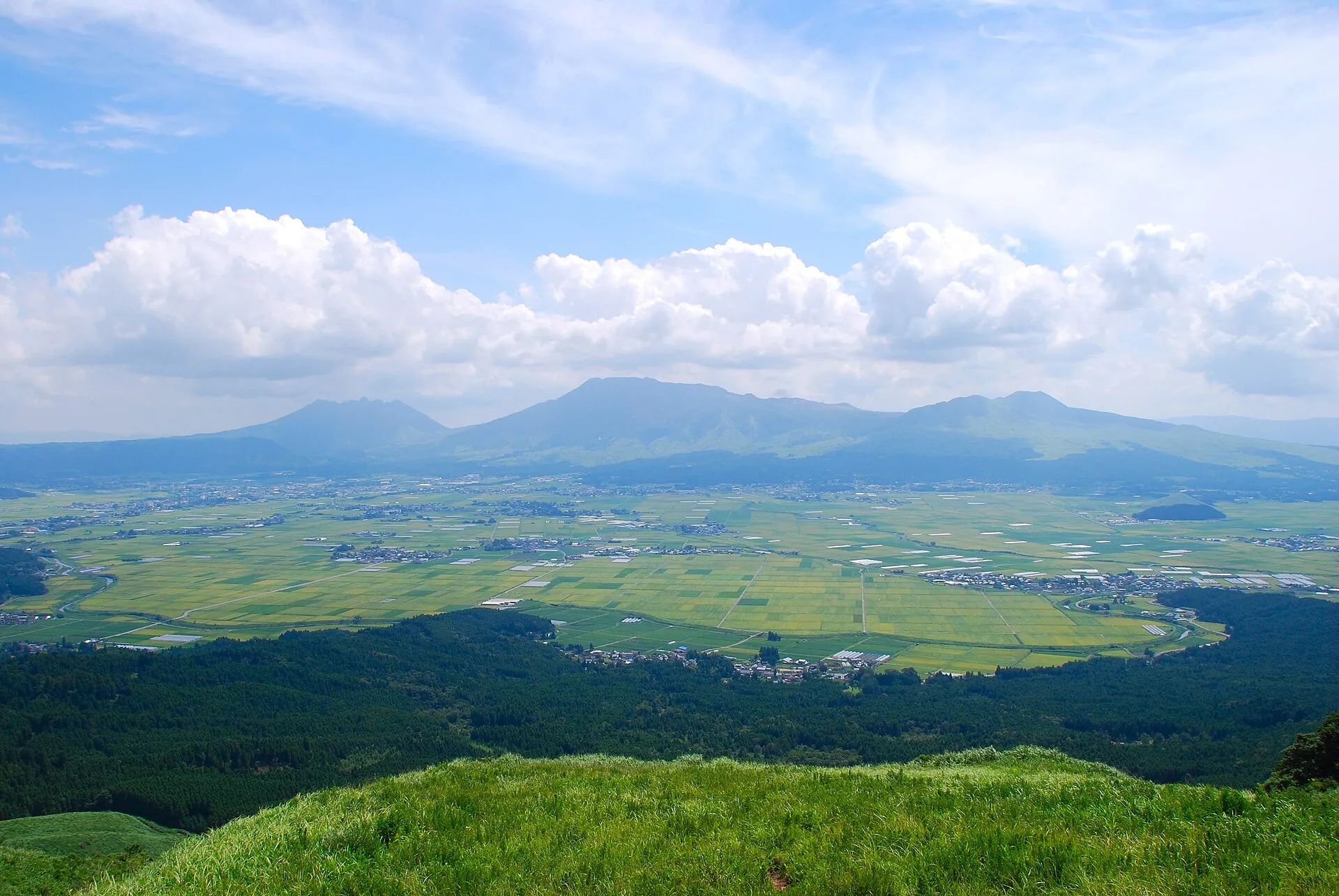
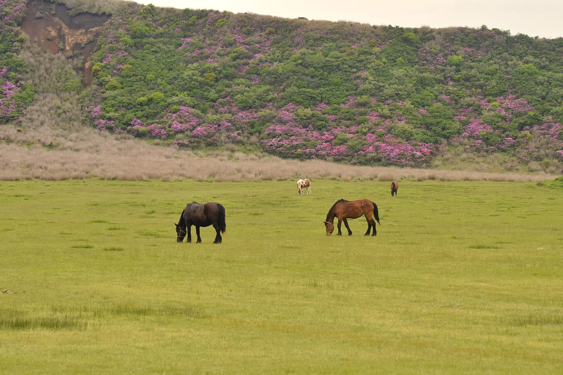
View from the wooded caldera rim of Mount Aso across rice fields and villages to the five central peaks Two horses grazing on the wide Kusasenri grassland at Mount Aso, with a slope of flowering azaleas behind A tall white-gray steam and ash cloud rising behind the ridge of Nakadake at Mount Aso, with a railing along the viewing path in front

Mount Aso

Up on the caldera rim lies a plain with towns, a railway line and rice fields – it is a volcanic basin.

In the middle sits the Kusasenri grassland, an old crater at 1,130 m (3,700 ft).

Behind it Nakadake is breathing. As of today, nobody gets to its rim.

Scroll –
from the caldera rim to the crater

As of 23 September 2026Mount Aso today: crater closed, Alert Level 2

The Japan Meteorological Agency has put Mount Aso at Alert Level 2 of 5 since 1 September 2026 – “do not approach the crater”. Everything within about one kilometer of the Nakadake crater is closed: the toll road, the shuttle bus, the footpath, any view of the crater. Open are the Aso-Sanjō terminal, the Kusasenri grassland and the volcano museum. To be blunt: if you are coming for the turquoise crater lake, you are coming for nothing right now.

Closed
1km

Nakadake crater

Level 2 with a roughly one-kilometer exclusion zone has applied since 21 June 2026, interrupted by Level 3 (2 km) from 14 August to 1 September. The crater view, the crater parking lot and the Sunasenri ash desert are off limits. No date is known for a downgrade.

JMA bulletin of 18 September 2026closed
Suspended

Toll road and crater shuttle

The city of Aso's toll road to the crater parking lot is shut, and the Sankō Bus shuttle has not run since 2 September because the road is closed. In normal operation they cost ¥1,000 per car and ¥800 per ride.

Sankō Bus, as of 2 September 2026closed
Open
1,130m

Aso-Sanjō and Kusasenri

The Aso-Sanjō bus terminal has been accessible again since 2 September, as has the panorama road with the Kusasenri grassland, the horses, the Komezuka cinder cone and the Daikanbō viewpoint on the northern caldera rim.

terminal office 9 am–4:30 pm · Kusasenri parking about ¥500free
Open
1,300¥

Aso Volcano Museum

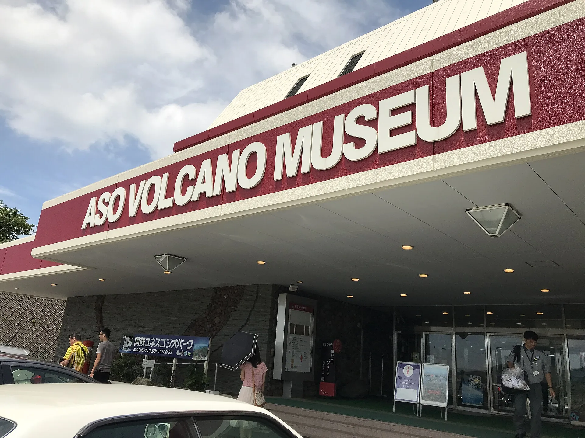
The museum at Kusasenri projects the feed of the live camera inside the crater – currently the only legal view into it. Daily 9 am–5 pm, last entry 4:30 pm, allow 40–50 minutes.

children ¥650 · seniors ¥1,100 · about US$9¥1,300
Sources: JMA Aso-san, bulletin of 18 September 2026, 4 pm (Level 2, 1 km zone, sulfur dioxide 1,800 t/day on 14 September, magma inflow since May 2026) · Aso Volcano Disaster Prevention Council (regulation status) · City of Aso (toll road closed) · Sankō Bus (shuttle suspended since 2 September 2026). The council also closes the rim on its own gas readings, even below the alert level – two systems that work independently.
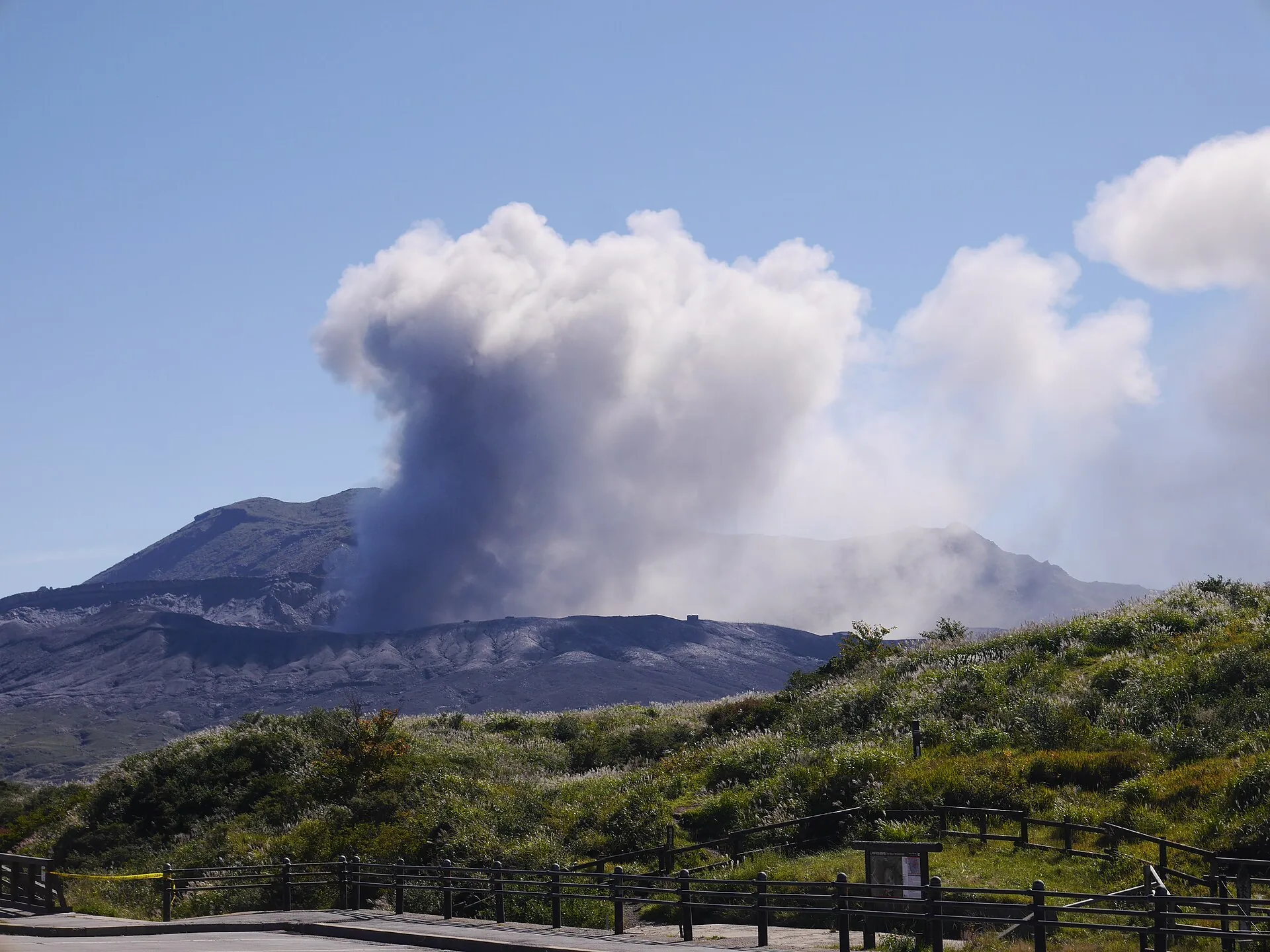
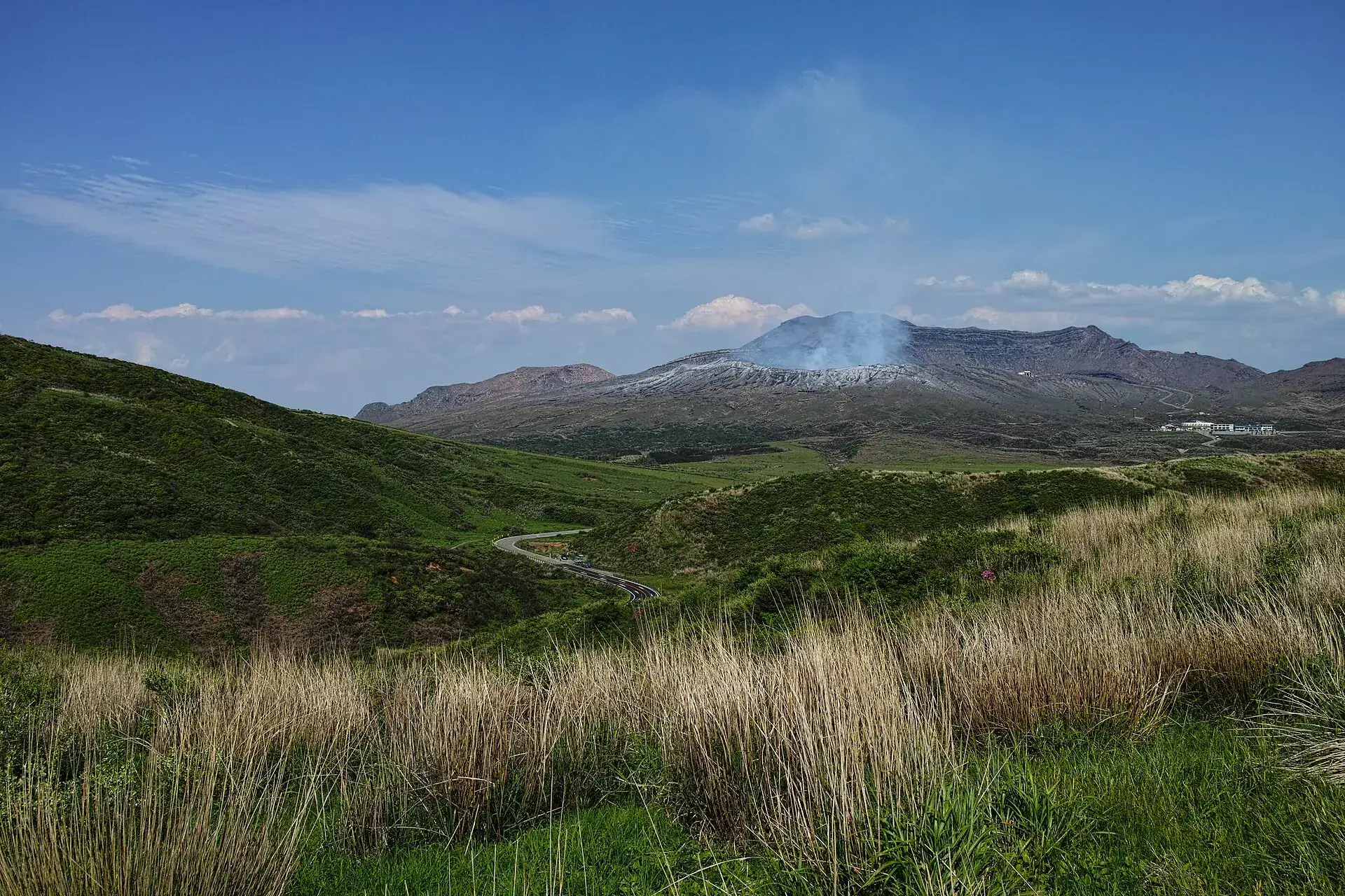
Grassy slopes at Mount Aso with the ridge of Nakadake and a pale steam plume behind, a road running below
The steam is visible from the panorama road – going up there is not allowed.

Photo: Thomas Au · CC BY 2.0

A basin people live inMount Aso: the caldera, Kusasenri and the five peaks

Aso is not a single mountain but a basin 25 by 18 kilometers (16 by 11 miles), formed by four huge eruptions between 270,000 and 90,000 years ago. Inside it are towns, fields and a railway line, and in the middle five peaks – the highest is Takadake at 1,592 m (5,223 ft), the active one Nakadake at 1,506 m.

From the Daikanbō viewpoint on the northern rim you see the whole plain at once: rice fields, villages, and behind them the chain of peaks that locals call the sleeping Buddha. In autumn a sea of cloud fills it in the morning. The mountain road climbs from the town of Aso up to Kusasenri, an old crater at 1,130 m where horses graze around two ponds.

What is missing is the point of the trip: the turquoise crater lake inside Nakadake, whose fence you normally walk up to within a few dozen meters. The Aso ropeway that once ran there has been idle since 2014 and was dismantled after the earthquakes and eruption of 2016. Since September 2026 the replacement shuttle has stopped as well. Come anyway and you have Kusasenri, Komezuka, the Aso shrine and the museum – half a day, honestly counted.

Affiliate links to GetYourGuide: if you book, we earn a commission and the price stays the same. Prices and ratings as of 22 September 2026. These tours run from Fukuoka and include the crater – as long as it is open. At Alert Level 2 the drive ends at Kusasenri; whether the operator substitutes something or refunds is in their terms, not ours. Read the council's status page before you book. Prices were collected in euros.

Two authorities, two reasons to closeAso crater: alert levels, the gas rule and the cost

Two bodies decide on access at Aso, independently of each other. The JMA sets the alert level for the whole mountain. The local disaster prevention council measures gas with six devices on the crater rim and closes zones or clears the rim – even at Alert Level 1. On top of that comes one rule that is not a formality.

1

Check the alert level the night before

Level 1 means the rim is open. Level 2 closes about one kilometer – crater, toll road, shuttle and Sunasenri. Level 3 closes two kilometers plus the summit trails on Nakadake and Takadake. The current status, with a timestamp, is on aso-volcano.jp.

2

The council's gas regulation

Six automatic sensors on the rim. If readings pass the threshold, individual zones are closed or the whole rim is cleared; the shuttle then runs only as a round trip to viewing zone E (¥1,600). You see steam, but not the lake – ask before you pay.

3

Asthma, bronchial or heart conditions: do not go up

The council bans the crater visit for people with asthma, bronchial or heart conditions and for anyone feeling unwell. The sulfur dioxide can be lethal; people died at the rim from it between 1994 and 1997. Nine concrete shelters stand along the rim.

4

Do what the crater wardens say

Wardens on the rim give instructions when gas levels rise. Anyone who notices a smell, a cough or stinging eyes goes back down immediately, no questions. There is no requirement to hire a guide – and no refund if the rim closes at short notice.

Official prices in normal operation · as of 09/2026, currently closed
Aso-san Park Road toll, car · motorcycle ¥400 · bicycle free · disability pass ¥500¥1,000 (about US$7)
Crater shuttle one way, adults · children ¥400¥800 (about US$5.50)
Crater shuttle, round trip to viewing zone E under gas regulation · children ¥800¥1,600 (about US$11)
Aso Volcano Museum, adults · elementary school ¥650 · seniors 65+ ¥1,100 · disabled 50%¥1,300 (about US$9)
Mountain bus from JR Aso Station to Kusasenri or Sanjō terminal, one way (guidebook figure)¥1,000 (about US$7)
The crater rim itself, Kusasenri, Komezuka, Daikanbōfree
Sources: City of Aso (toll since April 2024) · Sankō Bus (shuttle fares, timetable since 14 March 2026, payment in cash, by Kumamon IC card or contactless – Suica does not work here) · Aso Volcano Museum · disaster prevention council (visit banned for asthma, bronchial and heart conditions). The mountain bus fare comes from guidebooks, not from the operator's fare page. Dollar figures converted roughly at ¥145 to the dollar.
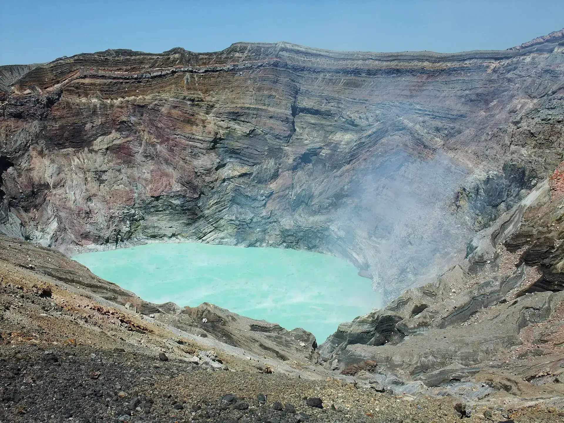
The turquoise crater lake inside the Nakadake crater of Mount Aso, ringed by red and gray layered crater walls with rising steam
This is what Nakadake looks like when it is open: a turquoise lake in a striped funnel. The photo is older than the closure.

Photo: Igorberger · CC BY-SA 3.0

Three ways, when the mountain allows themGetting to the Aso crater: toll road, shuttle, on foot

All three start at the Sanjō terminal at 1,130 m and end at the same fence. None of them is usable today; the figures describe normal operation at Alert Level 1.

Route → time, price, conditions
Toll road by car · Sanjō terminal → crater parking lot, about 5 minutes¥1,000 per car, ¥400 per motorcycle, bicycles free; ¥500 with a disability pass. Open 20 March to 31 October 8:30 am–6 pm (last entry 5:30 pm), in November until 5:30 pm, from 1 December to 19 March 9 am–5 pm. The barrier shuts half an hour before closing – arrive later and the drive up is wasted.
Sankō Bus crater shuttle · about 5 minutes each way, 32 seats¥800 one way, children ¥400. Timetable since 14 March 2026: 9:05 am by reservation only, then 9:45 am to 3:35 pm every 40–55 minutes. Payment in cash, by Kumamon IC card or contactless – Suica and Pasmo are not accepted here. The operator guarantees no view of the crater and refunds nothing if it closes.
On foot from the Sanjō terminal · 30–40 minutes to the rim, summit one hour moreFree, and only at Alert Level 1 without a gas alarm. The path runs beside the toll road. Nakadake summit (1,506 m) and Takadake (1,592 m) take another 2–4 hours over loose rock with no shade; some trails have been destroyed since the 2016 earthquakes and heavy rain, and the city of Aso points hikers to the Sarayama and Suzumeishi detours.
Mountain bus from JR Aso Station · 35–40 minutes to the Sanjō terminal¥1,000 one way to Kusasenri or Sanjō (guidebook figure; not covered by the Japan Rail Pass, but covered by the SUNQ pass). It runs to the terminal even when the crater is closed and stops at the volcano museum. After the earthquake of 28 July 2026 there were cancellations – check the operating status on the day.
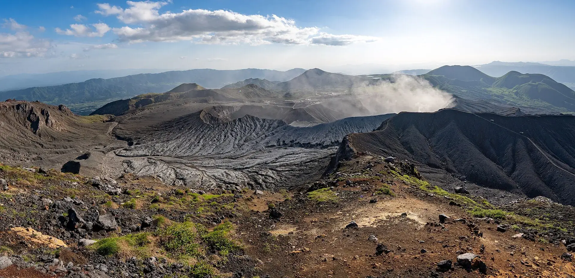
Panorama from the crater rim of Mount Aso across gray ash fields and the central peaks, with a steam plume on the right
The rim as a panorama: no railing anywhere, but nine concrete shelters in case rocks start flying.

Photo: Raita Futo from Tokyo, Japan · CC BY 2.0

28 July 2026After the Kumamoto earthquake: getting to Aso

On 28 July 2026 at 4:27 pm a magnitude 7.1 earthquake hit Kumamoto Prefecture, reaching the maximum intensity 7 on the Japanese scale. Three days later the Aso tourism association reported no major damage to sights, accommodation or roads. Railways, buses and expressways were cut, some of them for weeks.

Check before you travel

JR Hōhi Line

The Higo-Ōzu to Miyaji section was cut after the quake and reopened step by step from early August. We found no JR Kyushu statement for today's status – so look up the operating information before you go.

Kumamoto–Aso normally about 1.5 hours
No major damage

The town of Aso and its sights

Kusasenri, the museum, the Aso shrine, the roadside station: the tourism association reported no major damage on 31 July 2026. The Aso shrine had already collapsed in 2016 and has been rebuilt.

Aso city tourism association, 31 July 2026
The second quake in ten years

What happened in 2016

On 14 and 16 April 2016 two earthquakes (Mw 6.2 and 7.0) destroyed the Great Aso Bridge, the Aso shrine and rail lines; in October an eruption sent an ash column to 11,000 m. The ropeway survived neither.

277 dead in the region in total

Good to knowGetting there from Kumamoto, best time, tips

Getting there

Without a car: From Kumamoto on the JR Hōhi Line to Aso (regular service about 1.5 hours, about ¥1,300; the “Aso Boy” limited express carries a surcharge). After the earthquake of 28 July 2026 the Higo-Ōzu–Miyaji section was interrupted at first and reopened step by step from early August – check JR Kyūshū's operating status before you travel. From Aso Station the Sankō mountain bus to the Sanjō terminal, about 35–40 minutes, ¥1,000. From Fukuoka: Shinkansen to Kumamoto (about 35 minutes) plus Hōhi Line, or the Kyūshū Ōdan bus (Sankō) Kumamoto–Aso–Kurokawa Onsen; the Fukuoka–Kurokawa highway bus does not stop at the Aso crater. The SUNQ Pass is valid on Sankō buses, the Japan Rail Pass is not.

By car: From the Kumamoto IC about 80 minutes: Route 57 to the junction at Aso Station, then the Bōchū-sen mountain road (Aso Tozan Dōro) up; from Ōita/Beppu about 2 hours. Large parking lots at the Sanjō terminal and at the museum/Kusasenri (Kusasenri paid, about ¥500). From Sanjō onward only via the toll road (¥1,000), when open.

  • From Kumamoto · train about 1.5 h + bus 40 min; car about 80 min from the Kumamoto IC
    JR Hōhi Line to Aso, then the Sankō mountain bus; or by car via Route 57
  • From Fukuoka · about 3 hours
    Shinkansen to Kumamoto, then Hōhi Line and bus; or highway bus/car via the Kyūshū Expressway
  • From Ōita / Beppu · about 2 hours by car
    Hōhi Line or car via Route 57

Best time to go

Fall (October/November) with clear air, golden pampas grass on Kusasenri and a sea of clouds from Daikanbō in the early morning; spring (April/May) after the grass burning with fresh green. In summer heat and thunderstorms, in winter snow on the mountain road, shorter hours (9 am–5 pm) and winter tires. More important than the season is the day's conditions: the crater lake is most often free of steam and fog in the morning, and gas regulations cluster in calm weather and southerly winds – so come early and read the closure page the evening before. Until the level drops back to 1, the trip to the crater is not worth it anyway; Kusasenri, Daikanbō and Komezuka are always open.

Who it suits

Children
In normal operation: the crater rim can be reached by car or shuttle without effort, children's fares on the shuttle and at the museum. Toddlers and infants react more sensitively to sulfur dioxide – at the first smell or irritation move away from the rim immediately. At present (Level 2) families are left with Kusasenri with its horses and the museum with the live camera.
Minimum age
none
Fitness
None needed for the crater and Kusasenri. Summit trails Nakadake/Takadake: 2–4 hours, loose rock, no shade.
Altitude
Not an issue at 1,100–1,600 m (3,600–5,200 ft).
Heart and lungs
Central rule of the disaster prevention council: people with asthma, bronchial conditions, heart disease and anyone feeling unwell may not visit the crater – the gas can be deadly (deaths from SO₂ between 1994 and 1997). Anyone noticing symptoms at the rim descends immediately; crater wardens must be obeyed. Nine concrete shelters for 30 people each stand on the crater rim.
Wheelchair
Crater parking lot and viewing zones are paved and reachable by car (disability fare ¥500); the museum is accessible with a 50% discount. Not the summit trails.
Dogs
No rule found on the official pages (see unsicher).
Clothing
At the crater rim it is windy and noticeably cooler than in the caldera; jacket, in winter hat and gloves. Cloth or mask against gas and ash, head protection during an eruption (JNTO advice: helmet, cover your mouth with a cloth).
Footwear
Sturdy shoes; for Sunasenri and the summits hiking boots with tread (ash sand, blocky rock).

Tips you will need on site

  • Before you travel, read two pages: aso-volcano.jp (regulation stage with timestamp) and the JMA alert level. At Level 2 or 3 there is no crater view – then Kusasenri plus the museum with its live camera is the program.
  • The Sankō mountain bus runs to the Sanjō terminal even when the crater is closed; the ride past the museum through Kusasenri is still worth it.
  • With asthma, a bronchial or heart condition, skip the crater altogether – the rule is absolute and is enforced at the entrance.
  • Shuttle tickets only by cash, Kumamon IC or contactless card; Suica/Pasmo do not work here. The 9:05 am run needs a reservation.
  • By car the park road (¥1,000) is only worth it when the crater is open; the barrier closes half an hour before the end of operating hours.
  • Under gas regulation the shuttle only goes to zone E (¥1,600 round trip) – you see steam then, but not the lake. Ask before you pay.
  • After the earthquake of 28 July 2026, check the operating status of the Hōhi Line and the Sankō buses on the day you travel; the tourism associations report Aso City itself as undamaged.
  • Jacket even in summer: at the crater rim at 1,250 m (4,100 ft) the wind blows hard, and the viewing zones have no shelter apart from the concrete bunkers.

A short history

  • The caldera (25 × 18 km / 16 × 11 miles) was formed by four huge eruptions 270,000 to 90,000 years ago; today towns, a railway and fields lie inside it, with the five peaks and the active Nakadake in the middle.
  • 24 June 1958: eruption of the Dai-ichi crater with 12 dead and 28 injured; the same year the Aso ropeway to the crater rim opens.
  • 6 Sept 1979: a phreatic explosion kills three visitors and injures eleven; ropeway station and instruments damaged. In the 1990s several people die from sulfur dioxide – since then gas monitors and exclusion zones on the crater rim.
  • November 2014 to 2016: magmatic phase with ash and lava fountains; ropeway out of service from August 2014.
  • 14/16 April 2016: Kumamoto earthquakes (Mw 6.2 and 7.0; 277 dead in total) destroy the Great Aso Bridge, the Aso Shrine, railway lines and ropeway facilities; 8 Oct 2016 explosive eruption of Nakadake with an ash column to 11,000 m, Alert Level 3. The ropeway is abandoned and dismantled by 2019; a shuttle bus has run since.
  • 20 Oct 2021: eruption with a pyroclastic flow reaching 1.3 km, Level 3 again.
  • 10 Aug 2023: new viewing zone E on the crater rim opened for days under gas regulation.
  • 20 Jan 2026: a sightseeing helicopter (Robinson R44) crashes into the Nakadake crater; three people (the pilot and a couple from Taiwan) remain missing, the wreck still lies in the crater. From 22 Jan the crater view is closed for the recovery.
  • 21 June 2026 Alert Level 2; 28 July 2026 Kumamoto earthquake M 7.1 (intensity 7, Aso without major damage, railway and buses interrupted temporarily); 14 Aug 2026 Level 3 with a 2-km zone, recovery work halted; 1 Sept 2026 back to Level 2; 2 Sept Sanjō open again.
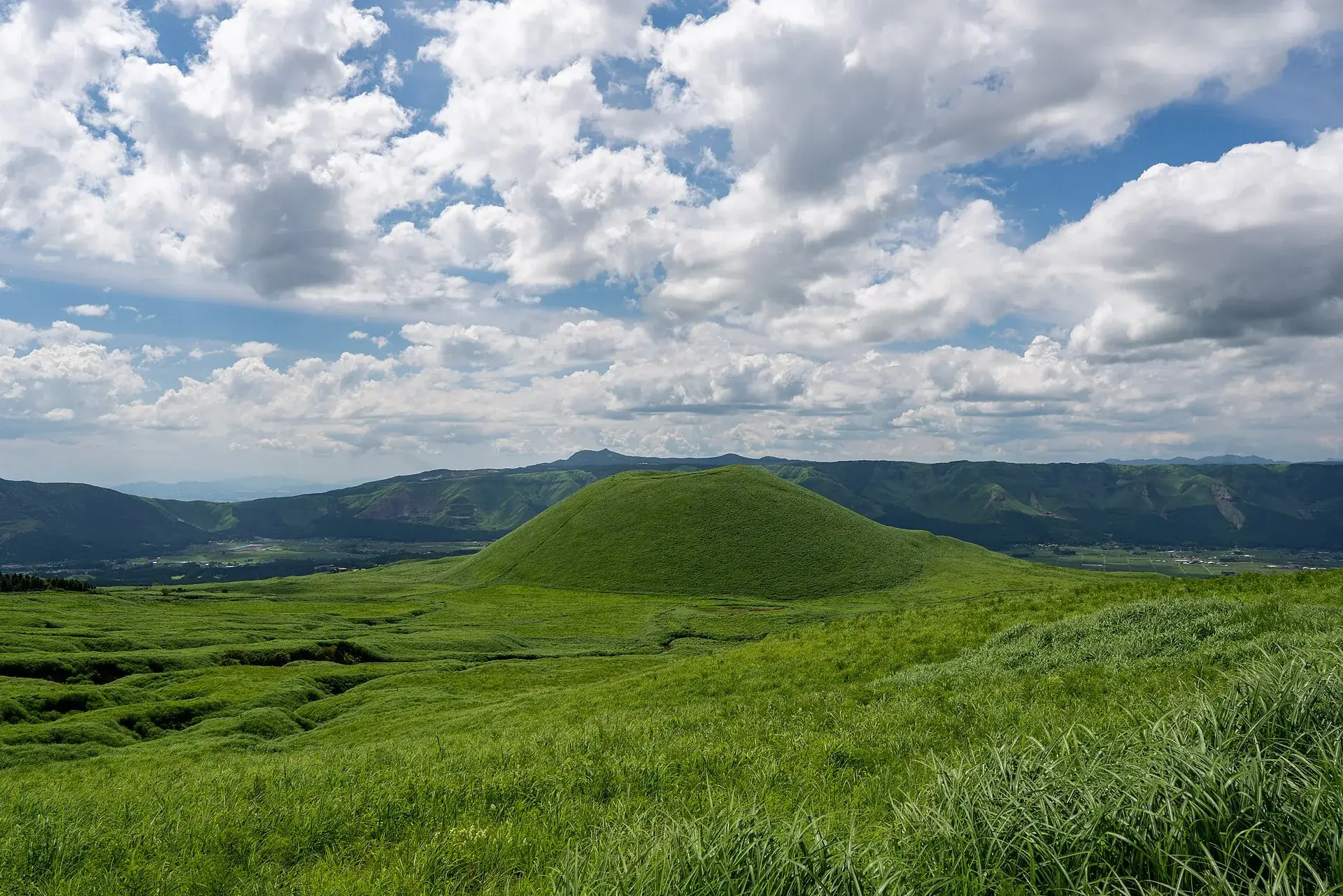
The grass-covered Komezuka cinder cone in the caldera of Mount Aso under a cloudy sky
Komezuka, the rice mound: a textbook cinder cone under grass. Climbing it is banned – looking at it is free.

Photo: Big Ben in Japan · CC BY-SA 2.0

From Kumamoto and privateMount Aso tour from Kumamoto: railway, onsen, private

From Kumamoto, Aso is a day trip by train and bus. If you would rather be driven, there are tours that combine the mountain with the Southern Aso Railway, Kurokawa Onsen or Kumamoto Castle. The selection is thin here: some of these have only a handful of reviews.

Affiliate links to GetYourGuide: if you book, we earn a commission and the price stays the same. Prices and ratings as of 22 September 2026. These tours cannot show the crater either at the moment. What the title says is what you book: railway, onsen, castle, grassland – not the crater rim. Prices were collected in euros.

Entrance of the Aso Volcano Museum at Kusasenri with red lettering on the canopy and visitors in front
The volcano museum at Kusasenri: its live camera inside the crater is currently the only legal view of it.

Photo: ltsc1980 · CC BY-SA 2.0

Out of date onlineWhat other sites get wrong

“You take the ropeway to the Aso crater.”
The Aso ropeway has been idle since August 2014 and was dismantled by 2019 after the earthquakes and eruption of 2016. Its replacement was the Sankō Bus crater shuttle – and that has not run since 2 September 2026 either.
“The shuttle costs ¥500 and the toll ¥600.”
Old prices. Since April 2024 the park road costs ¥1,000 per car and ¥400 per motorcycle, and the shuttle ¥800 one way (children ¥400), or ¥1,600 for the round trip to zone E under gas regulation.
“The crater is always accessible, it only closes when it is windy.”
In 2026 the crater view was shut for most of the year: from 22 January for the recovery of a crashed helicopter, from 21 June because of Alert Level 2, and from 14 August to 1 September because of Level 3 with a 2 km zone. As of 23 September 2026 it is still closed.
“The gas warning only concerns people with asthma.”
The disaster prevention council also excludes people with bronchial and heart conditions, and anyone feeling unwell. In the 1990s visitors died of sulfur dioxide at the crater rim.
“Mount Aso is 1,592 m high – that is the crater.”
1,592 m is Takadake, the highest of the five central peaks. Nakadake with the crater people visit is 1,506 m, and the crater parking lot sits at about 1,250 m.

Quick questionsBefore you travel to Mount Aso

Is the Aso crater open right now?

No. As of 23 September 2026 Alert Level 2 applies, with an exclusion zone of about one kilometer around Nakadake: the toll road and shuttle are stopped, the crater view and Sunasenri are off limits. Aso-Sanjō, Kusasenri and the volcano museum are open. No date is known for a downgrade.

What alert level is Mount Aso at?

Level 2 of 5 (“do not approach the crater”), since 1 September 2026 at 4 pm. From 14 August to 1 September, Level 3 applied with a 2 km zone. The JMA still reports raised sulfur dioxide – 1,800 tonnes a day on 14 September – and magma collecting in a deep reservoir under Kusasenri.

Is Mount Aso worth it while the crater is closed?

As half a day, yes: the caldera view from Daikanbō, the Kusasenri grassland with its horses, Komezuka, the Aso shrine and the volcano museum with the live camera inside the crater. If the crater lake is the whole reason for the trip, wait for the downgrade to Level 1.

What does a visit to the Aso crater cost?

In normal operation: ¥1,000 per car on the toll road, or ¥800 one way on the shuttle from the Sanjō terminal, children ¥400; the rim itself is free. The volcano museum charges ¥1,300 and the mountain bus from JR Aso Station about ¥1,000 one way.

Can I go to the crater with asthma or a heart condition?

No. The disaster prevention council bans the crater visit for people with asthma, bronchial or heart conditions and for anyone feeling unwell – the sulfur dioxide can be lethal. Kusasenri and the museum are not affected.

How do you get to Mount Aso from Kumamoto or Fukuoka?

From Kumamoto take the JR Hōhi Line to Aso, normally about 1.5 hours, then the Sankō mountain bus to the Sanjō terminal (35–40 minutes, ¥1,000). From Fukuoka take the Shinkansen to Kumamoto first, about three hours in total. By car it is roughly 80 minutes from the Kumamoto interchange on Route 57. After the earthquake of 28 July 2026, check the rail status.

Does the ropeway to the Aso crater still exist?

No. It last ran in 2014, was damaged by the 2016 earthquakes and eruption and dismantled by 2019. Today a Sankō Bus shuttle takes five minutes from the Sanjō terminal to the crater – when the park road is open.

Can you visit Mount Aso without a guide?

Yes, there is no guide requirement. At the crater rim, crater wardens give instructions, and during a gas alert everyone must get into the shelters or descend immediately. Summit hikes on Nakadake and Takadake need no guide, but Alert Level 1.

How long do you need at Mount Aso?

For Kusasenri, the museum and the crater rim (when open) half a day; with the trip from Kumamoto a full day trip. The walk from the Sanjō terminal to the crater takes 30–40 minutes, the Nakadake/Takadake summit loop 3–4 hours.

Is Mount Aso suitable for children?

In normal operation, yes: car or shuttle bring everyone to the rim without effort, and there are children's fares. But toddlers react sensitively to gas, so move away at the first smell or irritation. At present the horses on Kusasenri and the live camera in the museum are the children's program.

What should you wear?

A windproof jacket even in summer, sturdy shoes, a cloth or mask against gas and ash. In winter warm clothing and winter tires for the mountain road; hours are shorter then (9 am–5 pm).

Is Mount Aso dangerous?

In the open area the risk is low as long as you respect exclusion zones, gas announcements and crater wardens. The hazards are real: deaths in 1958 and 1979 from ejecta, in the 1990s from gas, and in 2026 the helicopter crash into the crater. So check the alert level and regulation stage before every visit.

What happened at Aso in 2016?

On 14 and 16 April 2016 two earthquakes (Mw 6.2 and 7.0) shook the region: the Great Aso Bridge collapsed, the Aso Shrine was destroyed, railway lines were cut. On 8 October 2016 an explosive eruption of Nakadake followed with an ash column up to 11,000 m. The ropeway survived neither.

What about the helicopter in the crater?

On 20 January 2026 a sightseeing helicopter crashed into the Nakadake crater; the pilot and two passengers from Taiwan are considered missing, drones spotted what were presumably the bodies in February. The recovery was halted because of Alert Level 3 in August; the wreck still lies in the crater.
Sources · accessed on 22 September 2026