Volcano·Guide
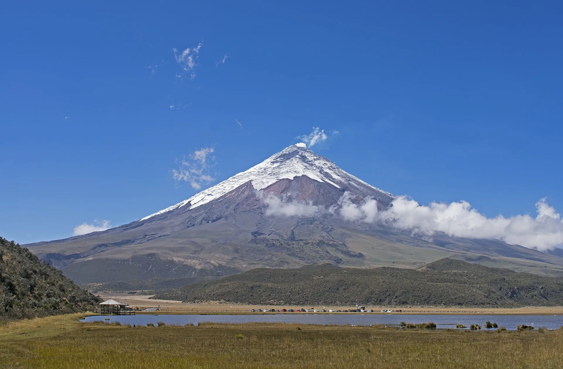
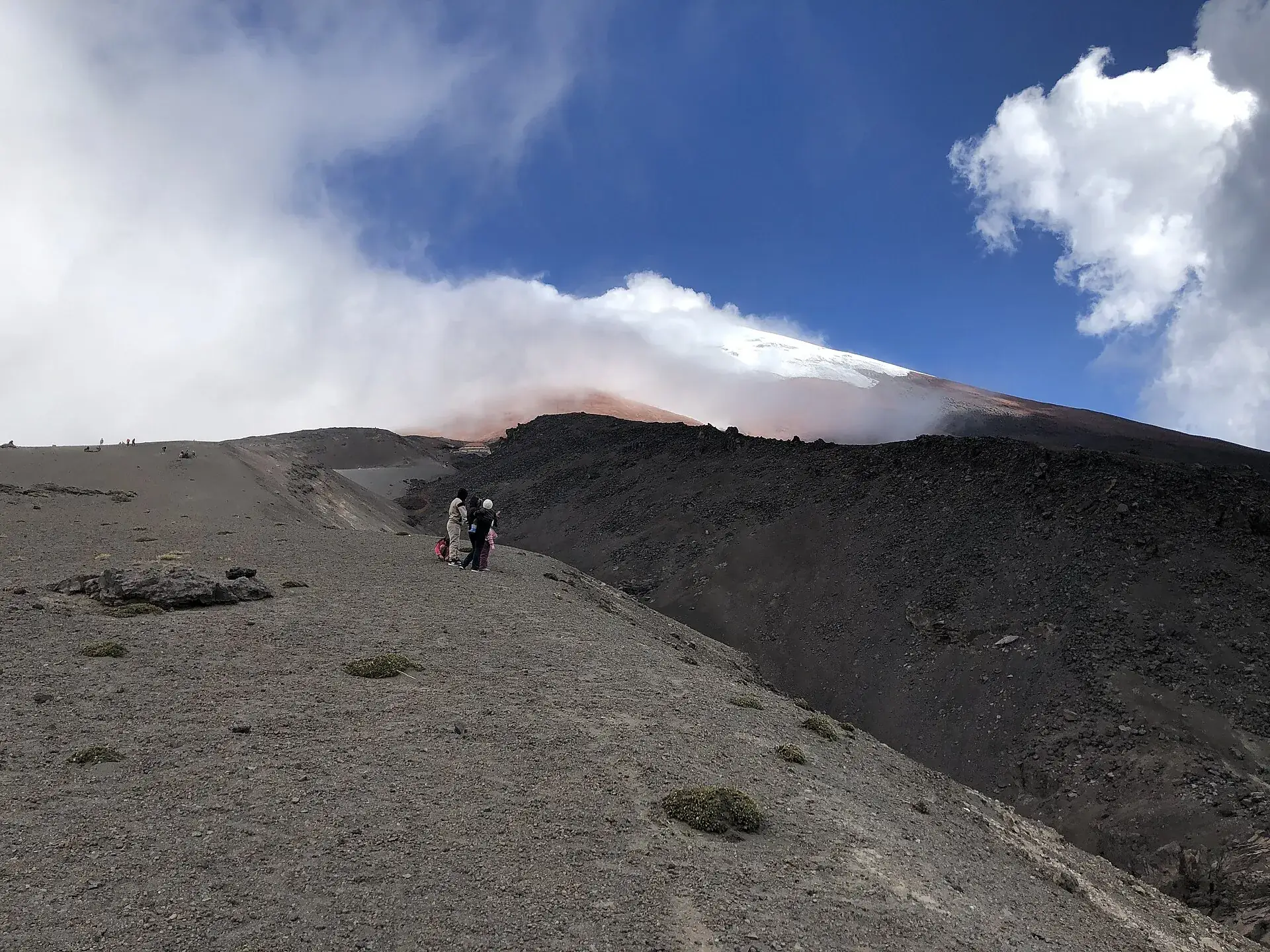
The snow-capped cone of Cotopaxi above Laguna de Limpiopungo, páramo grass in front under a blue sky Hikers on the gray ash slope above the Cotopaxi parking lot, the summit hidden in clouds The José Rivas refuge on Cotopaxi with its yellow roof, fresh snow on the ash slope, a hiker in front

Cotopaxi

From the lake it looks painted: a cone, almost symmetrical, white on top.

Above 4,600 m only volcanic sand carries you – every step slides half a step back.

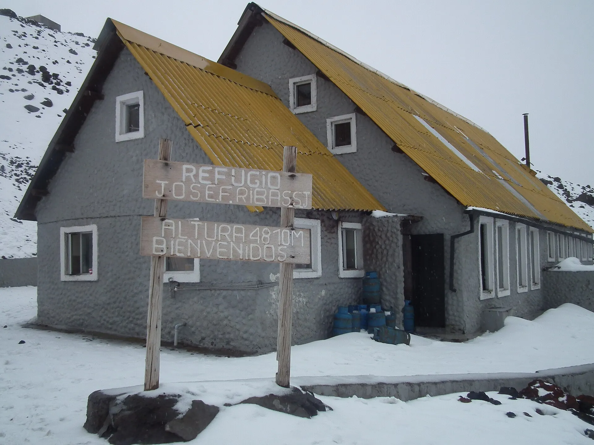
4,864 m, the refuge. Anyone may come this far. Above it the glacier begins, and that belongs to the guides.

Scroll –
up to the refuge

As of September 22, 2026Cotopaxi today: park open, summit open – with rules

The national park charges no entry fee, and anyone may hike to the José Rivas refuge at 4,864 m (15,958 ft) without a guide. The summit was closed from October 2022 to February 2024 and has been fully open to guided groups again since November 2024. On September 4, 2026, the IG-EPN reported low activity with no change. Many guides online still describe the closure.

Open, no guide needed
4,864m

Park, Laguna Limpiopungo, José Rivas refuge

Register with your passport at the Caspi or Norte checkpoint, entry 8 a.m. to 3 p.m. Drive to the parking lot at about 4,600 m (15,090 ft), then walk 45 to 60 minutes to the refuge.

Entry free for everyone since 2012$0
Guide required
5,897m

Glacier and summit

Above the refuge, high-mountain rules apply: certified mountain guide (ASEGUIM/IFMGA), registration with the park office, refuge reservation, liability waiver and an authorization wristband. Two clients per guide is the standard.

two-day guided climb, operatorsfrom about $300
Activity low
Sep 42026

IG-EPN: “baja, sin cambios”

The eruptive phase ended with the last ash emission on July 6, 2023. Since then the Instituto Geofísico has consistently rated internal and surface activity as low, most recently in its report of September 4, 2026.

SNGR yellow alert since 2022 for the lahar zones downstream; no lifting of the alert is known
Sources: IG-EPN report of September 4, 2026 and volcano page igepn.edu.ec/cotopaxi · park office in Latacunga (La Gaceta, November 2024: summit “habilitado al 100 %”) · reopening rules of the Ministerio del Ambiente, February 21, 2024 · Acuerdo Ministerial 006/2012 (free entry). Short closures of individual gates do happen, most recently on August 10–11, 2026 at the Caspi checkpoint.
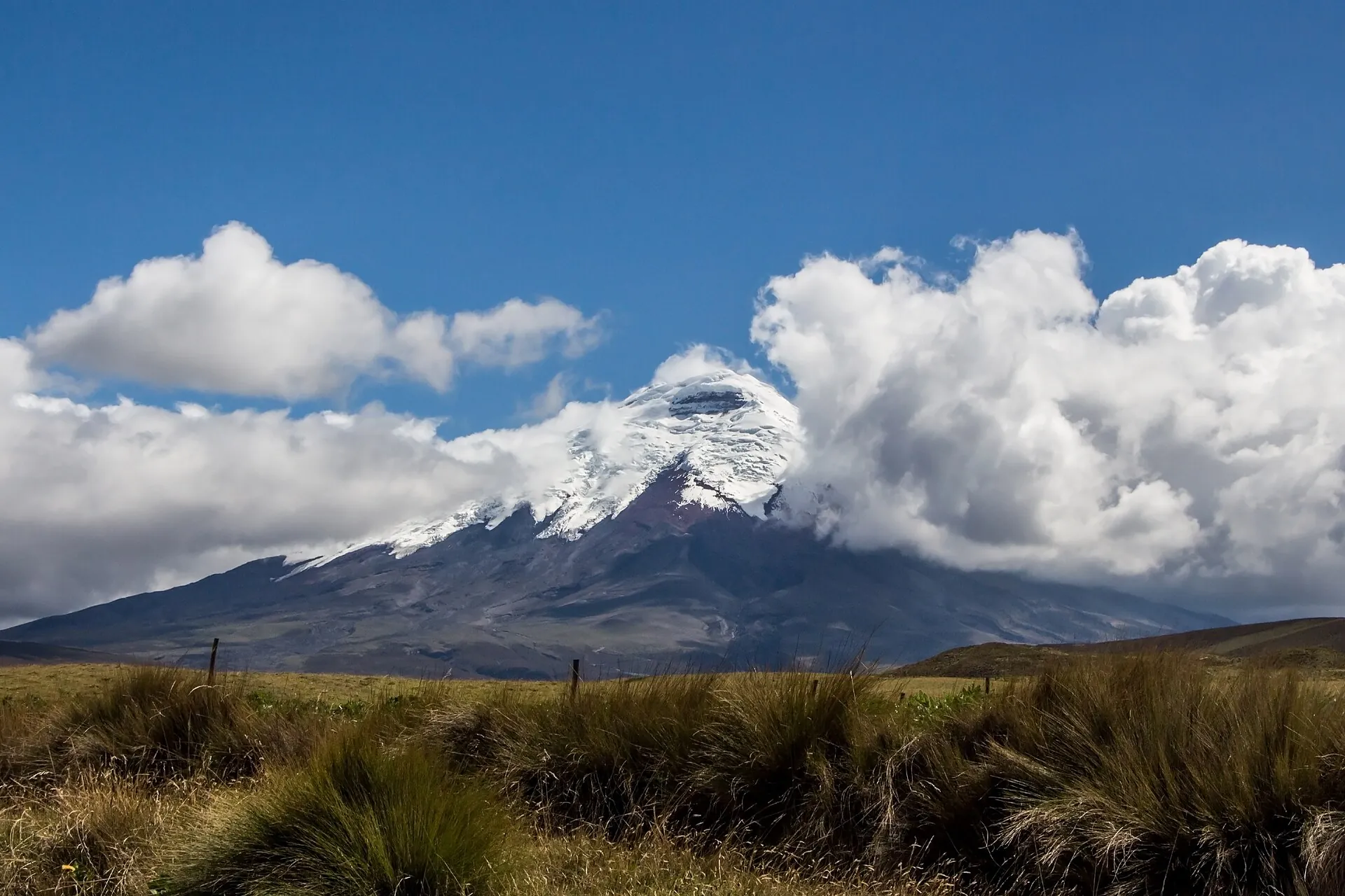
Cotopaxi with its glacier cap behind a band of cloud, yellow páramo grass in the foreground
5,897 meters (19,347 ft), almost perfectly symmetrical – and usually cloud-free in the morning. By afternoon it nearly always closes in.

Photo: Bernard Gagnon · CC BY-SA 3.0

The experienceThe Cotopaxi refuge hike – the part everyone can do

The parking lot sits higher than any summit in the Alps. From there it is only 260 m (850 ft) of climbing to the refuge, but the air holds half the oxygen of sea level and the volcanic sand gives way with every step. Barely an hour that feels like three.

The drive starts at the Caspi checkpoint just past kilometer 42 of the Pan-American Highway. After registering you follow a gravel road through the páramo: wild horses, Andean gulls, the shallow Laguna de Limpiopungo at 3,800 m (12,470 ft) with the cone behind it. The loop around the lake takes 45 minutes and is what most day tours do first.

Then the switchbacks through the ash up to the parking lot at about 4,600 m. From here on foot: a wide zigzag path, the yellow roof of the José Rivas refuge above. Wind and blowing snow are possible at any time, and even at midday the temperature often hovers around freezing. The refuge serves coca tea and snacks and holds the bunks of the summit climbers, who set off around midnight.

If you want to go on, the edge of the glacier at about 5,000 m (16,400 ft) is 30 to 60 minutes away – guide only. For everyone else the refuge is the goal, and the view down the slope across the páramo to Rumiñahui is more than enough.

Affiliate links to GetYourGuide: if you book, we earn a commission and the price stays the same. Prices and ratings as of 22 September 2026. Whether the summit shows itself is up to the weather – mornings give you the best odds.

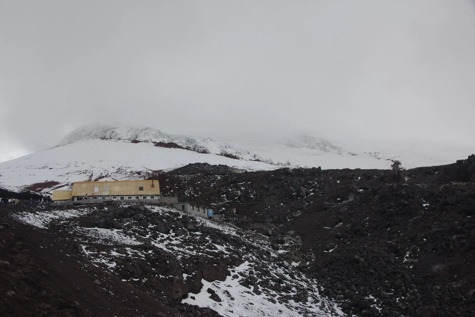
The José Rivas refuge as a small building on the dark ash slope of Cotopaxi, snow and clouds above
From below the refuge looks tiny – the 260 m from the parking lot are a serious hour at 4,800 m.

Photo: diego_cue · CC BY-SA 3.0

The rulesSummit with a guide only: what the climb requires

For the park and the refuge your passport is enough. For everything above, a list of requirements from the environment ministry has applied since the reopening on February 21, 2024 – in practice the operator handles it, but you should know what is on it.

1

Registration at the checkpoint

Show your passport or ID, your name goes in the book. No registration, no entry. Gates open 8 a.m. to 3 p.m.; for summit climbs, Caspi and Norte admit until 4 p.m.

2

Certified guide, two clients per guide

A professional high-mountain guide with a certificate is required – in practice ASEGUIM (IFMGA/UIAGM). Registered mountaineering clubs may enter with their club credential.

3

Quota, refuge, liability waiver

The operator applies for the quota with the park office (cotopaxi@ambiente.gob.ec), registers you in the SIB environmental system and books the refuge. Plus a liability waiver with a copy of your ID.

4

Wristband, gas mask, insurance

At the gate you get an authorization wristband – without it there is no way past the refuge. Also required: life insurance, an emergency kit, proof of the IG-EPN safety briefing and a gas mask with filter.

Official prices · as of 09/2026
Entry to Cotopaxi National Park, Ecuadorians and foreigners alike (Acuerdo Ministerial 006/2012)free
Registration at the checkpoint with passport or IDfree, mandatory
José Rivas refuge: overnight with dinner, midnight snack and breakfast (operator/portals, not official)approx. $34–35
José Rivas refuge: bunk only (portals, not official)approx. $20–30
Sources: reopening requirements of the Ministerio del Ambiente, February 21, 2024 (El Telégrafo, Teleamazonas, Primicias) · park office in Latacunga, November 2024 · ministry brochure “Áreas Protegidas de la Sierra”, November 2024. The lead time for summit registration is given inconsistently (24 hours to 4 days) – allow a week. Alcohol and pets are banned in the park. Ecuador uses the US dollar.
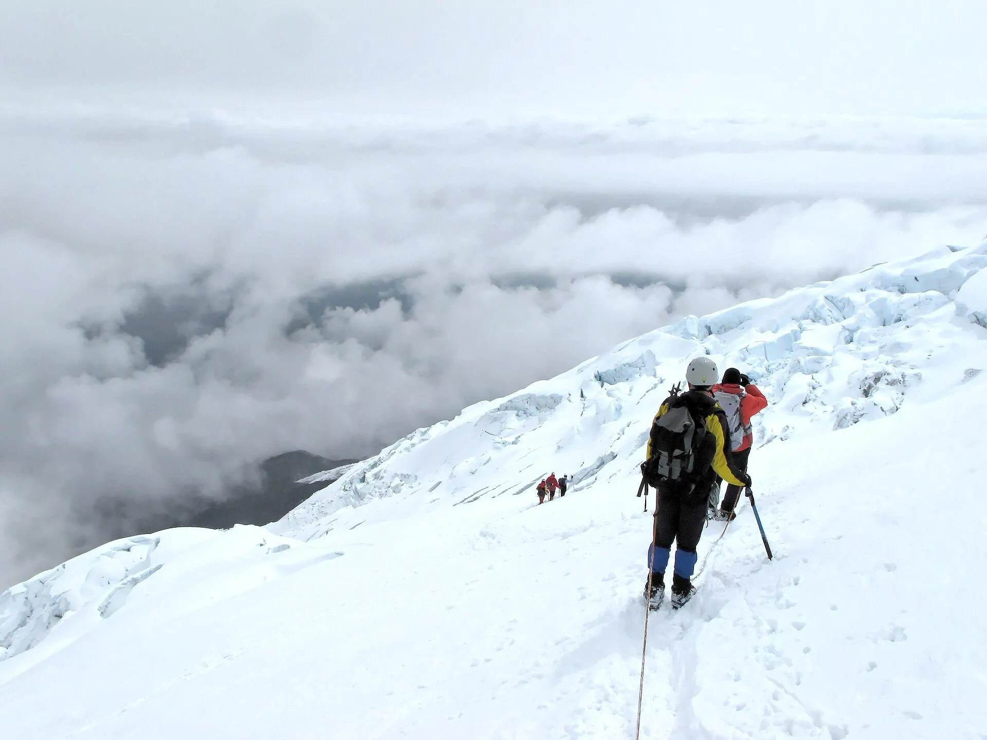
Two roped climbers on the glacier of the Cotopaxi normal route, a sea of clouds below
The normal route up the north flank: 6 to 8 hours of glacier in the dark, grade PD-, and one guide for every two clients.

Photo: Bbb-Commons · CC BY-SA 3.0

Ways upFrom the checkpoint to the crater rim

Stages on Cotopaxi · as of 09/2026
Road from the Caspi checkpoint (3,400 m / 11,150 ft) – Laguna Limpiopungo – parking lot (approx. 4,600 m / 15,090 ft)About 1 hour on gravel, switchbacks in volcanic sand near the top; 4WD recommended, not required. Free. Taxi or pickup from the Pan-American Highway $15–30 according to guidebooks.
Trail from the parking lot to the José Rivas refuge (4,864 m / 15,958 ft)260 m (850 ft) of climbing, 45–60 minutes up in loose volcanic sand, 20–30 minutes down. No guide needed, free. Refuge office 8 a.m. to 5 p.m.
Refuge – glacier edge (approx. 5,000–5,100 m / 16,400–16,730 ft)30–60 minutes. Guide and registration required – day-tour operators from Quito charge around $60–100 including transport.
Normal route, north flank – summit (5,897 m / 19,347 ft)Departure around midnight, 6–8 hours of ascent with crampons, ice axe and rope (PD-), 3–4 hours down. Two-day climb after 2–4 days of acclimatization, from about $300–450 with an ASEGUIM guide.
Best summit windows: December to February and June to September; March to May is the wettest period. Guides turn back in storms, fresh snow or open crevasses. After the earthquake of August 16, 2025, the IG-EPN warned of glacier instability.
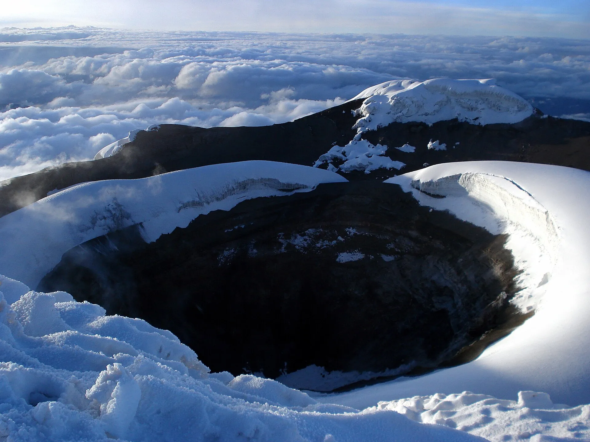
The summit crater of Cotopaxi: a dark pit with steep ice walls, snow and clouds all around
The crater rim at 5,897 m. CO₂ and SO₂ can pool here – which is why a gas mask is on the list of requirements.

Photo: Pete from USA · CC BY-SA 2.0

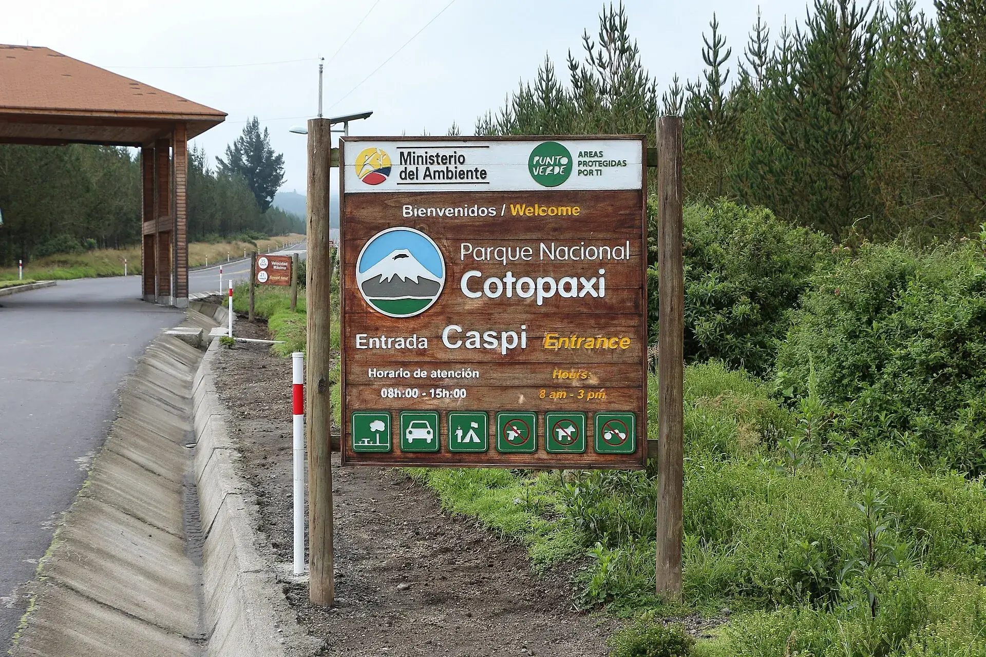
The entrance sign of Parque Nacional Cotopaxi at the Caspi checkpoint beside the access road
Control Caspi, the southern gate: show your passport, get written in, drive on. Nobody asks for money here.

Photo: Bernard Gagnon · CC BY-SA 3.0

Good to knowGetting to Cotopaxi, best time, altitude, tips

Getting there

Without a car: Bus from Quito (Terminal Quitumbe) toward Latacunga, get off at the Control Caspi turnoff (Pan-American Highway km 42) or in Machachi for the northern gate; from there pickup/taxi to the park (guidebooks: $15–30 per ride to the checkpoint, considerably more to the parking lot). Without a vehicle the park is practically impossible to explore – day tours from Quito (usually with Limpiopungo, the refuge and an optional mountain-bike descent) are the usual way.

By car: From Quito on the Pan-American Highway south (E35); southern gate: turn left at km 42 (shortly before Lasso), 15 minutes of asphalt to Control Caspi. Northern gate: in Machachi turn off toward Güitig and follow cobblestones to El Pedregal, 20 minutes to the checkpoint hut. Gravel inside the park; parking lot at the refuge at about 4,600 m, free. Registration at the checkpoint with passport.

  • From Quito · 1.5–2 hours to the checkpoint, about 1 more hour to the parking lot
    Pan-American Highway south to km 42 (Caspi) or via Machachi (Norte); day tour or rental car
  • From Latacunga · about 45 minutes to Control Caspi
    Pan-American Highway north to km 42 / Caspi turnoff
  • From Machachi · about 40 minutes to the checkpoint hut
    via Güitig and El Pedregal to Control Norte

Best time to go

The drier and clearer months are June to September and December to February; March to May brings the most rain (the ministry brochure names March, April and May as the wettest months). The summit shows itself most often early in the morning – if you want to see it, be at the checkpoint at 8 a.m. Clouds almost always roll in during the afternoon. For the summit climb, December–February and June–July/August are considered the best windows.

Who it suits

Children
Fine as far as Limpiopungo (3,800 m / 12,470 ft) and the parking lot; many families also walk to the refuge. Children are more sensitive to altitude – turn back immediately at the first headache or nausea. Summit: operators usually set a minimum age of 16–18 (not official).
Minimum age
none official for park and refuge; summit usually from 16–18 with parental consent according to operators
Fitness
Refuge hike: short, but strenuous at 4,600–4,864 m and in volcanic sand. Summit: fitness for 6–8 hours of glacier climbing at night, experience with crampons an advantage, several days of acclimatization required.
Altitude
Very relevant: the parking lot sits higher than any summit in the Alps. Coming straight from Quito (2,850 m / 9,350 ft), walk slowly, drink plenty, no alcohol. Symptoms (headache, nausea, dizziness) mean: stop and drive down. Before a summit attempt spend at least 2–4 days at altitude (e.g. Rucu Pichincha, Iliniza Norte, Rumiñahui).
Heart and lungs
With heart, lung or circulatory conditions get medical clearance first; the partial pressure of oxygen at the refuge is about 55 % of sea level. Volcanic gases: CO₂ and SO₂ can pool at the summit and crater rim; the 2024 rules require a gas mask with filter and point out that no filter protects against CO₂ – avoid gas-rich hollows.
Wheelchair
The road is driveable to the parking lot; Laguna Limpiopungo has a flat loop trail (partly boardwalk) but no designated accessibility. The refuge is not reachable.
Dogs
Pets are prohibited in the national park (park office 11/2024).
Clothing
Layers: base layer, fleece, windproof rain jacket, hat, gloves, sunglasses (UV on snow), sunscreen. At the refuge, 0–5 °C (32–41 °F) and strong wind are normal even at midday. Summit: down jacket, glacier glasses, helmet, crampons, ice axe, harness – provided by operators.
Footwear
Sturdy hiking boots for the refuge (the sand slides). Summit: crampon-compatible mountaineering boots.

Tips you will need on site

  • Be early: Cotopaxi is usually cloud-free only in the morning; entry from 8 a.m., last admission 3 p.m.
  • Bring your passport – without registration at the checkpoint there is no entry.
  • Take the refuge hike easy: 4,864 m is more than the distance suggests. There is coca tea at the top.
  • For the summit, do not book an operator without an ASEGUIM guide, quota and refuge reservation; the wristband at the gate is your ticket upward.
  • The mountain-bike descent from the parking lot (4,600 m) to the southern gate (3,400 m) is a popular tour option – on gravel and volcanic sand, helmet only.
  • Check the current status the evening before: the IG-EPN website or the Telegram channel 'Sismos & Volcanes IGEPN', plus the SNGR alert level.
  • Carry cash in small US-dollar bills for the refuge, pickups and snacks; there is no card payment in the park.
  • As of September 22, 2026, the night-time curfews of the state of emergency affect only coastal provinces; the Sierra route Quito–Latacunga is open, but road blockades during protests are possible at any time (German Federal Foreign Office).

A short history

  • The name means roughly 'neck of the moon' in Quechua; for the indigenous peoples the mountain was sacred.
  • 1742, 1744 and 1768: severe eruptions; June 26, 1877 the most destructive to date – lahars reached the Pacific and the Amazon basin more than 100 km (60 miles) away.
  • November 28, 1872: first ascent by the German geologist Wilhelm Reiss and the Colombian Ángel Escobar.
  • July 24, 1970 to April 1971: construction of the Refugio José F. Ribas by the Grupo Ascensionismo of the Colegio San Gabriel (Quito) under Father José Ribas SJ; inaugurated on May 1, 1971 in front of about 2,000 people; extended in 1976/77.
  • August 11, 1975: the national park is established (Acuerdo Interministerial 0259-A).
  • Easter 1996: an ice avalanche hits the refuge, 13 dead.
  • August 14, 2015: reawakening after 138 years; the SNGR declares Alerta Amarilla (resolution 042-2015), summit closed; activity ends January 24, 2016; October 4, 2017 summit reopened.
  • October 21, 2022 to July 6, 2023: eruptive phase with ashfall as far as Quito; Alerta Amarilla since October 22, 2022 (resolution SNGRE-311-2022); February 21, 2024 progressive reopening of the summit, fully from November 2024.
  • August 16, 2025: M 4.8 earthquake ten kilometers northeast of the volcano with 180 aftershocks; the IG-EPN steps up monitoring, no eruption.
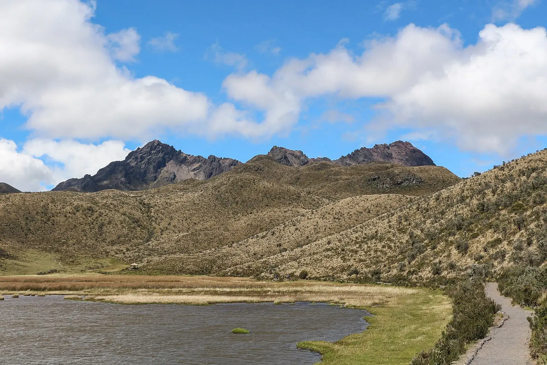
Laguna de Limpiopungo in Cotopaxi National Park with a lakeside trail, the rugged Rumiñahui behind
Limpiopungo, 3,800 m: the flat loop takes 45 minutes and is the part of the park that works even with an altitude headache.

Photo: Bernard Gagnon · CC BY-SA 3.0

Two destinations, one dayCotopaxi and Quilotoa in one day

The most booked tours from Quito combine Cotopaxi with the Quilotoa crater lake: Limpiopungo and the refuge hike in the morning, the view into the turquoise lagoon in the afternoon. Ten to eleven hours, a lot of driving – but the combination that otherwise costs two days.

Affiliate links to GetYourGuide: if you book, we earn a commission and the price stays the same. Prices and ratings as of 22 September 2026. With combo tours, ask in advance whether the hike to the refuge is included or only the lagoon.

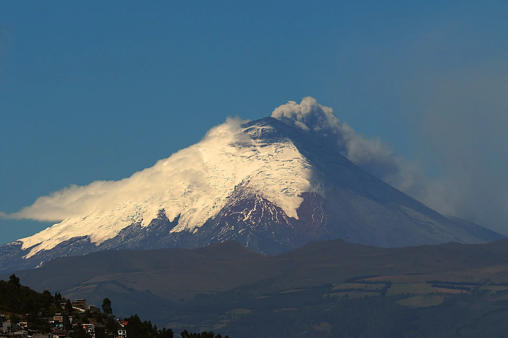
Cotopaxi sending up a gray ash column in August 2015, the houses of Quito in the foreground
August 2015, seen from Quito: the reawakening after 138 years. The mountain is quiet today – but this is how close the capital sits.

Photo: Agencia de Noticias ANDES · CC BY-SA 2.0

Outdated onlineWhat other sites get wrong

“The national park charges a $10 entrance fee.”
Since Acuerdo Ministerial 006 of January 17, 2012, entry to all of Ecuador's mainland protected areas is free, for foreigners too. Only registration is mandatory.
“You can only go as far as the refuge – the summit is closed.”
That was true in 2015–2017 and from October 2022 to February 2024. Since February 21, 2024, the summit has been reopened in stages, and fully for guided groups since November 2024.
“Cotopaxi is still erupting.”
The eruptive phase ended with the last ash emission on July 6, 2023. The IG-EPN has reported low activity continuously since 2024, most recently on September 4, 2026.
“You can walk up to the glacier without a guide.”
Everything above the refuge counts as high mountain terrain with mandatory registration and a guide – including the hour to the glacier edge.
“At 5,897 m it is the highest active volcano in the world.”
One of the highest, not the highest. Ojos del Salado (6,893 m) and Llullaillaco are higher. The ministry's wording is correct: “uno de los volcanes activos más altos del mundo”.

Quick answersBefore you drive into the park

Can you climb Cotopaxi right now?

Yes. The summit route has been fully open to guided groups since November 2024, and on September 4, 2026, the IG-EPN rated activity as low and unchanged. You need a certified guide, registration with the park office and a refuge reservation – the operator takes care of that.

Do you need a ticket for Cotopaxi National Park?

No. Entry has been free since 2012; at the checkpoint you register with your passport or ID. There is no online booking and no time slot.

How high is the José Rivas refuge and how do you get there?

4,864 m (15,958 ft). From the parking lot at about 4,600 m you walk 45 to 60 minutes uphill in volcanic sand, no guide needed. From the checkpoint to the parking lot is about an hour's drive on gravel.

Is a Cotopaxi day trip from Quito worth it?

Without your own vehicle it is the usual way in: the park is practically impossible to explore without a car, and taxis from the Pan-American Highway cost $15–30 to the checkpoint according to guidebooks, considerably more to the parking lot. Day tours with Limpiopungo and the refuge start at around €50.

What does the yellow alert at Cotopaxi mean?

On October 22, 2022, the SNGR declared a yellow alert for the lahar zones along the rivers downstream – not for visiting the park. Park and summit are open; if sirens sound, leave the river valleys. No formal lifting of the alert could be found as of September 22, 2026.

Is Cotopaxi open right now?

Yes, as of September 22, 2026, the national park, the refuge and the summit route are open. The IG-EPN rated activity as low and unchanged on September 4, 2026; the SNGR yellow alert from 2022 concerns the lahar zones in the surrounding area, not visits to the park. Short closures of individual gates occur during events (most recently August 10–11, 2026 at Control Caspi).

How much is the entrance fee for Parque Nacional Cotopaxi?

Nothing. All of Ecuador's mainland protected areas have been free for Ecuadorians and foreigners since 2012. At the checkpoint you are registered with your passport or ID. Costs arise only for transport, an overnight stay at the refuge and guides.

Can you climb Cotopaxi without a guide?

Up to the José Rivas refuge at 4,864 m, yes – anyone may go there without a guide or registration. From the glacier and for the summit, a certified high-mountain guide (ASEGUIM), registration with the park office, a refuge reservation, a liability waiver and an authorization wristband are mandatory.

How long does the climb take?

From the parking lot to the refuge is 45 to 60 minutes on foot. The summit is a two-day climb: travel in and overnight at the refuge, departure around midnight, 6 to 8 hours of ascent over the glacier, 3 to 4 hours back. Before that you should allow 2 to 4 days of acclimatization.

Is Cotopaxi suitable for children?

The park with Laguna Limpiopungo and the drive to the parking lot are family-friendly, and the hike to the refuge works with children who like walking. But the altitude of more than 4,600 m can cause headaches and nausea – if so, drive down immediately. For the summit, operators usually require an age of 16 to 18.

What should you wear?

Even when it is sunny in Quito: fleece, windproof rain jacket, hat, gloves, sunglasses and sunscreen, sturdy hiking boots. At the refuge the temperature is often around freezing with strong wind. Summit equipment (boots, crampons, ice axe, helmet, harness) is provided by the operator.

How do you get to Cotopaxi?

From Quito on the Pan-American Highway south to km 42 for the southern gate Control Caspi (1.5–2 hours) or via Machachi to Control Norte. Inside the park a gravel road leads past Limpiopungo to the parking lot at 4,600 m. Without a car: bus to the turnoff and a pickup, or a day tour from Quito.

Is Cotopaxi dangerous?

The volcano is active but has been quiet since July 2023; the risk inside the park is currently low. The real hazards are altitude sickness (parking lot at 4,600 m), sudden weather changes and, on the summit, crevasses, avalanches and volcanic gases – hence the guide requirement. In the surrounding area a yellow alert applies because of possible lahars in a future eruption.

How high is Cotopaxi, and is it the highest active volcano in the world?

5,897 m (19,347 ft) according to the IG-EPN. It is Ecuador's second-highest mountain after Chimborazo and one of the highest active volcanoes on Earth, but not the highest – Ojos del Salado in Chile/Argentina is higher at 6,893 m.

When did Cotopaxi last erupt?

From October 21, 2022 to the last ash emission on July 6, 2023, with ashfall as far as Quito. Before that in 2015/16 after 138 years of quiet. The last major eruption with lahars reaching the Pacific was in 1877.

How do you book the summit climb?

Through a licensed operator or registered mountaineering club, which applies for the quota with the park office (cotopaxi@ambiente.gob.ec), handles the SIB registration and reserves the refuge. Two clients per guide is the standard; operators require life insurance and proof of the IG-EPN safety briefing.

Can you stay overnight at the José Rivas refuge without going for the summit?

Yes, day visitors and overnight guests are welcome; bunks in dormitories, meals on advance order. Reserve by email (reservasrefugiocotopaxi@gmail.com) or via the Facebook page; an overnight stay with meals costs around $35 according to the operator.
Sources · accessed on 22 September 2026