Volcano·Guide
The Crow Valley at Mount Pinatubo: a gray lahar plain with jeep tracks, jagged ocher ash walls on both sides Two hikers in the O'Donnell riverbed at Mount Pinatubo, between tall light-gray lahar walls under a blue sky The turquoise crater lake of Mount Pinatubo inside the caldera, steep rock walls all around, a group of visitors on the shore

Mount Pinatubo

One hour in an open 4x4 through the lahar canyons of the Crow Valley.

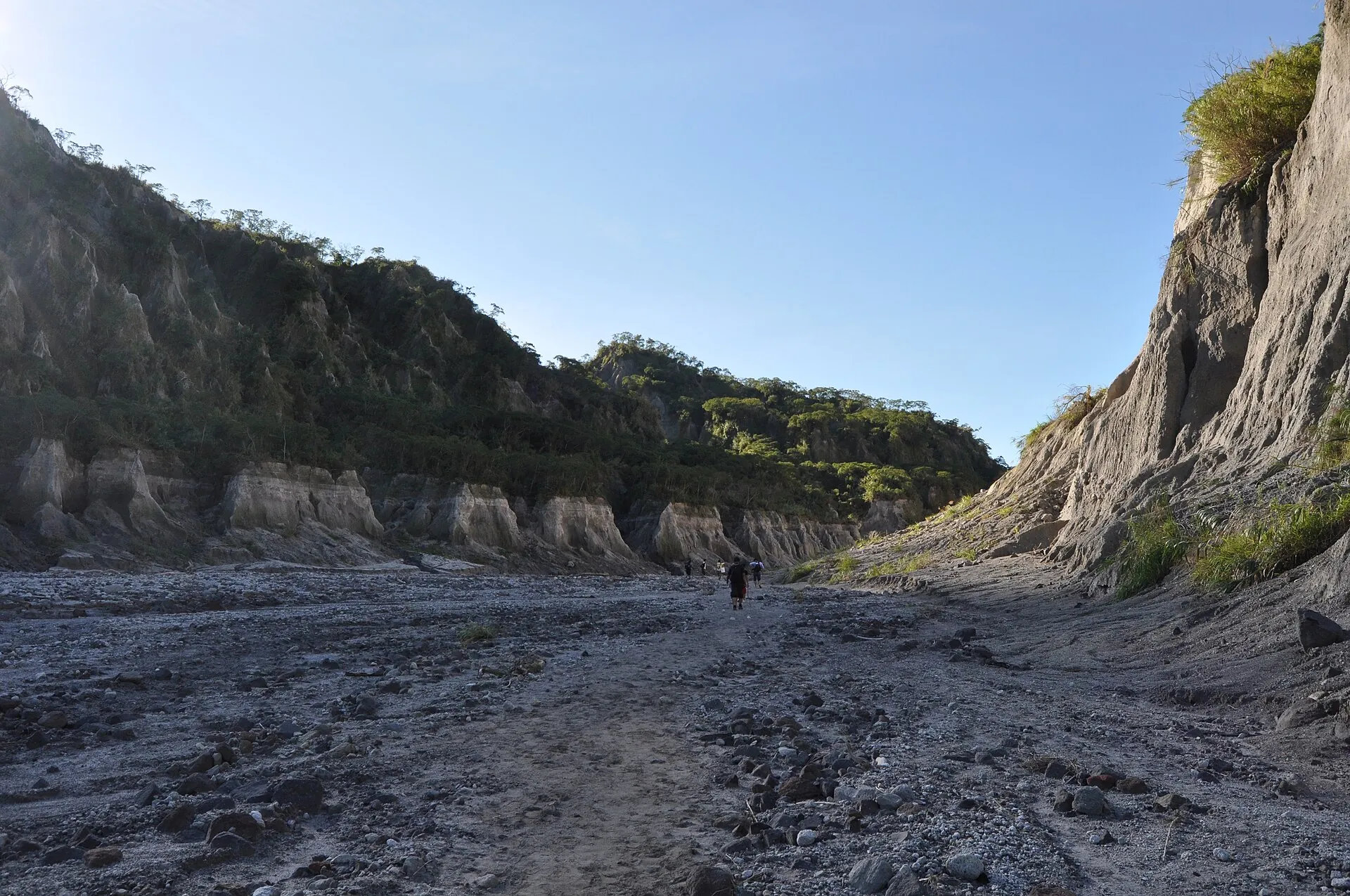
Then on foot, one and a half to two hours in the O'Donnell riverbed, with no shade.

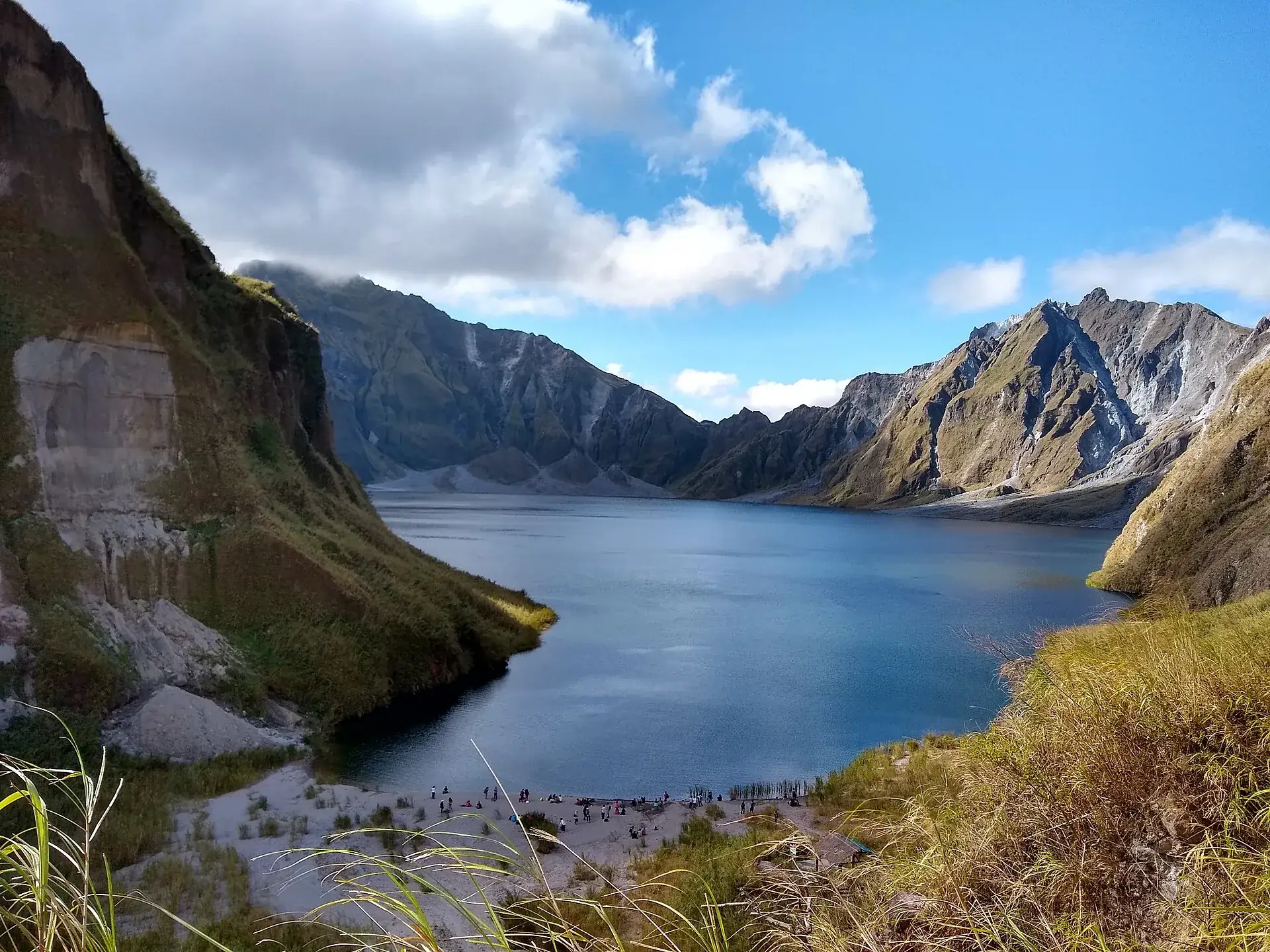
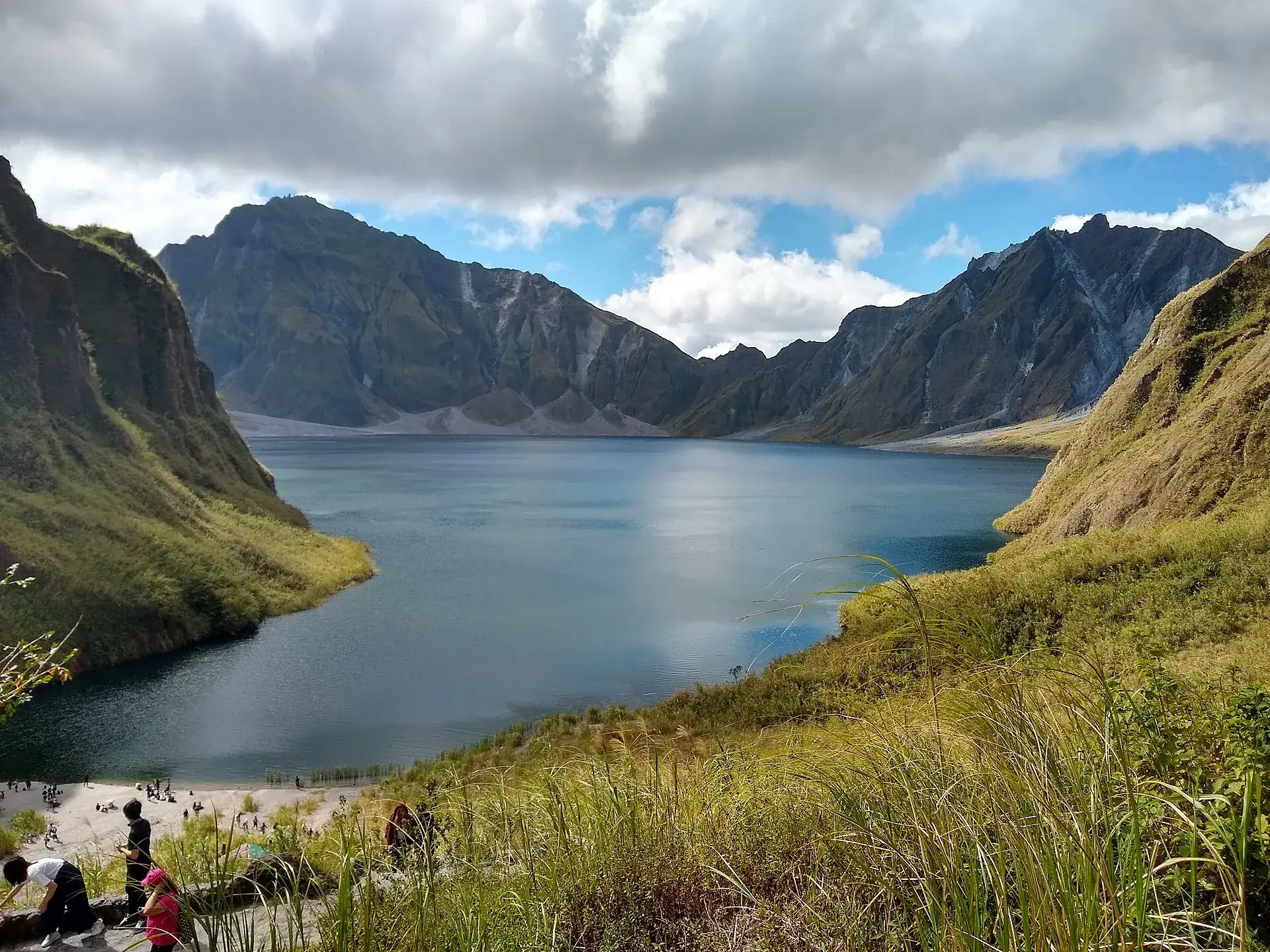
And suddenly: the lake, turquoise, in a caldera two and a half kilometers wide.

Scroll –
from the jeep to the crater lake

As of 23 September 2026What applies at Mount Pinatubo today

Mount Pinatubo (1,486 m / 4,875 ft) produced the second-largest volcanic eruption of the 20th century on 15 June 1991. Today a crater lake fills the caldera, and the way there is a regulated day trip: registration at dawn, an assigned jeep, an assigned guide. Volcanically it is quiet – Alert Level 0 since August 2021. The real hazard is flash floods in the riverbed you hike through: on 29 August 2026 PHIVOLCS issued a lahar warning because of the monsoon, explicitly including the O'Donnell.

Open · rainy season
5:00am

Capas route from Santa Juliana

Back in operation since 23 June 2025, after two months of closure. Day trips only: registration from about 4:45 am, last entry between 5:30 and 7:00 am depending on the source. Rainy season until November – on rainy days nobody starts.

Capas fee + Botolan/Aeta fee + jeep + guide, see belowfrom approx. 1,500 PHP p. p.
Mandatory for foreigners

Air Force visit clearance

The route crosses the Colonel Ernesto Rabina Air Base in the Crow Valley. Since 10 March 2024 foreign nationals need a clearance from the Philippine Air Force – passport copy 20 to 35 days ahead via the operator or the tourism office. No passport and copy on the day, no entry.

free according to operators0 PHP
Prohibited

Swimming in the crater lake

Since January 2013, after a visitor drowned. According to a PHIVOLCS analysis the water contains arsenic, aluminum and boron. Penalties hit both guest and guide. There are no boats anymore.

DOT warning of 5 January 2013
No clearance needed

Inararo route from Clark

Alternative via Sitio Inararo (Porac) to the Ana-An falls and the summit ridge – not through military land, so no Air Force clearance. Demanding; operators set a minimum age of 13 or 16.

operator packagesfrom 3,450 PHP p. p.
Sources: HazardHunterPH (DOST-PHIVOLCS) – Alert Level 0 since 12 August 2021 · PHIVOLCS lahar warning of 29 August 2026 (Philstar, Daily Tribune) · reopening of the Capas route on 23 June 2025 (TripZilla, operators) · Philippine Air Force, visit clearance effective 10 March 2024 (operator Pinatubo Mountainero, updated 27 February 2026). The Municipality of Capas' fee schedule was unreachable on 22 September 2026; all fees come from operator and travel sites (06/2025–02/2026).
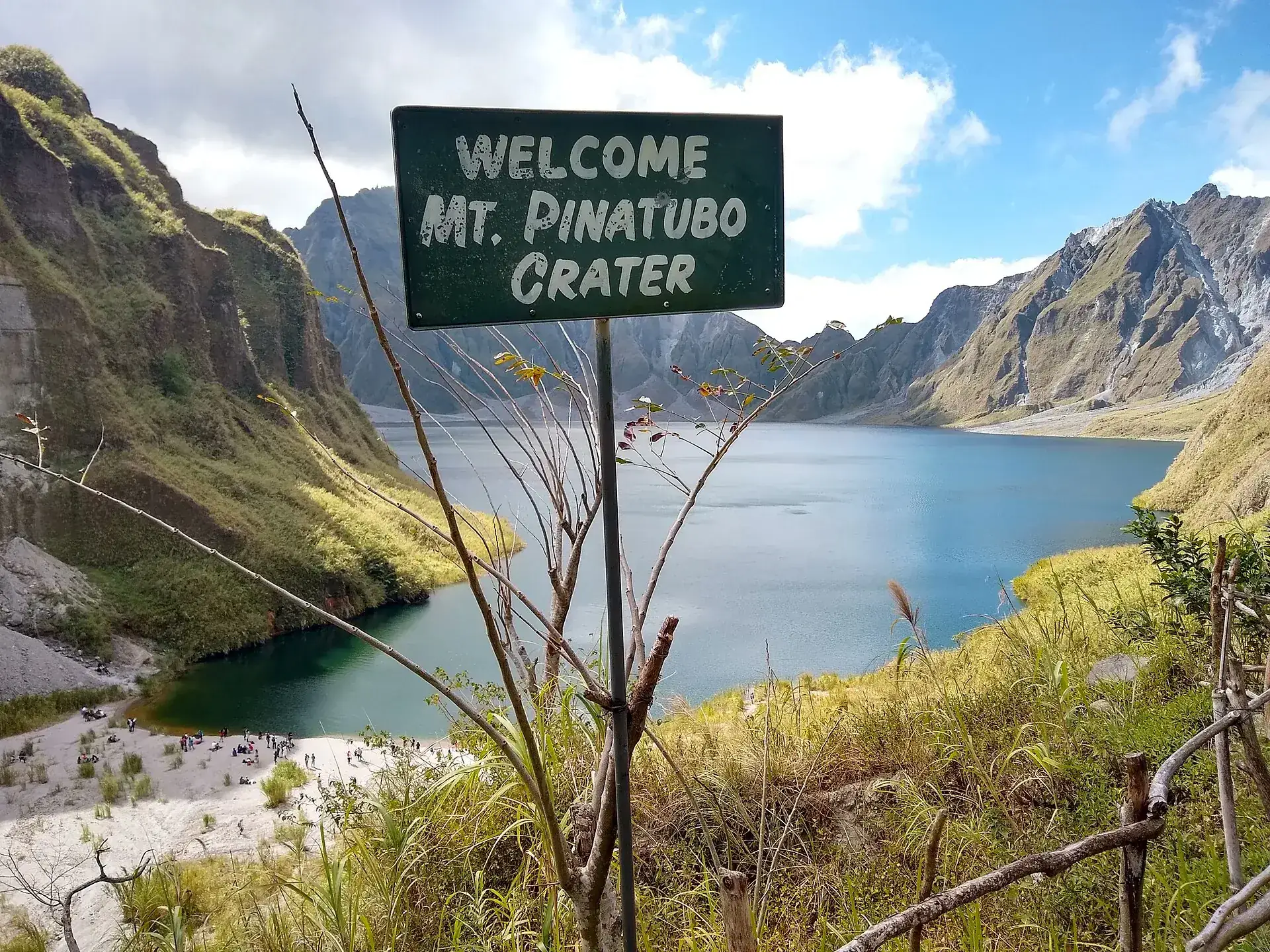
Green sign reading “Welcome Mt. Pinatubo Crater” at the viewpoint, the blue crater lake and caldera walls behind it
The sign at the end of the trail. Anyone standing here was in Santa Juliana at five in the morning.

Photo: Lance Vanlewen · CC BY-SA 4.0

The experienceThrough the ash of 1991 to a lake that only formed in 1992

The jeep ride is dusty and rough: the Crow Valley is a plain of lahar sand cut by streams, with walls of pale gray ash on both sides. Then you get out and continue in the O'Donnell riverbed, wading knee-deep several times, without a meter of shade. The final climb takes twenty minutes and is steeper. At the top lies the lake – 1.83 km² (0.7 sq miles), roughly 100 m (330 ft) deep, filled by rain since 1992. You may not swim. Sit down, look, eat: yes.

Affiliate links to GetYourGuide: if you book, we earn a commission and the price stays the same. Prices and ratings as of 22 September 2026. Only two offers with few reviews – the selection is thin. Foreign nationals: before booking, confirm that the operator applies for the Air Force visit clearance and how many days of lead time they need. If the authorities cancel (rain, exercises), operators say there is no refund.

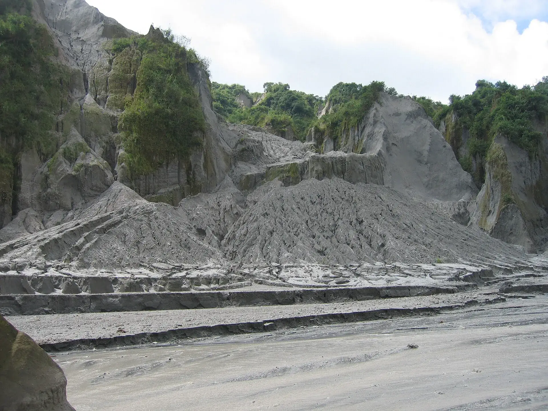
Pale gray lahar deposits at Mount Pinatubo: an eroded ash wall with gullies, the wide flat riverbed in front
Everything gray here came out of the mountain in 1991. In heavy rain it starts moving again – hence the lahar warnings.

Photo: Neureiter · CC BY 2.5

The rulesHow the Mount Pinatubo trek works – step by step

Nothing at Pinatubo is free-access. Entry starts at the Municipal Tourism Office in Santa Juliana (Capas, Tarlac) and passes two military checkpoints, Falcon Gate and Condor Gate. Knowing the order saves you from being turned away.

1

The evening before: get to Santa Juliana

From Manila 2.5–3 hours via NLEX and SCTEX, or bus to Capas Junction and a tricycle (300–600 PHP). Homestays in the barangay. If you are not at the tourism office by 5 am, you risk being turned away even with a booking.

2

Registration from 4:45 am

Queue number, waiver, blood pressure check from age 40, medical certificate or travel insurance from age 60. Foreigners: passport and copy, and the Air Force clearance must be on file. Last registration between 5:30 and 7:00 am depending on the source.

3

Jeep and guide are assigned

Private vehicles are not allowed into the Crow Valley. A local 4x4 with driver (2,500–3,500 PHP, up to 5 people) and a guide (500 PHP per group), mostly Aeta, are mandatory. Everything in cash – there is no ATM in Santa Juliana.

4

Back by 1–3 pm

One hour by jeep, 1.5–2 hours on foot, time at the lake, the same way back. In the dry season the jeeps drive farther and 30–60 minutes of walking remain. Showers at the homestays 50–100 PHP.

Fees at Mount Pinatubo · as of 02/2026 (operator and travel sites)
Environmental/conservation fee of the Municipality of Capas, per person300 PHP (approx. $4.80)
Botolan/Aeta fee (Municipality of Botolan, ancestral domain), per person – operators quote 400 to 700 PHP400–700 PHP (approx. $6.40–11.20)
4x4 jeep with driver (mandatory), per vehicle for up to 5 people2,500–3,500 PHP (approx. $40–56)
Local guide (mandatory), per group or per jeep500 PHP (approx. $8)
Surcharge for your own 4x4 instead of a rental jeep (private tours only) · parking at the tourism office 50 PHP · shower 50–100 PHP550 PHP
Philippine Air Force visit clearance for foreign nationalsfree (according to operators)
As a group of five in one jeep you end up at about 1,500–2,000 PHP per person (approx. $24–32); on your own you easily pay more than 4,000 PHP. Operator packages from Santa Juliana start at about 2,700–3,000 PHP, from Clark at 3,000–3,600 PHP. Legal basis of the Botolan fee according to SunStar: Municipal Ordinance No. 1 s. 2015 (700 PHP); which amount has officially applied since the 2025 reopening is not documented. We found no ordinance number for the Municipality of Capas.
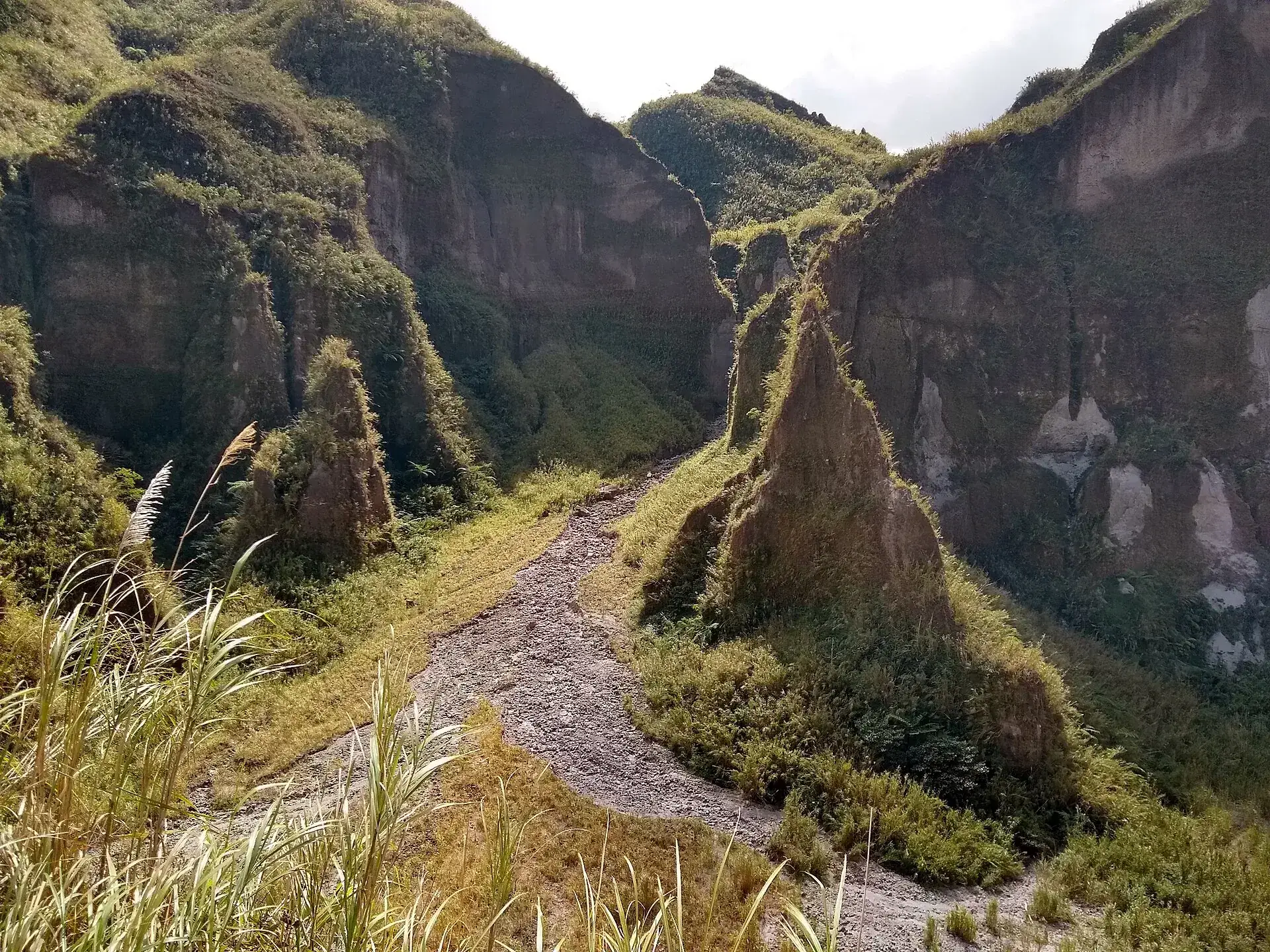
A narrow trail winds uphill between green-covered, pointed ash pinnacles at Mount Pinatubo
The final climb: twenty minutes steeper than the rest, between ash pinnacles the rain has been carving since 1991.

Photo: Lance Vanlewen · CC BY-SA 4.0

Ways upThree routes, one of them the standard

The crater lies in the territory of Botolan (Zambales), the usual starting point in Capas (Tarlac) – which is why two municipalities collect fees, and why Botolan was able to halt the trek by executive order in 2025.

Standard

Capas route: Crow Valley and O'Donnell

4x4 about 1 hour each way, then 5.5–7 km (3.4–4.3 miles) on foot (1.5–2 hours) with about 300 m (1,000 ft) of climbing, difficulty 2 of 9 on the Philippine scale. 6–8 hours in total from Santa Juliana. In the dry season the jeeps drive farther and the walk shrinks to 3–4 km.

December–May best, January–March clearest1,500–2,000 PHP p. p.
No military land

Inararo route from Clark

From Sitio Inararo (Porac, pickup in Clark/Angeles): 1 km to the Ana-An falls, another 4.8 km to the “Pinatubo Summit”. Developed since March 2022 by the village's Aeta organization; it also ran in 2025 while the Capas route was closed.

full day, minimum age 13 or 16 per operatorfrom 3,450–3,750 PHP p. p.
Rarely offered

Botolan route (west side)

Multi-day from Botolan/Villar in Zambales. Closed in 2025 together with the Capas route; today only occasionally on offer.

no reliable prices
Visitors sitting on the grassy slope above the crater lake of Mount Pinatubo, blue-green water, the caldera wall opposite
The shore is where it ends: no swimming since 2013, no more boats. Keep your distance from the walls – rockfall.

Photo: Lance Vanlewen · CC BY-SA 4.0

Good to knowGetting to Mount Pinatubo, best time, gear

Getting there

Without a car: Bus from Manila (Cubao or Pasay; Victory Liner, Five Star or other lines toward Baguio/Pangasinan/Tarlac) to Capas Junction (stop by the McDonald's), 210–280 PHP, 2.5–3 hours; then a tricycle to Santa Juliana, 20–24 km (12–15 miles), 300–600 PHP per ride – arrange the return trip right away. Because of the 5 am registration, most people go the evening before or book a transfer from Manila/Clark (pickup 2:30–4:00 am).

By car: NLEX to Dau/SCTEX, continue on the SCTEX to the Capas or New Clark City exit, then through Capas to Santa Juliana (2.5–3 hours from Manila). Parking at the tourism office 50 PHP. Your own car is not allowed into Crow Valley.

  • From Manila · 2.5–3 hours (Capas is 108 km / 67 miles north of Manila, Santa Juliana a further 20 km / 12 miles or so to the west)
    Car/van via NLEX and SCTEX (Capas or New Clark City exit) or bus to Capas Junction + tricycle
  • From Clark / Angeles City · about 1 hour
    Van transfer by the operators, pickup usually 3:30–4:00 am
  • From Tarlac City · about 1 hour
    via Capas (16 km / 10 miles) to Santa Juliana

Best time to go

December to May (dry season): the jeeps get far into the valley, the walk is short, the lake glows turquoise; January to March are considered the best weeks, with clear visibility. From April on, sweltering heat in the canyon and – usually from the second half of April to early May – the Balikatan exercise with possible closure days. June to November, southwest monsoon: flash floods in the O'Donnell, lahar warnings from PHIVOLCS, a longer walk, a muddy lake. Always start as early as possible: register at 5 am, reach the crater around 8 am, get back before the midday heat.

Who it suits

Children
Doable for school-age children who like to walk: a flat but long and shadeless route, plus a very rough jeep ride. Operators accept children from age 6 (Pinatubo Mountainero) or age 7 (e-Philippines).
Minimum age
6 or 7 years (operator rule; no municipal requirement was found). Blood pressure check at registration from age 40 (limit 140/90 per Tunex), medical certificate or travel insurance from age 60, otherwise no start.
Fitness
Low to moderate: 11–14 km (7–8.7 miles) round trip on gravel and lahar sand with stream crossings, about 300 m (985 ft) of elevation gain, difficulty 2 of 9 on the Philippine scale. The real adversary is the heat in the shadeless canyon.
Altitude
no (crater rim below 1,500 m / 4,920 ft)
Heart and lungs
High blood pressure is grounds for exclusion without a medical certificate (blood pressure check from age 40 at registration). Asthmatics: the jeep ride through the lahar valley is extremely dusty – bring a cloth mask or buff. At the crater rim, the DOT (2013) and PHIVOLCS (2021) warn of rockfall and landslides.
Wheelchair
not possible
Dogs
no rule found; practically ruled out because of the jeeps, heat and river fords
Clothing
Light, long clothing against the sun, hat or cap, sunscreen, cloth/mask against dust, a change of clothes for the ride back, at least 1.5–2 liters (50–68 oz) of water, snacks; in the rainy season a rain jacket and a waterproof bag.
Footwear
Trekking shoes or sturdy trail runners that can get wet – several knee-deep stream crossings; sandals are unsuitable, and a spare pair for the jeep makes sense.

Tips you will need on site

  • Travel to Santa Juliana (homestays) or Capas the evening before: anyone not standing at the tourism office at 5 am risks being turned away despite a booking.
  • Foreign nationals: send a passport copy to the operator or the tourism office 35 days ahead – the Air Force does not issue the Visit Clearance at the gate. Carry your passport and the copy on the tour day.
  • Pay cash: 300 PHP environmental fee, 400–700 PHP Botolan/Aeta fee per person, plus your share of the jeep (2,500–3,500 PHP) and guide (500 PHP) – there is no ATM in Santa Juliana.
  • Fill the jeep: the vehicle rental is per jeep for up to five people; solo travelers pay up to three times as much with operators.
  • Between mid-April and early May (Balikatan), ask the Capas tourism office or your operator whether Crow Valley is closed or the cutoff time has been moved earlier.
  • Stay out of the lake: swimming ban since 2013 with penalties for guest and guide, no more boats. On the shore, keep your distance from the walls (rockfall, and CO2 according to PHIVOLCS).
  • Don't push it under a rain warning: in 2009 seven people died in the O'Donnell flood. If the guide turns back, turn back.
  • Dust cloth and sunglasses for the jeep ride, water shoes for the stream crossings, leave a change of clothes in the jeep; showers are available at the homestays for 50–100 PHP.

A short history

  • Before 1991, Pinatubo was a 1,745 m (5,725 ft) forested and largely unknown volcano; the Aeta lived on its slopes. Phreatic explosions began on 2 April 1991, and PHIVOLCS and the USGS set up a monitoring network within weeks.
  • 15 June 1991: climax with VEI 6, eruption column 34–40 km (21–25 miles) high, about 10 km³ (2.4 cubic miles) of ejecta – the second-largest eruption of the 20th century after Novarupta in 1912. At the same time, Typhoon Yunya passed over Luzon; wet ash caused roofs to collapse. 847 dead, most from roof collapses. The evacuation of about 60,000 people and of Clark Air Base prevented 5,000–20,000 further deaths, according to USGS estimates.
  • About 20 million tons of sulfur dioxide in the stratosphere cooled the Earth by about 0.5°C (0.9°F) in 1991–1993. The summit dropped to 1,486 m (4,875 ft), leaving a 2.5 km (1.6 mile) wide caldera in its place.
  • 1990s: lahars from the pyroclastic deposits devastated valleys in Zambales, Tarlac and Pampanga for years; tens of thousands of Aeta were moved to resettlement areas. By 1992 the caldera had filled with rainwater to form Lake Pinatubo (1.83 km² / 0.7 sq miles, today about 95–115 m / 310–380 ft deep, water level around 900 m / 2,950 ft).
  • September 2001: fearing a breach of the crater wall, the government had a 5 m (16 ft) wide channel dug at the Maraunot Notch and a quarter of the lake's volume drained. On 10 July 2002 the wall breached anyway during storm rains: an estimated 160 million m³ (5.6 billion cubic feet) of water and sediment swept down the Bucao as a lahar toward Botolan.
  • In 1998 the Aeta began the first guided treks; from 2005 the municipality of Capas took over the Pinatubo Development Corp. and with it the management of the route from Santa Juliana. A 'Skyway' for 4x4s temporarily shortened the walk; it was destroyed in the 2011 rainy season.
  • 6 August 2009: during monsoon rains from Typhoon Kiko, a lahar flood of the O'Donnell sweeps away two jeeps; seven dead, including three French tourists and two guides. Police investigated negligence by municipal officials, and the DOT criticized the start despite a storm warning.
  • 2 January 2013: a 44-year-old overseas Filipino drowns after jumping into the crater lake – the first death in the lake. On 5 January 2013 the DOT warns of arsenic, aluminum, boron and other substances in the water and declares the lake 'no playground for swimming, kayaking or water wheels'; swimming ban since January 2013, boat rides (formerly 350 PHP) were discontinued.
  • 2009/2010: the NCIP grants the Aeta the Certificate of Ancestral Domain Title for the area around Pinatubo. 2015/2016: fee dispute between Botolan (Ordinance No. 1 s. 2015, 700 PHP) and Capas; Capas suspends the treks in March 2016, and in April 2016 Balikatan closes Crow Valley from 4 to 15 April.
  • 4 March 2021: after 25 years of quiet, PHIVOLCS raises the status to Alert Level 1 (1,722 weak earthquakes since January); 12 August 2021 back to Alert Level 0.
  • 10 March 2024: the Philippine Air Force requires a Visit Clearance for foreign nationals, because the route crosses the Colonel Ernesto Rabina Air Base.
  • 18 April 2025: Aeta block the access road and demand a share of the revenue; two arrests. 2 May 2025: Botolan suspends all tourism activities with EO No. 05 s. 2025, with the DOT's backing. 23 June 2025: reopening of the Capas route with new rules agreed with the Aeta clans.
  • 29 August 2026: PHIVOLCS lahar warning for the rivers of Pinatubo (including the O'Donnell) because of persistent monsoon rain – with no volcanic activity.
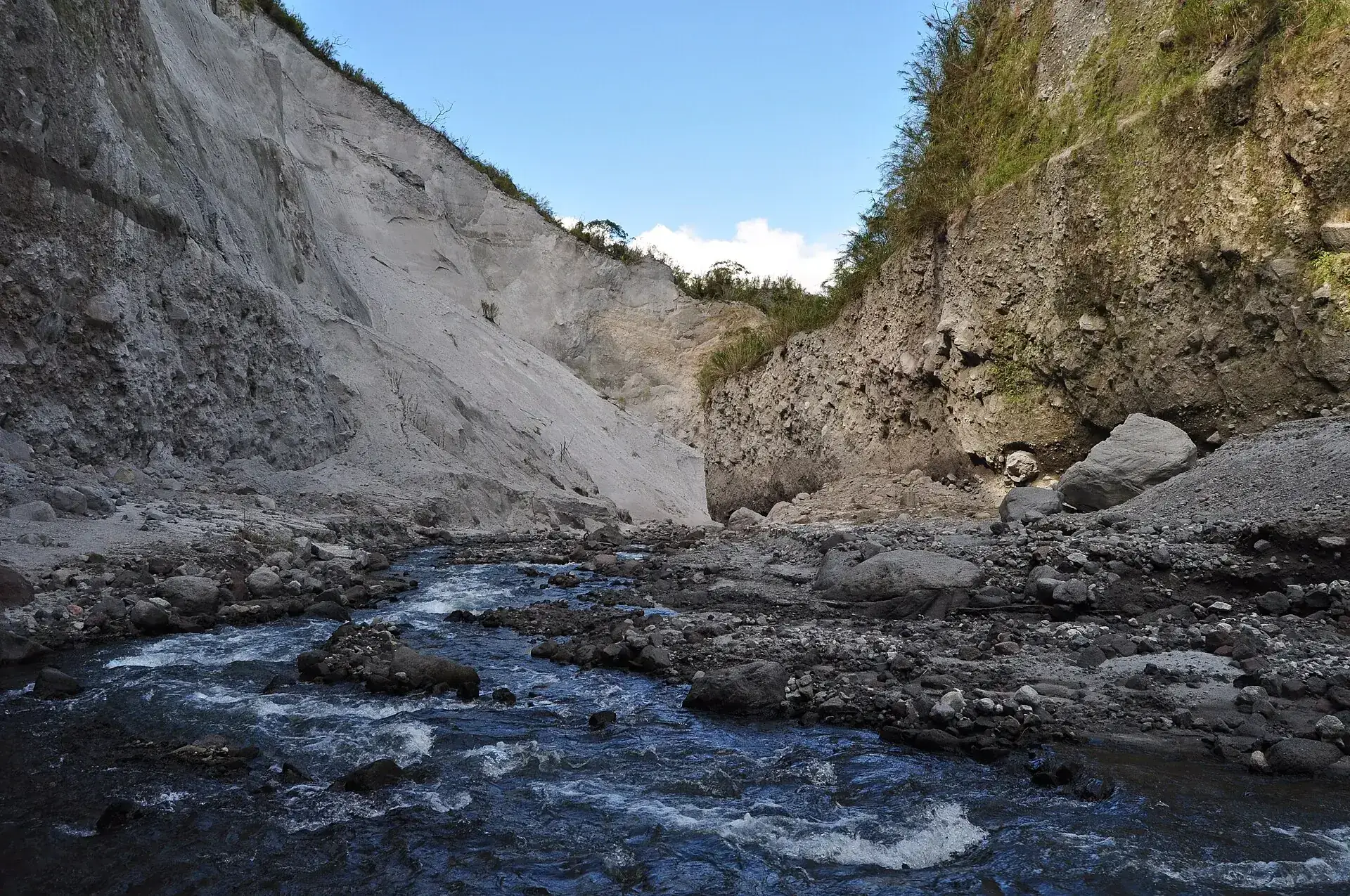
A clear stream flows over dark stones through the riverbed at Mount Pinatubo, a tall pale-gray ash wall behind
The stream crossings are knee-deep – in good weather. After rain the stream becomes a lahar; seven people died here in 2009.

Photo: Sindre Helvik · CC BY 3.0

When it does not runFour parties can close Mount Pinatubo

The trek does not depend on one authority but on four. Current closures appear on the Capas Tourism Office's Facebook page and with the accredited operators – ask first.

1

The Air Force

During live-fire exercises in the Crow Valley, above all during the annual Balikatan exercise with the US (2016: closed 4–15 April; 2024: operating with an earlier cut-off time; 2026 from 20 April, no closure was found). Ask between mid-April and early May.

2

The Municipality of Botolan

By executive order: No. 05 s. 2025 suspended all tourism activities from 2 May 2025 after Aeta blocked the access road on 18 April 2025, demanding a share of the revenue. Reopened 23 June 2025 with new rules agreed with the Aeta clans.

3

The Municipality of Capas

In a fee dispute (March 2016) or in bad weather. After the seven deaths of 6 August 2009 the Department of Tourism insisted on the old rule: start again only after two days of stable weather.

4

PHIVOLCS and the DOT

During volcanic unrest: in 2021 Pinatubo spent five months at Alert Level 1 and PHIVOLCS advised avoiding the crater. Regardless of the alert level, monsoon rain brings lahar warnings – most recently on 29 August 2026.

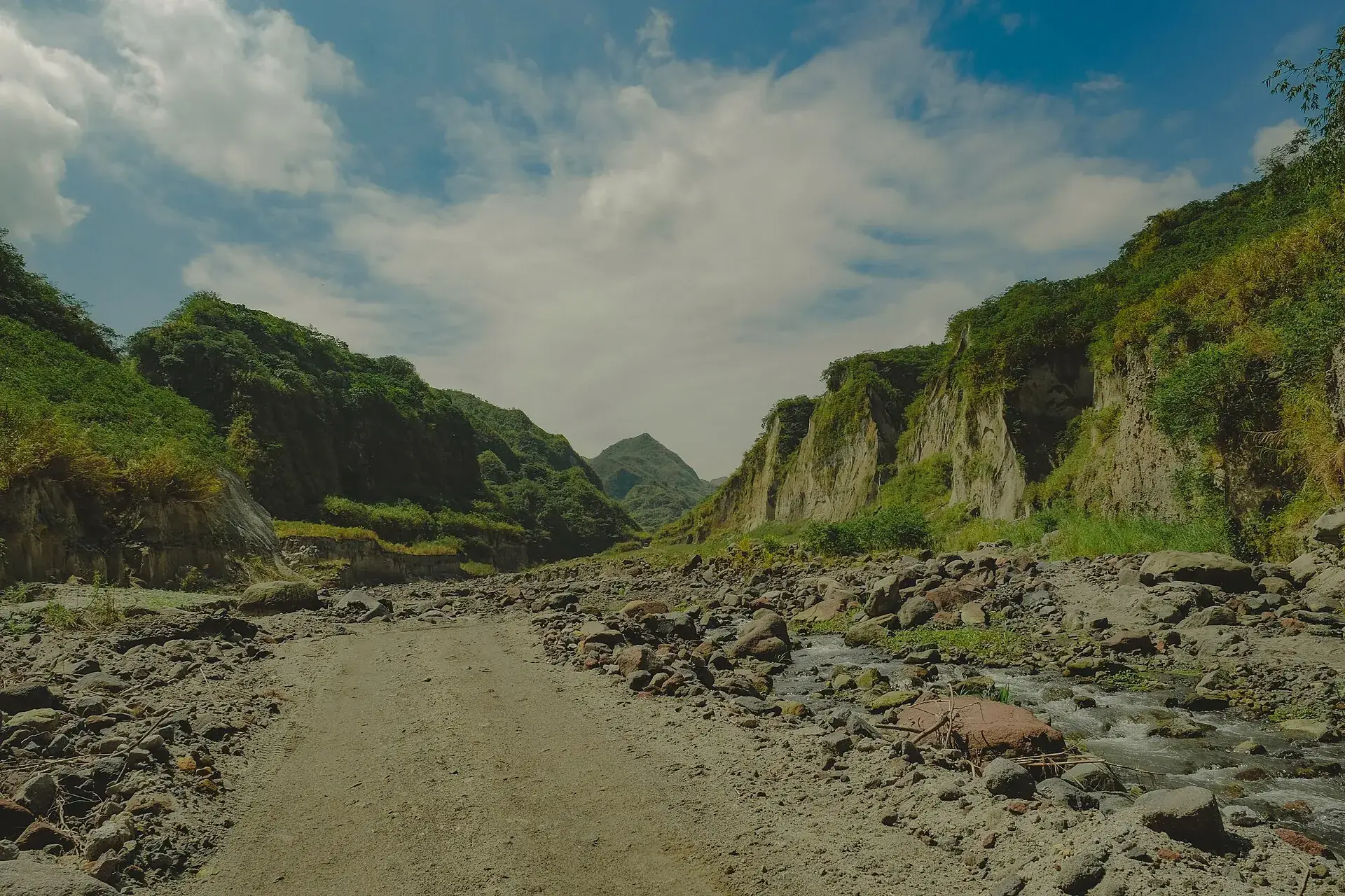
The jeep track in the Crow Valley at Mount Pinatubo: a stony lane in the wide riverbed, tall ash walls on both sides under clouds
The track through the Crow Valley. Military land – hence the checkpoints, hence the clearance for foreigners, hence the closure days.

Photo: Lyndon Aguila · CC BY-SA 4.0

Outdated onlineWhat other sites get wrong

“You can swim in the crater lake.”
A swimming ban has been in force since January 2013, after a visitor drowned; the DOT and PHIVOLCS warn of arsenic and other substances in the water. Boat rides no longer exist either.
“Pinatubo is an easy day trip from Manila, just drive up.”
Without registration by 5:30–7:00 am at the latest, an assigned jeep and a guide, nothing happens – and since 10 March 2024 foreign nationals need an Air Force clearance with up to 35 days of lead time.
“Entrance is a few hundred pesos.”
The Capas environmental fee (300 PHP) is only part of it. Add the Botolan/Aeta fee (400–700 PHP per person), the mandatory jeep (2,500–3,500 PHP) and the guide (500 PHP) – for one person alone easily more than 4,000 PHP.
“The volcano is extinct.”
PHIVOLCS classifies it as active; in 2021 it spent five months at Alert Level 1, and the lahar warnings (most recently 29 August 2026) concern the very riverbed you hike in.
“The hike only takes 30 minutes.”
That is true only in peak season, when the jeeps are allowed far in. Normally it is 5.5–7 km and 1.5–2 hours each way, more in the rainy season.

Quick answersBefore the 4 am alarm

Can you do Mount Pinatubo without a tour?

Yes, but not without a jeep and a guide: the Municipality of Capas assigns both at the tourism office in Santa Juliana. Arriving on your own only saves the transfer. Foreign nationals then have to apply for the Air Force clearance through the tourism office.

How do you get to Mount Pinatubo from Clark or Angeles?

Operators pick up in Clark and Angeles City, usually between 3:30 and 4:00 am; the drive to Santa Juliana takes about an hour (45 km / 28 miles). From Manila it is 2.5–3 hours via NLEX and SCTEX.

Do you need travel insurance for Mount Pinatubo?

From age 60 the registration requires a medical certificate or travel insurance. For everyone else it is not mandatory but sensible: operators say a weather cancellation is not refunded.

How high is Mount Pinatubo?

1,486 m (4,875 ft). Before the 1991 eruption it was 1,745 m (5,725 ft); the summit collapsed, leaving a caldera 2.5 km (1.5 miles) wide with the lake at about 900 m (2,950 ft). Altitude sickness is not an issue.

Is the Pinatubo trek currently open?

As of 22 September 2026: the volcano is at PHIVOLCS Alert Level 0 (since 12 August 2021), and the Capas route has been operating again since 23 June 2025. In September, though, the rainy season is still on, with lahar warnings (most recently 29 August 2026); on rainy days, tours do not start. Before traveling, check the day's status with the Capas Tourism Office or an accredited operator.

How much does the Pinatubo trek cost?

As a group of five in a jeep, about 1,500–2,000 PHP (≈ $24–32) per person: 300 PHP Capas environmental fee, 400–700 PHP Botolan/Aeta fee, a share of 2,500–3,500 PHP for the 4x4 and 500 PHP for the guide (as of 02/2026). Operator packages from Santa Juliana start at about 2,700–3,000 PHP, from Clark at 3,000–3,600 PHP, from Manila at just under 2,000 PHP plus transfer.

Can you do Pinatubo without a guide and without a jeep?

No. At the Santa Juliana tourism office, the municipality of Capas assigns every visitor a local guide and a 4x4 with driver; private vehicles are not allowed into Crow Valley, which is military land. Knowing the way changes nothing.

Do foreign nationals need a permit for Pinatubo?

Yes, since 10 March 2024 a Visit Clearance from the Philippine Air Force, because the route crosses the Colonel Ernesto Rabina Air Base. Submit a passport copy 20–35 days ahead (depending on the source) through an operator or the tourism office; free of charge. No entry without passport and copy on the tour day. The Inararo route from Clark does not require a clearance.

What time do you have to be in Santa Juliana in the morning?

Registration from about 4:45–5:00 am. Operators cite 5:30 am as the last registration; the jeeps depart by 7:00 am at the latest, and nobody is admitted after that. During military exercises the cutoff is moved earlier.

How long and how strenuous is the hike?

After about an hour's jeep ride come 5.5–7 km (3.4–4.3 miles) on foot each way through the flat bed of the O'Donnell with stream crossings and a short, steep final climb (about 300 m / 985 ft of elevation gain), 1.5–2 hours each way. Technically easy, but shadeless and hot; in the dry season the jeeps drive farther and sometimes only 30–60 minutes remain.

Are you allowed to swim in the crater lake?

No. A swimming ban has been in force since January 2013 after a visitor drowned; penalties hit guest and guide. According to a PHIVOLCS analysis, the water contains arsenic, aluminum, boron and other substances. Boat rides were discontinued too.

Is Pinatubo suitable for children?

Operators take children from age 6 or 7. The route is flat but long and hot, and the jeep ride is very bumpy and dusty. For smaller children, the Inararo ecotour (jeep only, no trek) is the alternative.

When is Pinatubo closed for military exercises?

Crow Valley is an Air Force training range. During live-fire exercises, above all during the annual Balikatan exercise (2026 from 20 April), access can be closed on individual days (2016: 4–15 April) or the cutoff time is moved earlier (as in 2024). Closures are announced by the Capas Tourism Office; ask ahead in April/May.

Is the Pinatubo trek dangerous?

Volcanically, not at present (Alert Level 0). The real dangers are flash floods and lahars in the O'Donnell during rain – seven people died in 2009, including three French nationals – as well as heat. So: only in stable weather, start early, follow the guide's instructions, stay out of the lake.

Which season is best?

December to May, ideally January to March: clear visibility, turquoise lake, short walk. June to November is the rainy season with flash flood risk, lahar warnings and a longer route.

What do you need to bring?

Sturdy shoes that can get wet, hat, sunscreen, dust cloth or mask for the jeep ride, 1.5–2 liters (50–68 oz) of water, snacks, a change of clothes, cash for all fees, and for foreign nationals passport plus copy.
Sources · accessed on 22 September 2026