Katla ice cave in Kötlujökull
Year-round, several departures a day from Vík. Only the operators' super jeeps drive the track into the glacier forefield; there is no public parking lot. About 3 hours, including 40 minutes of driving each way.
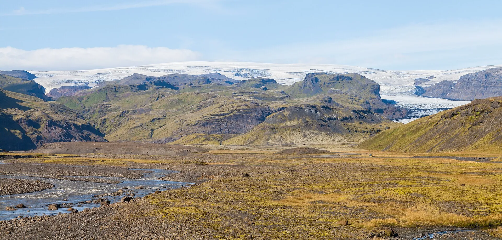
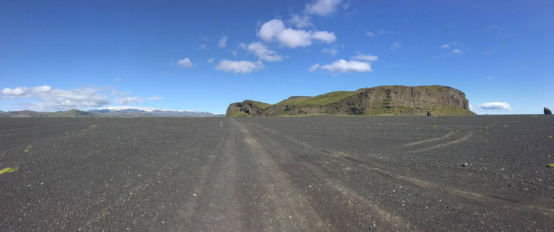
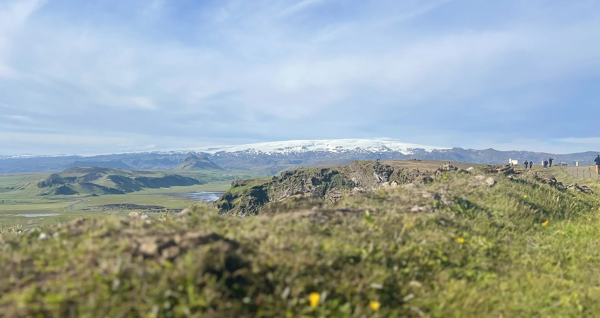
From Dyrhólaey, Katla is just a white line on the horizon.
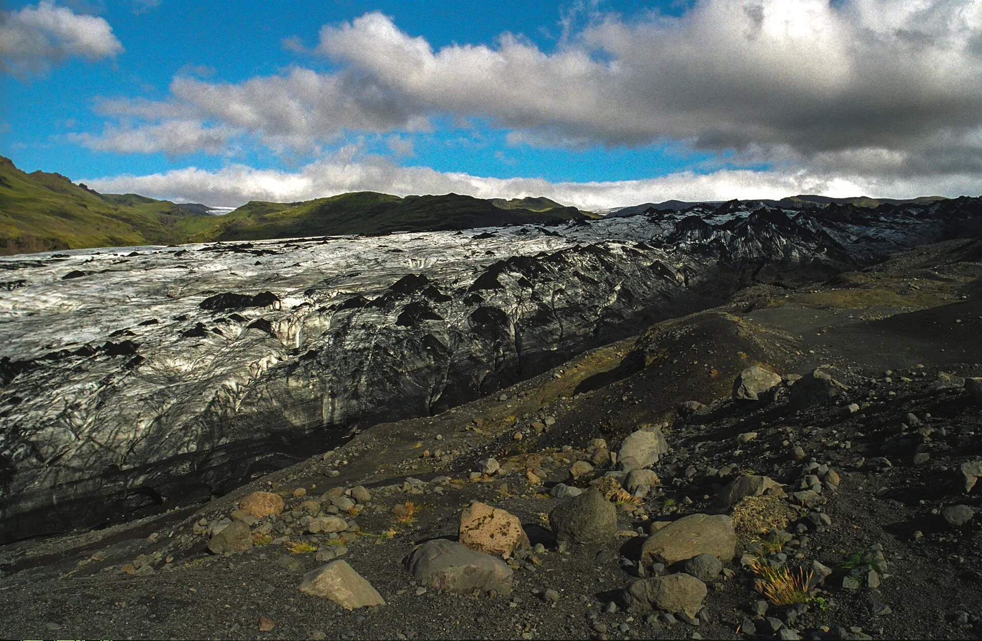
Closer in, the ice turns black: ash from the last eruptions.
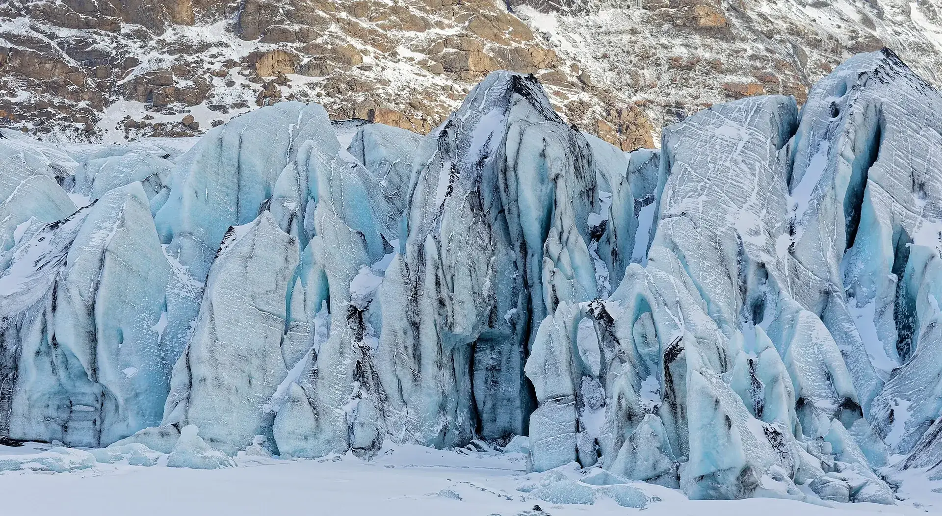
Up close: up to 700 meters of ice over a volcano that has been silent since 1918.
Scroll –
closer to the ice
Katla sits under the Mýrdalsjökull ice cap, a few miles north of Vík. As of September 22, 2026 the Icelandic Met Office lists the volcano at aviation color code green and alert level 0 – normal background activity, last confirmed on September 9, 2026. Nobody climbs the volcano itself. What you visit are its edges: the ice cave in Kötlujökull, the Sólheimajökull glacier and Reynisfjara beach. And that is exactly where a lot changed in 2026.
Year-round, several departures a day from Vík. Only the operators' super jeeps drive the track into the glacier forefield; there is no public parking lot. About 3 hours, including 40 minutes of driving each way.
The footpath from the parking lot to the viewpoint at the glacier snout is free (about 15 minutes). Glacier hikes were suspended by the operators after the Met Office warning of July 22, 2026: unstable ice, a new lagoon, rockfall.
No admission, but a warning light at the entrance: yellow caution, orange stay 25 m (80 ft) from the water, red beach closed. Since August 2025 the basalt columns and the cave are also closed at red – with a gate at the platform.

Photo: Diego Delso · CC BY-SA 4.0
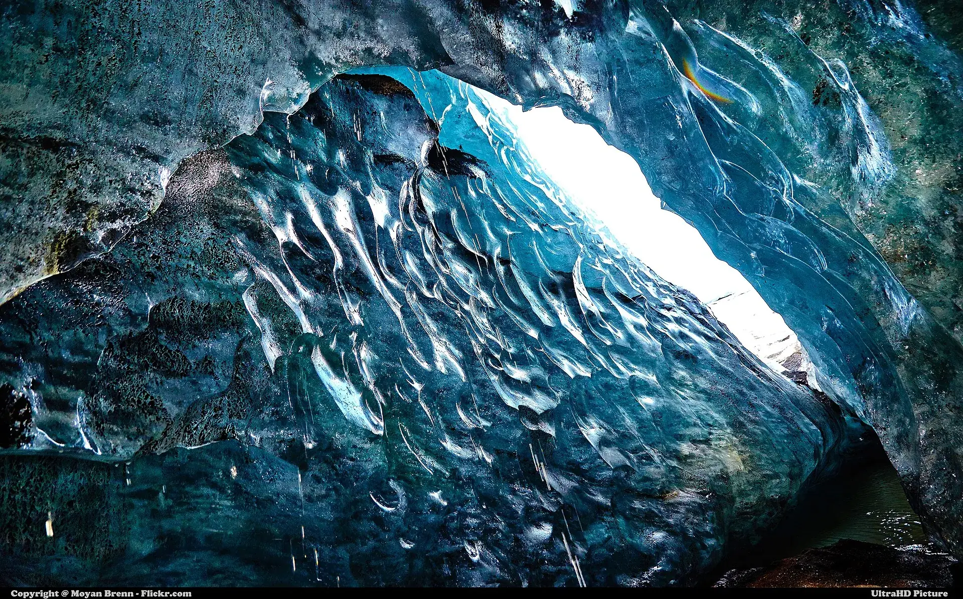
Vík, meeting point in the village. The super jeep rolls across the Mýrdalssandur outwash plain, then along a track of black ash into the forefield of Kötlujökull. The last minutes are on foot over scree and ice, with crampons and a helmet. Then you stand inside the cave: ice that is not white but banded black – every dark layer is ash from an eruption. In winter the ice glows blue and the cave is stable; in summer parts melt away, but access is easier. What the cave looks like this month is up to the glacier.

Photo: Moyan Brenn from Italy · CC BY 2.0
Affiliate links to GetYourGuide: if you book, we earn a commission and the price stays the same. Prices and ratings as of 22 September 2026. If the operator cancels for weather, you are rebooked or refunded – the cave exists all year, its shape does not.
There is no legal requirement to take a guide – and still no way around the operators. The cave lies behind a super jeep track with no public parking, and glacier ice without a guide is life-threatening. Three operators based in Vík run year-round.
Online with the operator or through a reseller. Small groups (Katlatrack 2–12 people per guide, Arctic Adventures 1 guide per 14 guests) – book ahead in high season. Children: state their age, child seats in the jeep are mandatory.
Troll Expeditions: The Vik Inn, Víkurbraut 26 (be there 20 minutes early). Katlatrack: Austurvegur 16 next to the gas station. Arctic Adventures: bus parking lot behind the Icewear building. All within walking distance, also from the Strætó bus.
Across the outwash plain and an ash track into the forefield of Kötlujökull. Then 20–60 minutes of walking on ash, scree and ice, with Arctic Adventures partly on ladders. Sturdy hiking or winter boots are required; crampons and helmet are provided.
From age 6 (Troll in summer, Arctic Adventures), from 8 in winter (Troll), from 12 with Katlatrack. Troll: full refund up to 24 hours before, minus a 3% card fee, nothing after that. Arctic Adventures: free cancellation up to 24 hours before.
| Katla ice cave, Katlatrack from Vík (about US$290) | 39,900 ISK |
| Katla ice cave, Troll Expeditions from Vík – listed in US$ only | US$240 |
| Katla ice cave, Arctic Adventures from Vík | from US$200 |
| Parking at Sólheimajökull, car up to 5 seats, per calendar day (+ 89 ISK fee) · 6–9 seats 1,000 ISK · motorcycle 300 ISK | 750 ISK |
| Surcharge if parking is not paid within 24 hours | 1,960 ISK |
| Reynisfjara, Dyrhólaey, Sólheimajökull viewpoint | free |

Photo: Hyppolyte de Saint-Rambert · CC BY-SA 4.0
Katla has no summit trail and no crater rim for visitors. It has four edges you can reach – each with its own rule.
From Vík by super jeep, about 40 minutes each way, then a short walk. About 3 hours in total (Katlatrack 3–4 hours, with one or two caves depending on the state of the glacier). From Reykjavík as an 11-hour day tour with waterfall stops.
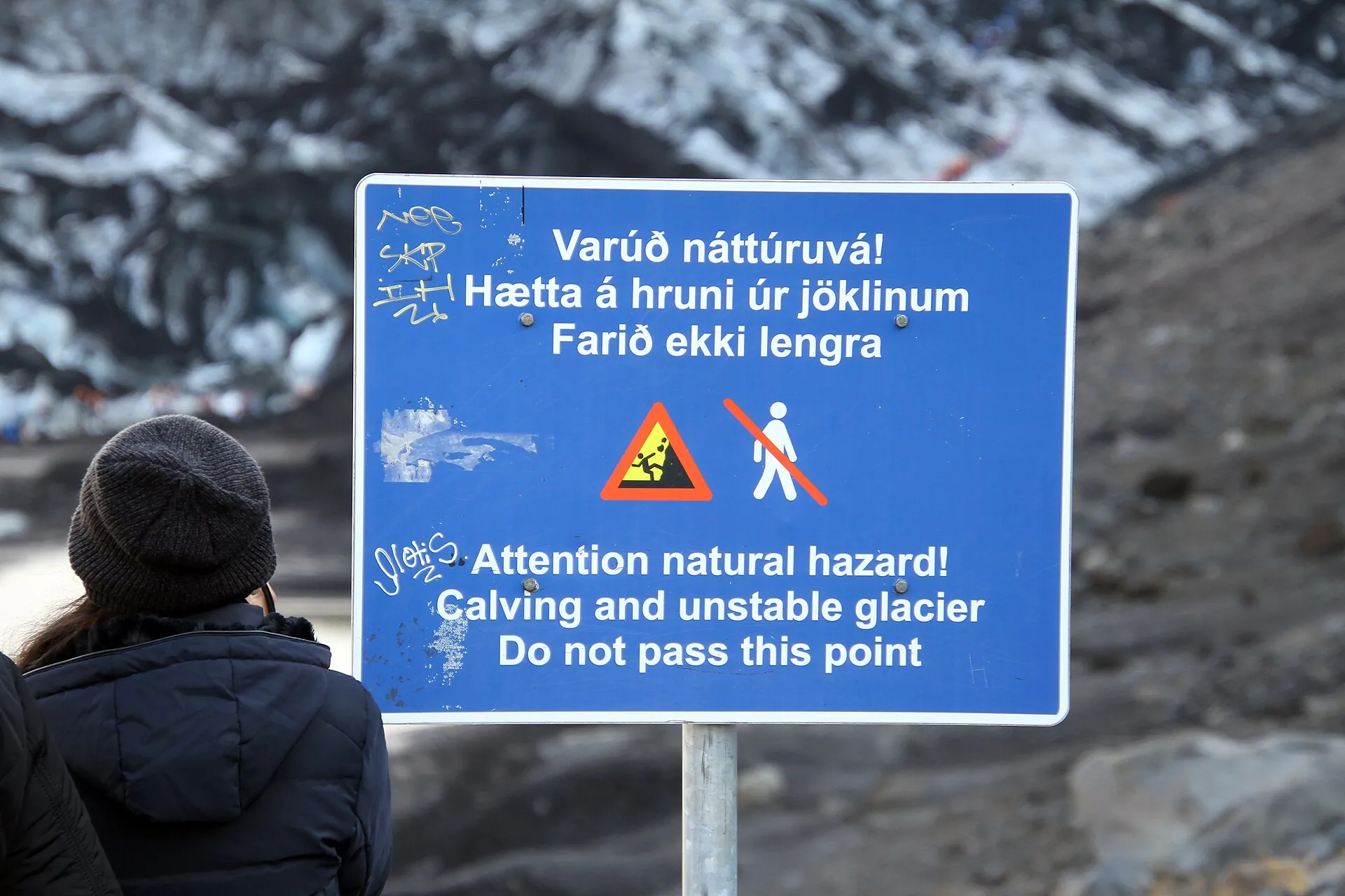
Road 221 off the Ring Road, gravel parking lot with restrooms. Footpath to the viewpoint at the glacier snout about 15 minutes, free. Onto the ice only with a guide – and in summer 2026 suspended because of an unstable ice ridge, a new lagoon and rockfall from Jökulhaus. Whether operators are hiking new routes again is not confirmed as of September 22, 2026.
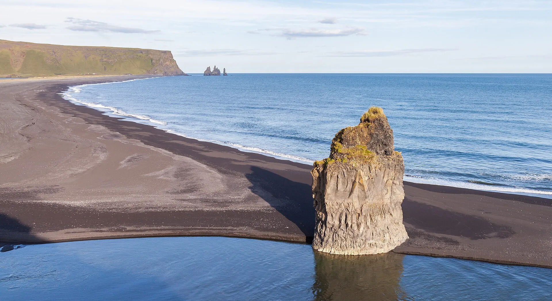
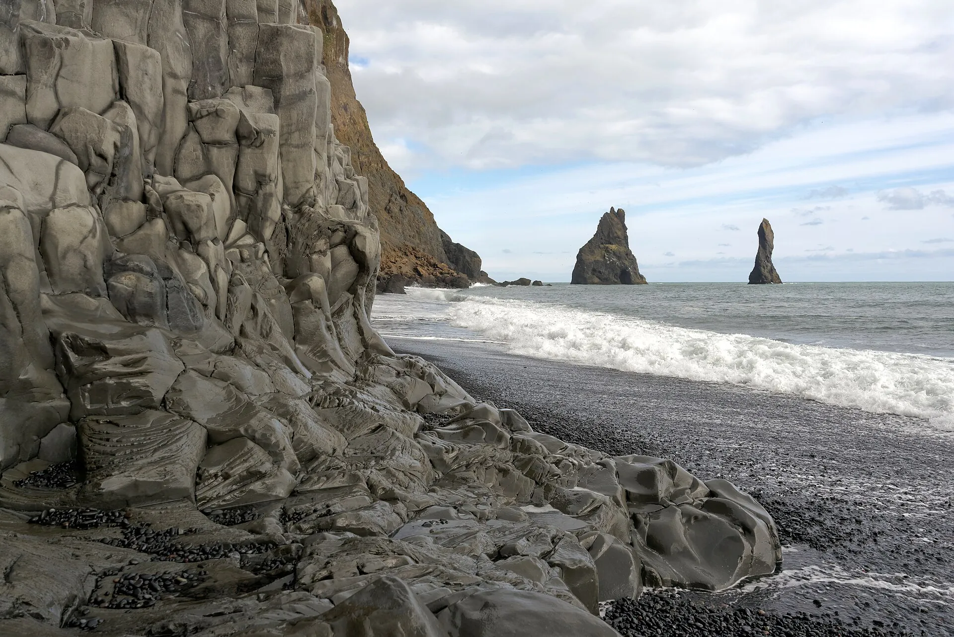
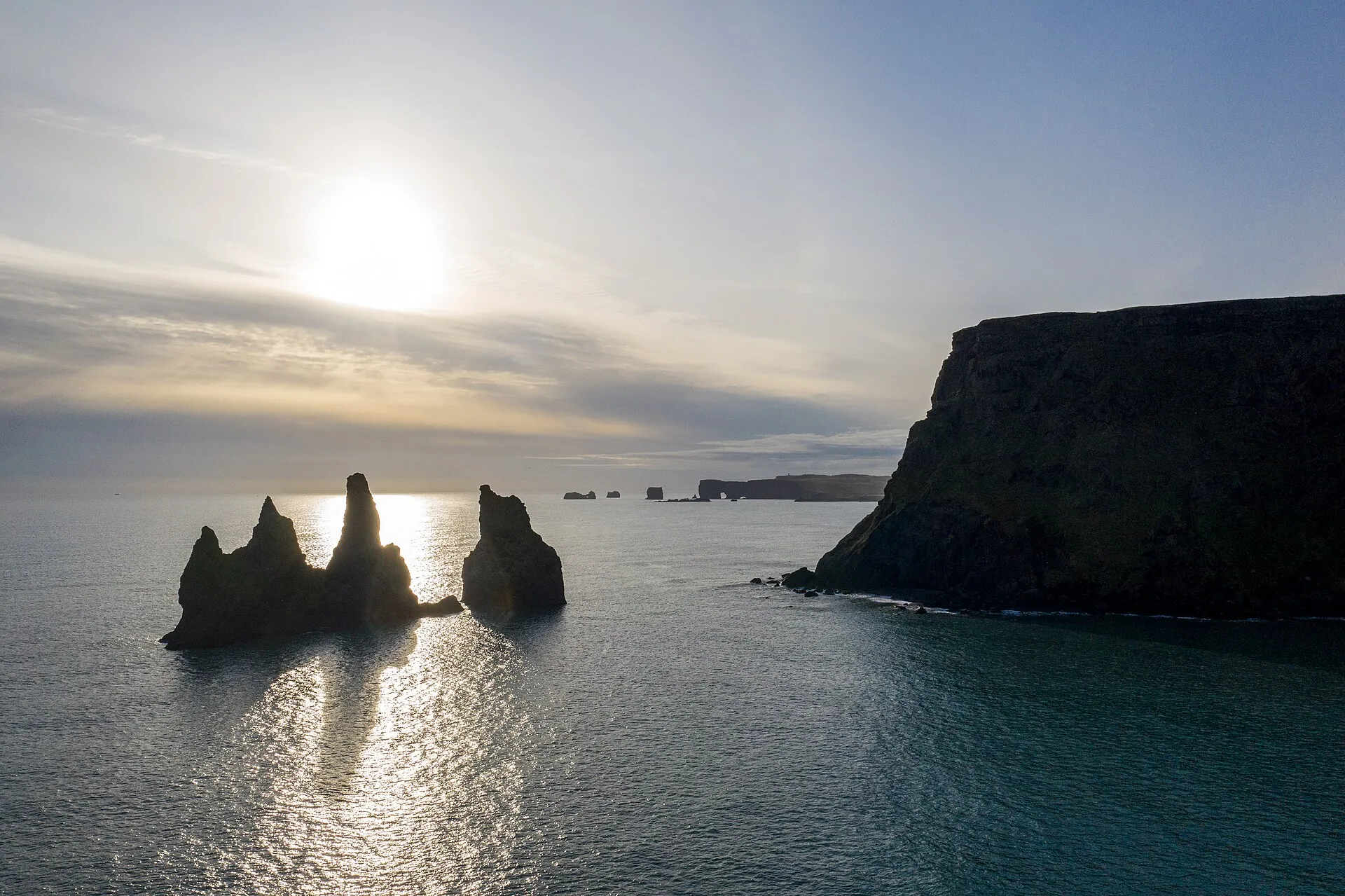
Parking lot on road 215, 30–60 minutes on the beach. Basalt columns, the Hálsanefshellir cave, the Reynisdrangar sea stacks. Several people have died here in sneaker waves; the warning light has existed since 2022, the gate at the platform since August 2025.
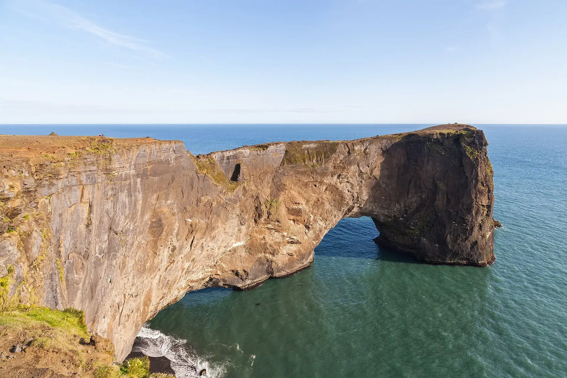
Rock arch and lighthouse west of Vík, with a view of Mýrdalsjökull and Reynisfjara – the best spot to see the volcano as a whole. Puffins in early summer, when parts are closed to protect the nesting birds.

Photo: Diego Delso · CC BY-SA 4.0
A warning light at the entrance shows the level of the day, linked to the wave forecast of the Icelandic Road Administration. Cameras feed to the police in Selfoss. The color applies regardless of sunshine.
The beach is open, the yellow-marked zone at the water is off limits. Never turn your back to the sea, keep children by the hand.
Waves reach farther up than the wet sand suggests. Basalt columns and cave only from a good distance.
Only the viewing area at the platform. Since August 2025 the basalt columns and Hálsanefshellir are closed at red, the gate is shut – and the trigger for red was moved earlier.

Photo: Jakub Hałun · CC BY-SA 4.0
Every eruption under Mýrdalsjökull melts ice – and sends a glacial outburst flood (jökulhlaup) across the outwash plain. Civil protection expects 100,000 to 300,000 cubic meters of water per second, and 15 to 20 minutes for the farms at Sólheimar, about 30 minutes for Vík. The flood paths are considered unpredictable.
So: keep your phone switched on in Vík. In an eruption the 112 emergency center sends a text message in Icelandic and English to every phone in the area. You follow the instructions of police and civil protection and move to higher ground. The response plan was revised in 2025 because so many people are now close to the glacier; the civil protection leaflets come in five languages.
How seriously this is taken showed on July 27, 2024: an outburst flood in the Skálm river put water over the Ring Road, the police commissioner declared an uncertainty phase and had the area between Skaftártunga and Vík and around Sólheimajökull evacuated. It was not an eruption – just geothermal meltwater. The procedure was the same.

Photo: Patrick Reijnders · CC BY-SA 4.0
Without a car: Strætó bus 51 Reykjavík (Mjódd) – Selfoss – Vík – Höfn; according to the municipality, departures from Vík toward Reykjavík on weekdays except Wednesday at 4:00 pm, Sat/Sun 2:42 pm; ticket via the Strætó app (Klapp) or from the driver. The ice cave meeting points are in the village. No bus runs to Sólheimajökull (turnoff 221).
By car: Ring Road 1 to Vík (about 180 km / 110 miles from Reykjavík, a good 2.5 hours). Sólheimajökull: road 221 off the Ring Road, gravel parking lot with restrooms, 750 ISK via Parka. Kötlujökull: the track to the ice cave is not for rental cars, only the operators' super jeeps.
Ice cave: year-round; in winter (November–March) with the clearest blue ice and stable caves, but storm risk and short days; in summer parts of the cave melt, but days are long and access is easier. Sólheimajökull: summer for hikes – restricted in 2026 though. Glacial rivers carry geothermal water with gas most often in summer (June–September); the IMO notices matter most then. Reynisfjara: avoid in southerly storms and high swell – check the warning light, regardless of sunshine.

Photo: Diego Delso · CC BY-SA 4.0
About 180 kilometers (110 miles) separate Reykjavík from Vík. The day tours take in the south coast – waterfalls, black beach, then the super jeep – and run 10 to 12 hours. Back around 8 pm.
Affiliate links to GetYourGuide: if you book, we earn a commission and the price stays the same. Prices and ratings as of 22 September 2026.
Katla is an active volcano, but currently quiet: aviation color code green and alert level 0 at the Icelandic Met Office as of September 22, 2026. The last major eruption was in 1918.
Only on a super jeep tour from Vík – meeting point in the village, about 40 minutes of track, then a short walk with crampons. From Reykjavík as a day tour along the south coast, 10 to 12 hours.
With the Vík operators 39,900 ISK (Katlatrack, about US$290), US$240 (Troll) or from US$200 (Arctic Adventures); on GetYourGuide from €158 (as of September 22, 2026). Helmet, crampons and guide are included.
The path to the viewpoint is open. Glacier hikes were suspended by the operators after the Met Office warning of July 22, 2026; whether they are running again on new routes is not confirmed as of September 22, 2026. Ask the operator before booking.
Beach closed – only the viewing area at the platform remains. Since August 2025 the basalt columns and the cave are also closed at red, and the gate is shut.
About 180 kilometers (110 miles) on the Ring Road, a good two and a half hours by car. Without a car, Strætó bus 51 runs from Reykjavík (Mjódd) via Selfoss to Vík.
As of September 22, 2026 the Icelandic Met Office lists Katla at aviation colour code green and alert level 0 (normal background activity). In August 2026 there was a small outburst flood in the Múlakvísl with gas, but no sign of an eruption. The current danger for visitors comes from glacier ice, rockfall and gas at glacier margins, not from lava.
Practically no. The cave lies in Kötlujökull behind a super jeep track with no public parking, and glacier ice without a guide is life-threatening. Tours leave Vík several times a day and take about three hours.
Depending on the operator from age 6 (Troll in summer, Arctic Adventures), in winter with Troll from 8, with Katlatrack from 12. Child seats in the jeep are mandatory, so state the age when booking.
From Vík about three hours, including 40 minutes of driving each way and 30–60 minutes on site and walking on ash and ice, partly with ladders. The operators rate it easy to moderate; sturdy boots are required.
Only with a guide, and in summer 2026 only to a limited extent: on July 22, 2026 the Met Office warned of unstable ice, a new lagoon and rockfall; the operators suspended tours and are looking for new routes. Freely accessible is the footpath from the parking lot (750 ISK) to the viewpoint.
Every phone in the area receives a text from the 112 emergency center in Icelandic and English; for Vík and its surroundings civil protection expects 15–30 minutes until the outburst flood arrives. You follow the instructions of police and civil protection and move to higher ground; the response plan was revised in 2025.
Wind- and waterproof jacket, warm layers, hat and gloves; in the cave it is around freezing. Sturdy hiking or winter boots are required, crampons and helmet are provided by the operator. Clothing cannot be rented on site.
Yes, several people have died there in sneaker waves. A warning light at the entrance shows the level: yellow caution, orange at least 25 m (80 ft) from the water, red beach closed – since August 2025 the basalt columns and the cave are also closed at red.
At times, yes. During outburst floods hydrogen sulfide escapes at the river sources; in August and September 2026 readings at the Múlakvísl were above limits. The IMO then advises against staying near the river or glacier margin and to leave immediately if eyes or nose are irritated.
In winter the ice is at its bluest and the cave stable, but days are short and storms frequent. In summer access is easier and tours are cancelled less often; parts of the cave may have melted by then.
Sources · accessed on 22 September 2026

Photo: Kasa Fue · CC BY-SA 4.0