Volcano·Guide
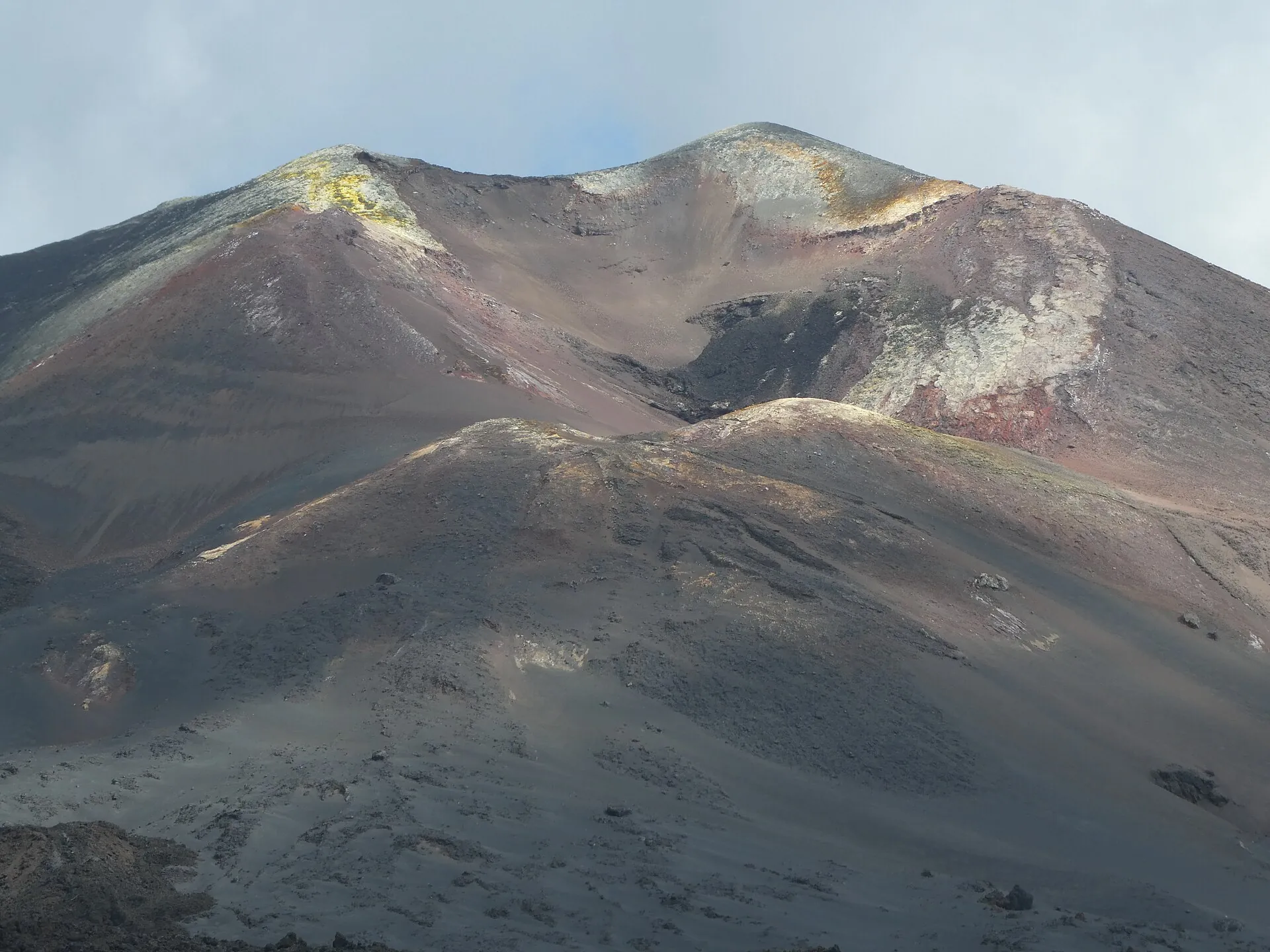
The volcanic eruption on La Palma in November 2021 by night: a lava fountain and a glowing lava flow The new volcanic cone on the Cumbre Vieja in 2021 by day with an ash cloud Sulphur deposits at the crater of Tajogaite in 2023

La Palma

19 September 2021: the earth tears open on the Cumbre Vieja.

85 days later there is a new mountain – and a valley under lava.

It still steams today. And is called Tajogaite.

Scroll –
85 days, five years

Europe's youngest volcanoYou only get there with a guide

Cone, crater and lava flows lie in an exclusion zone set by the island administration: more than 300 °C has been measured in lava tubes, the ground is unstable. There is a single legal route – and only in small groups with licensed guides.

With guide
6km

From Llano del Jable to the cone

A good two hours' walking over black ash, about three with briefing and transfer. The trail ends at a safe distance – it does not lead into the crater.

Market price according to local portalsabout €35
Free
0

The viewpoints

The church of Tajuya, the Virgen de Fátima monument, the port of Tazacorte, the Mirador del Castillo de la Virgen – and the new roads built straight across the lava.

Exclusion zone
12.5km²

Lava fields and crater

Off limits on your own. In storm warnings the island closes the guided trail too – most recently on 27 February 2026. If you are only staying briefly, put the tour at the start of the holiday.
Sources: visitlapalma.es (official island tourist board) · Cabildo de La Palma. The area of the exclusion zone and the decree number (2026/208) come from press reports of 17 February 2026, not from the legal text. No official daily quota was found.
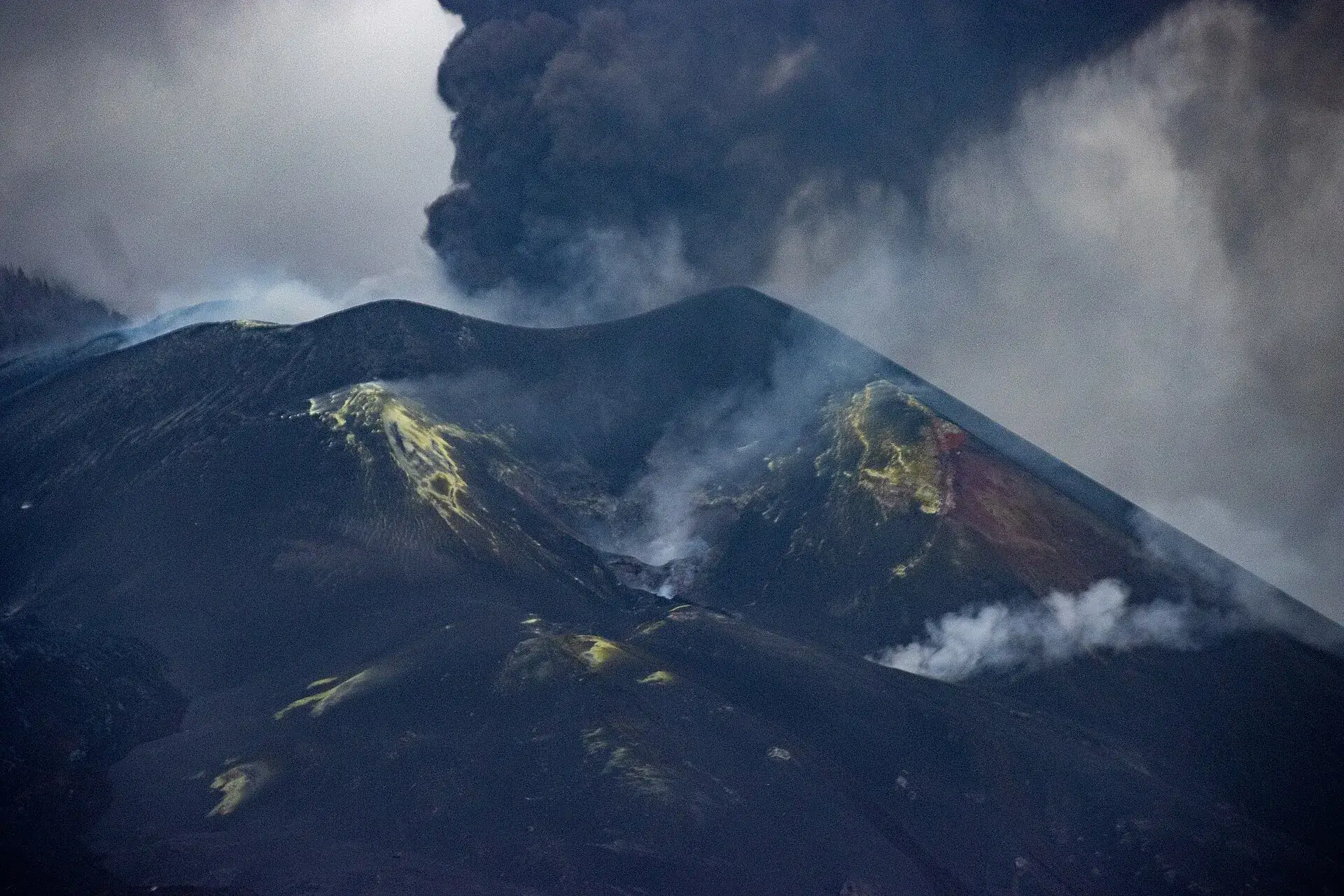
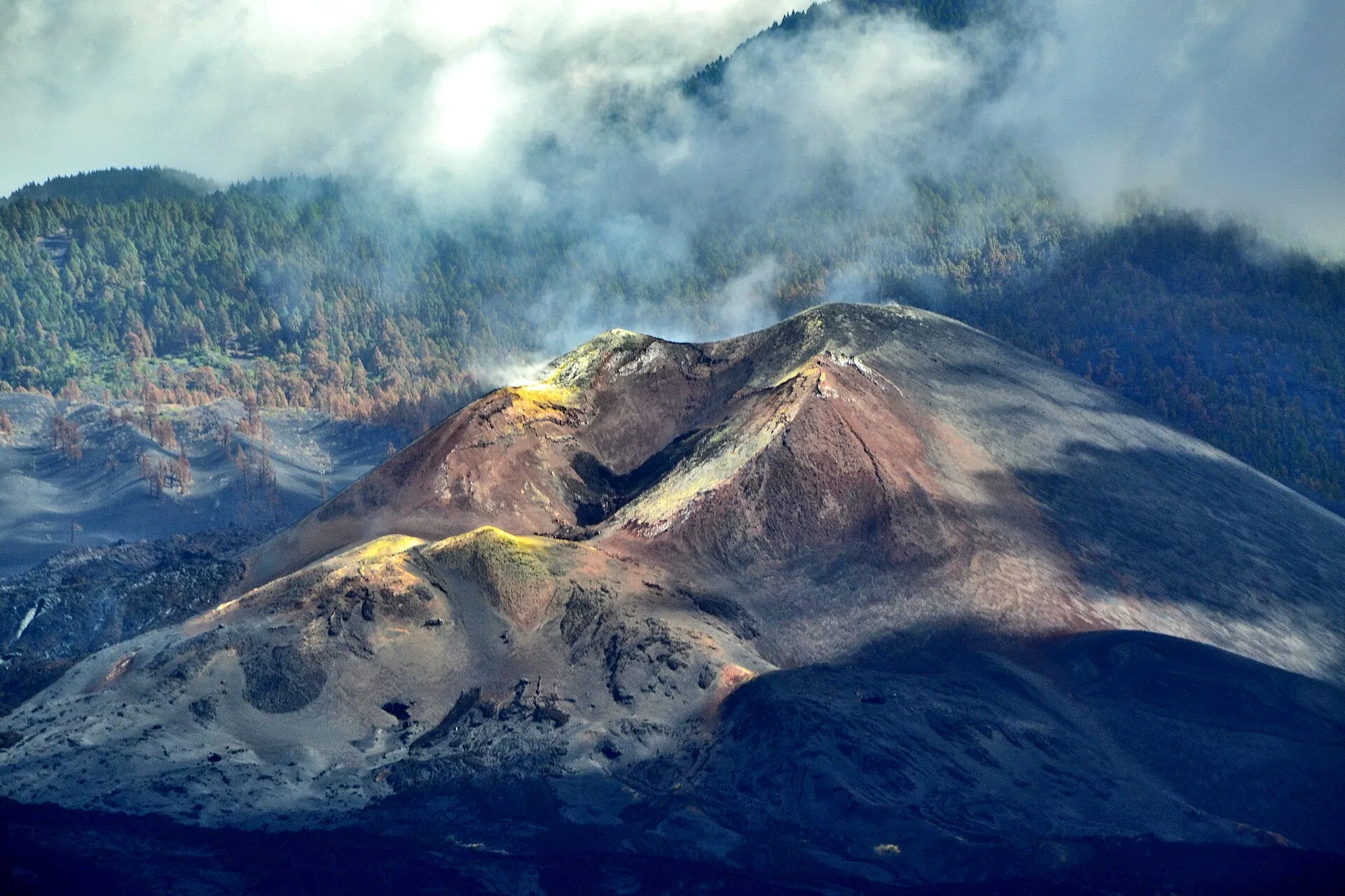
Tajogaite on La Palma: the young cone with yellow sulphur patches and steaming cracks, wooded slopes in the haze behind
Tajogaite three years after the eruption: the ground is still hot, the cracks steam – hence guide only and marked trail only.

Photo: Rolfcosar · CC BY-SA 4.0

Five years onThe light is on yellow – and what that means

La Palma is the only Canary Island whose volcanic traffic light is not green. That does not mean an eruption is imminent: gas emissions, ground temperatures and terrain stability are not yet back to pre-2021 levels. In Puerto Naos and La Bombilla carbon dioxide is still being measured; buildings are released one by one.

1,182

Homes in Puerto Naos released again

As of mid-September 2026, plus 65 in La Bombilla. The hotel and around 20 businesses are open; only part of Playa Chica is still closed. The figures come from press reports.

Yellow

Follow official notices, respect the barriers

Current status of the light: Canary Islands government. Holidaymakers who do not enter closed buildings and cellars run no particular risk.
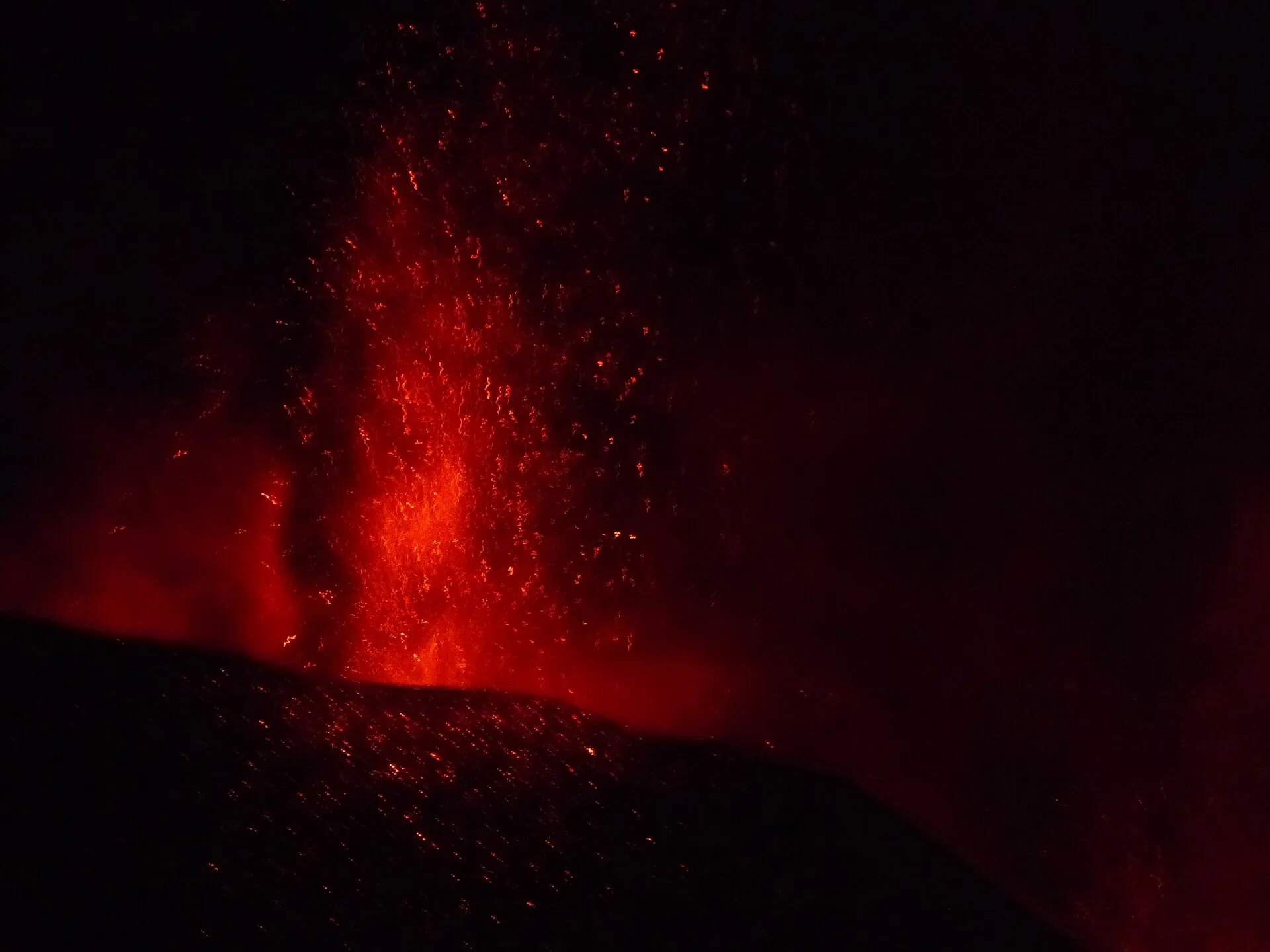
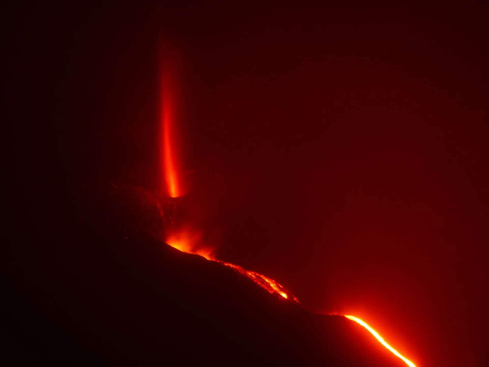
Night-time lava fountain of the 2021 Cumbre Vieja eruption: glowing red scoria shoots out of the cone into the darkness
September to December 2021, for 85 days: what keeps the light on yellow today is the gas still rising beneath this lava.

Photo: Benjamín Núñez González · CC BY-SA 4.0

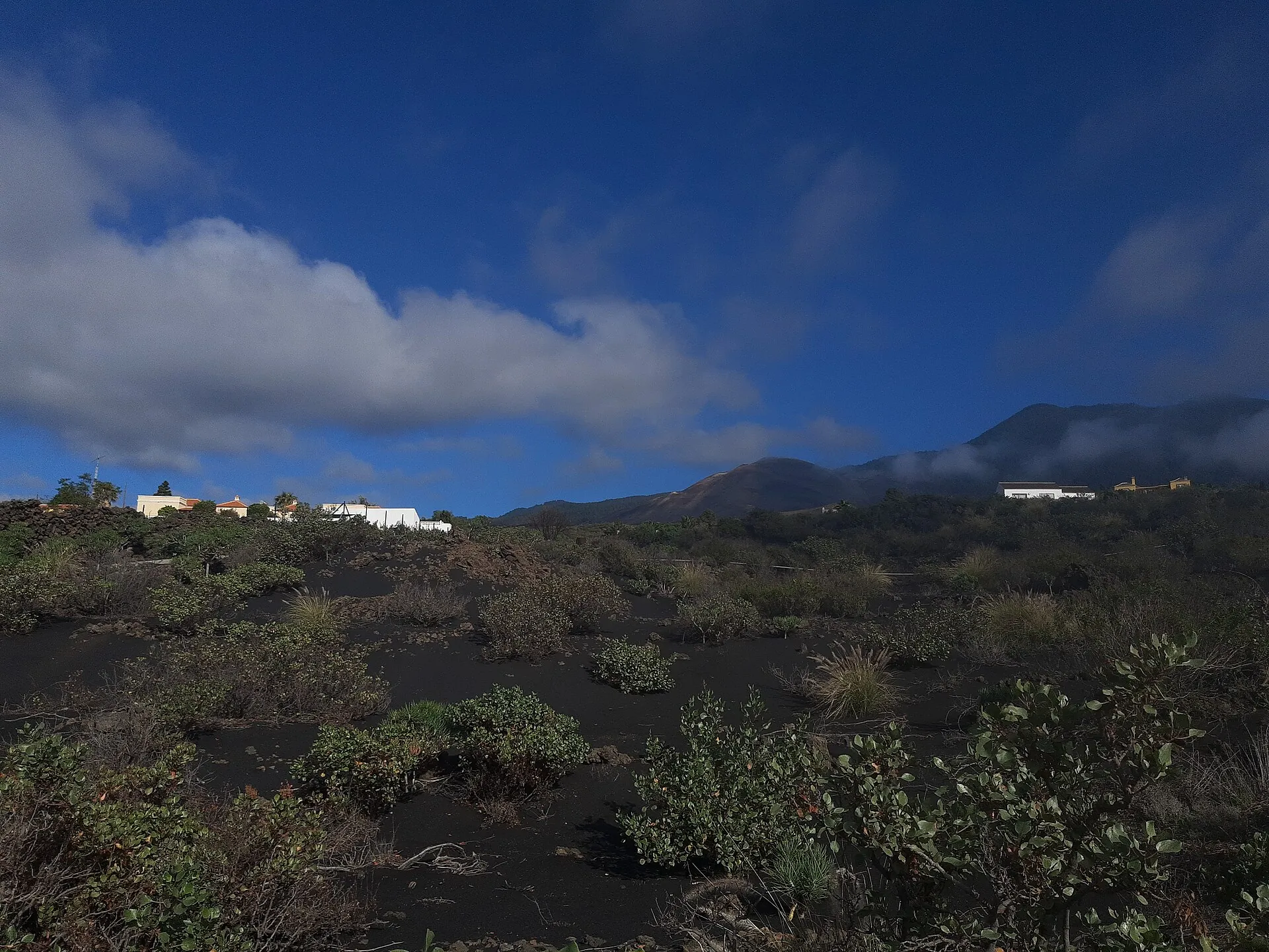
White houses stand half sunk in a black lava field on La Palma, lapilli and first plants in front, clouds above
Todoque and La Laguna: the tours lead to the edge of the lava flows, where the houses are buried in rock up to the roof.

Photo: Gerda Arendt · CC0

Good to knowGetting there, best time, tips

Getting there

By car: The tours start from El Paso; the operators state the meeting point and transfer to Llano del Jable when you book.

Best time to go

Possible all year. What matters is not so much the season as the wind: in storm warnings the island closes access completely. If you are only staying a few days, put the tour at the start of the holiday so you can switch dates if it is cancelled.
Who it suits

Fitness
The island tourist board grades the trail easy to moderate; you walk on loose lapilli.
Clothing
Weatherproof mountain clothing, sun protection and water are recommended.
Footwear
sturdy hiking boots

Tips you will need on site

  • Only book with operators who explicitly mention the Cabildo's licence for the Tajogaite trail – the island tourist board refers to the specialised local companies.
  • Check the trail status and weather warnings before the tour; when PEINPAL (the island emergency plan) is activated, access is closed.
  • For an overview without a tour, use the viewpoints named by the Cabildo, such as Tajuya or the Castillo de la Virgen – all with parking.
  • The lava delta is best seen from the water; boats leave from Tazacorte.
  • In Puerto Naos take the barriers and CO2 signs seriously, especially in low-lying rooms such as garages and cellars.
  • Sturdy shoes: lapilli is as slippery as coarse gravel.

A short history

  • The eruption began on 19 September 2021 and ended on 13 December 2021 – at 85 days the longest historically documented on La Palma.
  • The new cone rises about 200 m above the former terrain and reaches about 1,120 m (3,675 ft) above sea level; the main crater measures 172 × 106 m.
  • The island parliament (the Cabildo's plenary) officially fixed the name 'Volcán de Tajogaite'.
  • On 3 January 2022 the Cabildo, with the approval of PEVOLCA, reopened the first closed hiking trails.
  • In April 2022 the first guided walks from Llano del Jable took place – initially free for locals, at most 14 people, under a safety protocol drawn up with scientists.
  • In September 2022 a QR-code system was introduced in Puerto Naos allowing residents to visit their homes for a few hours at a time.
  • The Tajogaite lava-tube system lies 20–60 m deep on three levels and could be the longest in Europe.
  • In September 2026, five years after the eruption began, the volcanic traffic light is still on yellow; 1,182 homes in Puerto Naos have been released again.
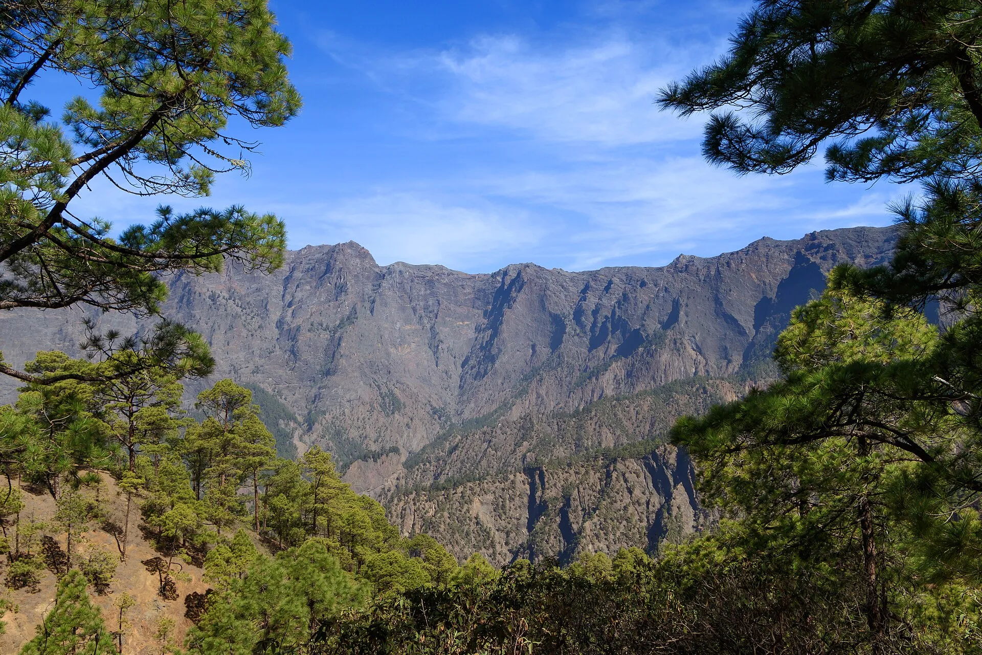
View through pines into the Caldera de Taburiente: steep, furrowed rock walls under a blue sky
The Caldera de Taburiente in the north has nothing to do with the eruption – it is eight kilometres across and the older reason to go to La Palma.

Photo: H. Zell · CC BY-SA 3.0

Out of date onlineWhat other sites get wrong

“Puerto Naos is a closed ghost town.”
That was true until 2023/early 2024. Today the hotel, beach and most homes have been released again.
“On the guided tour you climb onto the crater.”
The licensed trail ends at a safe distance from the cone.
“The yellow light means a new eruption is imminent.”
Yellow has applied continuously since the eruption because some readings have not yet normalised; it does not mean a pre-eruptive alarm.
“You can simply walk across the lava to the volcano from the end of the road.”
Lava fields and cone lie in the exclusion zone; the only legal way is the guided trail from Llano del Jable.

Quick questionsBefore the tour

Can you visit the volcano on La Palma without a guide?

Not as far as the cone. Without a guide there remain the free viewpoints around the lava field.

Is the volcano on La Palma still active?

The eruption has been over since 13 December 2021. The light is still on yellow because gas emissions, ground temperatures and terrain stability have not yet normalised.

How long does the tour take?

The trail is about six kilometres long; the island tourist board reckons a good two hours' walking. With briefing and transfer allow three hours.

How much does the Tajogaite hike cost?

There is no official fee, you pay the operator's price. Local portals quote about €35 per person for 2026. The viewpoints cost nothing.

Is Puerto Naos open again in 2026?

Largely yes. The Cabildo releases buildings individually after CO2 measurements; in mid-September 2026 it was 1,182 homes in Puerto Naos and 65 in La Bombilla. Beach and hotel are operating; part of Playa Chica is still closed.

Is a holiday on La Palma dangerous because of the gases?

The CO2 problem affects narrowly defined areas in Puerto Naos and La Bombilla, monitored by more than 1,500 sensors. Visitors who respect the barriers and do not enter closed buildings or cellars run no particular risk. The rest of the island is not affected.

Can you get into the crater of Tajogaite?

No. The permitted trail comes close to the cone and ends at a safe distance. Crater and crater rim are off limits.

Where is the best place to see the volcano without a tour?

The Cabildo has named several viewpoints with parking, including the church of Tajuya, the Virgen de Fátima monument, the Museo Benahoarita, the port of Tazacorte and the Mirador del Castillo de la Virgen. From the sea, boat trips from Tazacorte show the new lava deltas.

When is access to Tajogaite closed?

In severe weather warnings the Cabildo activates the island emergency plan and closes exposed trails – most recently documented on 27 February 2026 because of a storm, together with the GR-131. The island's hiking-trail portal shows the current status.

What equipment do I need for the tour?

Sturdy hiking boots, clothing suited to the weather, sun protection and water are recommended. The ground consists of loose volcanic ash.

Sources · accessed on 21 September 2026