Volcano·Guide
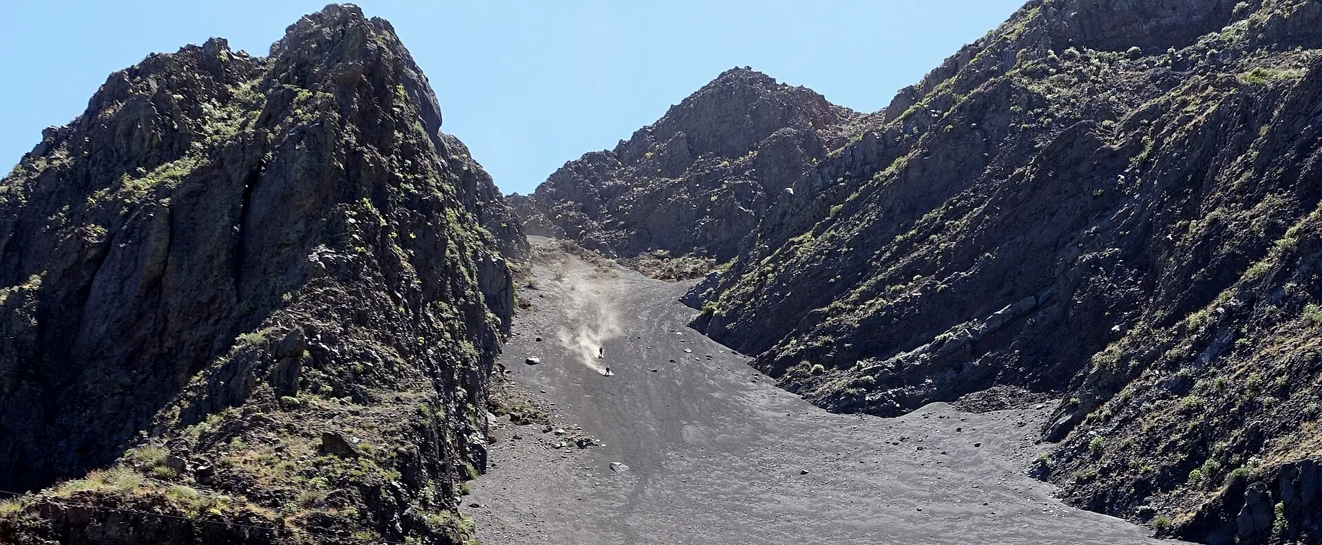
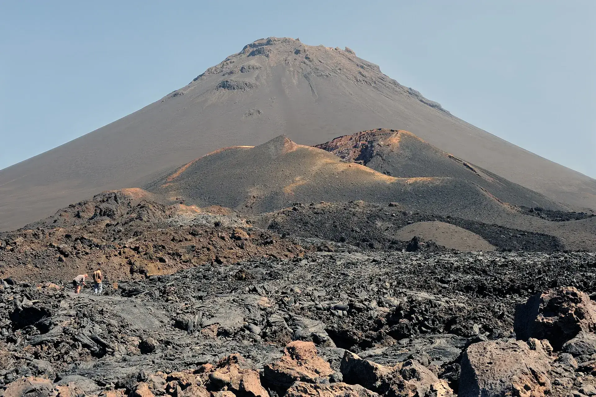
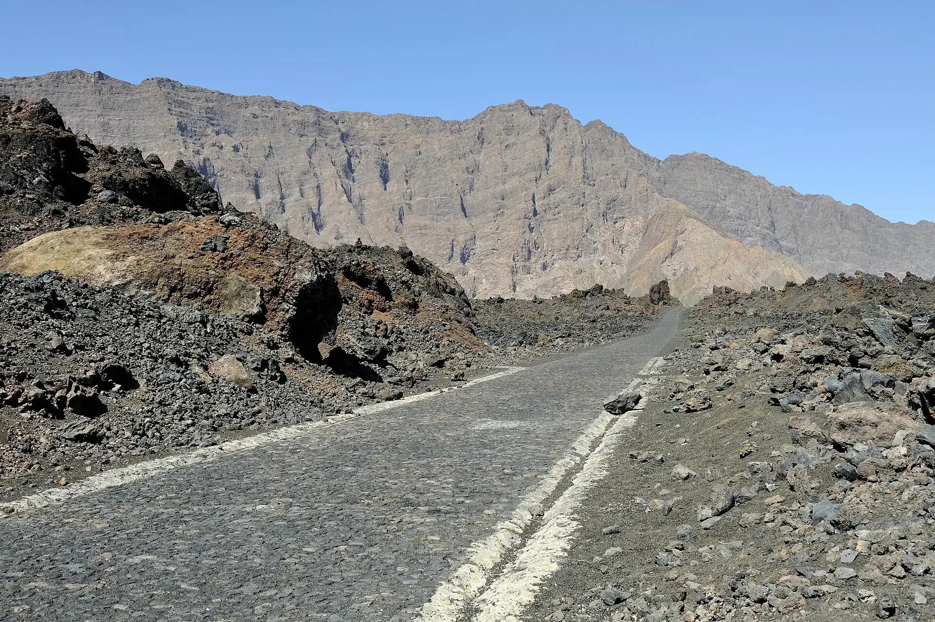
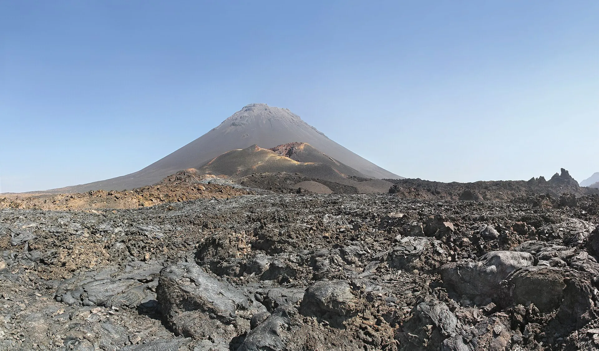
The cobbled road into the Chã das Caldeiras caldera on Fogo, black lava on the left, the Bordeira cliff behind The cone of Pico do Fogo above the lava field, in front of it the reddish-brown Pico Pequeno cone of 1995 Descending Pico do Fogo: a plume of dust over the gray ash gully between dark lava rocks

Pico do Fogo

The road climbs over the 2014 lava to a village at 1,700 m (5,600 ft).

At six in the morning you start: 1,100 m (3,600 ft) of loose scree, three to four hours, no shade.

And then the way down – under an hour, straight down the ash.

Scroll –
up the cone

As of 23 September 2026Open – no ticket, no entrance fee, but only with a guide from the village

Pico do Fogo is the highest mountain in Cape Verde and an active volcano that last erupted in 2014/15. Today it is quiet: after the earthquake of 12 July 2026 the national meteorology and geophysics institute INMG saw no anomalies and no cause for concern. There is no closure, no entrance fee and no online booking. What there is, is a rule that the park lives by: you climb to the summit with a mountain guide from Chã das Caldeiras.

Open
9,281ft

The summit

No known closure as of 23 September 2026. In an emergency the civil protection service SNPC closes the mountain – as in 2014, when it banned the climb and any approach within 500 m of the cone. In storms the guides themselves call it off.

guide, group of up to 3 · about €546,000 CVE
Guide required
AGTC

Guides from Chã das Caldeiras

The village's mountain guides are organized in the Associação de Guias Turísticos de Chã das Caldeiras. You book through the guesthouse you sleep in – many hosts guide themselves. We found no regulation behind the rule; it is park practice, and the route is not marked.

each additional person · about €182,000 CVE
Free
0CVE

Caldera, village, lava fields

As far as the village and on the trails through the caldera you need neither a guide nor a ticket. The Parque Natural do Fogo charges no entrance fee. Only the Monte Velha forest checkpoint on the trail to Mosteiros collects 200 CVE.

Monte Velha forest checkpoint200 CVE
Sources: Expresso das Ilhas and A Nação, 12–13 July 2026 (INMG on the earthquake, no anomalies at Fogo); island guide caboverdeexpert.com (no entrance fee, guide mandatory for the summit); German Alpine Club route description (only with a licensed local guide); travel report indietraveller.co, updated 13 May 2026 (guide fees). The INMG website was under maintenance on 22 September 2026 and showed no volcano status. No fine for climbing without a guide has been published; according to user reports, checks are not always made.
Pico do Fogo seen from the caldera: the gray ash cone, in front of it the red and ocher crater of Pico Pequeno, black block lava in the foreground
The small cone in front is Pico Pequeno, born in 1995 – its fissures released the lava that buried the village in 2014.

Photo: Cayambe · CC BY-SA 3.0

The experienceA cone of ash, a village on the lava

Chã das Caldeiras is a place that should not really exist: about 700 people inside a caldera nine kilometers (5.6 miles) across, between the lava flows of 1951, 1995 and 2014, with grapevines growing in black lapilli. Above it all stands the cone, almost symmetrical, 1,100 m (3,600 ft) above the village.

The day starts in the dark. At six the guide is waiting outside the guesthouse; half an hour across the lava field brings you to the foot of the cone. Then it gets steep: loose scree at about 30 degrees, every step sliding back a little. There is no marked trail, only the line the guides take. Three to four hours, no shade, and behind you the Bordeira, the caldera wall up to 1,000 m (3,300 ft) high.

At the crater rim, steel cables secure the last few meters. Small fumaroles steam inside the crater, it smells of sulfur, and on a clear day the neighboring islands of Santiago and Brava sit out in the ocean. There is no glowing lava – the last of it flowed on 8 February 2015.

The descent is the part everyone talks about: instead of going back down the scree you take long strides straight down the ash slopes, half a meter per step, the whole cone done in under an hour. Your boots fill with black lapilli, and your knees notice it that evening.

Affiliate links to GetYourGuide: if you book, we earn a commission and the price stays the same. Prices and ratings as of 22 September 2026. The selection for Fogo is small. The coffee-plantation day tour is an island tour, not a summit climb. If you stay in the village, you usually book the guide directly through the guesthouse.

The rulesReserve a guide, pay cash, start at six

There is no ticket office, no permit and no quota. Everything runs through the village – and through timing: if you arrive by shared taxi from São Filipe at midday, you will not reach the summit that day.

1

Stay in the village

Since the rebuilding, Portela and Bangaeira have about ten guesthouses with roughly 100 beds. Example Casa do Alcindo: 3,500 CVE with breakfast, dinner 700 CVE. The hosts arrange the guide – reserve the day before, earlier in the December–March high season.

2

Agree the price first

Documented benchmark for 2026: 6,000 CVE for a group of up to three, 2,000 CVE for each additional person. Cash only; euros are accepted, change is scarce. The only ATM is in São Filipe.

3

6 am: the climb

Start at 6 to 6:30 am so you are up before the midday heat. Three to four hours on loose scree, and at the crater rim a short section secured with steel cables – sure footing needed, no climbing skills.

4

Down the ash

30 to 60 minutes down, five to six hours in total, up to seven with children. Gaiters or high boots keep the lapilli out. In storms or thunderstorms – rare, August to October – the guides cancel.

What it costs · as of 09/2026 · €1 = 110.265 CVE (fixed peg)
Entrance to the Parque Natural do Fogono fee
Mountain guide Pico do Fogo, group of up to 3 · booked through the guesthouse6,000 CVE · about €54
Mountain guide, each additional person from the fourth2,000 CVE · about €18
Monte Velha checkpoint on the Chã – Mosteiros trail200 CVE · about €1.80
Shared taxi (aluguer) São Filipe – Chã das Caldeiras, one way900–1,000 CVE · about €8–9
Private taxi São Filipe – Chã das Caldeiras, one way6,000 CVE · about €54
Day tour from São Filipe with transfer and guide (operator)€78–85
Guesthouse in Chã das Caldeiras, example Casa do Alcindo with breakfast3,500 CVE · about €32
Sources: travel reports indietraveller.co (April–May 2026), 365diasnomundo.com (December 2025) and viajarentreviagens.pt; caboverdeexpert.com; picotours.de. There is no official AGTC price list; the guide fees are benchmarks from travel reports. The island guide quotes €25–50 per person depending on group size. 'No entrance fee' rests on the island guide, not on an official statement – the municipality of Santa Catarina has discussed an access charge for Chã, but none has been adopted.
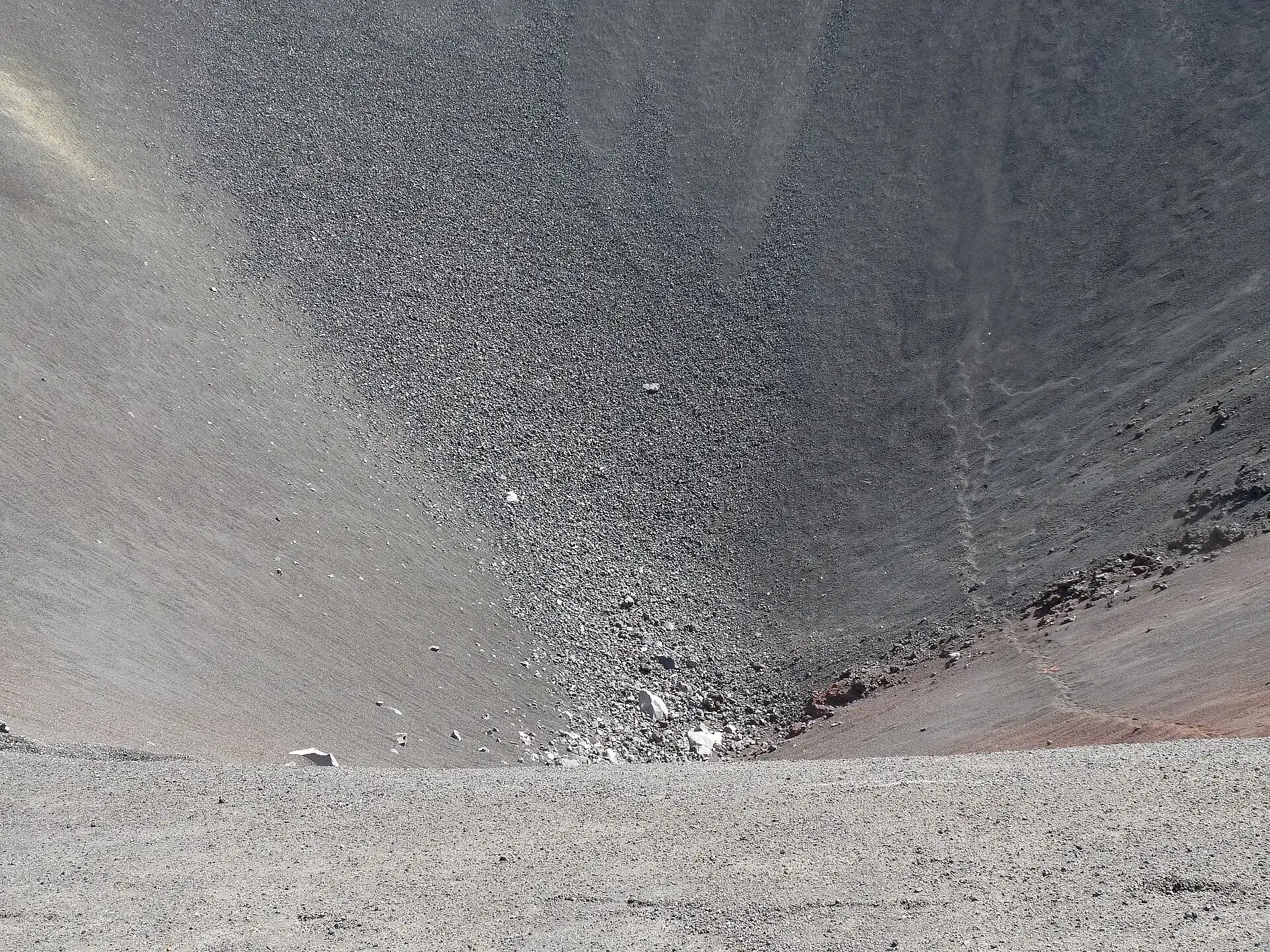
Looking into the crater of Pico Pequeno on Fogo: gray ash slopes, a narrow track running along the crater rim
Pico Pequeno in an hour: the family option when 1,100 m of climbing is too much.

Photo: Ji-Elle · CC BY-SA 3.0

Ways upStandard route, loop via Pico Pequeno, day tour from São Filipe

One cone, one route – but three ways to walk it. All start in Portela at about 1,700 m (5,600 ft), and all end down the ash slopes.

The three versions · as of 09/2026
Standard route from Portela – from the village (about 1,717 m / 5,633 ft) across the lava field to the foot of the cone, then up loose ash and scree to the crater rim (2,829 m / 9,281 ft); about 8 km (5 miles), 1,100–1,140 m (3,600–3,740 ft) of climbing, Alpine Club grade T33–4 h up · 30–60 min down · 6,000 CVE for up to 3
Loop via Pico Pequeno – summit, then descent to the 1995 cone (about 2,020 m / 6,630 ft) and back across the 2014 lava fields; 11–12 km (7–7.5 miles)6–7 h · supplement about 2,000 CVE (as of 03/2024)
Day tour from São Filipe – hotel pickup, 1–1.5 hours' transfer each way, then the same climb with a guide from Chã; Monday to Sunday, weather permittingfull day · €78–85 per person
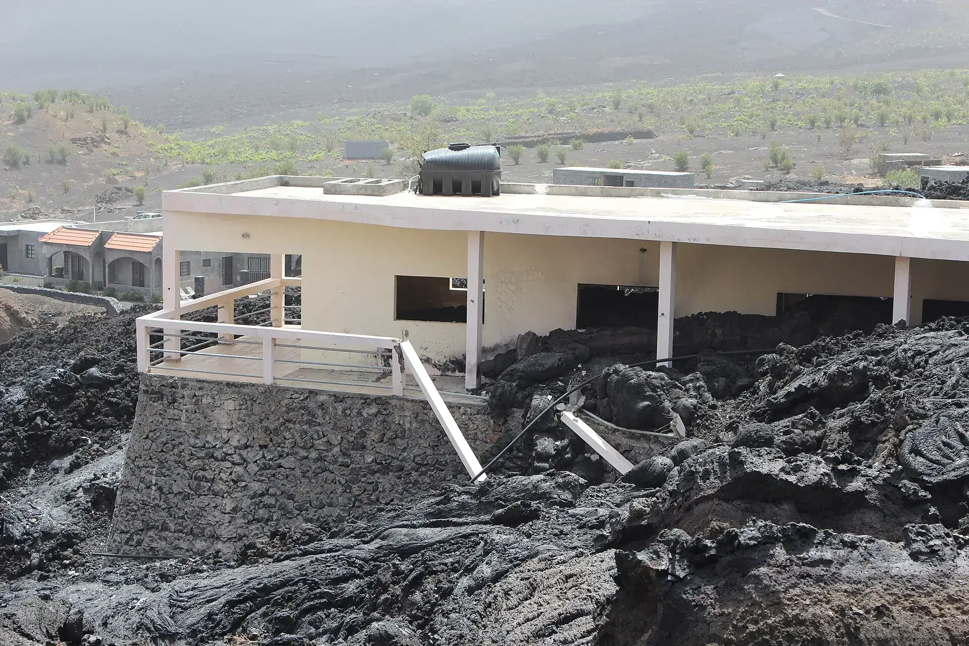
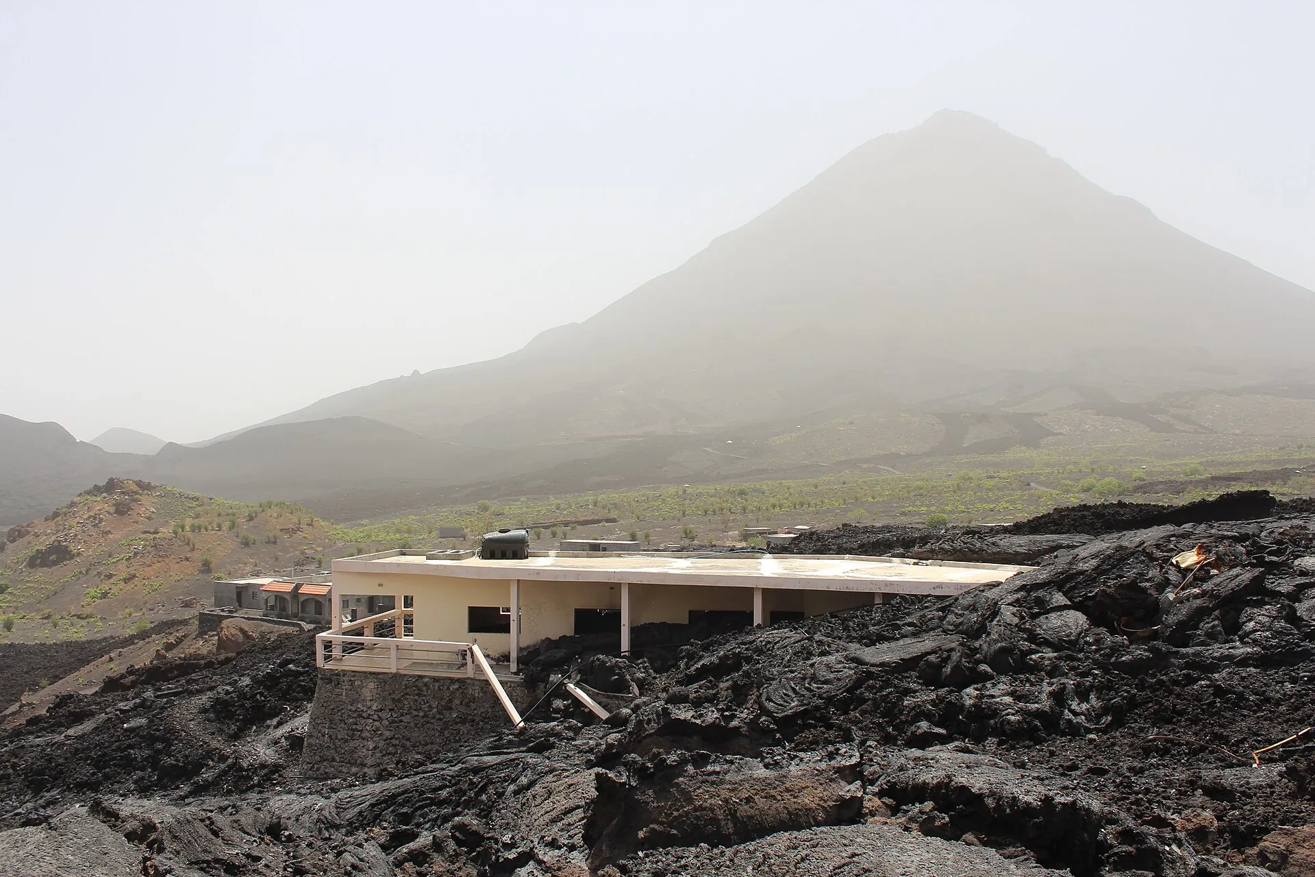
A house in Portela on Fogo whose ground floor is engulfed by the black lava of the 2014/15 eruption, vines and the caldera behind
Portela, 2014: the lava stopped at the first floor. Today several hundred people live on and beside the flow again.

Photo: Zinneke · CC BY-SA 3.0

Good to knowGetting there, best time, tips

Getting there

Without a car: From São Filipe (market/bus station) shared taxis (aluguer, mostly Hiace minibuses) leave for Chã das Caldeiras as soon as they are full – in the late morning around 11 a.m. to noon and in the afternoon, 1.5–2 hours, 900–1,000 CVE. Return from Chã at 6 a.m. and at midday; hardly any vehicles run on Sundays. Private taxi about 6,000 CVE (€50–60) each way. The road from São Filipe via Santa Catarina into the caldera is asphalted or cobbled; inside the caldera you drive across the 2014 lava on a newly built track.

By car: Rental cars in São Filipe are scarce (a December 2025 travel report: 7,000 CVE per day, hard to get); a four-wheel-drive vehicle makes sense. Park in the village at the guesthouse.

  • From São Filipe (SFL airport and ferry port) · 1–2 hours
    Shared taxi or taxi via Santa Catarina do Fogo (Cova Figueira) into the caldera, about 30 km (19 miles)
  • From Praia (Santiago) · Flight 30 min; ferry 4 h
    Flight with Cabo Verde Airlines / TACV on an ATR 72 (about 30 minutes; the airline has served Fogo again since 20 March 2024, cancellations frequent according to the German Federal Foreign Office) or ferry CV Interilhas 'Liberdadi' (about 4 hours, three departures per week in the rotating Sotavento timetable, weather cancellations possible)
  • From Mosteiros (northeast coast) · 5–7 hours
    on foot from Chã over the Bordeira and down through the Monte Velha forest (11 km / 7 miles, 5–7 hours, 200 CVE forest fee), return by taxi

Best time to go

November to June (dry season): clear views, dry trails, pleasant 20–25 °C in the village during the day. The coolest months are January and February; from December to March the 'bruma seca' (Saharan dust in the trade wind) can blur the view of Santiago and Brava. August to October is the rainy season – mostly short showers, but humid and with a risk of thunderstorms. Time of day: start at 6 a.m., then you are at the top before the midday heat and back for lunch; the view is clearest in the morning.

Who it suits

Children
Feasible for athletic children from about 9–10 years: a Portuguese family group (March 2025) with six children, the youngest 9, reached the top in 4 hours and was down in 2 hours. For smaller children the guides offer Pico Pequeno (about 1 hour) or hikes across the lava fields.
Minimum age
none set; the guides decide
Fitness
Demanding: a good 1,100 m (3,609 ft) of elevation gain in one go on loose lapilli and scree at around 30° incline, near the top a short section on the crater rim secured with steel cables (German Alpine Club: T3, sure-footedness required, no climbing technique). The descent down the ash slopes is fast but hard on knees and thighs.
Altitude
Low. The summit is below 3,000 m (9,843 ft); anyone who stays overnight in Chã (1,700 m / 5,577 ft) is acclimatized by morning. If you get a headache or nausea, slow down.
Heart and lungs
The crater smells of sulfur, small fumaroles steam; asthmatics keep their distance. The ascent is in full sun with no shade – people with cardiovascular conditions should start early and drink plenty.
Wheelchair
not possible; the village and the lava fields can be reached by four-wheel-drive vehicle
Dogs
no rule published; the family group of March 2025 had a dog with them
Clothing
Layering: in Chã, winter nights are cool (12–14 °C in the higher areas), and at the summit there is usually a strong wind – windproof jacket, long pants, hat. Plus sun hat and sunscreen (no shade), 1.5–2 liters of water per person (no spring along the way), bars and fruit. Gaiters or high boots keep the ash out on the descent.
Footwear
Broken-in, ankle-high hiking boots with a stiff sole; the lava is sharp-edged, and the ash slopes fill low shoes immediately.

Tips you will need on site

  • Stay overnight in the village and start at 6 a.m. – anyone arriving by shared taxi from São Filipe on the day gets there too late for the summit the same day.
  • Book the guide through the guesthouse and settle the price beforehand: 6,000 CVE for up to three people is the documented benchmark from 2026; euros are accepted, change is scarce.
  • Take at least 1.5 liters of water per person and food – there is nothing on the mountain, and the ascent is in full sun.
  • Pack gaiters or leg warmers: the descent down the ash slopes is the fun part of the tour, but it fills every shoe with black lapilli.
  • Do not plan too much for the day of arrival: shared taxis only leave when they are full, and the return from Chã goes at 6 a.m. or at midday – best to avoid Sunday altogether.
  • Get cash in São Filipe; there is no ATM in Chã das Caldeiras.
  • Plan the ferry and domestic flight with a buffer: the German Federal Foreign Office reports increasing cancellations at Cabo Verde Airlines, and the ferry is canceled in rough seas – do not schedule the return flight to Europe for the day after Fogo.
  • Visit the Adega Chã in the morning: tasting of white, red and passito, with goat cheese from the village – in the afternoon it is often closed.

A short history

  • Around 73,000 years ago the eastern flank of the old shield volcano Monte Amarelo slid into the sea and left the caldera open to the east (about 10 km × 7 km / 6 × 4 miles) with the Bordeira up to 2,700 m (8,858 ft) high; Pico do Fogo then grew inside it.
  • 1680: Last major summit eruption with ashfall, which drove part of the population to flee to the neighboring island of Brava; only flank eruptions since.
  • 1917/1920: Founding of the villages of Bangaeira and Portela in the caldera; viticulture on lava soils becomes the livelihood.
  • 1951: One of the strongest documented eruptions on the island, lava reaching the northeast coast near Mosteiros.
  • 2/3 April 1995: Eruption at the foot of the Pico, the Pico Pequeno cone forms; 1,300 people flee in the night.
  • 2000: Opening of the Adega Chã. 24 February 2003: Decreto-Lei 3/2003 creates the Parque Natural do Fogo; 2 June 2008 boundaries set, 2009 construction of the park headquarters in Chã, 19 April 2010 management plan.
  • 23 November 2014 (9:45 a.m.) to 8 February 2015: 77 days of eruption; the lava destroys Portela, Bangaeira and Ilhéu de Losna including the school, health post, hotel and park headquarters, around 1,000 people are evacuated, 400–520 ha of land covered, damage around 5 billion CVE (€45 million).
  • From 2016 families return and build with lava stone on the lava; by 2019 around ten guesthouses with about 100 beds are running, and a ring road, water and electricity are being built. In 2021 the Chã wine receives a protected designation of origin.
  • 28 October 2020: UNESCO declares the entire island of Fogo a Biosphere Reserve. 12 July 2026: magnitude 4.7 earthquake southwest of Brava, INMG: no anomalies at Fogo.
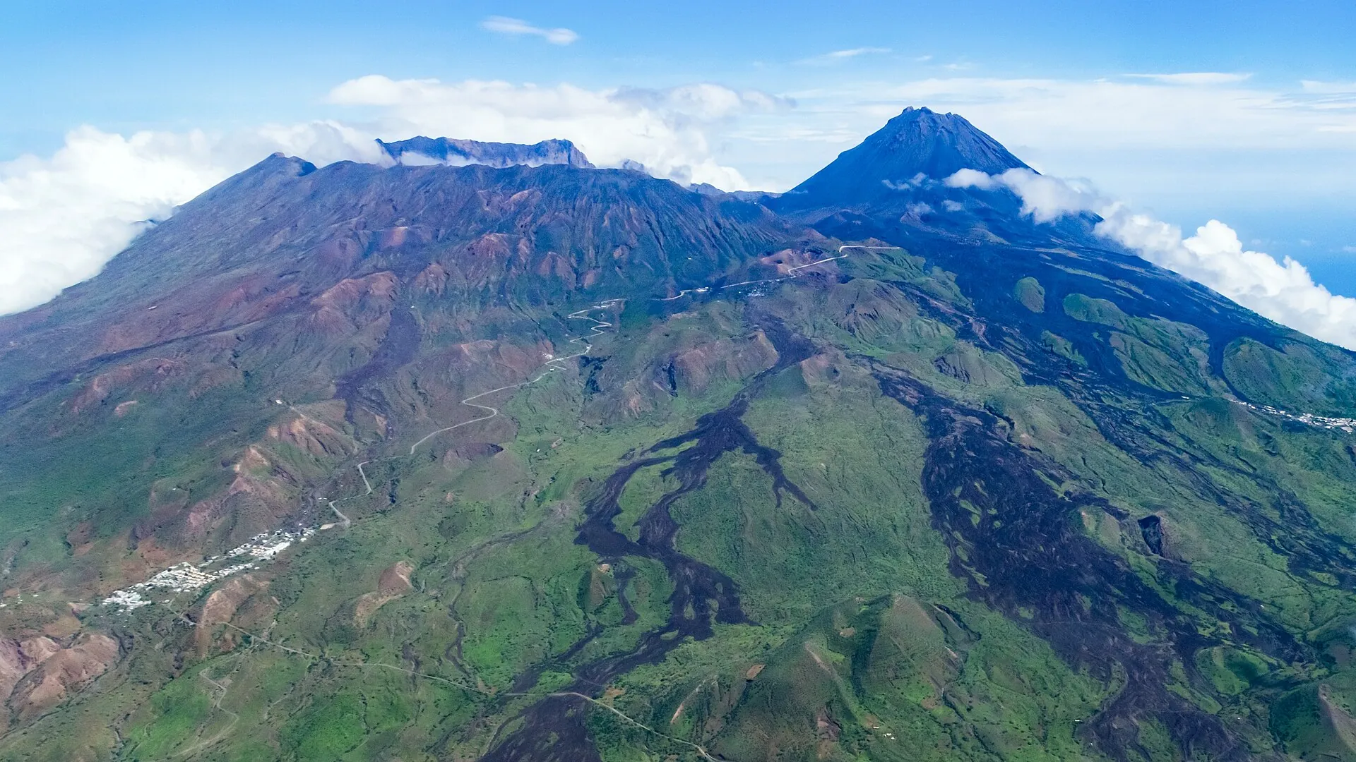
Aerial view of Fogo island from the south: the green Bordeira wall, the black lava flows in the caldera and the cone of Pico do Fogo
From above you can see why the caldera is open to the east: 73,000 years ago half the island slid into the sea.

Photo: Martin Mergili · CC BY 3.0

Around the mountainChã das Caldeiras without the summit: 2014 lava, wine, the Bordeira

If you do not want the summit or cannot do it, the caldera still fills a whole day – and the wine is worth a trip of its own.

Pico Pequeno

The 1995 cinder cone at the foot of the Pico, source of the lava in 1995 and 2014; its crater is colored red, yellow and black. With a guide about an hour from Portela.

supplement, as of 03/2024about 2,000 CVE

Lava fields and the ruins of Portela

The 2014 flow buried the school, the hotel and about 75 percent of the buildings. Today houses built of lava stone stand on the lava. Freely accessible; the guides show a lava tube near Pico Pequeno.

free access0 CVE

Adega Chã

The wine cooperative with 102 members makes white, red, rosé, passito and sparkling wine, with a protected designation of origin since 2021. Open mornings only according to one travel report – not confirmed.

tastingby arrangement

Over the Bordeira to Mosteiros

Over the caldera wall (up to 2,700 m / 8,860 ft) and down through the Monte Velha cloud forest to the northeast coast, through coffee plantations and across the 1951 lava. 11 km (7 miles), 5–7 hours, taxi back.

Monte Velha forest checkpoint200 CVE
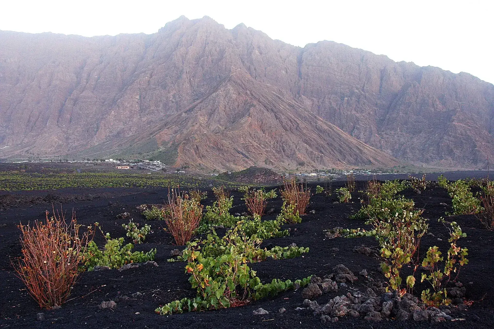
Grapevines on black lava soil in Chã das Caldeiras, behind them the reddish-brown cliff of the Bordeira
Vines in the lapilli: Chã wine grows on what the mountain throws down.

Photo: imke.stahlmann · CC BY-SA 2.0

Outdated onlineWhat other sites get wrong

“The guide costs 25 to 35 euros.”
Those were the prices of 2005 to 2013. A travel report from April/May 2026 quotes 6,000 CVE (about €54) for up to three people plus 2,000 CVE per additional person – €18 to €54 per person, depending on the group.
“The guide requirement is set by law.”
We found no legal provision. The rule is documented as park practice and as the village's economic base; checks are not always made. If you go without a guide, the main risk is the unmarked route.
“Chã das Caldeiras has been abandoned since 2014.”
The residents have been back since 2016. By 2019 there were about ten guesthouses again, a ring road, water and power; today several hundred people live in Portela and Bangaeira once more.
“Chã das Caldeiras lies at 1,500 meters.”
The plateau lies at about 1,700 m / 5,600 ft (Alpine Club: start at 1,717 m). From the village it is 1,100 to 1,140 m (3,600 to 3,740 ft) of climbing to the summit, not 1,300 or more.
“You can see glowing lava.”
The last lava flowed on 8 February 2015. Today there are fumaroles and the smell of sulfur in the summit crater, and young but cold lava fields.
The cone of Pico do Fogo in the haze of the bruma seca above the ruins of a lava-engulfed house in Chã das Caldeiras
From December to March Saharan dust can take the view – the bruma seca is part of winter on Fogo.

Photo: Zinneke · CC BY-SA 3.0

Quick answersBefore the climb

How hard is the Pico do Fogo hike?

Demanding but without climbing skills: a good 1,100 m (3,600 ft) of continuous ascent on loose lapilli and scree at about 30 degrees, with a short cable-secured section at the crater rim. The German Alpine Club grades it T3. If you regularly hike 1,000 m of ascent, you will be up in three to four hours.

How much does climbing Pico do Fogo cost in total?

There is no entrance fee. According to 2026 travel reports the guide costs about 6,000 CVE (about €54) for up to three people, 2,000 CVE for each additional person. Add the journey (shared taxi 900–1,000 CVE each way) and a night in the village (example 3,500 CVE with breakfast). Day tours from São Filipe with transfer cost €78–85 per person.

Can you do Pico do Fogo as a day trip from São Filipe?

Yes, with an operator: hotel pickup, 1 to 1.5 hours' drive, 4 to 6 hours' hike, back in the afternoon. Not on your own – the shared taxis leave only late in the morning once they are full, and the guides start at six.

Is Pico do Fogo still active?

Yes. The volcano last erupted from 23 November 2014 to 8 February 2015, before that in 1995 and 1951. The INMG monitors it seismically; as of September 2026 there are no anomalies and no closure.

What is Pico Pequeno?

The cinder cone of just under 2,000 m (6,600 ft) at the foot of the Pico, formed in the 1995 eruption. Its fissures also released the 2014 lava. With a guide it takes about an hour from Portela – the option for younger children, or the descent on the loop route.

Is Pico do Fogo currently open?

Yes, as of 22 September 2026 there is no closure. After the earthquake of 12 July 2026 the INMG saw no anomalies at the Fogo volcano and no cause for concern. In an emergency the civil protection service SNPC would close it, as in 2014.

How much is the entrance fee for the Parque Natural do Fogo?

Nothing. The park charges no entrance fee; only at the Monte Velha forest post on the trail to Mosteiros are 200 CVE due. The municipality of Santa Catarina is discussing an access fee to Chã, but it has not been adopted.

Can you climb Pico do Fogo without a guide?

Officially no: a guide from Chã das Caldeiras (AGTC) is mandatory for the summit. No regulation on this was found, and it is not always enforced – but the trail is unmarked, and the guides are the village's main source of income.

How much does the guide for Pico do Fogo cost?

According to a 2026 travel report around 6,000 CVE (about €54) for a group of up to three people, each additional person 2,000 CVE. Older figures (€25–35) are outdated. Day tours from São Filipe with transfer cost about €78–85 per person.

How long does the climb take?

Three to four hours up, barely an hour down the ash slopes – five to six hours in total from Chã das Caldeiras. With the descent via Pico Pequeno or with children it is six to seven hours.

How much elevation gain is it?

Around 1,100–1,140 m (3,609–3,740 ft) of elevation gain: Chã das Caldeiras lies at about 1,700 m (5,577 ft), the summit at 2,829 m (9,281 ft). The trail is about 8 km (5 miles) long, 11–12 km (7–7.5 miles) with Pico Pequeno.

Is Pico do Fogo suitable for children?

For sure-footed, athletic children from about 9–10 years, yes – a family group with children aged 9 and up was up and down in 6 hours in 2025. For younger children the guides offer Pico Pequeno in about an hour.

What should you wear and bring?

Ankle-high hiking boots, long pants, windproof jacket and hat for the summit, sun hat and sunscreen for the shadeless ascent, at least 1.5 liters of water, food, gaiters against the ash. In Chã the winter nights are cool.

How do you get to Chã das Caldeiras?

From São Filipe by shared taxi (900–1,000 CVE, 1.5–2 hours, departures in the late morning and afternoon, back from 6 a.m.) or taxi (about 6,000 CVE). You reach São Filipe from Praia by plane (Cabo Verde Airlines, 30 minutes, about €75) or by CV Interilhas ferry (about 4 hours, from about 4,450 CVE, three departures per week).

Is the volcano dangerous?

Fogo is active and last erupted in 2014/15, but is seismically monitored by the INMG; eruptions give warning. The everyday risks are heat, sun, loose scree and the cable-secured crater rim – so start early, drink plenty and stay with the guide.

Can you see lava or smoke?

No glowing lava; the eruption ended on 8 February 2015. In the summit crater small fumaroles steam and it smells of sulfur; in the caldera you walk across the black 2014 lava that buried Portela.

When is the best time?

November to June: dry, clear, mild during the day. January/February are the coolest, December to March sometimes brings Saharan dust. August to October is humid with showers. Always start at 6 a.m.

Can you stay overnight in Chã das Caldeiras?

Yes, in the rebuilt guesthouses of Portela and Bangaeira (in 2019 around ten houses with about 100 beds; example Casa do Alcindo: 3,500 CVE with breakfast, dinner 700 CVE). The hosts also arrange the guide for the early start.

Do you need a ticket or a permit?

No. There is no ticket, no online booking and no permit; you only pay the guide in cash. You should reserve the guide the day before through your accommodation.
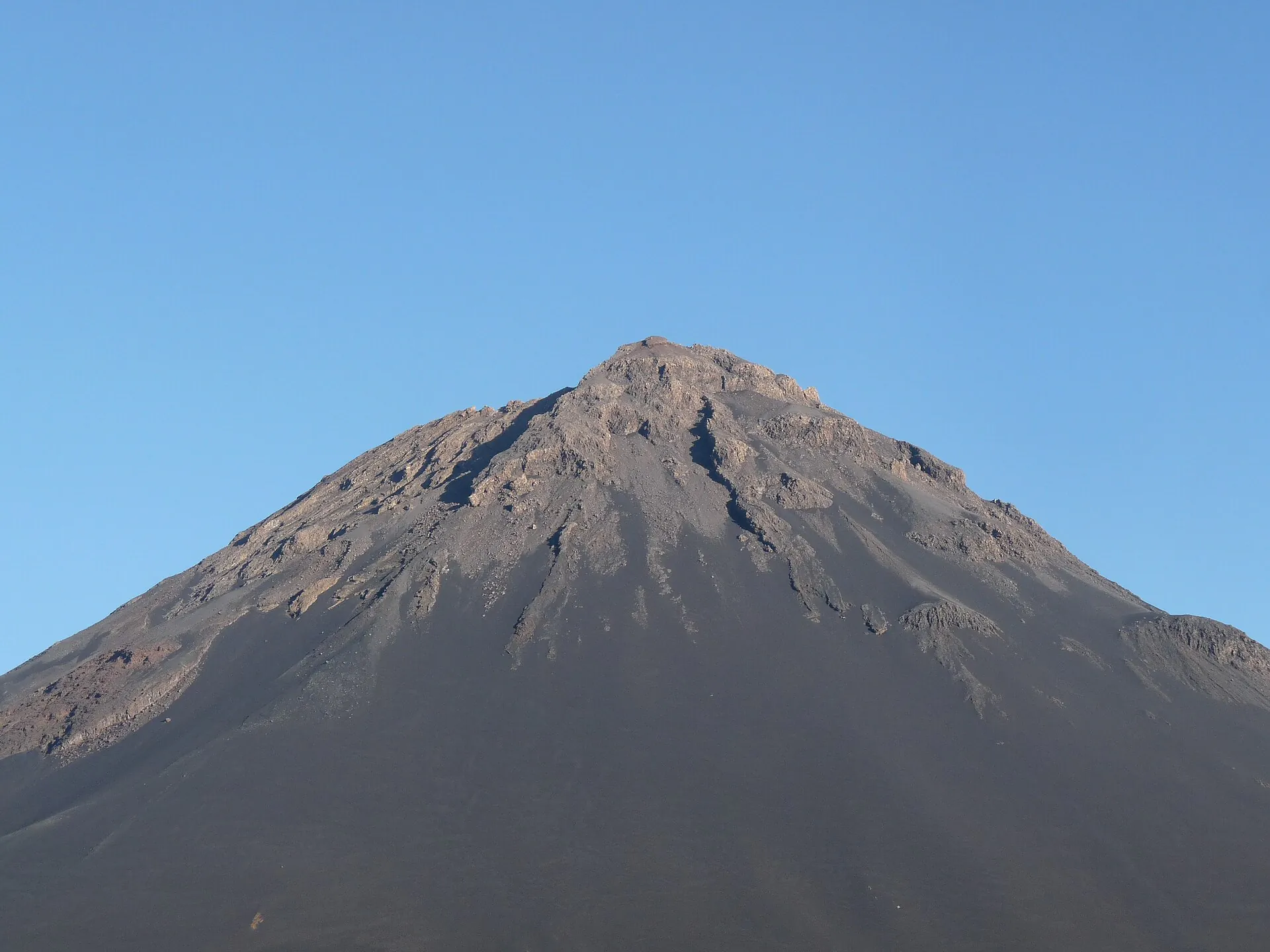
Pico do Fogo under a clear sky: an almost symmetrical cone of dark ash with a jagged crater rim
From below an almost perfect cone. From the top: Santiago and Brava in the ocean – when the Saharan dust allows it.

Photo: Ji-Elle · CC BY-SA 3.0

Sources · accessed on 22 September 2026