Volcano·Guide
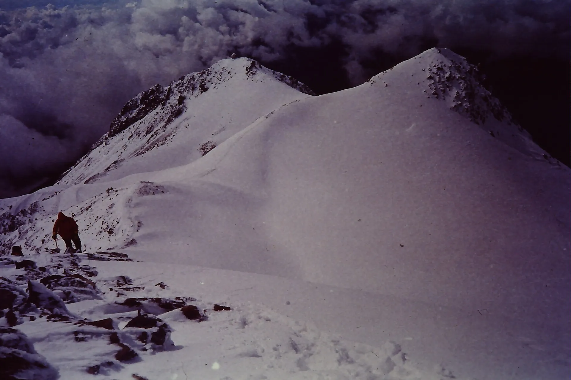
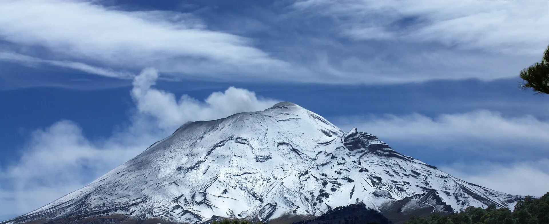
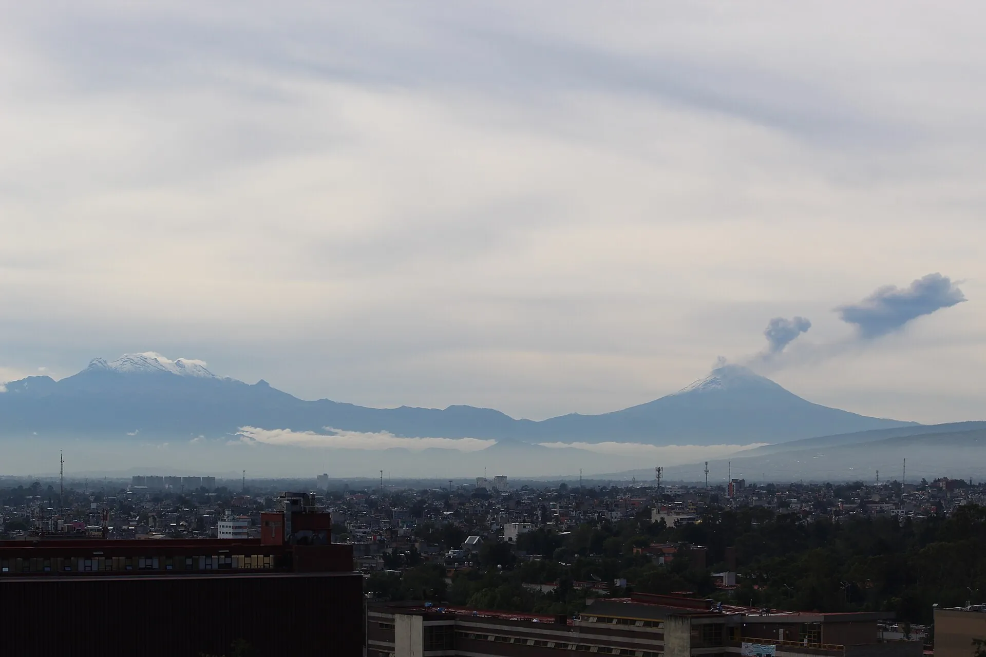
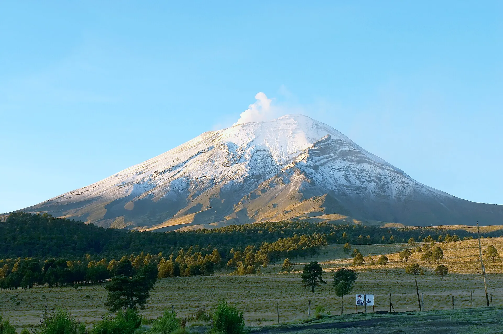
Popocatépetl and Iztaccíhuatl above the rooftops of Mexico City: two snow-capped peaks on the horizon, a steam plume above the one on the right Popocatépetl seen from Paso de Cortés: snow-covered cone with a steam plume above pine forest and highland meadow A climber on the snowy summit ridge of Iztaccíhuatl, clouds behind

Popocatépetl and Iztaccíhuatl

From Mexico City they are two white peaks above the haze. The one on the right is smoking.

At Paso de Cortés, 3,700 m up, it stands right in front of you. You are not allowed any closer.

The one you can climb is the other: the sleeping woman, 5,230 m.

Scroll –
closer in

As of September 22, 2026Popocatépetl today: closed – Iztaccíhuatl is open

Two 5,000-meter volcanoes, one national park, two completely different sets of rules. Popocatépetl has been continuously active since it reawakened in 1994 and is closed within a 12 km (7.5 mile) radius of the crater – the volcanic traffic light stands at Yellow Phase 2, and CENAPRED repeats every day: “No intentes subir al volcán” – do not try to climb the volcano. You can still see it, from Paso de Cortés, legally and from the closest point allowed. And you can climb its neighbor across the pass: the dormant Iztaccíhuatl.

Closed
12km exclusion radius

Popocatépetl: no climbing, no Tlamacas

The summit, all flanks and the former climbers' base at Tlamacas lie inside the exclusion zone. The State of Mexico's high-mountain police checks at Paso de Cortés and patrols Tlamacas; according to the park administration, anyone who enters is handed over to the authorities. Offers for a “Popocatépetl climb” are illegal.

Exclusion zone since 1994 · CENAPRED report of September 21, 2026
Open
5,230m

Iztaccíhuatl: register at Paso de Cortés

The national park is open. You register at the visitor center, pay the daily fee in cash and get a wristband. No guide required – on the marked Portillos and Ayoloco routes up to the summit, El Pecho.

per person and day · under US$2 · as of July 202630.50 MXN
Short notice
Phase 2Yellow

Ashfall and closures without warning

On September 21, 2026 CENAPRED counted 120 exhalations, 55 minutes of tremor and an ash plume drifting south-southwest; ash fell in Amecameca on August 31, 2026. If activity rises to Phase 3, CONANP closes the whole park – most recently from May 19 to June 10, 2023. Snow, fog and wildfires also lead to closures.

Before you go: CENAPRED daily report and the park's Facebook page
Sources: CENAPRED, daily Popocatépetl reports of September 20 and 21, 2026 (Yellow Phase 2, 12 km radius) · SSPC/Protección Civil, notices of August 13, 2019 and June 6, 2023 · CONANP park page (not reachable on September 22, 2026; fee and wristband according to search-result excerpts of that page and press of July 1, 2026) · Germany's Federal Foreign Office, as of September 22, 2026. A change of alert level in 2026 is not documented; every CENAPRED report names Phase 2 throughout.
Popocatépetl from Paso de Cortés: snow-covered cone with a white steam plume under a blue sky with thin clouds
This is the legal view: from Paso de Cortés at about 3,700 m (12,100 ft). Everything closer is exclusion zone.

Photo: Carlos Valenzuela · CC BY-SA 3.0

The experiencePaso de Cortés: face to face with Popocatépetl

The pass between the two volcanoes is where Hernán Cortés crossed toward Tenochtitlán in 1519. Today there is a visitor center, the pay station and a monument – and you stand at about 3,700 m (12,100 ft) between a mountain that smokes and one that sleeps.

From Amecameca the road winds 23 km (14 miles) uphill through pine forest until the trees thin out and the pass opens. To the left Popocatépetl, an almost perfect cone, above its crater a plume of steam and gas that is white or gray depending on the wind. To the right the long silhouette of Iztaccíhuatl, which from here really does look like a woman lying down: head, chest, knees, feet. The wind is cold, even in summer, and the air is already so thin that you sway for a moment when you get out of the car.

If you only want to look, this is the place – in the morning, before the clouds build. When the Popo has one of its small explosions you do not hear it; you just see the plume suddenly turn thicker and darker. When ash falls, it crunches between your teeth. On weekends the parking lot is full; on a clear winter weekday morning you have the pass almost to yourself.

For the Iztaccíhuatl climb you continue: 6.5 to 8 km (4 to 5 miles) of dirt road to La Joya, by car only with a reservation, otherwise on foot. What starts there has nothing to do with a hike – 1,200 m (3,900 ft) of elevation gain in thin air, scrambling sections, glacier remnants, a start in the middle of the night. On top, on the Pecho, in clear weather you see the Popo's ash plume from above and the Valley of Mexico below.

Affiliate links to GetYourGuide: if you book, we earn a commission and the price stays the same. Prices and ratings as of 22 September 2026. Day tours from Mexico City or Puebla take you onto Iztaccíhuatl, usually as far as the Refugio de los Cien or the Rodillas, not to the summit. The view of Popocatépetl is included – whether it smokes or sits in cloud that day is up to the mountain.

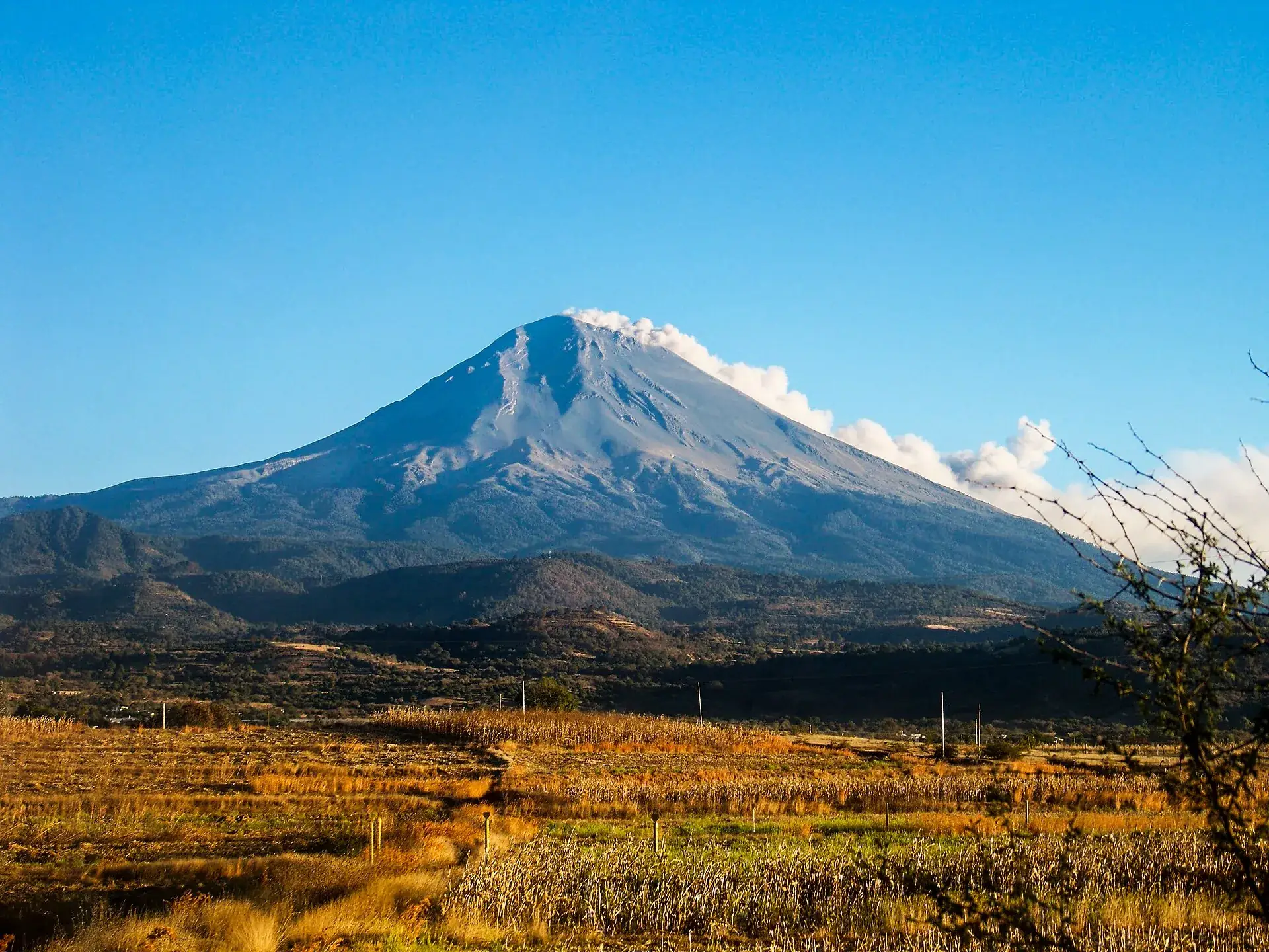
Popocatépetl with an ash plume above autumn fields near Metepec, Puebla, under a blue sky
Seen from the Puebla side: the plume drifts east – then the ash lands on the fields, not on Amecameca.

Photo: Metrocamell · CC BY-SA 4.0

The rulesIzta-Popo National Park: fee, registration, reservations

The park belongs to CONANP, Mexico's protected-areas agency; the exclusion zone around Popocatépetl is set by civil protection on the basis of CENAPRED's hazard maps. There is no online ticket and no time slot – but there is registration on site and a mandatory reservation for anything that drives beyond the pass or stays overnight in the park.

1

Register and pay cash

At the Paso de Cortés visitor center every person signs in and pays 30.50 MXN per day – cash, in pesos. You wear the wristband visibly for the whole stay; park rangers and the high-mountain police check. Children under 6 and people with disabilities pay nothing.

2

Driving to La Joya only with a reservation

The dirt road beyond the pass requires a reservation: portal reservaciones.conanp.gob.mx (create an account, wait for approval) or phone +52 597 978 3829 / 3830, Mon–Thu 9 a.m.–3 p.m. On weekends, without a reservation the drive ends at Paso de Cortés; on foot you can always continue.

3

Guides: not required, but licensed

CONANP strongly recommends an authorized mountain or mid-mountain guide for Iztaccíhuatl and publishes the list with registration numbers on the park's Facebook page. Ask the operator for the number – unlicensed guides are a known problem.

4

Staying overnight in the park

The Albergue Altzomoni on the road to La Joya and camping also need a reservation; a night at Altzomoni costs another 30.50 MXN per person. If you start for the summit at night, you register the day before. Whether the high-mountain huts on the mountain are open is not documented.

CONANP park fees · as of July 2026 · rate on September 22, 2026: 1 MXN ≈ €0.05
Park fee per person and day, proof by wristband · about €1.5530.50 MXN
Night at the Albergue Altzomoni, per person and night, in addition · reservation required30.50 MXN
Children under 6 and people with disabilitiesfree
Guide for the summit climb, optional · operator prices per expedition, about €125–3552,500–7,000 MXN
Sources: CONANP park page and reservation portal (not reachable via DNS on September 22, 2026; fee, wristband, Altzomoni surcharge and exemptions from search-result excerpts of those pages as well as press of July 1, 2026 and operator pages of April 2025) · CONANP notice of March 5, 2021 (phone reservation, weekend rule) · park administration, notices of July 2, 2025 and December 28, 2025. No primary source gives current opening hours of the pay station; the three figures in circulation differ. Fine amounts are not published.
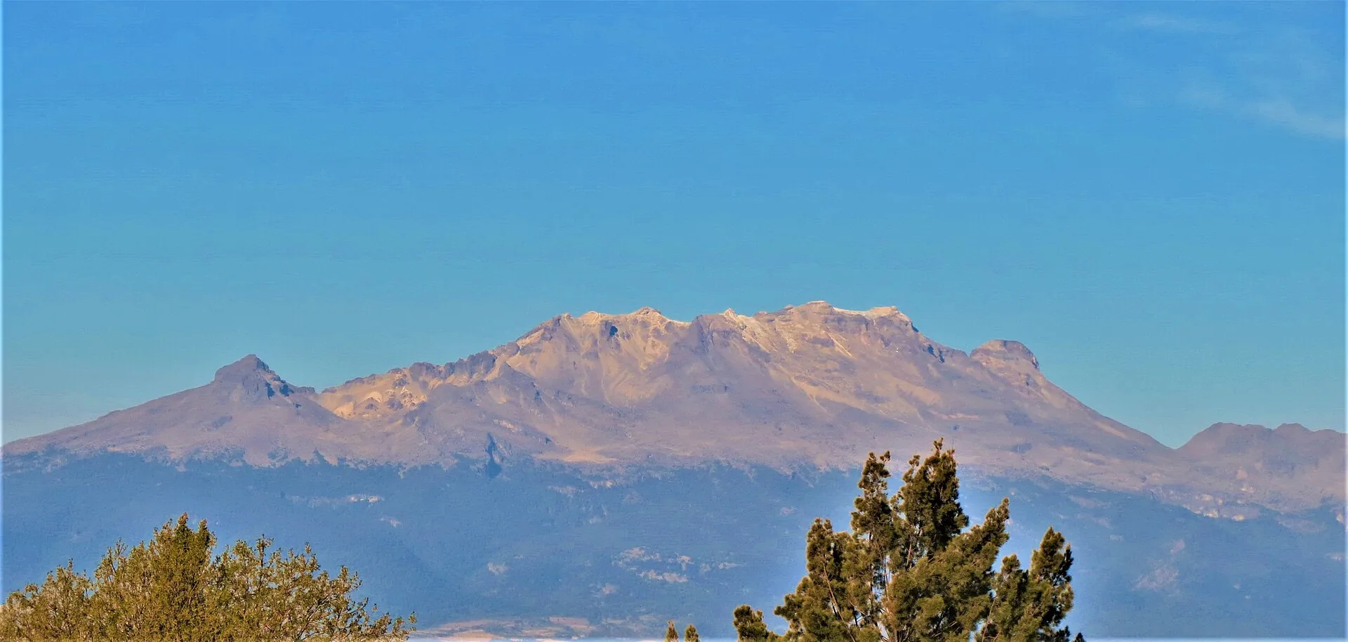
Iztaccíhuatl from the east, seen from Puebla: long snow-covered mountain silhouette with several summits above a tree
From Puebla she lies there the way the Aztecs saw her: head, chest, knees, feet. The summit is the chest, El Pecho.

Photo: Luis Alvaz · CC BY-SA 4.0

Ways upClimbing Iztaccíhuatl: routes, times, elevation gain

The park administration names only two marked routes and, since the fatal fall on the Arista de la Luz in December 2025, explicitly warns against “new” paths. Three climbers died on Iztaccíhuatl in 2025. Safety equipment is to be “worn at all times and used correctly.” Heights of intermediate points and walking times come from operators.

Routes in the Izta-Popo National Park · as of July 2026 · times according to operators
Iztaccíhuatl, Ruta de los Portillos (standard route) – La Joya (about 4,000 m / 13,100 ft) → Refugio de los Cien (about 4,780 m / 15,680 ft) → Las Rodillas (about 4,740 m / 15,550 ft) → El Pecho (5,230 m / 17,160 ft)10–14 hours round trip from La Joya, 15–17 hours from Paso de Cortés; to Las Rodillas only, 8–10 hours. About 1,200 m (3,900 ft) of elevation gain, scrambling sections (UIAA I–II), boulder fields, glacier remnants at the Pecho. The usual plan: a night at La Joya or the refugio, start between 11 p.m. and 4 a.m. Season November–March (firm snow, clear views, very cold), rainy season June–September with afternoon thunderstorms.
Iztaccíhuatl, Ruta Ayoloco – La Joya → Ayoloco glacier area → El PechoThe second marked route, often used for the descent. Same heights, same season, same demands. Other paths are unmarked – the park administration asks you to use only Portillos or Ayoloco and to tell relatives your route.
Popocatépetl, view from Paso de Cortés (no climb) – Amecameca (2,480 m / 8,140 ft) → Paso de Cortés (about 3,700 m / 12,100 ft)23 km (14 miles) of road, about 45 minutes from Amecameca. Visitor center, pay station, parking lot; walks near the pass and toward La Joya are suitable for families. Checkpoints and roadblocks during elevated activity, access road closed in snow. Best views early in the morning in the dry season.
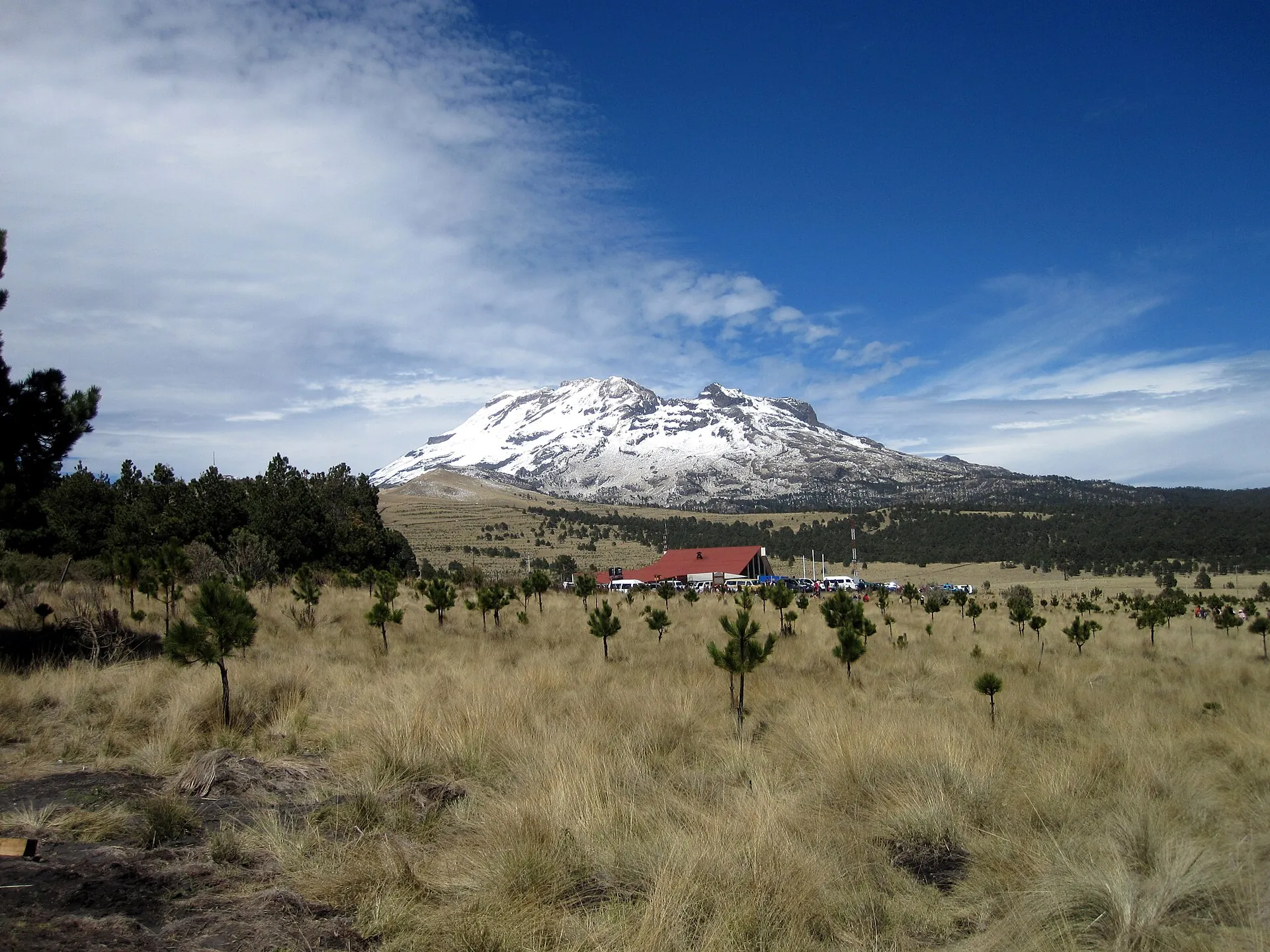
Snow-covered Iztaccíhuatl above a highland meadow with young pines and a red-roofed building at Paso de Cortés
A snowy weekend at the pass: then the vehicle slots to La Joya are gone fast – and the police presence is stepped up.

Photo: Haakon S. Krohn · CC BY-SA 3.0

Good to knowGetting there from Mexico City, best time, gear

Getting there

Without a car: From Mexico City's TAPO terminal with the Volcanes or Autobuses del Sur lines to Amecameca (every 20 minutes from 5 a.m. to 10:30 p.m., about 1 h 20, ticket around 30–40 MXN). In Amecameca take a taxi or shared taxi to Paso de Cortés (23 km / 14 miles); arrange a pickup for the way back. From Puebla: CAPU – Estrella Roja to San Marcos – Volcanes to Amecameca. From Cuautla: Volcanes to Amecameca.

By car: Autopista México–Puebla (150D) to the Chalco exit, continue toward Cuautla to Amecameca, at the edge of town turn left toward Tlamacas/Paso de Cortés via San Pedro Nexapa; park entrance at km 82.5 of the federal highway México–Puebla. Parking lot at Paso de Cortés; driving on to La Joya only with a reservation. Roadblocks by the authorities are possible during activity or snow. Germany's Federal Foreign Office advises driving overland only in daylight.

  • From Mexico City · 1.5–2.5 hours to Paso de Cortés
    Car, or bus TAPO–Amecameca plus taxi
  • From Amecameca · about 45 minutes
    Taxi/shared taxi or car via San Pedro Nexapa
  • From Puebla
    Car via Nealtican / Santiago Xalitzintla to Paso de Cortés (eastern access, partly dirt road)

Best time to go

November to March for the climb: clear views, firm snow, little precipitation – but very cold and crowded on snowy weekends (March 31, 2026: around 100 visitors in one morning, increased police presence). October to May for views and hikes; in the rainy season June–September the fog closes in by midday, with afternoon thunderstorms. Popo view: early in the morning before the clouds build; the ash plume is visible depending on the wind.

Who it suits

Children
Paso de Cortés and the trails around La Joya: yes, suitable for families. Iztaccíhuatl summit: no – high-alpine, above 5,000 m (16,400 ft), glacier remnants, exposed terrain. In July 2025 a minor who was on the Portillos route alone and without equipment died of hypothermia at 4,400 m (14,400 ft).
Minimum age
None published by CONANP; operators take adults only for the summit climb.
Fitness
Summit: very good fitness, 1,200 m (3,900 ft) of elevation gain from La Joya in thin air, scrambling sections (UIAA I–II), boulder fields, 10–17 hours. Rodillas (4,740 m / 15,550 ft) as a shorter goal. Walk at Paso de Cortés: easy.
Altitude
Very relevant: Paso de Cortés is already at 3,700 m (12,100 ft), La Joya at 4,000 m (13,100 ft), the summit at 5,230 m (17,160 ft). At least one night at La Joya or Altzomoni to acclimatize; operators build it in as standard.
Heart and lungs
Operators exclude people with high blood pressure, asthma, vertigo or back/knee problems from the summit climb. Ashfall irritates the airways – in ash CENAPRED recommends covering mouth and nose, rinsing the eyes and wearing glasses instead of contact lenses.
Wheelchair
Paso de Cortés is reachable by car (view from the parking lot), the trails are not accessible.
Dogs
No published park rule found.
Clothing
Three-layer system, down jacket, hat, gloves, glacier glasses, sun protection; in winter a sleeping bag rated to −15 °C (5 °F). At Paso de Cortés a jacket even in summer – wind and temperatures around freezing.
Footwear
Crampon-compatible mountaineering boots; crampons, ice axe and helmet depending on conditions (glacier at the Pecho, ice in winter). The park administration requires that safety equipment be 'worn at all times and used correctly'.

Tips you will need on site

  • Read the CENAPRED daily report first (gob.mx/cenapred): alert level, ash plume and wind direction are posted there every day – at Phase 3 CONANP shuts the park.
  • Reserve in advance at reservaciones.conanp.gob.mx if you want to drive to La Joya; without a reservation the drive ends at Paso de Cortés on weekends.
  • Bring cash in pesos for the 30.50 MXN fee and wear the wristband visibly – park rangers and the high-mountain police check.
  • Plan at least one night at 3,700–4,000 m (12,100–13,100 ft) (Altzomoni or La Joya); Mexico City sits at 2,240 m (7,350 ft), and jumping to 5,230 m (17,160 ft) without acclimatizing is the most common reason for turning back.
  • Use only the Portillos or Ayoloco routes and tell relatives your route – the park administration explicitly asks for this after the accidents of 2025.
  • Find guides via the park's Facebook page and ask for the CONANP registration number; unlicensed operators are a known problem.
  • Pack a dust mask and close-fitting glasses: depending on the wind, ashfall from the Popo also reaches La Joya and Amecameca.
  • Offers for a 'Popocatépetl climb' are illegal – anyone who books one breaks the law and risks their life; the alternative with a view of the Popo is exactly Iztaccíhuatl.

A short history

  • 1519: Hernán Cortés marches with his troops over the pass between the volcanoes toward Tenochtitlán – hence the name Paso de Cortés.
  • 1889: First documented ascent of Iztaccíhuatl by James de Salis.
  • November 8, 1935: President Lázaro Cárdenas declares both mountains a national park by decree (39,819 ha) – one of Mexico's oldest protected areas.
  • December 21, 1994: Popocatépetl reawakens after about 70 years of rest; ash falls up to 25 km (16 miles) away. The exclusion zone has been in force ever since.
  • April 30, 1996: Five climbers die in the exclusion zone from incandescent ejecta – the case Protección Civil cites to justify the 12 km (7.5 mile) radius.
  • December 2000: Largest eruption in 1,200 years, tens of thousands are evacuated; by 2001 the glaciers of Popocatépetl have disappeared.
  • 2010: UNESCO lists the area as the biosphere reserve 'Los Volcanes' (172,000 ha); management program in 2013.
  • May 21–June 6, 2023: Traffic light at Yellow Phase 3, park closed from May 19 to June 10, 2023; back at Yellow Phase 2 since June 6, 2023.
  • May 12, 2026: CENAPRED launches the 'No es una hazaña' campaign against illegal Popo climbs; several deaths on Iztaccíhuatl in 2025/26 (March, July and December 21, 2025).
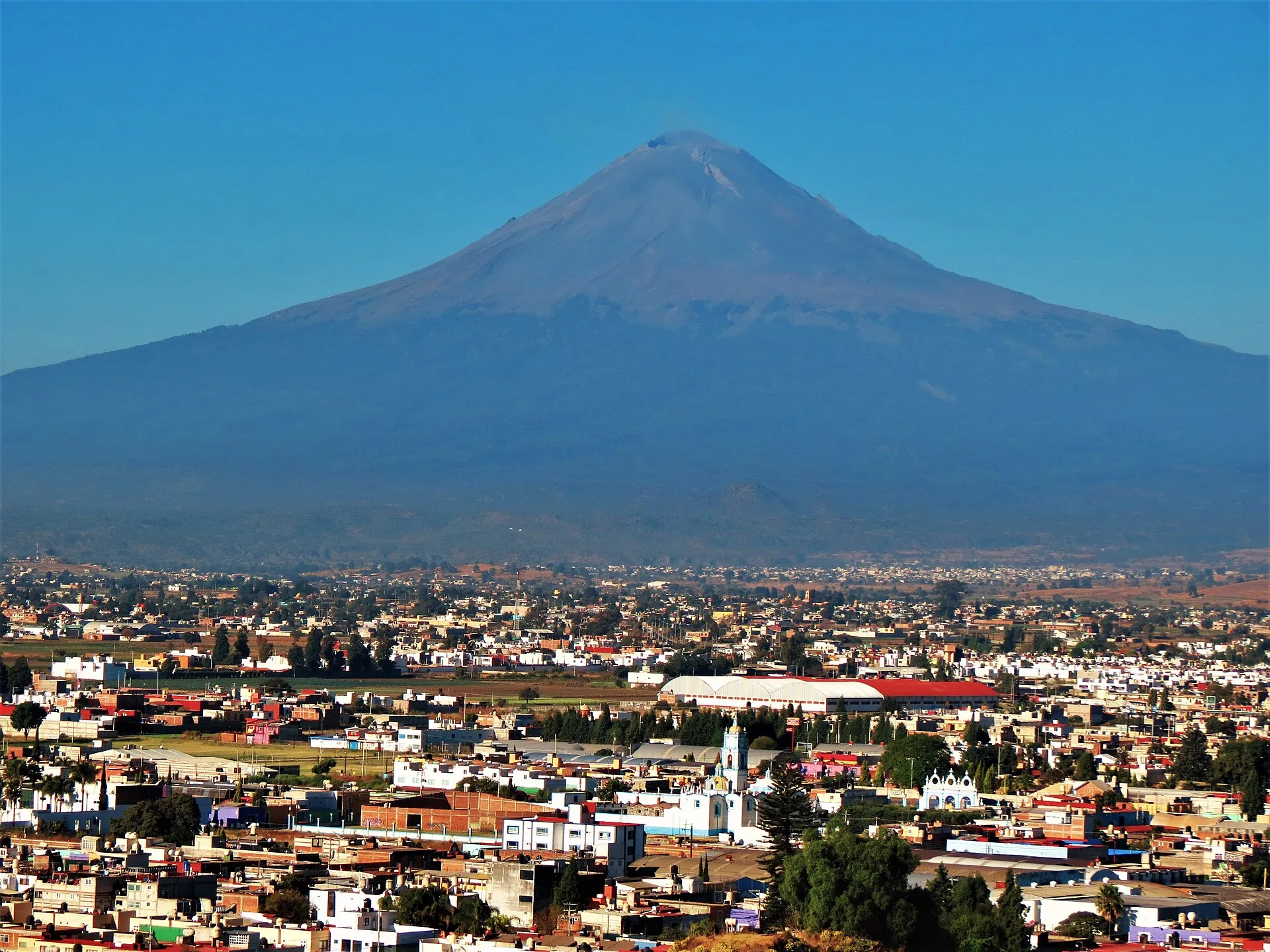
Popocatépetl above the city of Cholula near Puebla: dark cone with a pale plume above the crater, houses and a church in front
From Puebla and Cholula the Popo is part of everyday life – the eastern access to Paso de Cortés runs via Nealtican and Xalitzintla, partly on dirt road.

Photo: Luis Alvaz · CC BY-SA 4.0

Two days, one night at 4,000 mBooking an Iztaccíhuatl summit climb: from Mexico City and Puebla

If you really want to reach the Pecho, you need two days: the drive in, a night at La Joya or the refugio to acclimatize, a start in the dark. Operators take adults only and exclude people with high blood pressure, asthma or vertigo. Ask in advance whether the park fee, tent, crampons and helmet are provided – and for the guide's CONANP registration number.

Affiliate links to GetYourGuide: if you book, we earn a commission and the price stays the same. Prices and ratings as of 22 September 2026. The summit tours have only a handful of reviews – this is a small market. Whether you make it to the top depends on weather, snow and your acclimatization: Mexico City sits at 2,240 m (7,350 ft), and jumping to 5,230 m (17,160 ft) without a night in between is the most common reason for turning back.

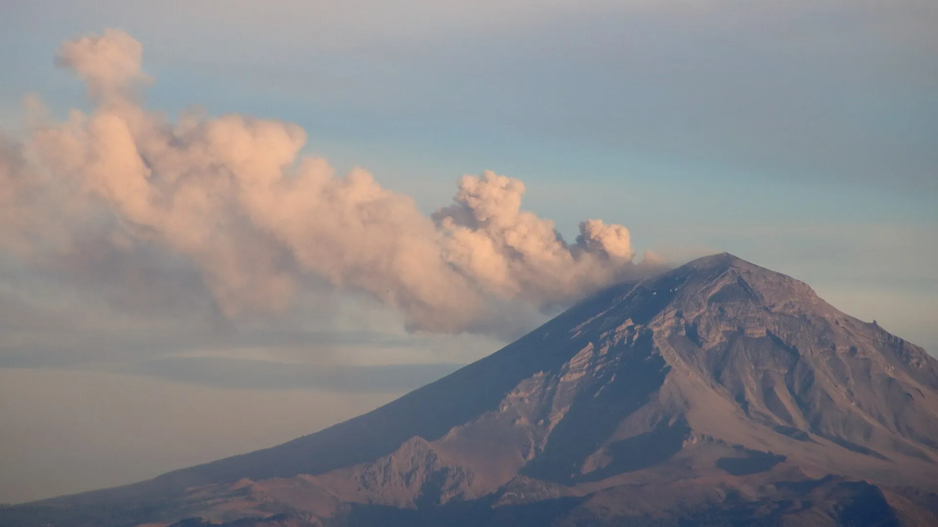
Popocatépetl ejects a dense, pinkish-gray ash cloud drifting to the left over the cone; telephoto shot from Mexico City
This is Yellow Phase 2: exhalations, an ash plume, incandescent ejecta possible. The reason for the 12 km (7.5 mile) distance.

Photo: Irosasr · CC BY-SA 4.0

Outdated onlineWhat other sites get wrong

“You can climb Popocatépetl with a mountain guide, at least as far as Tlamacas.”
No. Since 1994 a 12 km (7.5 mile) exclusion radius applies around the crater, Tlamacas is a restricted area, and CENAPRED repeats daily “no intentes subir al volcán.” The only legal point is Paso de Cortés. In 1996 five climbers died inside the zone.
“The Popo is at Yellow Phase 3.”
That applied only from May 21 to June 6, 2023. Since then, and in every CENAPRED report of 2026 – most recently September 21, 2026 – the traffic light stands at Yellow Phase 2, still with the exclusion zone.
“Admission is 50 pesos (or 120).”
50 MXN was the pandemic rule of 2021; 120 MXN is quoted by a private booking site. The official fee is 30.50 MXN per person and day (as of July 2026).
“Iztaccíhuatl is a strenuous hike.”
It is a mountaineering route: scrambling sections, glacier remnants, 10–14 hours from La Joya, above 5,000 m (16,400 ft). Three climbers died in 2025, among them a teenager who was alone and without equipment.
“You simply drive up to La Joya.”
The dirt road beyond Paso de Cortés requires a reservation – via the portal or by phone. Without one, on weekends you continue on foot only.
“The national park is closed because of the volcano.”
The park is open; the last volcano-related closure was May 19–June 10, 2023. What is closed is Popocatépetl itself. Weather closures come at short notice.
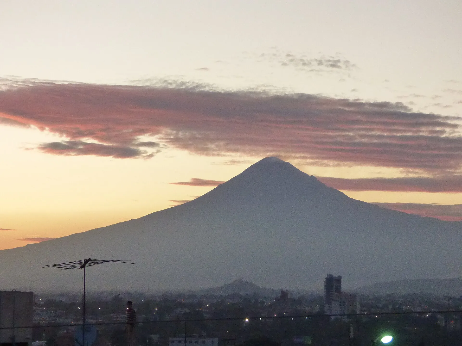
Popocatépetl as a silhouette against an orange evening sky above the rooftops of Puebla, a palm tree in the foreground
Evening over Puebla: the plume is often just a small shadow at the summit – and at night a faint glow when incandescent material flies.

Photo: Luisalvaz · CC BY-SA 4.0

Quick answersBefore the drive to Paso de Cortés

Is Popocatépetl active right now?

Yes, continuously since December 21, 1994. On September 21, 2026 CENAPRED reported 120 exhalations, 55 minutes of tremor and an ash plume drifting south-southwest; the traffic light stands at Yellow Phase 2. Major peaks of activity came in December 2000, 2013, 2019 and May 2023.

How tall is Popocatépetl?

About 5,400 m (17,700 ft) – sources give 5,393 to 5,452 m depending on the survey and year, because the summit crater changes with the activity. Iztaccíhuatl measures 5,230 m (17,160 ft).

Where is the best view of Popocatépetl?

From Paso de Cortés (about 3,700 m / 12,100 ft, legally permitted, visitor center) you face it directly; from the Sacromonte in Amecameca you see both volcanoes. From Puebla and Cholula it often shows clearly in the morning, before the clouds build.

How much does the Izta-Popo National Park cost?

30.50 pesos (under US$2) per person and day, in cash at the Paso de Cortés visitor center; you get a wristband for it. A night at the Albergue Altzomoni costs another 30.50 pesos (as of July 2026).

Can you climb Iztaccíhuatl in one day?

Operators reckon 10–14 hours round trip from La Joya, 15–17 from Paso de Cortés. Day tours therefore usually end at the Refugio de los Cien or the Rodillas. For the summit, two days are the norm – also because of acclimatization.

Can you reach Paso de Cortés by bus?

As far as Amecameca, yes: from the TAPO terminal in Mexico City every 20 minutes, a good hour. The last 23 km (14 miles) to the pass are by taxi or shared taxi; best arrange the return trip right away.

Can you climb Popocatépetl?

No. Since the 1994 reawakening a 12 km (7.5 mile) exclusion radius applies around the crater; the traffic light stands at Yellow Phase 2 (CENAPRED, September 21, 2026) with explosions and incandescent ejecta. Anyone who goes in is handed over to the authorities – and risks their life; five climbers died there in 1996.

Is Iztaccíhuatl currently open?

Yes, as of September 22, 2026 the national park is open; Popocatépetl remains at Yellow Phase 2. CONANP closes at short notice when activity rises (most recently May 19–June 10, 2023), during wildfires or in snow/fog – check the CENAPRED report and the park's Facebook page before you drive.

Do you need a guide for Iztaccíhuatl?

Not required, but CONANP recommends one of its authorized mountain guides – the list with registration numbers is on the park's Facebook page. The route is long, with scrambling sections and glacier remnants; without experience you should not go alone.

How long does the Iztaccíhuatl climb take?

From La Joya (4,000 m / 13,100 ft) operators reckon 10–14 hours round trip to the Pecho (5,230 m / 17,160 ft), from Paso de Cortés 15–17 hours. Two days are the norm: a night at La Joya or the Refugio de los Cien (4,780 m / 15,680 ft), start between 11 p.m. and 4 a.m.

Do you have to reserve in advance?

For driving beyond Paso de Cortés to La Joya, and for Altzomoni and camping, yes – via reservaciones.conanp.gob.mx or by phone Mon–Thu 9 a.m.–3 p.m. If you only drive to Paso de Cortés or continue on foot, you register on site.

How do you get to Paso de Cortés without a car?

Bus from the TAPO terminal (Mexico City) to Amecameca, every 20 minutes, a good hour. From there a taxi or shared taxi 23 km (14 miles) up to the pass; best arrange the return trip right away.

Is the visit suitable for children?

Paso de Cortés and the trails around La Joya, yes – dress warmly, it is at 3,700–4,000 m (12,100–13,100 ft). Not the summit climb: operators take adults only, and in 2025 a teenager who climbed alone died of hypothermia at 4,400 m (14,400 ft).

What should you wear and bring?

For the summit: crampon-compatible boots, crampons, ice axe, helmet, three-layer system, down jacket, glacier glasses, headlamp, sleeping bag rated to −15 °C (5 °F), 3 liters of water. For Paso de Cortés a jacket, hat and sun protection are enough – plus a dust mask and glasses in case of ashfall.

Is it dangerous – because of ash or crime?

Outside the 12 km (7.5 mile) zone ashfall is a nuisance, not a danger (mask, glasses); ash fell in Amecameca on August 31, 2026. The State of Mexico's high-mountain police is present at Paso de Cortés and in Tlamacas; Germany's Federal Foreign Office mentions only the volcanic exclusion zone for the park and advises driving in daylight.

When is the best time?

November to March for the climb (clear, firm snow, but very cold and crowded on weekends), October to May for views and hikes. In the rainy season June–September fog moves in from midday.
Sources · accessed on 22 September 2026