Volcano·Guide
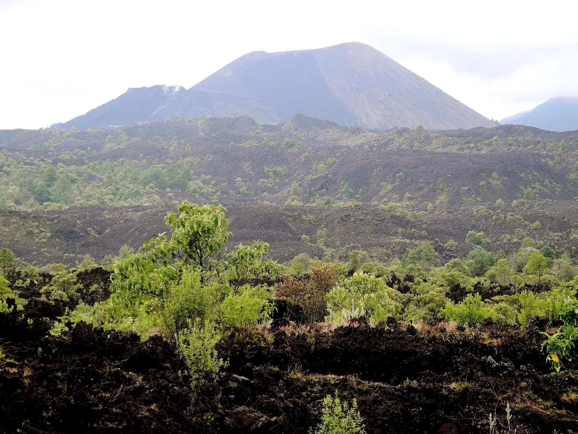
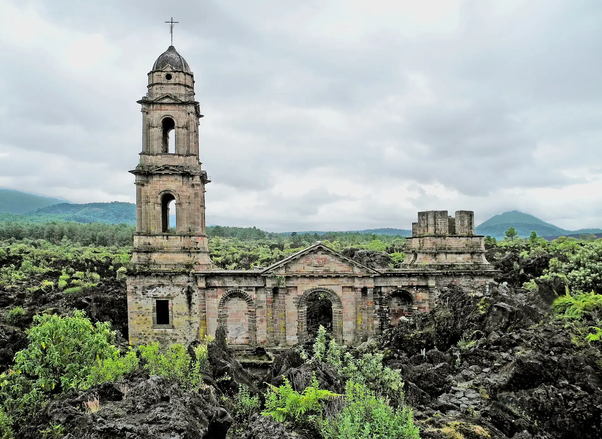
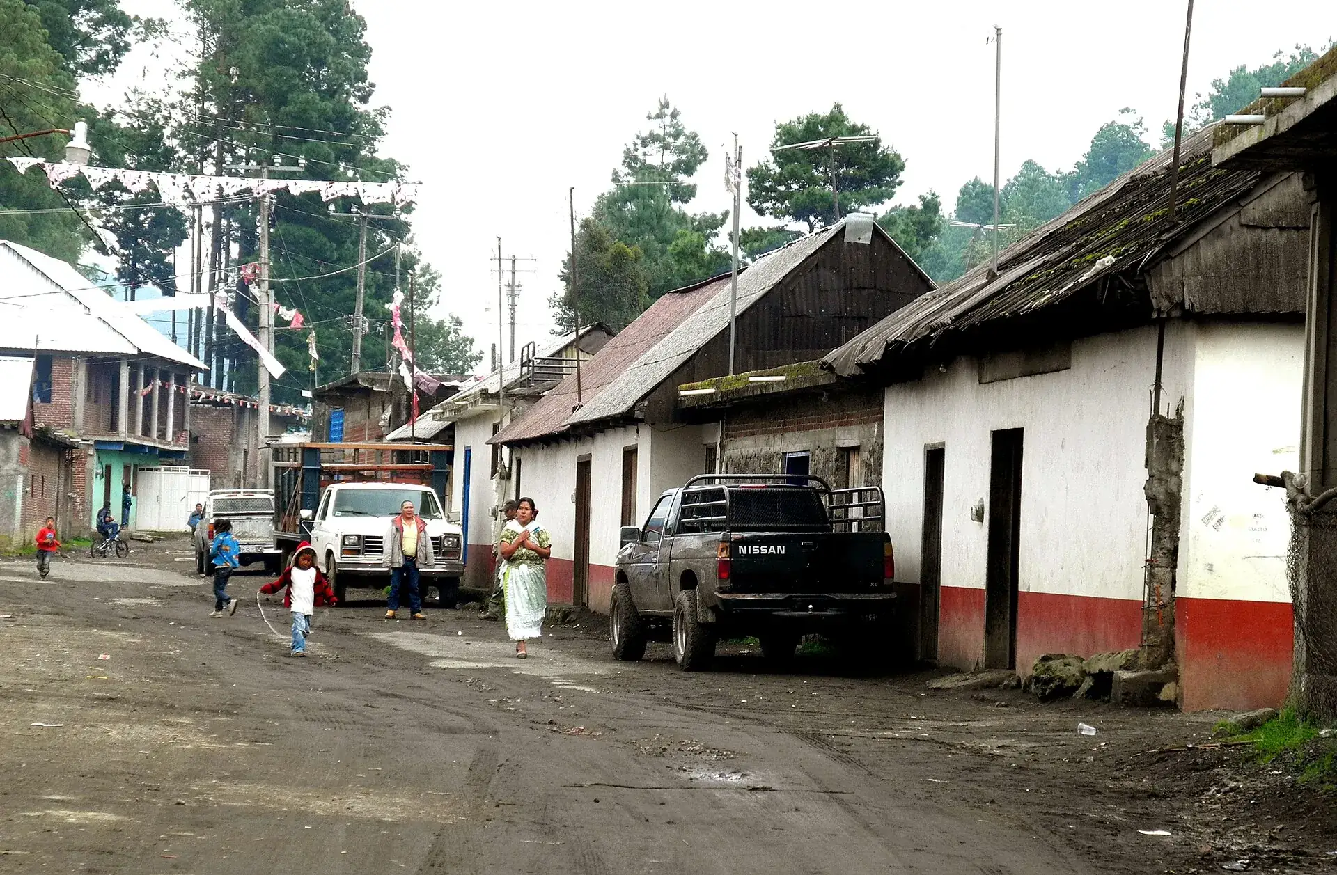
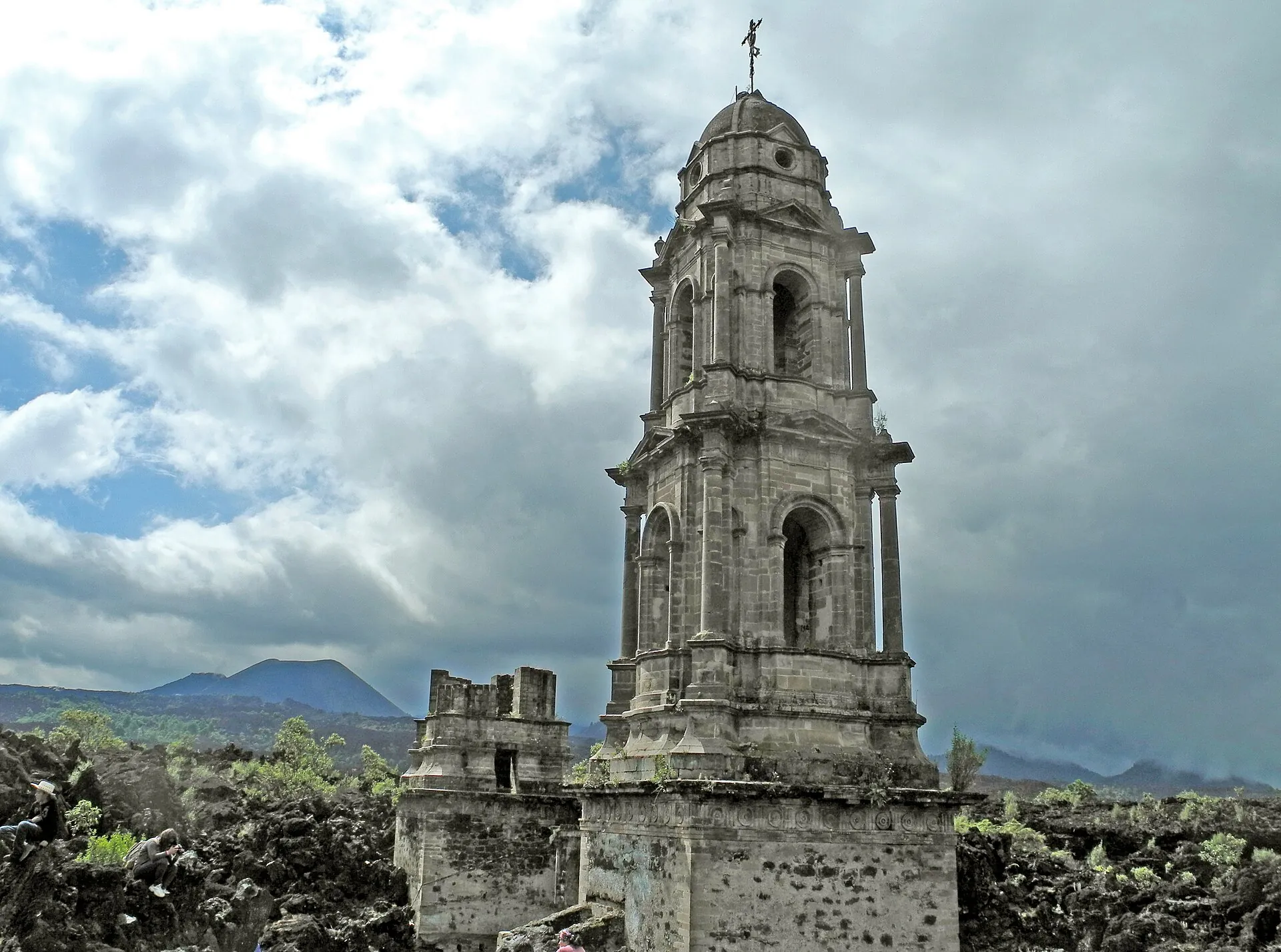
A street in Angahuan, Michoacán: white houses with wooden roofs, people and a pickup truck, pines behind The church tower of San Juan Parangaricutiro rises out of black lava under a dramatic cloudy sky, the cone of Paricutín in the background The cone of Paricutín above the cooled lava field, which is slowly being reclaimed by bushes and trees

Paricutín

In Angahuan the horses are waiting. From here it is three kilometers to the first ruin.

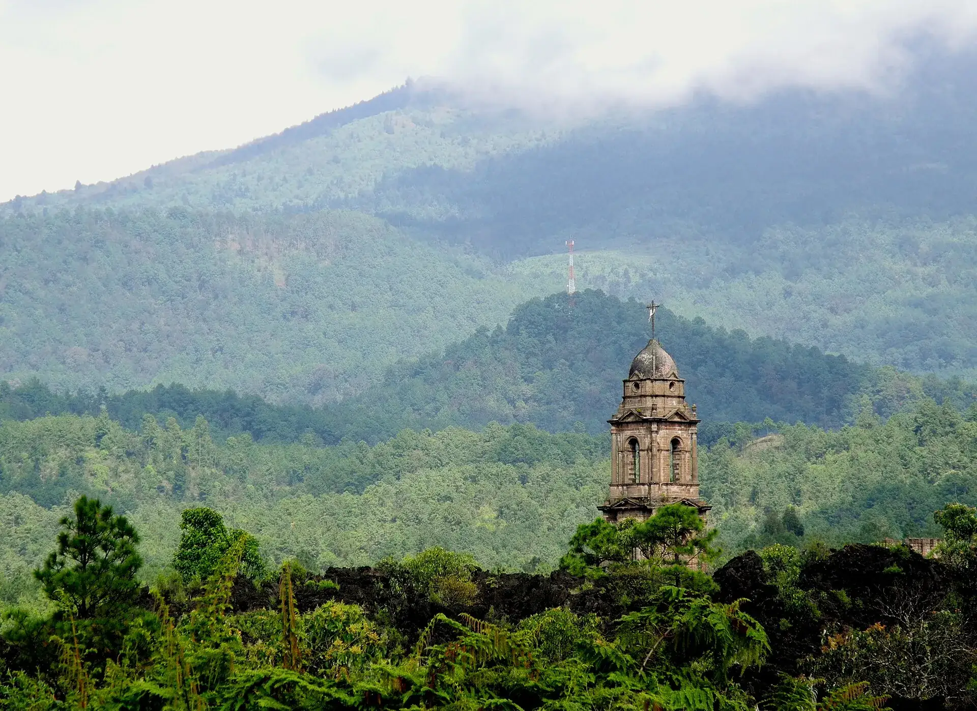
Then a church tower rises out of black lava. The town beneath it is San Juan – buried since 1944.

And behind it, the mountain that did this: born in a cornfield in 1943, extinct since 1952.

Scroll –
out onto the lava

As of September 22, 2026Paricutín today: extinct, open – and in Michoacán

Paricutín is the volcano that broke through a farmer's cornfield on February 20, 1943 and went extinct forever after nine years – a monogenetic cinder cone that does not erupt a second time. There is no alert level, no ticket and no national park: the land belongs to the Purépecha community of Angahuan, and the community provides the guides and horses. What you need to know beforehand is not on CENAPRED's site but in the travel advisories: Michoacán is on the do-not-travel lists.

Open
1952extinct

Volcano and lava field

No closure, no permit, no monitoring – CENAPRED publishes no reports on Paricutín. The route across the lava field to the cone is unmarked; in practice everyone goes with a guide from Angahuan. A few warm fumaroles remain at the crater rim.

Guides and horses: community prices, cash · see the rules
Open
3km from Angahuan

Church ruin of San Juan Parangaricutiro

Tower, facade and altar of the parish church rise out of the lava flow that buried the town on May 10, 1944. Reachable on foot in 30–45 minutes from the Mirador, even without a guide; according to travel reports there is no admission fee. A pilgrimage site with candles and crosses.

Halfway to the volcano · suitable for families
Travel advisory
Level 4U.S. State Department

Security situation in Michoacán

The U.S. State Department lists Michoacán at Level 4, Do Not Travel, but cleared Uruapan again for its personnel on August 8, 2026. Germany's Federal Foreign Office advises against travel to Michoacán except Morelia by direct flight (as of September 22, 2026). If you go: daylight only, main roads, reach your destination before dark.

Check the advisories again before you travel
Sources: U.S. travel advisory Level 4 and partial clearance of Uruapan on August 8, 2026 (readable only via secondary sources on September 22, 2026) · Germany's Federal Foreign Office, travel and safety advice for Mexico, as of September 22, 2026 (unchanged since August 20, 2026) · Sectur Michoacán, February 11, 2025 (Angahuan community, guides and horses) · CENAPRED (no reports on Paricutín, checked September 22, 2026). A volcano-related closure is impossible at an extinct cone; rainy season June–October with slippery lava and thunderstorms.
The two towers of the church ruin of San Juan Parangaricutiro rise out of the black lava field, forest and hills behind under an overcast sky
The lava came slowly. People had time to leave – and took their Christ figure with them. The church stayed.

Photo: LBM1948 · CC BY-SA 4.0

The experienceParicutín hike: across the sea of lava to the church in the rock

Paricutín is the only volcano whose entire life scientists watched from the first hour to the last day. Today it is silent. What remains is a 424 m (1,390 ft) cone, a black sea of lava that the forest is slowly taking back – and a church standing in the middle of it.

At the Mirador of Angahuan the Purépecha guides wait with their horses. From here a forest trail leads downhill, then the lava begins: sharp-edged blocks, black and rust-red, with pines and cacti growing between them. After about 30 minutes the church tower appears. The lava flowed right into the chancel and stopped there; candles and crosses stand at the front, and pilgrims still come today.

Beyond the church the route gets serious: 8 to 10 km (5 to 6 miles) across the lava field without markings, in the saddle or on foot, and then the cone stands in front of you – a heap of dark cinders, surprisingly smooth. Everyone climbs the last 30 minutes themselves: very steep, two steps forward, one back. On top a crater, a few warm fumaroles, and all around the whole Meseta Purépecha to the horizon.

The lava stores heat. If you start in Angahuan at nine, you reach the cone at noon when the field is an oven, and in the rainy season the thunderstorm comes in the afternoon. Allow 5 to 8 hours for the whole way, 19 to 23 km (12 to 14 miles) round trip – or about 4 hours in the saddle plus the climb.

Affiliate links to GetYourGuide: if you book, we earn a commission and the price stays the same. Prices and ratings as of 22 September 2026. Only two offers, one review each – Paricutín is not a mass destination. Both start in Morelia, the one city in Michoacán that the U.S. embassy and Germany's Federal Foreign Office treat differently from the rest of the state. On site in Angahuan you book guide and horse directly with the community.

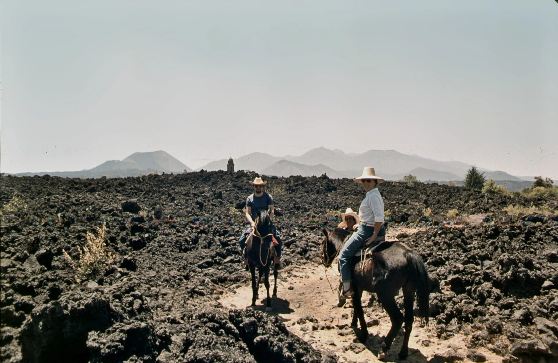
Two riders in hats lead their horses along a sandy path through the black lava field of Paricutín, a church tower in the distance
On horseback to the foot of the cone: the guides from Angahuan know the way through the lava – it is not marked.

Photo: Rolf Cosar · CC BY 3.0

The rulesGuides, horses, fees: what applies at Paricutín

No state agency, no CONANP, no wristband. Angahuan has governed itself since December 22, 2021, and tourism to the volcano is community business: horses, guides and the food stands at the Mirador are the comuneros' income. There is no published rate – all prices are negotiated or quoted by operators, and they contradict each other.

1

No ticket, no permit

For a day visit you need nothing – neither online nor on site. The visit effectively begins at the barrier of the Centro Turístico/Mirador of Angahuan, where travel reports quote 15–20 MXN for parking. Filming, events and wild camping would have to be arranged with the Concejo Comunal.

2

Guides: not required, but unavoidable

You can find the church ruin on your own. From there the lava field is unmarked; the community, all operators and Sectur Michoacán recommend a guide. Operators quote from about 1,500 MXN (roughly US$80) per group of up to 10 in 2026; older travel reports say 300 MXN. Agree the price for the whole group beforehand.

3

Horses to the foot of the cone

Horseback tour with guide according to an operator 1,600 MXN (roughly US$85) for the first person plus 600 MXN for each additional (as of 2025); older reports quote 150 MXN to the church and 300 MXN to the crater. Riding experience is required, riding is at your own risk. Everyone walks the last 30 minutes to the crater.

4

Cash in pesos

The parking barrier, guides, horses, food at the Mirador and a small trail-maintenance fee at the cone (caseta) are cash only; there is no card reader. Operators also quote “access fees” of 50–100 MXN per person at the volcano in 2026 – who charges them and for what is not cleanly documented.

Centro Turístico de Angahuan (community-run) · as of September 2026 · rate on September 22, 2026: 1 MXN ≈ €0.05
Cabin for 2 people, per night · about €511,000 MXN
Cabin for 4 people, per night · about €761,500 MXN
Cabin for 6 people, per night · about €961,900 MXN
Camping, per person100 MXN
Parking for overnight guestsfree
Sources: Centro Turístico de Angahuan (cabins, camping, parking) · Sectur Michoacán, February 11, 2025, and State of Michoacán, Autogobierno Angahuan (self-government since December 22, 2021) · guide and horse prices: operator pages 2025/2026 and travel reports 2018 – no rate published by the community. There are no official fees or fines.
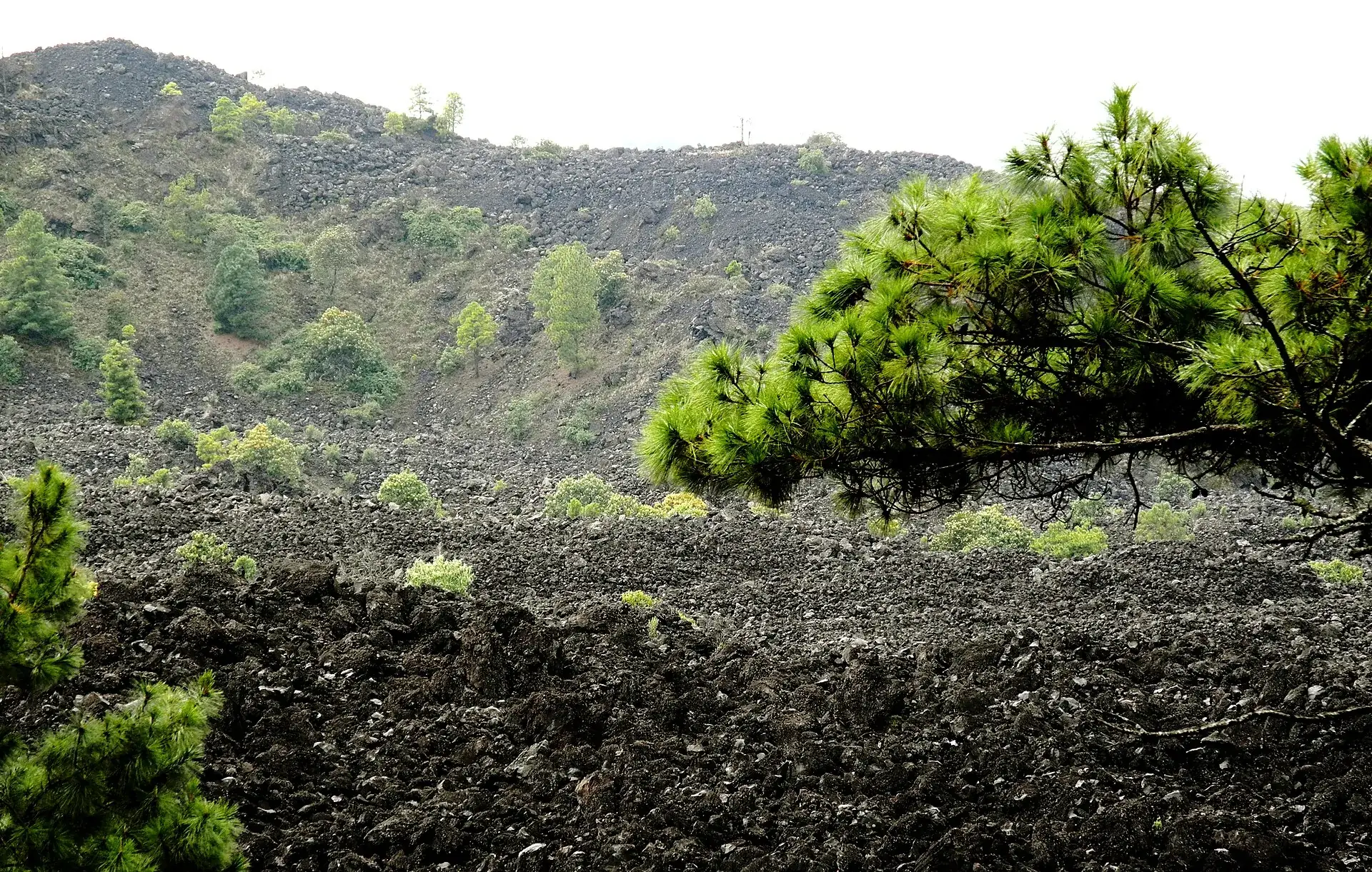
The lava field of Paricutín near Angahuan: black block lava with pines and bushes growing out of it, a pine branch in the foreground
Eighty years after the eruption the forest is taking the field back – tree by tree, in the cracks of the lava.

Photo: LBM1948 · CC BY-SA 4.0

Ways upTo the crater of Paricutín: routes, times, distances

Four ways, one goal. Heights are approximate (Angahuan about 2,400 m / 7,900 ft, crater rim about 2,800 m / 9,200 ft), walking times are operator figures. From Uruapan the church and the Mirador make a half day; the crater is a full day.

Routes to Paricutín · as of September 2026 · times according to operators
On foot from Angahuan via the church ruin (main route) – Mirador (about 2,400 m / 7,900 ft) → San Juan Viejo → lava field → foot of the cone → crater rim (about 2,800 m / 9,200 ft)19–23 km (12–14 miles) round trip, 5–8 hours depending on fitness (ascent 3–4 h, descent 2 h); from the foot of the cone to the crater about 30 minutes steeply up loose cinders. Guide from about 1,500 MXN per group; agency tour from Uruapan 950 MXN per person, from 4 people 490 MXN. Year-round, best November–April; slippery in rain, no shelters.
On horseback from Angahuan to the foot of the cone, final climb on footAbout 4 hours in the saddle round trip, about 6 hours in total with church and crater (operators: 6–8 hours). 1,600 MXN first person plus 600 MXN each additional including guide (as of 2025); agency horseback tour 2,950 MXN plus 690 MXN. Riding experience required.
Only to the church ruin of San Juan Parangaricutiro30–45 minutes on foot each way through forest and lava, 2–3 hours for the walk with time on site. Ruin freely accessible according to a travel report; horse to the church about 150 MXN according to an older figure. The right choice with small children.
Southern access from Nuevo San Juan Parangaricutiro (car to near the cone)16 km (10 miles) of dirt road to the ruin, another 11 km (7 miles) to the volcano (travel report 2018), then 30–60 minutes on foot from the end of the track; agency variant “Route B” 15 km instead of 23 km (9 instead of 14 miles). Crater access 20 MXN per person (2018). Track passable for cars in the dry season, difficult in the rainy season.
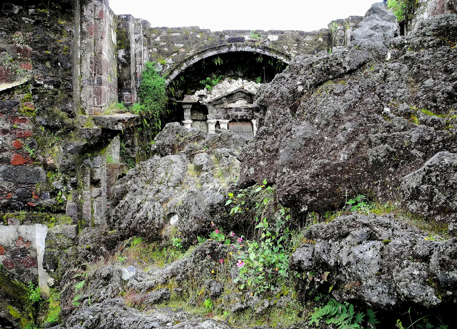
The chancel of the church ruin of San Juan Parangaricutiro: lava blocks fill the nave up to the stone altar under the arch
This is where the lava stopped. The altar stayed clear – a miracle for the Purépecha, and a destination for pilgrims to this day.

Photo: LBM1948 · CC BY-SA 4.0

Travel advisoriesSafety: Michoacán and the travel advisories

The U.S. State Department lists Michoacán at Level 4, Do Not Travel; on August 8, 2026 the U.S. embassy cleared Uruapan, Tancítaro, Tacámbaro and the Morelia–Pátzcuaro corridor again for its personnel, with road restrictions. Germany's Federal Foreign Office advises against travel to the state except Morelia by direct flight, and recommends driving overland only in daylight and reaching your destination before dark. Tourists drive the 33 km (21 miles) from Uruapan to Angahuan every day; the decision is yours. If you go: main roads, daylight, no night driving, keep valuables out of sight.

Sources: U.S. travel advisory and U.S. embassy notice of August 8, 2026 (readable only via secondary sources on September 22, 2026) · Germany's Federal Foreign Office, travel and safety advice for Mexico, as of September 22, 2026. Advisories change – check again before you travel.
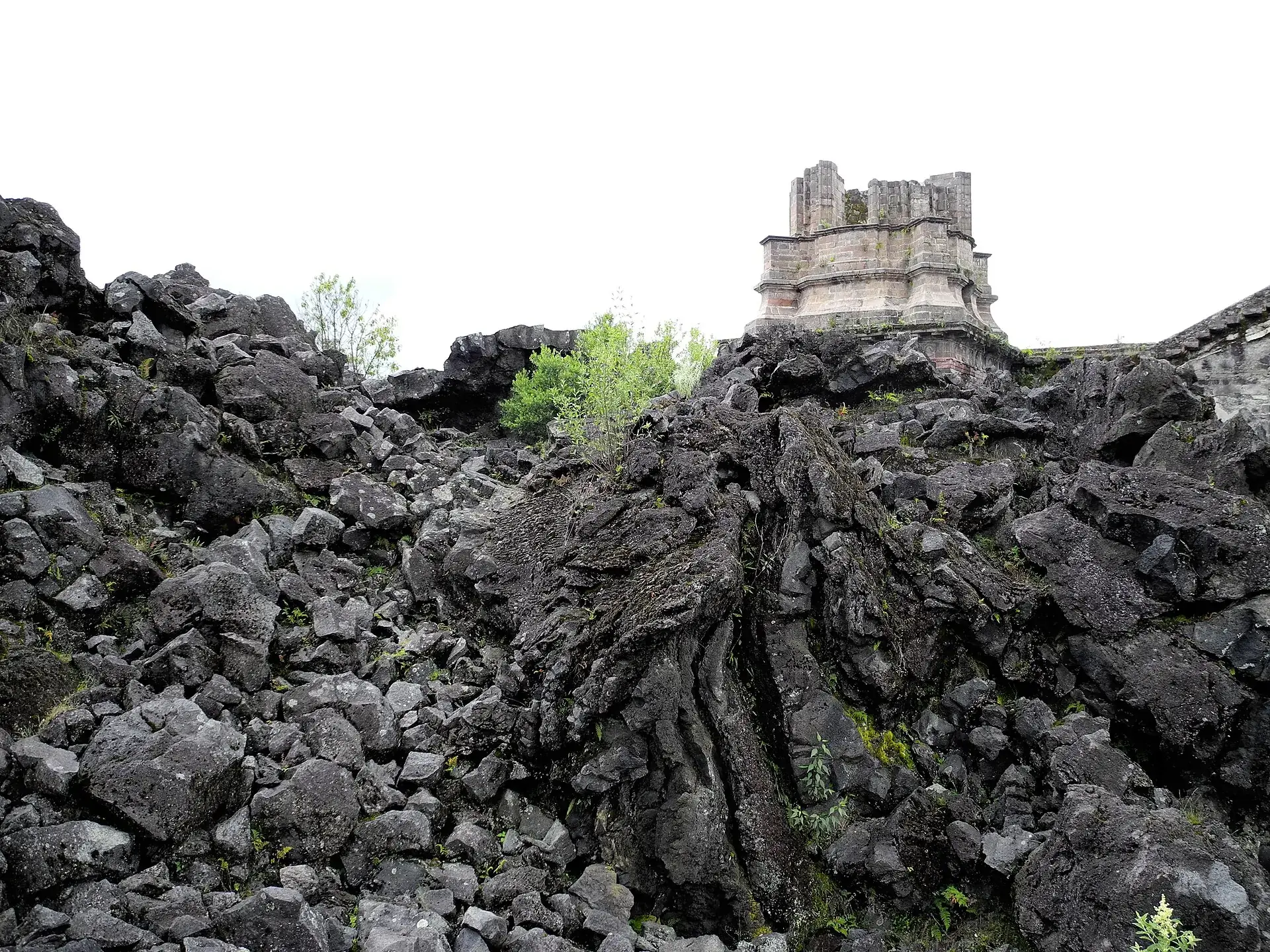
The upper part of a church tower of San Juan Parangaricutiro rises out of a wall of black block lava, young trees in between
From the lava side: the tower is buried up to the belfry. From here it is still about 8 km (5 miles) to the cone.

Photo: LBM1948 · CC BY-SA 4.0

Good to knowGetting there from Uruapan and Morelia, best time, gear

Getting there

Without a car: Uruapan, Central de Autobuses (Carretera Uruapan–Pátzcuaro km 1): regional buses toward Los Reyes stop in Angahuan (bus portal: hourly 5:45 a.m.–7 p.m., about 20 MXN, line 'Rumbos Tarascos'); shared taxis also from Uruapan. From Morelia to Uruapan with Primera Plus, Parhikuni, ETN and others, 1.5–2 hours (92 km / 57 miles). From Mexico City to Uruapan by bus about 6 hours, or fly to Morelia. Germany's Federal Foreign Office advises flying directly to Morelia for Michoacán.

By car: From Uruapan on the highway toward Los Reyes, after about 30 km (19 miles) the turnoff to Angahuan (33 km / 21 miles, about 40 minutes); in the village follow the signs 'Mirador/Centro Turístico'. Parking at the Centro Turístico (15–20 MXN according to travel reports, free for overnight guests). Alternatively the southern access via Nuevo San Juan Parangaricutiro. Overland travel only in daylight (Germany's Federal Foreign Office).

  • From Uruapan · 35–45 minutes
    Car/taxi toward Los Reyes, or regional bus
  • From Morelia · 2.5–3 hours
    Bus or car to Uruapan (Autopista 14D), then on to Angahuan
  • From Mexico City · bus about 6 hours to Uruapan
    Flight to Morelia or long-distance bus to Uruapan

Best time to go

November to April (dry season): clear views, 15–25 °C (59–77 °F) by day, grippy lava. May to October rainy season with afternoon thunderstorms – start early then. Year-round, start in the morning: the lava stores heat, and by midday the field is an oven. Around February 20 Angahuan celebrates the volcano's 'birthday' with a festival and atole market (2025: February 21–23).

Who it suits

Children
From about age 10 for the crater tour (operator recommendation); younger children on horseback to the church. Family horseback tours with a personal guide are offered.
Minimum age
none; operators: from age 10 to the crater
Fitness
Moderate: a long, largely flat stretch on forest trail and sharp-edged lava, then 30 minutes very steeply up loose cinders (two steps forward, one back). On horseback only the climb up the cone remains.
Altitude
hardly relevant (2,400–2,800 m / 7,900–9,200 ft), but Uruapan sits at 1,600 m (5,250 ft) – sun and heat on the lava are the bigger problem
Heart and lungs
No particular notes; the steep cinder climb is short but strenuous. Dust in the crater.
Wheelchair
Mirador Angahuan with a view of the volcano and lava field is reachable by car; the trails are not accessible.
Dogs
no rule known
Clothing
Light long clothing, hat, sun protection, 2–3 liters of water per person, snacks; gloves for the sharp lava when descending into the crater; rain jacket June–October.
Footwear
Sturdy hiking boots with thick soles – operators call the lava 'one of the most abrasive surfaces'; sandals are unsuitable, cinders fill low shoes.

Tips you will need on site

  • Hire a guide at the Mirador of Angahuan and agree the price for the whole group beforehand – the lava field has no markings, and the community lives on this income.
  • If you do not want to walk 20 km (12 miles): ride to the foot of the cone, and everyone climbs the last 30 minutes themselves; operators require riding experience.
  • Start early (leave Angahuan by 9 a.m. at the latest), 2–3 liters of water, hat, thick soles, gloves – lava is as sharp as glass.
  • The church ruin is a destination even without the volcano: 30–45 minutes on foot from the Mirador, good for families with small children.
  • Bring cash in pesos: the parking barrier, guides, horses, the trail-maintenance fee and food at the Mirador are all cash only.
  • Check the security situation: Germany's Federal Foreign Office advises against Michoacán except Morelia, and the U.S. government cleared Uruapan again for its personnel in August 2026. Drive only in daylight, stay on main roads, avoid night driving.
  • Look at the warm fumaroles at the crater rim, but do not descend into the crater without a guide – loose ground and steep walls.
  • Staying overnight in the cabins of the Centro Turístico Angahuan (from 1,000 MXN) saves the morning drive and lets you watch the sunrise over the lava.

A short history

  • February 20, 1943, around 4 p.m.: The ground opens in the cornfield of farmer Dionisio Pulido; within a day a 50 m (160 ft) cone stands there – the birth of Paricutín.
  • June 1943: The village of Paricutín is evacuated and completely buried by ash and lava.
  • May 10, 1944: San Juan Parangaricutiro is cleared, the lava overruns the town; only the tower and altar of the church remain standing. On May 23, 1944 the residents found Nuevo San Juan, a municipality in its own right since 1950.
  • 1943–1952: Four eruptive phases; lava flows up to 10 km (6 miles), 233 km² (90 sq mi) damaged; three people die from lightning in the ash clouds, none from the eruption itself.
  • 1952: Activity ceases after nine years; the cone is 424 m (1,390 ft) high. As a monogenetic volcano it will not erupt again.
  • 1993: Smithsonian volcanologists Luhr and Simkin publish the standard monograph on the 'volcano from the cornfield' – Paricutín is the first fully observed life cycle of a volcano.
  • December 22, 2021: Angahuan is granted Indigenous self-government (autogobierno), with its own budget since April 2022; tourism at the volcano is a community matter.
  • February 2025: Angahuan celebrates 82 years of Paricutín with a cultural program and atole market (Sectur Michoacán).
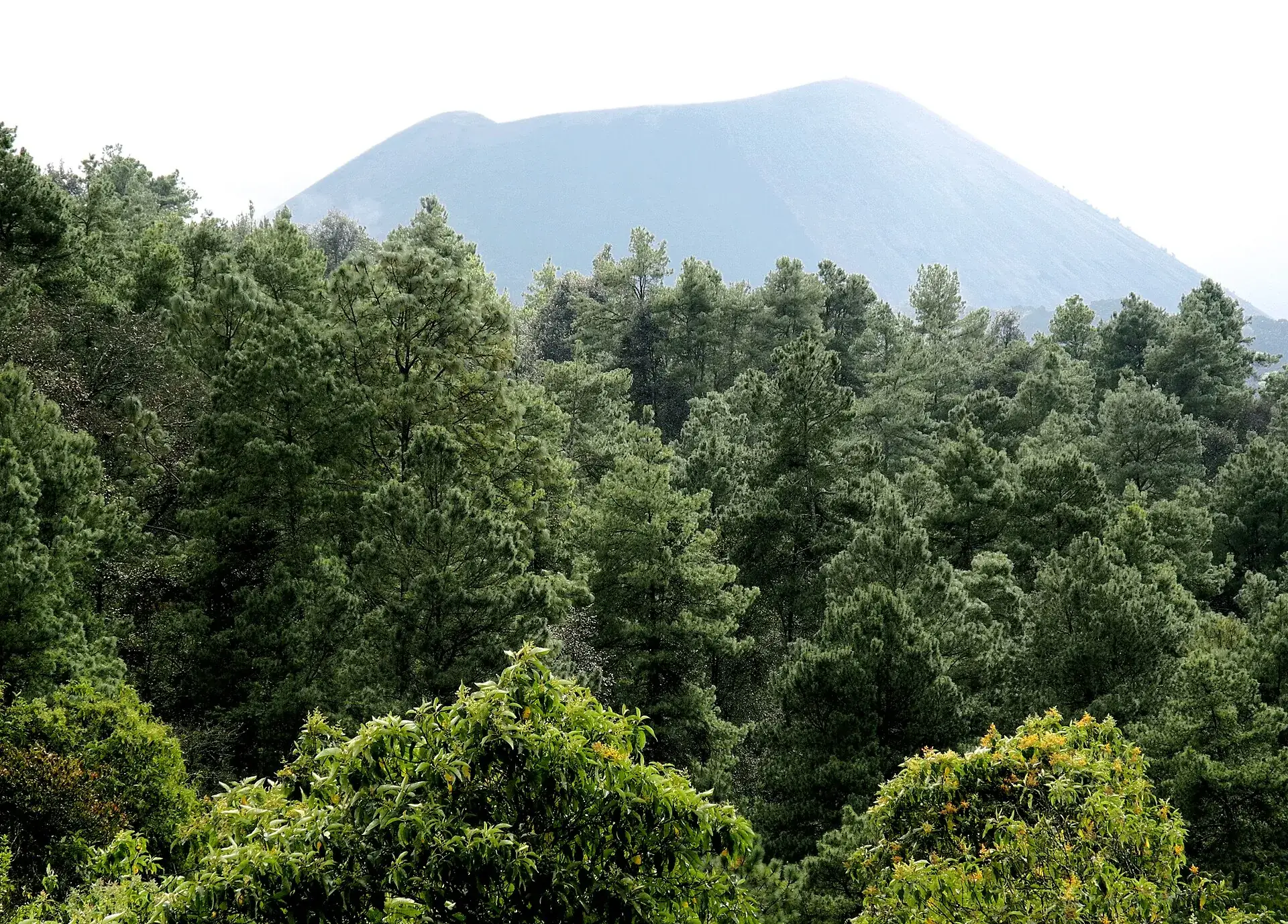
The gray cone of Paricutín rises above a dense pine forest that survived the eruption
The pine forest at the edge of the lava field survived the eruption – and still supplies the Purépecha with the wood for their trojes.

Photo: LBM1948 · CC BY-SA 4.0

Outdated onlineWhat other sites get wrong

“Paricutín is active and could erupt again.”
It is a monogenetic cinder cone, extinct since 1952. The fumaroles in the crater are residual heat; no alert level exists, and CENAPRED publishes no reports.
“You need a ticket or a permit like at Popocatépetl.”
There is no CONANP fee and no national park. What you pay for is parking at the Mirador and the Angahuan community's guides and horses – in cash and without an official rate.
“The village was buried in 1943.”
The village of Paricutín, yes, in June 1943. San Juan Parangaricutiro – whose church ruin you visit – not until May 10, 1944. Its residents founded Nuevo San Juan on May 23, 1944.
“The hike is short.”
From Angahuan it is 19–23 km (12–14 miles) round trip and 5–8 hours depending on the route. Short is only the way from Nuevo San Juan by car to near the cone – or the side trip to the church.
“Michoacán is closed to tourists.”
There is no closure, but a U.S. Level 4 advisory and a do-not-travel recommendation by Germany's Federal Foreign Office (as of September 22, 2026). If you go, know the advice and travel in daylight.
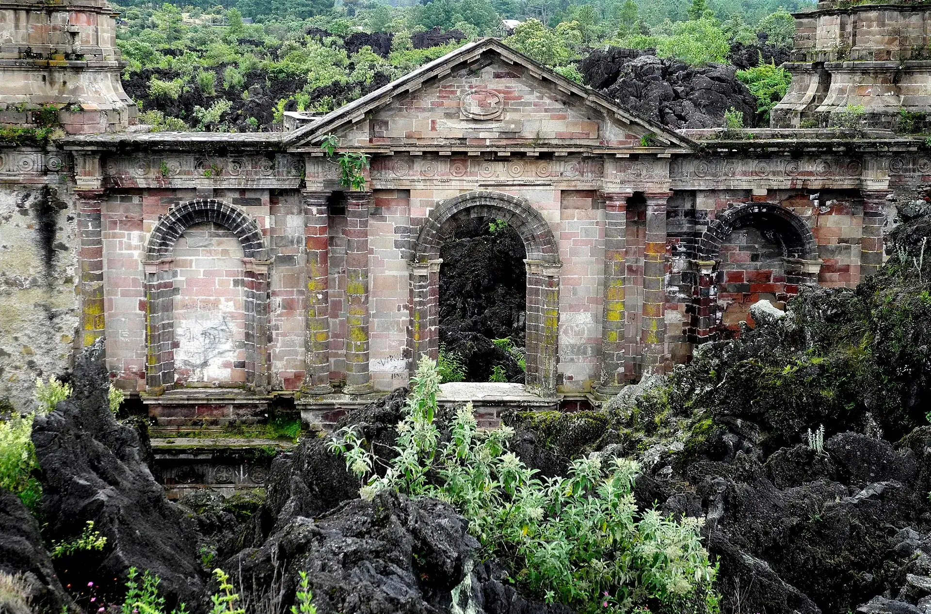
The facade of the church ruin of San Juan Parangaricutiro with three arches and lichen on the stone, lava blocks and ferns in front
The facade stands, the roof is gone, the nave is full of lava. The church was built for a town that no longer exists.

Photo: LBM1948 · CC BY-SA 4.0

Quick answersBefore the drive to Angahuan

Where is Paricutín?

In the state of Michoacán in western Mexico, on the Meseta Purépecha, 33 km (21 miles) from Uruapan and about 125 km (78 miles) from Morelia. The starting point is the Purépecha village of Angahuan; from Mexico City it is 322 km (200 miles), about 6 hours by bus to Uruapan.

Can you climb Paricutín?

Yes. Across the lava field from Angahuan on foot or on horseback to the foot of the cone, then 30 minutes steeply up loose cinders to the crater rim at about 2,800 m (9,200 ft). No permit, but practically only with a guide, because the way across the lava is not marked.

How tall is Paricutín?

The cone rises 424 m (1,390 ft) above the former cornfield; the crater rim sits at about 2,800 m (9,200 ft). Within one day in February 1943 it was 50 m (160 ft) tall, after nine years it was finished.

When did Paricutín erupt?

On February 20, 1943, around 4 p.m., in the cornfield of farmer Dionisio Pulido. The activity lasted until 1952 – nine years in which lava flowed up to 10 km (6 miles) and affected 233 km² (90 sq mi). Three people died, from lightning in the ash clouds, none from the eruption itself.

Is Paricutín worth a day trip from Morelia?

It can be done, but it is long: 2.5–3 hours each way to Angahuan, plus 5–8 hours at the volcano. Agencies in Morelia offer day tours with the church and the Mirador; if you want the crater, better stay overnight in Uruapan or in the cabins at Angahuan.

Is Paricutín active or dangerous?

No. The volcano has been extinct since 1952 and, as a monogenetic cone, cannot erupt again; only warm fumaroles remain in the crater. The real hazards are sun, sharp lava and getting lost in the lava field without a guide.

Do you need a guide for Paricutín?

Not required, but beyond the church ruin there is no marked trail across the lava field – in practice everyone goes with a Purépecha guide from Angahuan. Guides and horses wait at the Mirador; operators quote from about 1,500 MXN per group or 1,600 MXN for horseback tours with guide (first person).

How much does the visit cost?

No state ticket. Budget for 15–20 MXN parking at the Mirador, the guide (operators: from 1,500 MXN per group, older reports 300 MXN) and the horse (about 300–600 MXN per person according to operators) plus a small trail-maintenance fee at the cone. All cash in pesos.

How long does the tour take?

On foot from Angahuan 19–23 km (12–14 miles) round trip, 5–8 hours. On horseback about 4 hours in the saddle plus a 30-minute steep climb on foot to the crater. To the church ruin only, it is 30–45 minutes each way.

Can you visit Paricutín with children?

To the church ruin, yes, it is a short walk through forest and lava. For the crater, operators recommend a minimum age of about 10; the last 30 minutes in loose cinders are strenuous. Family horseback tours with their own guide exist.

How do you get to Angahuan?

From Uruapan 33 km (21 miles) toward Los Reyes, 35–45 minutes by car or taxi; regional buses from Uruapan's Central de Autobuses run hourly according to a bus portal (about 20 MXN). From Morelia first to Uruapan (1.5–2 h by bus), from Mexico City fly to Morelia or take a long-distance bus to Uruapan.

Is Michoacán safe enough for the trip?

Germany's Federal Foreign Office advises (as of September 22, 2026) against travel to Michoacán, except Morelia if you fly there directly; the U.S. lists the state at Level 4 but cleared Uruapan again for its personnel on August 8, 2026. Tourists drive the Uruapan–Angahuan road daily; if you go, drive only in daylight and on main roads.

What should you wear and bring?

Sturdy hiking boots with thick soles, long light pants, hat, sunscreen, 2–3 liters of water, snacks, gloves for the sharp lava, and a rain jacket in the rainy season. Do not forget cash.

Can you visit the church ruin without the volcano tour?

Yes. The towers and altar of San Juan Parangaricutiro are about 3 km (2 miles) from the Mirador of Angahuan and can be reached on foot in 30–45 minutes; according to travel reports there is no admission fee. Many combine the ruin and the Mirador as a half-day trip from Uruapan.

When is the best time to visit?

November to April: dry, clear views, pleasant temperatures. In the rainy season May–October start early, because thunderstorms come in the afternoon and the lava gets slippery.

How did Paricutín form?

On February 20, 1943 the ground broke open in a cornfield belonging to farmer Dionisio Pulido; in one day a 50 m (160 ft) cone grew, in nine years 424 m (1,390 ft). The lava buried the villages of Paricutín (1943) and San Juan Parangaricutiro (1944); in 1952 the volcano went extinct.

Can you stay overnight at the volcano?

Not in an organized way on the mountain; in Angahuan the community's Centro Turístico offers cabins (1,000–1,900 MXN) and camping spots (100 MXN per person). Camping at the lava field would have to be arranged with the community.
The church tower of San Juan Parangaricutiro rises above the forest, wooded hills and low clouds behind
From the Mirador only the tip of the tower shows where old San Juan lies. The rest has become forest.

Photo: LBM1948 · CC BY-SA 4.0

Sources · accessed on 22 September 2026