Volcano·Guide
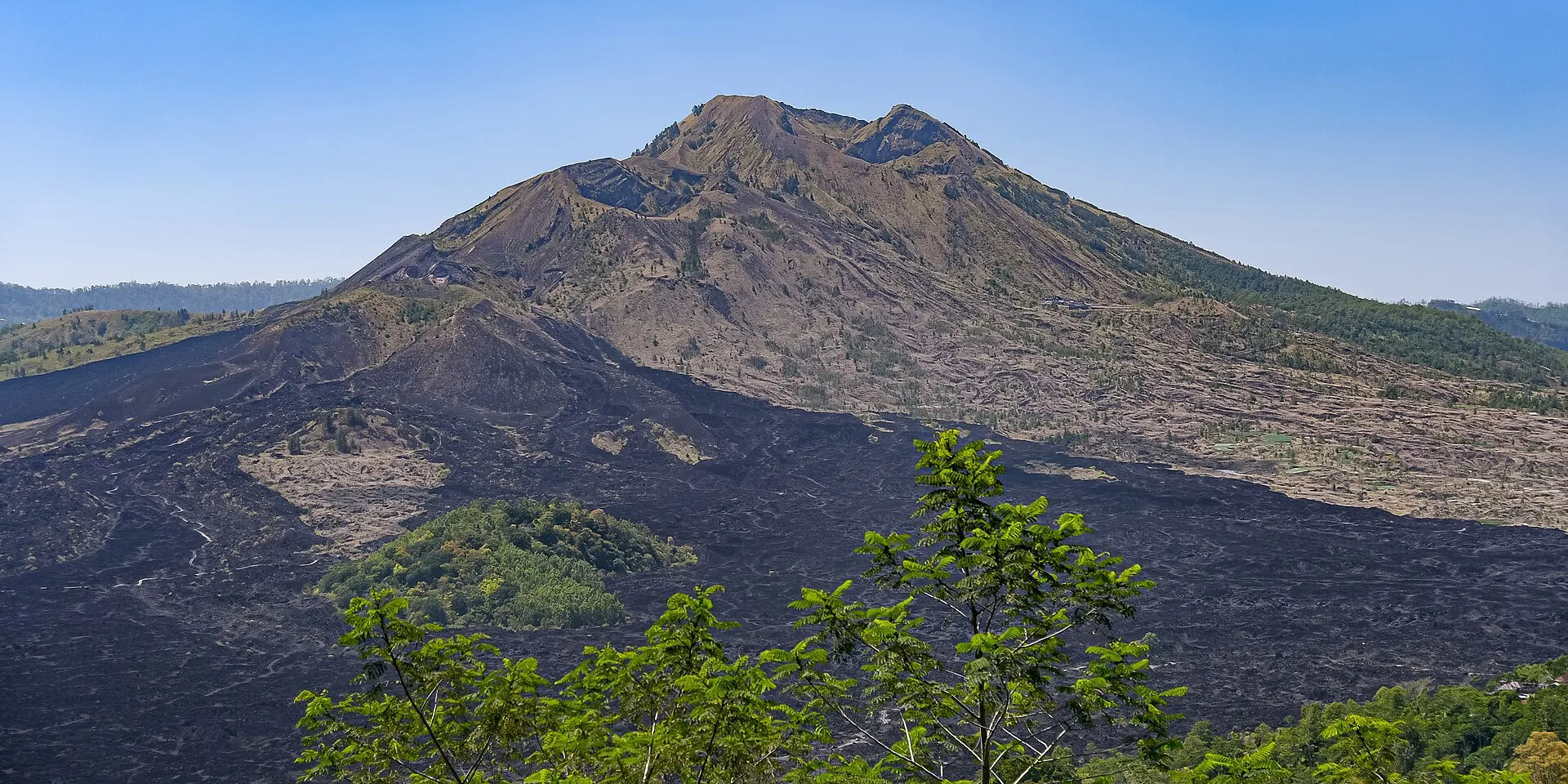
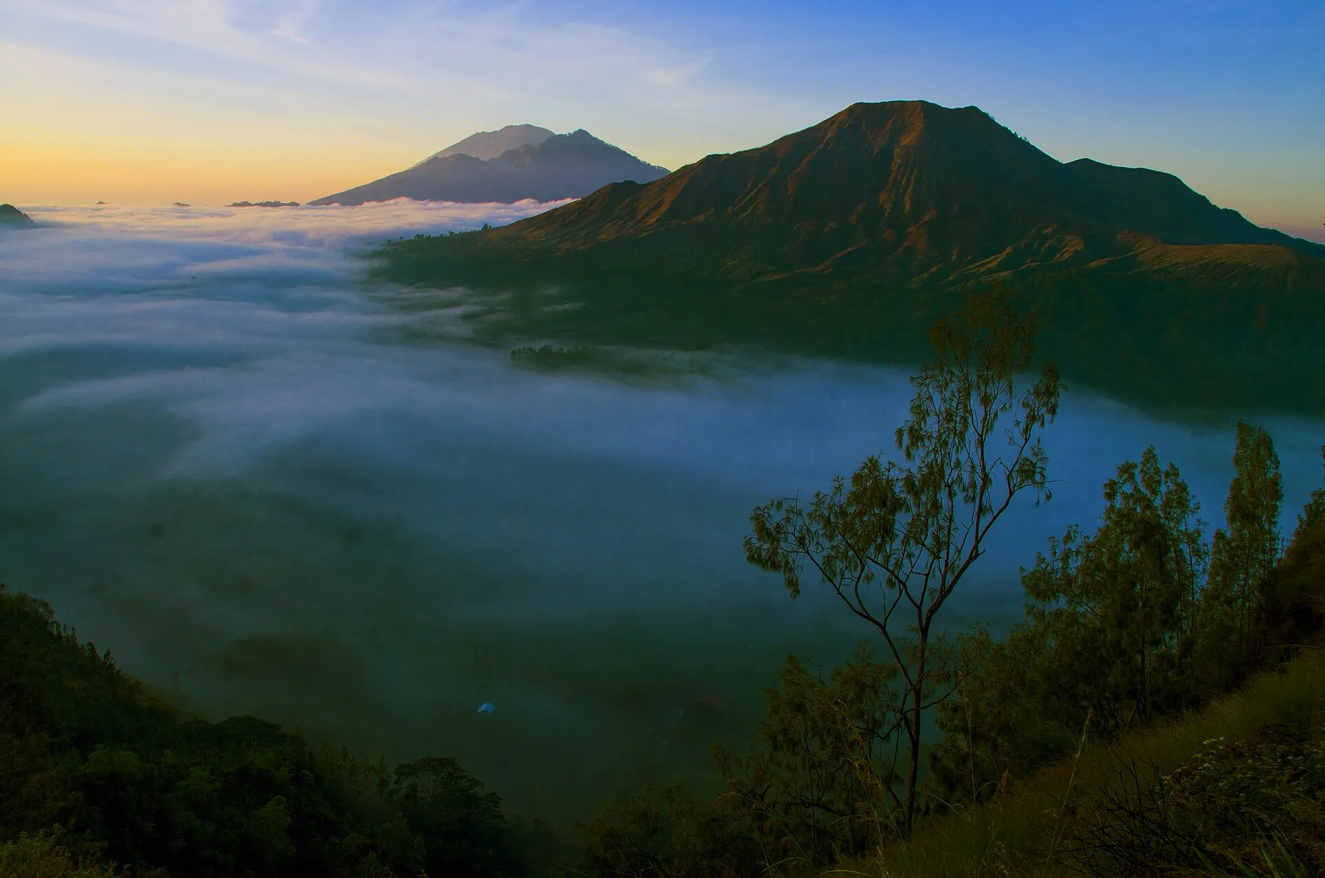
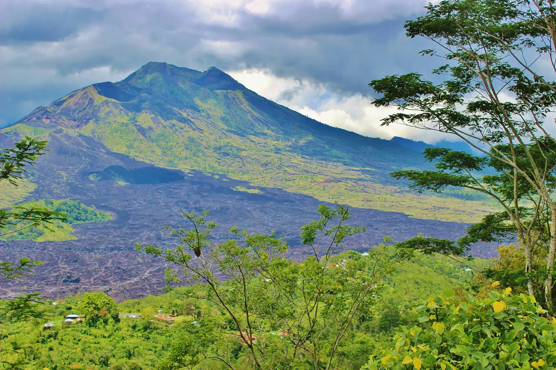
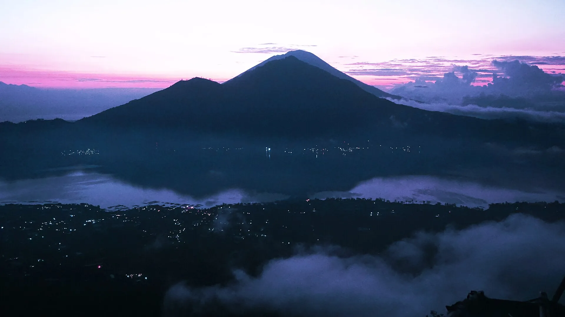
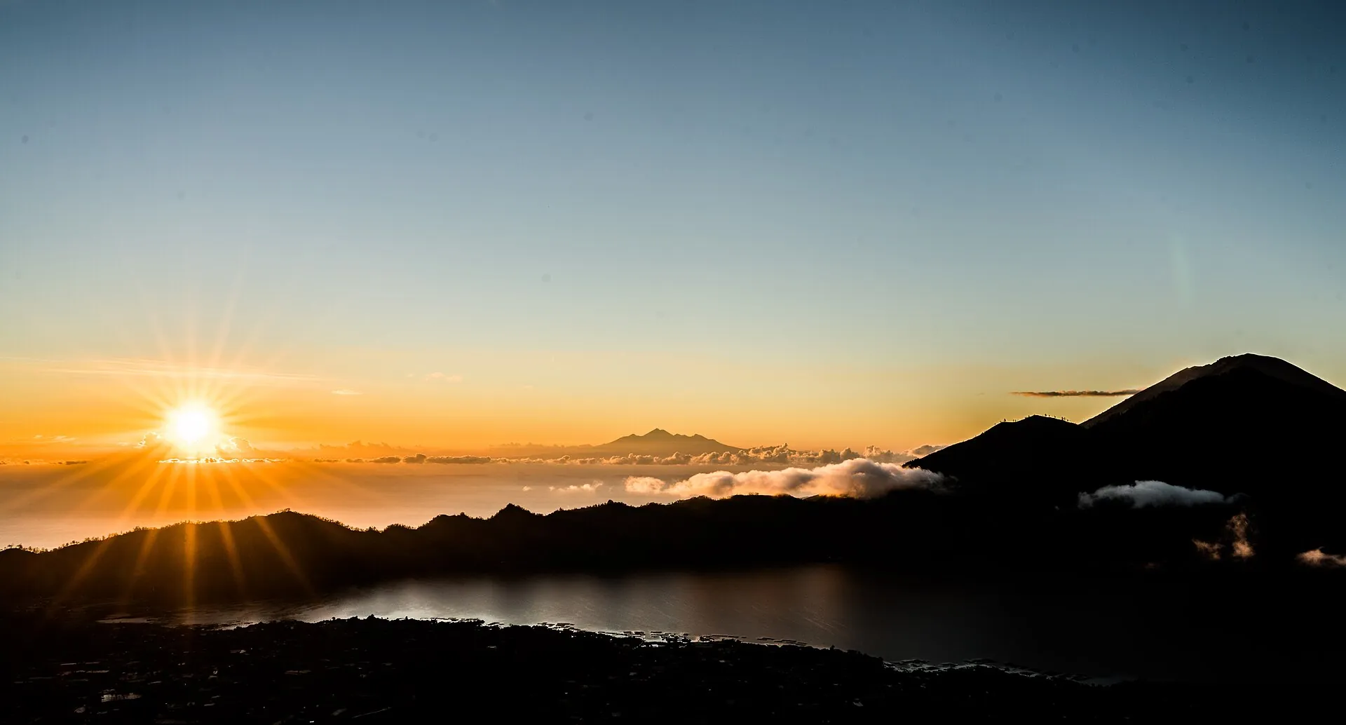
First light over the Batur caldera on Bali: dark mountain silhouettes against a pink sky, with mist banks and village lights below Sunrise from the summit of Mount Batur: the sun above a sea of cloud, Lake Batur below, the cone of Abang on the right The cone of Mount Batur by day, with the black lava fields of the Kintamani caldera in front of it

Mount Batur

At half past three all you see is headlamps and a few village lights.

Just after six, half of eastern Bali is lying below you.

In daylight you find out what you walked across: hardened lava.

Scroll –
the morning arrives

As of 21 September 2026Mount Batur today: open, Level I, guides at the trailheads

Mount Batur is open. In its report of 20 September 2026 the volcano agency PVMBG lists it at Level I (Normal) – no crater plume, two distant tectonic earthquakes. No closure is known, and according to the reports we reviewed, Batur is not among the areas shut by the Ministry of Forestry's wildfire circular of 31 August 2026.

Two things other sites get wrong. The hiking ban Bali's governor announced in May 2023 was never enacted as a regulation – in 2025 the agency counted 73,619 ascents of Batur. And we found no statutory guide requirement: the escort is enforced by the guides' association P3GB and the village communities at the access points. The result is the same either way – without a guide you do not get up.

Open · Level I
1,717m

Summit and crater rim

PVMBG reported normal conditions on 20 September 2026. The climb takes 1.5 to 2 hours according to the conservation agency BKSDA, which rates the mountain Grade 1–2: easy to moderate and explicitly beginner-friendly. That is 5,633 ft.

Counted in 2025: 73,619 ascents
Mandatory in practice

A P3GB guide

We could not find a regulation that puts the guide requirement in writing. The local association P3GB and the villages still let nobody through the trailheads alone. Our advice: go with a booked guide rather than negotiate one on the path at four in the morning.

Guide rates are not officially published
Paid at the ticket post
100,000IDR

State admission

The figure for foreign visitors comes from a press report on the 2025 annual figures of the agency unit KPHK Kintamani. The BKSDA Bali tariff page returned a 404 error on 21 September 2026 – so we quote the number with that caveat. The Culali post has accepted cards since 31 January 2025.

about €4.90 · per person100,000 IDR
Keep it short

The crater area

Even at Level I, PVMBG advises keeping your stay in the active crater area short, not camping there and staying clear of the gas vents. Those are exactly the cracks where guides like to cook eggs in the steam.

PVMBG daily report, 20 September 2026
Sources: MAGMA Indonesia / PVMBG, daily report for Batur, 20 September 2026 (Level I, crater-area advice) · BKSDA Bali, 30 September 2025 (Grade 1–2, 1.5–2 hours, official guides) · Denpost on the 2025 figures (73,619 ascents, 100,000 IDR admission) · CNBC Indonesia, 31 August 2026, on the wildfire circular. For today's status see magma.esdm.go.id.
Morning mist in the Batur caldera on Bali: banks of fog over the caldera floor, with the cones of Abang and Agung behind in first light
This is what you get up at three for: half an hour in which the caldera belongs to nobody.

Photo: Arthamade · CC BY-SA 4.0

What it is likeMount Batur sunrise: two hours in the dark, then light

Batur is not an expedition. It is a 1,717 m (5,633 ft) cone inside a double caldera up to 13 km (8 miles) across – and what people get up in the middle of the night for is the half hour after first light.

The trek starts around 3 to 4 a.m., usually at Toya Bungkah by the lake. The path is dark and the ground sandy and rocky; BKSDA describes it as free of extreme drops but slippery on the way down. Roughly 600 to 700 m (2,000–2,300 ft) of climbing, 1.5 to 2 hours – those are the agency's own figures. The summit is windy and, in BKSDA's words, 'very cold towards morning'; operators quote 8 to 12 °C (46–54 °F). Come without a jacket and you will be cold for exactly the hour you came for.

Sunrise falls between about 5:30 and 6:30 a.m. depending on the season. Below you is Lake Batur, opposite it Abang, behind that Agung, and on very clear mornings Rinjani on Lombok stands on the horizon. Steam rises from cracks near the crater. Guides cook eggs in it; PVMBG warns of toxic gases at those same vents. You can watch without putting your face over them.

It gets crowded. In 2023 an average of 200 people climbed per day, with peaks of 500 – which is also the summit's capacity according to the carrying-capacity study the agency cites. May and June are the busiest months. By about 9 a.m. you are back down, and the rest of the day belongs to sleep or to the hot springs on the lakeshore.

With pickup, guide and breakfastMount Batur sunrise trek: tours from Ubud and south Bali

A booked tour solves two problems at once: the guide you need anyway, and the drive at two in the morning. What is included is set out in each listing – before you book, ask explicitly whether the 100,000 IDR state ticket is part of it, and ask to see it on the mountain.

Affiliate links to GetYourGuide: if you book, we earn a commission and the price stays the same. Prices and ratings as of 21 September 2026. Whether the sky is clear is up to the mountain – in the rainy season the summit is often in cloud. Choose a rate you can cancel.

The rulesMount Batur without a guide: what actually applies

There is no online ticket, no time slot and no quota. What there is: two cash desks one after the other – the regency's on the road to Kintamani and the state one at the ticket post – and a guide requirement nobody has written down.

1

The state ticket

The cone sits inside BKSDA Bali's nature tourism park. From the ticket post onward the state fee applies: 100,000 IDR for foreigners, 10,000 IDR for Indonesians (15,000 on public holidays). The Culali post has accepted card payment since 31 January 2025. The foreigner figure comes from the press, not from a reachable tariff page.

2

The guide

According to NusaBali the guides are accredited by the Ministry of Forestry via BKSDA, and the agency itself names cooperation with local guides as part of its management. There are no official rates. An older report quotes 400,000 IDR per trek; all-in packages from local operators run 200,000 to 575,000 IDR per person.

3

Bangli Regency's area levy

At the entrance to Kintamani/Penelokan, Bangli Regency collects a levy of its own. It has nothing to do with the mountain and does not replace the state ticket. We found no reliable source for the current amount – older figures say 31,000 IDR, blogs say 50,000 IDR.

4

Up top: stay briefly, keep your distance

Even at Level I, PVMBG says: do not camp in the crater area, keep your stay short, avoid the gas vents. Then there are the unwritten rules – Batur is a sacred mountain. No litter, modest clothing, do not touch the offerings. In 2023 the behavior of a few tourists nearly led to a blanket ban.

Official prices · as of 09/2026 · 1,000 IDR ≈ €0.049
State admission to the nature tourism park, foreign visitors (figure from press coverage of the 2025 annual report; the agency's tariff page was unreachable on 21 September 2026)100,000 IDR (about €4.90)
State admission for Indonesians, weekday / public holiday (PP No. 36/2024)10,000 / 15,000 IDR
Drone filming inside the protected area (rate for Indonesians per Antara; higher for foreigners)2,000,000 IDR
Bali Province tourist levy, one-off on arrival via the 'Love Bali' portal150,000 IDR (about €7.30)
Guiding by P3GB · no official rate; older press figure per trek400,000 IDR
Sources: BKSDA Bali on cashless payment at the Culali post since 31 January 2025 (rates under PP 36/2024) · Denpost (statement by the KPHK Kintamani unit on the 2025 figures) · Antara (protected-area size, drone rate, SIMAKSI) · NusaBali (guide accreditation, 400,000 IDR, Kintamani area levy). No valid, reachable BKSDA Bali tariff overview existed on 21 September 2026.

Three ways up, one summitMount Batur hike routes: Toya Bungkah, Pura Jati, Culali

Only the walking time on the standard route is officially documented: 1.5 to 2 hours according to BKSDA Bali. Trailhead elevations and the times for the other routes come from local operators.

Route → what it involves, how long, what is different
Standard route from Toya Bungkah · from the lakeshore at about 1,050 m (3,445 ft) to the summit at 1,717 m (5,633 ft)The route almost every sunrise tour uses: 1.5 to 2 hours up (BKSDA), starting around 3 to 4 a.m. and back by about 9 a.m. Roughly 600 to 700 m (2,000–2,300 ft) of climbing on sandy, rocky ground.
Pura Jati route · from the temple southwest of Toya BungkahAbout two hours, gentler at the start, crossing the lava fields. A longer approach, but less traffic in high season (operator figure).
Short routes from Serongga and Culali · western flank, starting around 1,300 m (4,265 ft)About an hour to the crater rim, marketed as the 'short path'. The jeep tours into the black lava fields start here too – they do not go to the summit.
The cone of Mount Batur by day from the west: green slopes above the broad black lava field of 1963, with trees in the foreground
The black field in front is from 1963. The villages beside it were rebuilt after 1926.

Photo: Michelle Maria · CC BY 3.0

Good to knowGetting to Mount Batur, best time, tips

Getting there

Without a car: There is no usable public transport at night. The normal options are a hotel pickup (1:30–2:30 a.m. in the south of Bali) or driving up with a driver or scooter; staying overnight in Toya Bungkah or Kintamani buys you hours of sleep.

By car: There is parking at the Toya Bungkah and Pura Jati trailheads. Bangli Regency charges an area levy at the entrance to Kintamani/Penelokan.

  • From Ubud · 1–1.5 hours
    Driver or tour transfer via Tegallalang to Kintamani and down to Toya Bungkah
  • From Seminyak / Kuta / Canggu · 2–2.5 hours
    Tour transfer, pickup around 1:30–2 a.m.
  • From Amed · about 2 hours
    Driver via the Rendang/Besakih road to Kintamani

Best time to go

The dry season from roughly April/May to October brings the clearest mornings; Germany's Federal Foreign Office names November to March as the monsoon season, when cloud on the summit and slippery paths are common. According to the agency's figures the busiest months are May and June (2025: 8,669 and 9,378 ascents) plus the European summer; weekdays and the later daytime trek are quieter. No trek is possible on Nyepi.

Who it suits

Children
BKSDA Bali rates Batur as Grade 1–2 (easy to moderate) and 'beginner-friendly'. Sure-footed school-age children manage the trek; local operators also take children under ten. There is no official minimum age.
Minimum age
none found officially
Fitness
Easy to moderate: roughly 600–700 m (2,000–2,300 ft) of climbing in 1.5 to 2 hours. According to BKSDA the ground is sandy and rocky volcanic terrain without extreme drops, and slippery on the way down.
Altitude
Not an issue at 1,717 m (5,633 ft).
Heart and lungs
Physical fitness is needed; keep your distance at the fumaroles (PVMBG warns of toxic gases at the vents). With a heart or lung condition, check with a doctor first.
Wheelchair
not possible; the viewpoints at Penelokan/Kintamani are the alternative
Dogs
no rule found
Clothing
It is cold and windy before sunrise – BKSDA calls it 'very cold towards morning', operators say 8–12 °C (46–54 °F) in the cooler months. Bring a warm layer, a windproof jacket, a headlamp and enough water. The mountain is sacred: dress and behave respectfully, and leave no litter.
Footwear
BKSDA asks for 'proper hiking boots'; trainers with a decent tread are the minimum, sandals are unsuitable.

Tips you will need on site

  • Book your guide through your accommodation in Toya Bungkah/Kintamani or a tour with a clearly stated scope, and settle in writing beforehand: is the state ticket (100,000 IDR) included, how big is the group, which route?
  • If you would rather not be picked up at 1:30 a.m. in the south of Bali, stay the night by the lake – then a 3 a.m. alarm is enough.
  • Pack a warm layer and a windproof jacket, take a headlamp (often provided) and at least a liter of water.
  • Keep your distance from steaming cracks, however tempting the eggs cooked in the steam – PVMBG warns of toxic gases at exactly those vents.
  • Show respect: Batur is a sacred mountain, and the misbehavior of a few tourists almost led to a blanket ban in 2023. No litter, no immodest dress, and do not touch the offerings.
  • Check the MAGMA status the evening before; if the level is raised to II, the rules change immediately.
  • For anyone who hates 3 a.m.: the daytime trek from 7–8 a.m. – fewer people, and in the dry season often just as clear a view.

A short history

  • Batur sits at the center of two nested calderas: the outer one measures about 10 × 13 km (6 × 8 miles) and formed some 29,300 years ago, the inner one (7.5 km / 4.7 miles) about 20,000 years ago. Lake Batur fills the southeastern part.
  • First documented eruption in 1804, most recent so far in 2000. The black lava fields on the western flank date mostly from 1963.
  • In 1926 lava buried the old village of Batur; the village and its main temple, Pura Ulun Danu Batur, were rebuilt on the caldera rim.
  • 20 September 2012: the Batur caldera joins the UNESCO Global Geoparks network.
  • 31 May 2023: after a string of tourist misbehavior (including nude photos on sacred mountains), Governor Wayan Koster announces a ban on all tourist activity on Bali's 22 mountains and says he will enact it as a Perda; guides are to be retrained as rangers. Guides, villages and tourism businesses protest.
  • October 2023: Koster has left office; the responsible forestry agency states that ascents are continuing, averaging 200 people a day, and that the ban is barely enforceable because of central-government competences.
  • 30 October 2024: new state admission rates under PP 36/2024; cashless payment at the Culali post since 31 January 2025.
  • 2025: the agency counts 73,619 ascents of Batur and Bukit Payang and about 1.315 billion IDR in admission income. In September 2025 BKSDA Bali rates the mountain Grade 1–2 under the ministry's new grading scheme.

Without the night climbMount Batur jeep tour and hot springs: the alternative

Not everyone wants a 1:30 a.m. pickup and two hours of climbing in the dark. The jeeps run from the western flank into the black lava fields – at sunrise or later in the day – and usually end at the thermal baths of Toya Bungkah. The summit is not part of it.

Affiliate links to GetYourGuide: if you book, we earn a commission and the price stays the same. Prices and ratings as of 21 September 2026. Jeep tours run through the lava fields, not to the summit. If you want to stand on top, you have to walk.

Outdated onlineWhat other sites get wrong

“Bali has banned mountain climbing.”
Announced on 31 May 2023, never enacted as a regulation. In October 2023 the forestry agency stated that ascents were continuing and that a blanket ban was barely enforceable given central-government competences. In 2025, 73,619 ascents of Batur were counted.
“There is no guide requirement – just set off early and go alone.”
We could not find a legal text either. But the mountain is a BKSDA protected area, the guides are accredited through the agency, and the association enforces escort at the access points. Anyone who tries without one is stopped and ends up taking a guide anyway – at four in the morning, at whatever the price is then.
“Admission is a 50,000 IDR geopark fee.”
That is Bangli Regency's area levy for Kintamani, not the state ticket for the mountain. The latter costs foreigners 100,000 IDR according to the agency and comes on top, unless it is inside your tour price.
“Batur is an extinct local hill.”
It is active – last eruption in 2000, and the black fields on the western flank date from 1963 – and it is monitored daily. Even at Level I, PVMBG advises against camping in the crater area and against approaching the gas vents.
“It's tropically warm up there, a sweater is enough.”
BKSDA calls it 'very cold towards morning', operators say 8 to 12 °C (46–54 °F), and there is wind. Without a windproof jacket the wait at the summit becomes an endurance test.

Quick answersBefore the Mount Batur trek

Can you do Mount Batur without booking a tour?

The walk itself, yes – but you still need a guide, and you will be hiring one on the spot, with no agreed inclusions and no fixed price. If you are already staying in Toya Bungkah or Kintamani, book the guide through your accommodation; coming from Ubud or the south, a tour is usually cheaper and more predictable.

What is included in a Mount Batur tour price?

That is set out in each listing, and it is worth reading. Settle in writing beforehand: is the 100,000 IDR state ticket included? How big is the group? Which route? In 2025 the press reported inflated demands at the access points; a paid package with a receipt protects you from that.

Do I have to pay the Bali tourist levy as well?

Yes, but not for the mountain. Bali Province charges every foreign visitor a one-off 150,000 IDR (about €7.30) through the 'Love Bali' portal. It applies to the island, not the volcano, and is due on arrival.

Can you see Mount Batur without the night climb?

Yes, in three ways: the daytime trek from 7 to 8 a.m. – fewer people, and in the dry season often just as clear; a jeep tour through the lava fields; or no climb at all. The viewpoint road at Penelokan and Kintamani shows the whole cone and the lake without a single meter of ascent.

How crowded does the summit get?

In high season, very. In 2023 an average of 200 people climbed per day, with peaks of 500 – which is also the summit's capacity according to the study the agency cites. Peak months are May and June plus the European summer. Weekdays are quieter.

Mount Batur or Mount Agung?

Batur is the half-day trek almost anyone can do: 1,717 m (5,633 ft), Grade 1–2, 1.5 to 2 hours up. Agung, at 3,142 m (10,308 ft), is Bali's highest and holiest mountain and a completely different undertaking – press reports say local guides have been mandatory on its Pengubengan route since January 2025.

Is Mount Batur open right now?

Yes, as of 21 September 2026: the alert level is I (Normal) and no closure is known. In the crater area PVMBG says to keep your stay short and to avoid the gas vents.

Is there a climbing ban on Bali?

No. Governor Koster announced one in 2023, but it was never enacted as a regulation; the forestry agency called it practically unenforceable. In 2025 more than 73,000 ascents of Batur were counted. No new ban could be found up to September 2026.

Can you climb Mount Batur without a guide?

In practice, no. The local guides' association P3GB and the village communities let nobody past the access points without a guide, and the conservation agency works with those guides officially. That said, we could not find a published legal text behind it.

What does climbing Mount Batur cost?

The state ticket costs foreigners 100,000 IDR (about €4.90). The guide comes on top; all-in packages from local operators run at roughly 200,000–575,000 IDR per person, and tours with hotel pickup from the south of Bali cost considerably more. Official guide rates are not published.

How long does the Mount Batur hike take?

1.5 to 2 hours from the trailhead to the summit according to BKSDA Bali. With the sunrise, breakfast and the descent you are out for four to six hours.

What time do you have to start for the sunrise?

The trek starts around 3 to 4 a.m., with sunrise between roughly 5:30 and 6:30 a.m. depending on the season. From Ubud the drive takes a good hour, from Seminyak or Canggu over two.

How hard is the trek – can beginners do it?

BKSDA rates Batur Grade 1–2, easy to moderate and explicitly beginner-friendly. The ground is sandy and rocky, though, and slippery on the descent; sturdy shoes and ordinary fitness are needed.

Is Mount Batur suitable for children?

For sure-footed school-age children, yes; there is no official minimum age. The bigger problem is the hour and the cold at the summit. For younger children the later daytime trek makes more sense.

Is Mount Batur dangerous?

The volcano is active but currently quiet (Level I). The real risks are falls on loose ground in the dark, gas at the fumaroles and thunderstorms in the rainy season. With a guide, a lamp and sturdy shoes the trek is well manageable.

What should you wear?

Long trousers, a warm layer and a windproof jacket for the summit, sturdy shoes with a good tread, plus a headlamp and water. Operators quote 8–12 °C (46–54 °F) before sunrise.

When is the best time to go?

April/May to October. In the rainy season from November to March the summit is often in cloud. May, June and the European summer are the busiest; on Nyepi (19 March in 2026) no trek is possible.
Sources · accessed on 21 September 2026

  • MAGMA Indonesia / PVMBG – alert levels for every Indonesian volcano; daily report for Batur, 20 September 2026: Level I, no crater plume, advice on the crater area and the gas vents
  • BKSDA Bali, 30 September 2025 – Grade 1–2, 1.5–2 hours up, sandy and rocky ground, 'very cold towards morning', hiking boots; cooperation with local people as official guides
  • BKSDA Bali – cashless payment at the Culali ticket post since 31 January 2025, rates under PP 36/2024. The tariff page on the adjustment of 30 October 2024 returned a 404 error on 21 September 2026
  • Denpost – 2025 figures: 73,619 ascents, peaks in May and June, admission for foreigners 100,000 IDR (statement by the KPHK Kintamani unit)
  • Antara – nature tourism park Gunung Batur Bukit Payang, 2,075 ha, domestic rates, drone fee, SIMAKSI permit
  • The Bali Sun, 25 October 2023 – ban not implemented; 200 visitors a day, summit capacity 500 per the study, the KPHK head on accompaniment by guides
  • NusaBali – guides accredited by the Ministry of Forestry via BKSDA, P3GB, guiding 400,000 IDR, Kintamani area levy 31,000 IDR (older, undated report)
  • CNBC Indonesia, 31 August 2026 – wildfire circular SE.4/KSDAE/…/8/2026; Batur is not among the closures
  • German Federal Foreign Office, as of 21 September 2026 – climb with local guides, avoid exclusion zones, rainy season November to March, Bali tourist levy 150,000 IDR
  • Wikipedia: Mount Batur – elevation, caldera dimensions, eruptions 1804 to 2000, lava fields of 1963, UNESCO Global Geopark since 20 September 2012 (not an official source)
  • Photos: JurakiVandel (CC BY-SA 4.0), Aaron Rentfrew (CC BY-SA 4.0), Jorge Franganillo (CC BY 2.0), Arthamade (CC BY-SA 4.0), Michelle Maria (CC BY 3.0), via Wikimedia Commons