Volcano·Guide
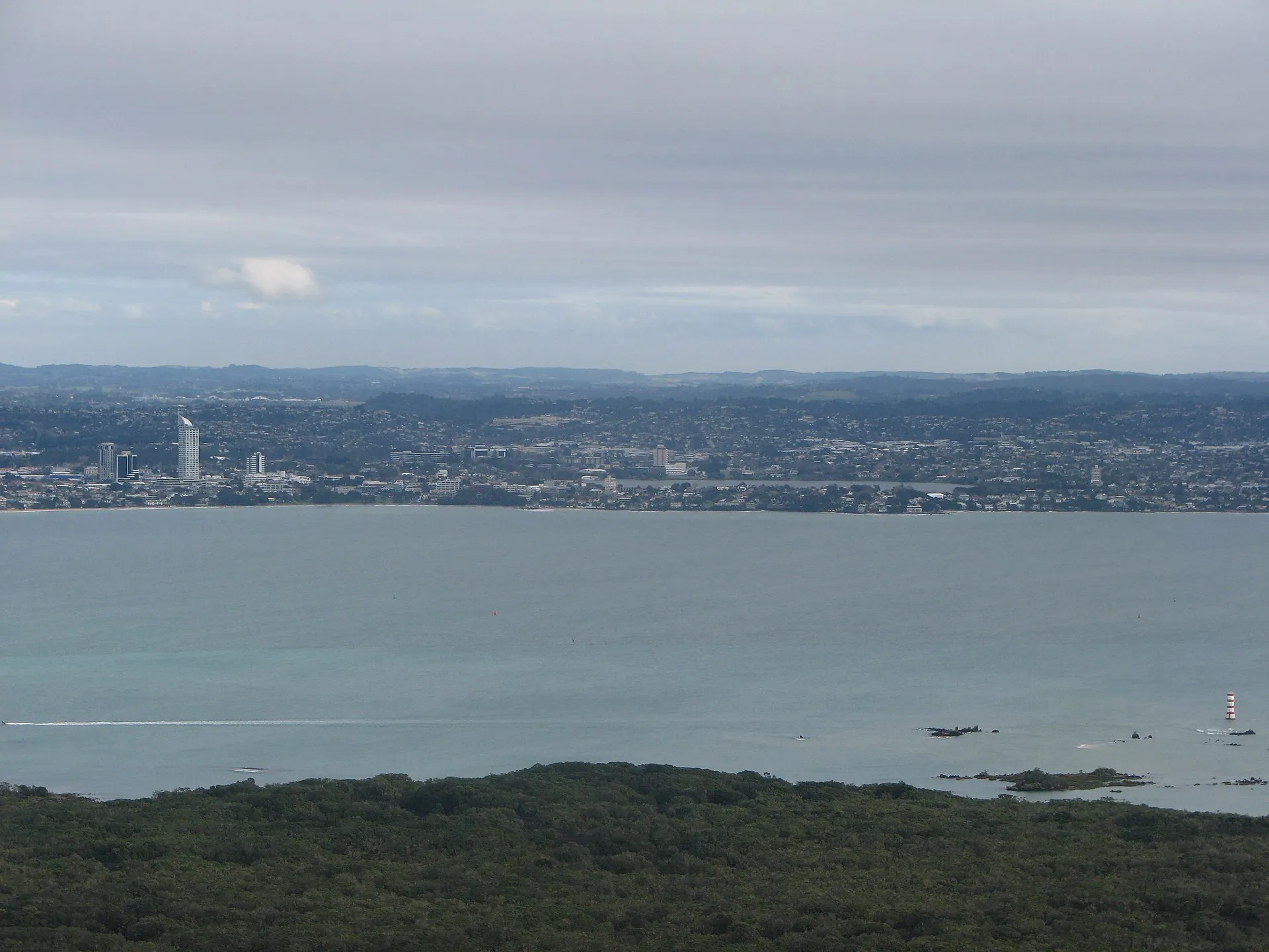
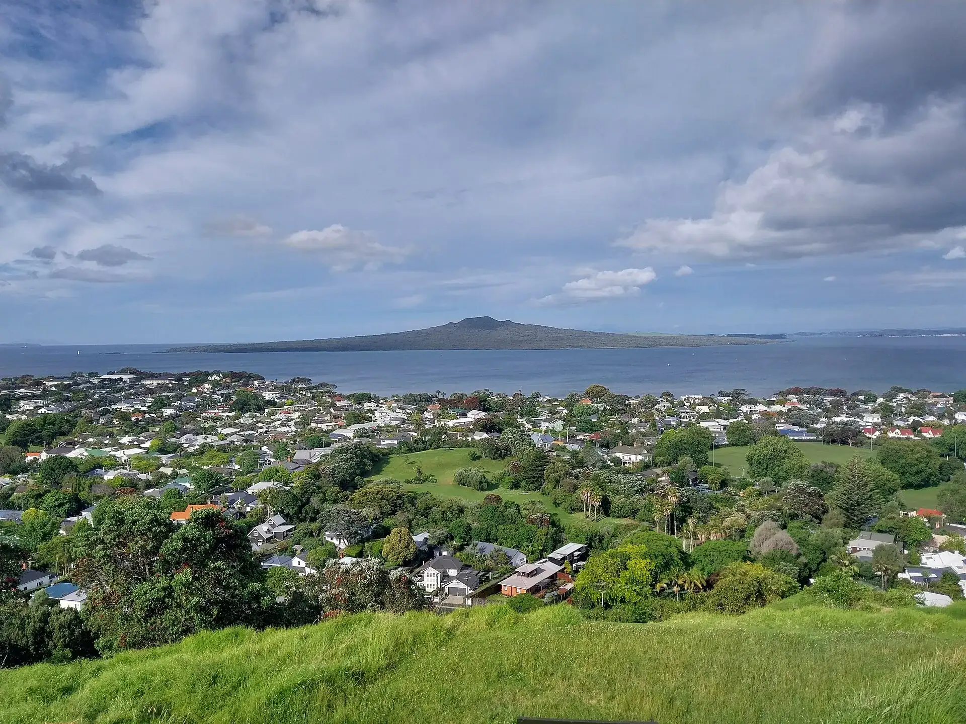
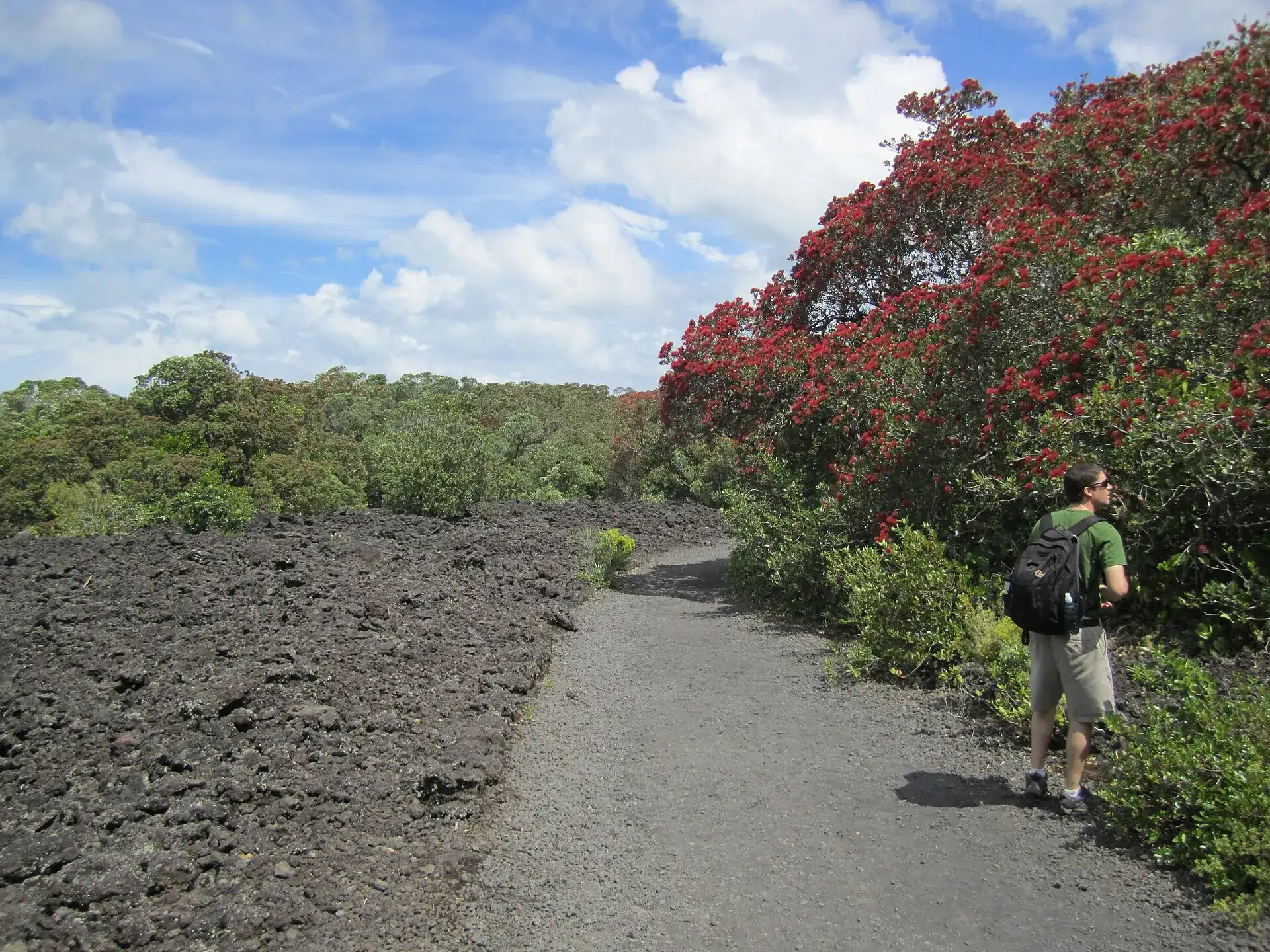
Rangitoto Island seen from Mount Victoria in Devonport: the low volcanic cone lies beyond the Hauraki Gulf, with the houses of Auckland in the foreground The track across Rangitoto Island: a gravel path between a black lava field and pōhutukawa trees in red flower, a walker at the edge The view from the summit of Rangitoto across the Hauraki Gulf to the Auckland mainland, with the island's pōhutukawa forest in the foreground

Rangitoto Island

From the city, Rangitoto is a low shield on the horizon.

On the island the ground is black and sharp-edged – and pōhutukawa flowers right beside it.

Two hours later you are 260 m (853 ft) up, looking back at Auckland.

Scroll –
25 minutes and 260 meters

As of 21 September 2026Rangitoto Island today: the island is free, the ferry is not

The island itself costs nothing – no entry fee, no ticket, no opening hours. The only thing you pay for is the crossing, and you have to book it in advance: the operator states that bookings are essential and that the ticket is valid only for the time and date shown on it. Turning up at the wharf and walking on is not provided for.

GeoNet lists the Auckland Volcanic Field at Volcanic Alert Level 0 today. DOC describes Rangitoto as dormant, not extinct – and a new eruption in the field would most likely open a new vent somewhere else anyway, not here. The real risks on the island are of a different kind: sharp-edged lava rock, loose scree, the heat the black stone throws back at you, and unstable rock inside the lava caves.

Free
0NZD

The island, every track, the summit

Setting foot on the island costs nothing, the summit track nothing, the lava caves nothing, the crater loop nothing. There is no ticket office and no gate. Permits are needed only for weddings and similar events, commercial filming and commercial guiding – and flying a drone without a permit is prohibited.

Department of Conservation
Booking essential
55NZD

The ferry from Auckland

Twenty-five minutes from the Downtown Ferry Terminal, 20 from Devonport. Return fares are NZ$55 (about US$34) for adults, NZ$25 for children aged 5 to 15 and NZ$119 for a family of two adults and two children; under-5s travel free. From Auckland City there are only two morning sailings on weekdays.

Fullers360 · return, adultNZ$55
Unresolved

The last ferry back

We deliberately give no time here. The operator's timetable page was blocked by a bot protection on 21 September 2026, and the most recent archive copy is from January 2023 – unusable. So: fix your return sailing when you book and check the time printed on your ticket. DOC warns explicitly against missing the ferry; there is no accommodation, and replacement transport is expensive.

Unverified because it was unreachable – not because it does not matter
Before boarding

The biosecurity check

Rangitoto and neighboring Motutapu have been pest-free since 2011. Before boarding, the operator checks bags and shoes for soil, seeds and stowaways. Keep bags closed, food in sealed containers, and clean your shoes beforehand. Rats fit through a 12-millimeter gap, mice through seven.

Bringing pests to a Hauraki Gulf island is an offence
Does not exist

Water, shop, rubbish bin

There is no shop, no drinking water and no rubbish bin on the island – your own rubbish comes back with you. On top of that: a total fire ban including portable barbecues, no camping and no pets. Food, water, sun protection, a hat and a flashlight for the caves all go in your pack.

Hauraki Gulf Maritime Park by-laws
Level 0
0Level

GeoNet's alert level

The Auckland Volcanic Field sits at Volcanic Alert Level 0 ("no volcanic unrest"), Aviation Colour Code Green. Rangitoto is the youngest of the roughly 50 volcanoes in that field – DOC says about 600 years old. No fire, no steam, no hot springs: if you came for lava, you came to the wrong island.

GeoNet API, checked on 21 September 2026
Sources: DOC – Rangitoto Island (no shop, no water, no bins, fire ban, drone ban, closure of the controlled mine base) · Fullers360 (fares, sailings from Auckland City, booking obligation, the check before boarding) · DOC – visiting pest-free islands · GeoNet – Auckland Volcanic Field, checked on 21 September 2026.
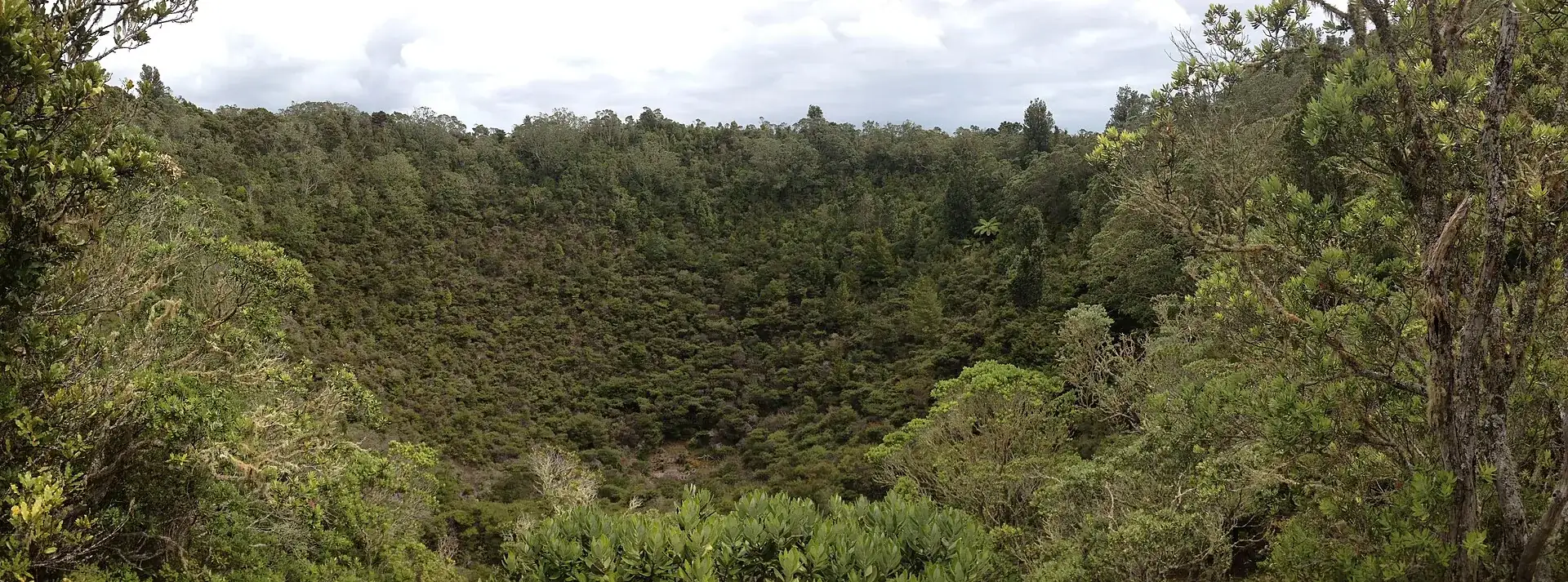
The forested crater of Rangitoto Island: a round hollow about 60 meters deep, completely overgrown with pōhutukawa and rewarewa
What waits at the top is not a crater of bare rock but a forest in a hole.

Photo: MurielBendel · CC BY-SA 4.0

What is actually out thereSummit walk, crater, lava caves: 7 km over black rock

DOC gives the Rangitoto Summit Track as 7 km (4.3 miles), two hours return, with 250 m (820 ft) of climbing. It is graded “easy to intermediate” – which says nothing about the surface: rough, uneven volcanic rock, loose slippery scree, and almost no shade on hot days.

The track starts at Rangitoto Wharf under a waharoa, a carved gateway representing the ancestor Peretū. After that it runs almost level at first, through the largest pōhutukawa forest in the world – and again and again, right beside it, lies the thing the forest grows on: broken black lava nobody would want to walk across. The two surfaces meet edge to edge, with the gravel path down the middle.

Forty-five minutes in, the Lava Caves Track branches off to the right: 500 m (0.3 miles), 15 minutes, into natural tunnels left by one of Rangitoto's eruptions. Without a flashlight they stay a dark hole. DOC describes them as dark, with low ceilings, jagged rock and uneven floors – duck your head, keep children close, and do not climb on the rock inside, which is unstable.

Just below the summit is the viewing platform over the crater: a hollow about 60 m (200 ft) deep, completely grown over with pōhutukawa and rewarewa. From there the Crater Rim Track loops around in 20 minutes and 850 m (0.5 miles), past remains of the military installations. Two minutes further on you stand at the summit lookout at 260 m (853 ft), with seating and a historic fire control post – and the city on the other side of the water.

On hot days the detour over Wilson's Park Track pays off: an hour instead of half of one, 1.4 km (0.9 miles), but in the shade. The black lava floor radiates the sun back, and DOC warns explicitly of “very hot temperatures, especially in summer”.
The one line on the billRangitoto ferry: book it, check the time, come back

The Fullers360 public ferry is the normal way across – 25 minutes from the Downtown Ferry Terminal, 20 from Devonport, and only two morning sailings on weekdays. If you would rather paddle or go guided, both leave from Auckland too. The one thing you decide yourself in every case: the return.

Affiliate links to GetYourGuide: if you book, we earn a commission and the price stays the same. Prices and ratings as of 21 September 2026. Check which return sailing your ticket names – we found no documented time for the last departure from Rangitoto.

The rule behind the islandThe rules: biosecurity, fire ban, no rubbish bins

Rangitoto is one of the most demanding conservation projects in the world. Possums and wallabies were removed in 1992; in 2011, after a four-year programme, seven mammal species went at once – feral cats, rabbits, stoats, hedgehogs, Norway rats, ship rats and mice. Species have been returning by themselves since. Every rule you meet on the island hangs on that.

1

Check, clean, close

Inspect your gear before departure for rats, mice, ants and skinks, clear soil and seeds off your shoes, keep bags closed, food in sealed containers. Anyone staying overnight in one of the baches also hands a completed checklist to the ranger.

2

No pets, anywhere

DOC: “To protect our native wildlife, dogs are not allowed anywhere in this place.” The same goes for cats and other pets on the Hauraki Gulf island reserves – and for the ferry, which carries no animals.

3

Fire: none at all

A total fire ban applies across the island, portable barbecues included. Camping is banned. There are no rubbish bins – what you bring, you take back with you.

4

The mine base is closed

The former controlled mine base is closed until further notice because of asbestos: “All access to the controlled mine base is not allowed until further notice.” DOC does not say since when or until when.

Every other track is open
5

Boats may not tie up

At the two wharves, private boats may only load and unload people. If you arrive by your own kayak: land in daylight only, anchor offshore at night, fit rodent guards to lines and anchor chains – and never tie lines directly to the shore.

6

Drones only with a permit

Flying a drone without a permit is explicitly prohibited. Commercial filming, commercial guiding and events such as weddings also require permits.

Official prices · as of 09/2026 · NZ$1 ≈ US$0.61
Setting foot on the island, all tracks, the summit, the lava caves, the crater loopfree
Ferry return, adultNZ$55 (about US$34)
Ferry return, child aged 5 to 15NZ$25 (about US$15)
Ferry return, family of 2 adults and 2 childrenNZ$119 (about US$73)
Ferry, child under 5free
A night in one of the three historic baches (Bach 52, 78, 114)rates through DOC – not checked by us
Sources: Fullers360 (fares and sailings from Auckland City, as of 09/2026) · DOC – Rangitoto Island (Hauraki Gulf Maritime Park rules, the baches, the asbestos closure). The DOC page about staying overnight could not be retrieved on 21 September 2026 – which is why no rental rate appears here. US dollar figures use the ECB reference rate of 21 September 2026.

Two sailings in the morningHow the day on Rangitoto works

  1. BeforehandBook the ferry – both directions at once

    There are no tickets at the wharf on the day of travel, and your ticket is valid only for the sailing you booked. Decide right away which ferry brings you back and write the time down – nobody on the island will tell you.

  2. In the morningPack water, food, flashlight

    There is nothing to buy and nothing to drink on the island. Add sun protection and a hat (DOC names both as required kit), rain and wind protection, sturdy shoes with grip – and a flashlight, or the lava caves stay shut to you.

  3. Before boardingBags and shoes are checked

    The operator looks for soil, seeds and stowaways. Bags closed, food in sealed containers. Take the first sailing and the climb is behind you before the lava fields heat up.

  4. After 20 to 25 minutesRangitoto Wharf

    Through the waharoa and away. Right beside the wharf stands Bach 38, one of about 30 surviving holiday huts from the 1930s, now a museum. Two hours for the summit return, plus the caves and the crater loop.

  5. At the top260 meters, crater, fire control post

    The platform over the forested crater, the Crater Rim Track in 20 minutes, the summit lookout over the Hauraki Gulf to Auckland. The island was used for defence from 1935 to 1957 – the remains stand up here.

  6. In good timeBack to the wharf

    DOC puts it drily: “alternative transport back to the mainland is expensive”. There is no accommodation apart from the three rentable baches. Leave a buffer – the walk back over lava scree is no faster than the walk out.

Distances and timesTracks on Rangitoto: summit, lava caves, crater rim

Every track is free and signposted from Rangitoto Wharf. The times come from DOC.

Track → what it takes, how long it lasts
Rangitoto Summit Track · Rangitoto Wharf → Summit Lookout (260 m / 853 ft) · 7 km (4.3 miles), 2 hours returnThe main track, 250 m (820 ft) of climbing, graded “easy to intermediate” by DOC. Surface: rough, uneven volcanic rock and loose scree, with almost no shade. At the junction with the Crater Rim Track there is a viewing platform over the roughly 60 m (200 ft) deep, forested crater; two minutes further on is the summit lookout with seating and a historic fire control post. Free.
Lava Caves Track · junction 45 minutes from the wharf, 15 minutes below the summit · 500 m (0.3 miles), 15 minutes one wayNatural tunnels and caves from one of Rangitoto's eruptions. A flashlight is essential. DOC: dark, low ceilings, jagged rock, uneven floors – duck your head, keep children close, do not climb on the rock inside, which is unstable. DOC names the caves explicitly as a good option for children. Free.
Crater Rim Track · junction just below the summit · 850 m (0.5 miles), 20 minutes as a loopOnce around the crater, past remains of the military installations from 1935 to 1957. Free.
Wilson's Park Track · junction on the left, 40 minutes from the wharf · 1.4 km (0.9 miles), 1 hour one wayThe longer but shaded way to the summit – DOC calls it the better choice on hot days. It crosses lava fields with uneven surfaces and loose rock. Free.
Kayak from Devonport or Takapuna Beach · about 2 hoursDOC names this option explicitly for experienced paddlers only. The biosecurity rules apply to your own boat too: check beforehand, carry bait or traps, land only in daylight, anchor offshore at night, never tie lines directly to the shore.
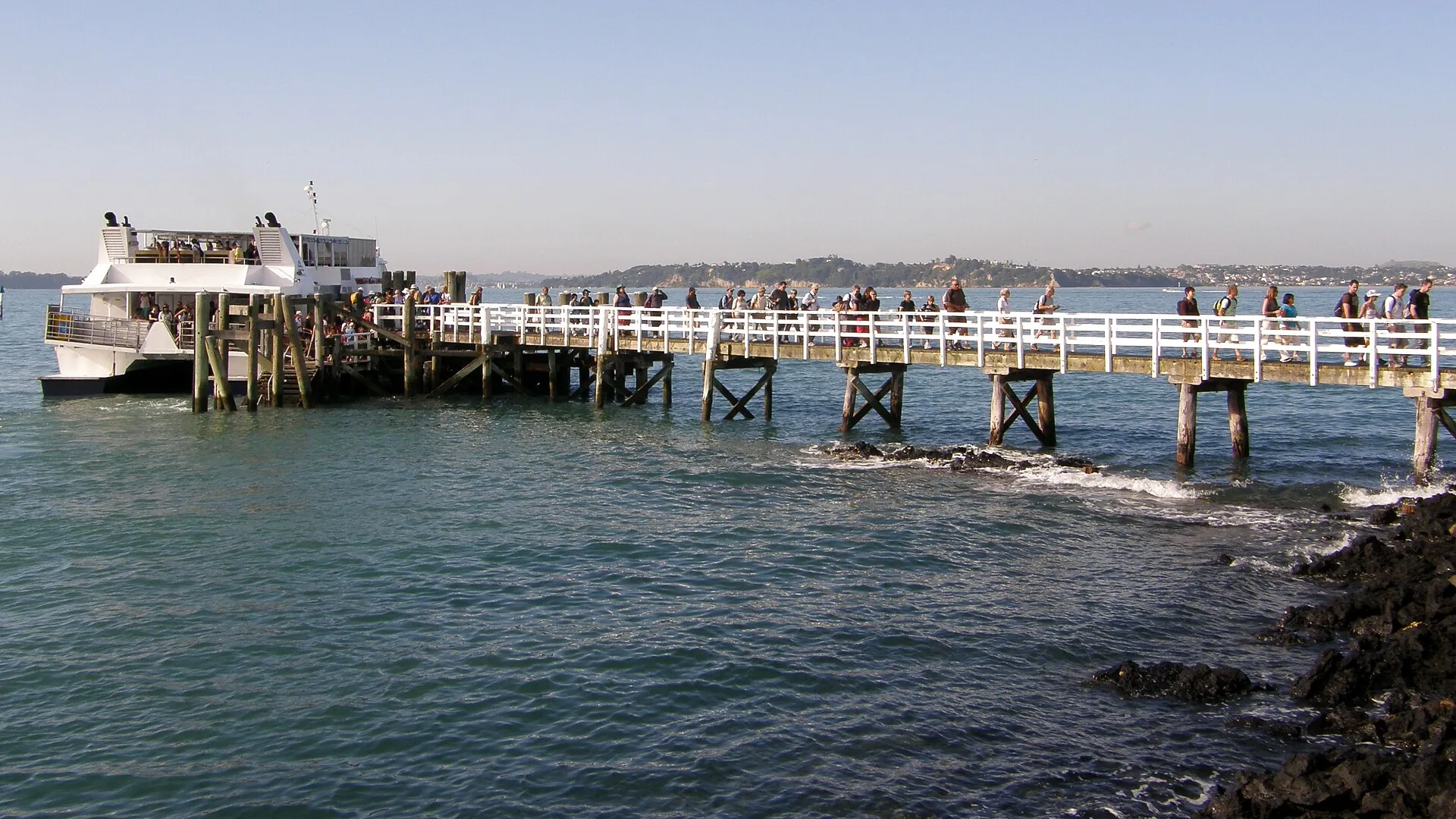
The ferry alongside Rangitoto Wharf, visitors walking down the long white wooden jetty to the island, with the Auckland coast behind
The jetty is the only way back. The time for it is printed on your ticket.

Photo: russellstreet · CC BY-SA 2.0

Good to knowGetting to Rangitoto, best time, tips

Getting there

Without a car: By boat only. Public ferries berth at Rangitoto Wharf on the south side of the island: 25 minutes from Queens Wharf downtown, 20 minutes from Devonport. Water taxis and charter boats run from licensed operators. Experienced paddlers need about two hours from Devonport or Takapuna Beach.

By car: There are no public roads for visitor vehicles on the island. You park on the mainland at the ferry terminals in Auckland or Devonport.

  • From Auckland Downtown Ferry Terminal (Queens Wharf) · 25 minutes
    Fullers360 ferry, booking compulsory
  • From Devonport · 20 minutes
    ferry; the earlier sailing from Auckland City calls here
  • From Takapuna Beach · about 2 hours
    by kayak only, for experienced paddlers

Best time to go

The first ferry. Come on the earliest sailing and the climb is behind you before the lava fields heat up, with time to spare for the lava caves, the crater loop and the walk back to the wharf. In summer the heat reflected off the black rock is the biggest problem; that is when Wilson's Park Track is the better, shadier way up. Pōhutukawa flower red in December – the best time to see the world's largest pōhutukawa forest. Wasp numbers rise in the warm months. All year round: check the forecast and be ready for rain and wind.

Who it suits

Children
Good. DOC calls the lava caves 'a great option for kids' but asks you to keep children close inside them. Under-5s travel free on the ferry. Seven kilometers over lava scree is still a long day for small legs.
Minimum age
none
Fitness
Moderate. 7 km (4.3 miles) return, 250 m (820 ft) of climbing, a steady gradient but over rough, uneven volcanic rock with loose scree.
Heart and lungs
No geothermal gases. The strain is the heat: black lava reflects the sun, and DOC warns of 'very hot temperatures, especially in summer' with little shade. If you react badly to wasp stings, bring antihistamines – wasp numbers rise in the warm months.
Wheelchair
The summit track is not wheelchair accessible. Whether a vehicle service to the summit exists could not be confirmed from a primary source – see uncertain.
Dogs
Not allowed. DOC: 'To protect our native wildlife, dogs are not allowed anywhere in this place.' Cats and other pets are not permitted on the Hauraki Gulf island reserves either.
Clothing
Sun protection and a hat are required kit according to DOC, plus rain and wind protection – the weather turns quickly.
Footwear
Sturdy walking shoes with good grip. DOC: 'Wear sturdy walking shoes that can cope with the rugged lava surfaces.' For the lava caves, add a flashlight.

Tips you will need on site

  • Book the ferry in advance. Fullers sells no tickets at the wharf on the day of travel, and there are only two morning sailings.
  • Pack food and water. There is no shop, no drinking water and no rubbish bin on the island – your own rubbish comes back with you.
  • Do not forget a flashlight, or the lava caves stay a dark hole. The junction is 45 minutes past the wharf, 15 minutes below the summit.
  • Clean your shoes beforehand. Before boarding, the operator checks bags and shoes for soil, seeds and stowaways; bags should be closed and food in sealed containers.
  • On hot days take Wilson's Park Track up – a little longer, but shaded. The black lava ground radiates the heat back at you.
  • Do the crater loop: 20 minutes, 850 meters, plus the view from the platform into the 60 m deep, forested crater.
  • Be back at the wharf in good time. DOC warns explicitly against missing the ferry – there is no accommodation and the alternatives are expensive.
  • Leave dogs at home. They are banned across the island, as are cats and other pets.
  • If you are allergic to wasp stings, bring your emergency medication; DOC lists wasps as a risk that increases in the warm months.

A short history

  • DOC says Rangitoto rose from the sea about 600 years ago, making it the youngest volcano in New Zealand. The eruptions came in two phases, around 1450 and around 1500.
  • The island is a symmetrical shield volcano with scoria cones at its centre, 5.5 km (3.4 miles) across, 2,311 hectares in area and 260 m (853 ft) high – the youngest and at the same time the largest of the roughly 50 volcanoes of the Auckland Volcanic Field.
  • The summit area carries the name Ngā Pona-toru-a-Peretū and is a scenic reserve of its own. At Rangitoto Wharf the track begins through a waharoa, a carved gateway representing the ancestor Peretū.
  • In the 1920s and 1930s simple holiday huts, the baches, went up around the coast. About 30 still stand, largely unchanged; Bach 38 by the wharf is now a museum.
  • From 1935 to 1957 Rangitoto served the country's defence: the island lies between both approaches to Auckland harbour. The fire control post at the summit and the causeway to neighboring Motutapu, built during the Second World War, date from that time.
  • In 1992 possums and wallabies were removed from Rangitoto and Motutapu. The badly damaged pōhutukawa forest was then able to recover.
  • In 2011, after a four-year programme, both islands were declared pest-free – one of the most complex eradication projects in the world. Seven mammal species were removed at once: feral cats, rabbits, stoats, hedgehogs, Norway rats, ship rats and mice.
  • Species have returned of their own accord since – kākāriki, bellbirds and kākā – while saddlebacks and whiteheads were reintroduced. Rangitoto carries the largest pōhutukawa forest in the world, along with more than 200 native tree and flowering plant species and over 40 species of fern.

Outdated onlineWhat other sites get wrong

“You walk up to the wharf and hop on.”
The operator requires a booking, and the ticket is valid only for the sailing you booked. Walking on for the same day is not provided for – and from Auckland City only two ferries run on weekday mornings.
“There is a cafe on the island, or at least water.”
No. DOC: “Bring your own food and water. There are no shops on the island.” There are no rubbish bins either, so your rubbish comes back with you.
“Rangitoto is extinct – nothing can happen there.”
DOC describes it as dormant, not extinct, and GeoNet runs the Auckland Volcanic Field as a monitored volcanic centre of its own – at Level 0 on 21 September 2026. A new eruption in the field would most likely open somewhere else.
“The biosecurity check is a formality.”
It happens before boarding, and bags and shoes are inspected. Rats fit through a 12-millimeter gap, mice through seven. Taking any of the Auckland pest species to a Hauraki Gulf island is an offence.
“The summit track is an easy stroll.”
DOC grades it “easy to intermediate” but lists 250 m (820 ft) of climbing, rough uneven volcanic rock, loose slippery scree and almost no shade. Sandals are the wrong choice.
“The lava caves are lit.”
They are not. DOC describes them as dark, with low ceilings, jagged rock and uneven floors, and requires a flashlight. The rock inside is unstable and must not be climbed on.

Quick answersBefore the crossing

When does the last ferry leave Rangitoto?

We deliberately give no time here. The operator's timetable page was blocked by a bot protection on 21 September 2026, and the most recent archive copy is from January 2023. So fix your return sailing when you book and check the time printed on your ticket. DOC warns explicitly against missing the ferry – there is no accommodation on the island.

How much time should I allow for Rangitoto?

A full day. DOC gives two hours return for the summit track; with the lava caves, the crater loop and breaks it becomes three to four. Add 20 to 25 minutes of ferry each way and a buffer before the return. The operator recommends allowing a full day itself.

What do I absolutely have to bring?

Water and food for the whole day, because neither is available on the island. Then sun protection and a hat – DOC names both as required kit – rain and wind protection, sturdy shoes with grip, and a flashlight for the lava caves. And a bag for your own rubbish.

Summit Track or Wilson's Park Track – which one?

Both end at the same lookout. The Rangitoto Summit Track is the direct way from the wharf, open and with almost no shade on hot days. Wilson's Park Track branches off to the left 40 minutes past the wharf and takes about an hour for 1.4 km (0.9 miles) instead of half of one – but in the shade. DOC names it explicitly as the better choice on hot days. Nothing stops you taking one up and the other down.

Will I see lava or steam on Rangitoto?

No. Rangitoto is dormant, and DOC puts the last eruption about 600 years ago. There is no fire, no hot spring and no steaming vent. What you see is solidified lava – black, sharp-edged and in many places already grown over with forest.

What does it cost to visit Rangitoto Island?

The island itself costs nothing – no entry fee and no ticket for the tracks. You pay only for the ferry: NZ$55 (about US$34) return for adults, NZ$25 for children aged 5 to 15, NZ$119 for a family of two adults and two children; under-5s travel free.

How do I get to Rangitoto?

By boat only. The Fullers360 public ferry takes 25 minutes from the Downtown Ferry Terminal in Auckland and 20 minutes from Devonport. Sailings from Auckland City are at 9:30 and 10:30 am on weekdays and at 9:15 and 10:30 am at weekends and on public holidays; the earlier one calls at Devonport. There are also water taxis, charter boats and – for the experienced – kayaks.

Do I have to book the ferry in advance?

Yes. Fullers states that bookings are essential and that the ticket is valid only for the time and date shown on it. You cannot simply turn up at the wharf.

How long does the climb to the summit take?

The Rangitoto Summit Track is 7 km (4.3 miles) long and takes two hours return according to DOC, with 250 m (820 ft) of climbing. With the lava caves, the crater loop and breaks, allow three to four hours; Fullers suggests a full day.

Do I need a flashlight?

For the lava caves, yes. DOC describes them as dark, with low ceilings, jagged rock and uneven floors, and requires a flashlight. The junction is 45 minutes above the wharf, and the track in takes 15 minutes.

Is there water or a cafe on the island?

No. DOC says it plainly: bring your own food and your own water, there are no shops on the island. There are no rubbish bins either – your rubbish comes back with you.

What are the biosecurity rules about?

Rangitoto and Motutapu have been pest-free since 2011. So: check, clean, close – inspect your gear for rats, mice, ants and skinks, clear soil and seeds off your shoes, keep bags closed, food in sealed containers. Before boarding, the operator checks bags and shoes. Anyone staying overnight also hands a completed checklist to the ranger.

Can I bring my dog?

No. Dogs are banned across the island, as are cats and other pets on the Hauraki Gulf island reserves. The reason is protecting the native wildlife.

Can I stay the night on Rangitoto?

Camping is banned and there is no hostel. DOC does rent out three historic holiday huts: Bach 52 at Rangitoto Wharf and Bach 78 and Bach 114 at Islington Bay. For everyone else the rule is simple: do not miss the last ferry, because replacement transport is expensive.

Is Rangitoto dangerous?

Volcanically, not at the moment: GeoNet lists the Auckland Volcanic Field at Volcanic Alert Level 0 on 21 September 2026. The real risks are of a different kind – sharp lava rock, loose scree, strong reflected heat, wasps in the warm months and unstable rock in the lava caves. The former controlled mine base is closed because of asbestos.

When is the best time to visit?

On the first ferry, so the climb is done before the midday heat. Pōhutukawa flower red in December – Rangitoto carries the world's largest pōhutukawa forest. On hot days the shadier Wilson's Park Track is worth the detour on the way up.

Is the island suitable for children?

Yes, with limits. DOC names the lava caves explicitly as a good option for children but asks you to keep them close inside. Seven kilometers over lava scree is still a lot for small children; the ferry is free under 5.

Can I fly a drone?

No. DOC writes that flying a drone without a permit is strictly prohibited. Commercial filming, commercial guiding and events such as weddings also require permits.

How old is the volcano?

DOC says Rangitoto rose from the sea about 600 years ago – the youngest volcano in New Zealand. The eruptions came in two phases, around 1450 and around 1500. The island is 5.5 km (3.4 miles) across, 2,311 hectares in area and 260 m (853 ft) high.

Sources · accessed on 21 September 2026

  • DOC – Rangitoto Island: the youngest volcano in New Zealand, about 600 years, pest-free; no shop, bring your own food and water; total fire ban, no camping, no rubbish bins, no pets; closure of the controlled mine base for asbestos; the drone ban; three rentable baches
  • DOC – Rangitoto Summit Track: 7 km, 2 hours, 250 m of climbing, “easy to intermediate”; the waharoa for Peretū; crater 60 m deep; Crater Rim Track 850 m; Lava Caves Track 500 m with a flashlight; Wilson's Park Track as the shady alternative; heat and weather warnings
  • DOC – nature and conservation: two reserves, pest-free since 2011 after a four-year programme, seven mammal species removed at once, possums and wallabies in 1992, the world's largest pōhutukawa forest
  • DOC – visiting pest-free islands: check, clean, close; rats 12 mm, mice 7 mm; the offence; rules for private boats and kayaks
  • Fullers360 – Rangitoto Island: return fares, sailings from Auckland City, the booking obligation and no same-day walk-on, the check of bags and shoes before boarding, the recommendation to allow a full day. Not reachable on 21 September 2026 was the timetable page with the return sailings (bot protection) – which is why we give no time for the last ferry
  • GeoNet – Auckland Volcanic Field and the alert level interface: Level 0, Aviation Colour Code Green, checked on 21 September 2026
  • Wikipedia – Rangitoto Island: height 260 m, width 5.5 km, area 2,311 ha, eruptions around 1450 and 1500, the youngest and largest of the roughly 50 volcanoes of the Auckland Volcanic Field (DOC gives only “about 600 years” and 250 m of climbing from the wharf)
  • ECB reference rates of 21 September 2026: EUR 1 = NZD 2.0035 = USD 1.2296 – the basis for the conversions on this page
  • Photos: Danny William Wilson (CC BY-SA 4.0), portengaround (CC BY-SA 2.0), wfeiden (CC BY-SA 2.0), MurielBendel (CC BY-SA 4.0), russellstreet (CC BY-SA 2.0), via Wikimedia Commons