Volcano·Guide
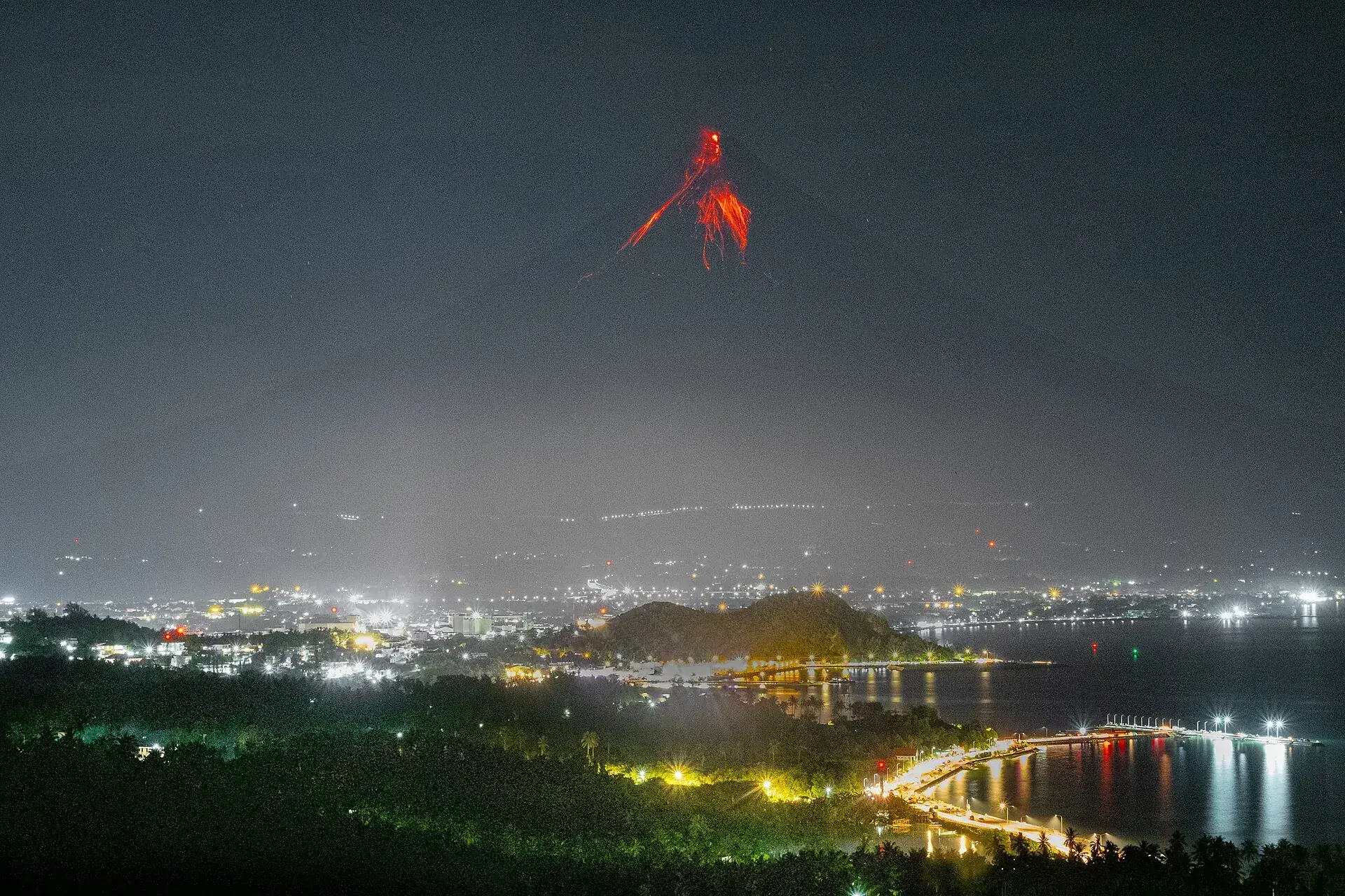
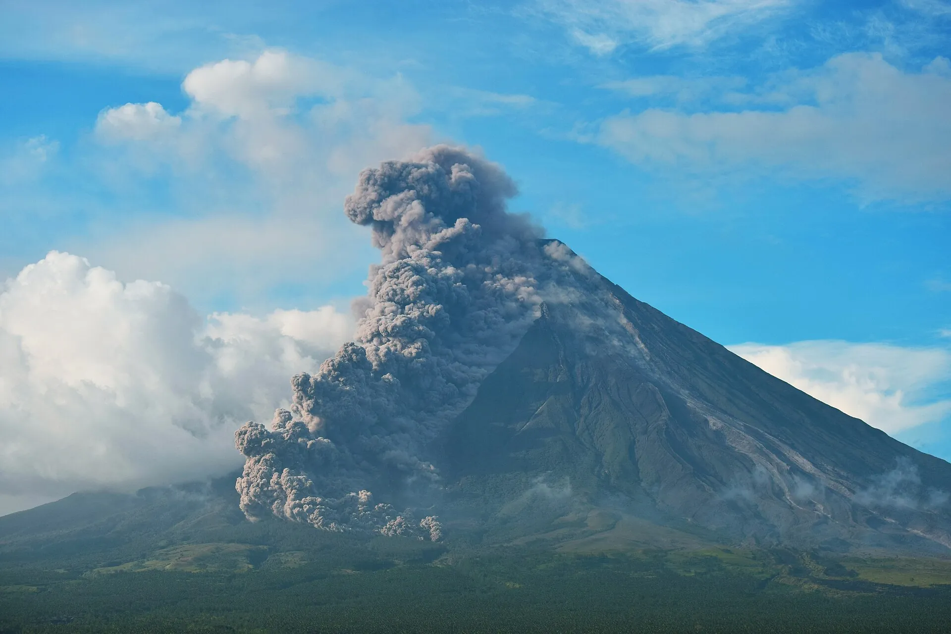
Mayon at night during an eruption: glowing lava runs in bands from the summit down the flank Ash cloud above Mayon, with the weathered baroque facade of Daraga Church in the foreground The near-symmetrical cone of Mayon seen from Ligñon Hill in Legazpi, the summit clear of cloud

Mayon Volcano

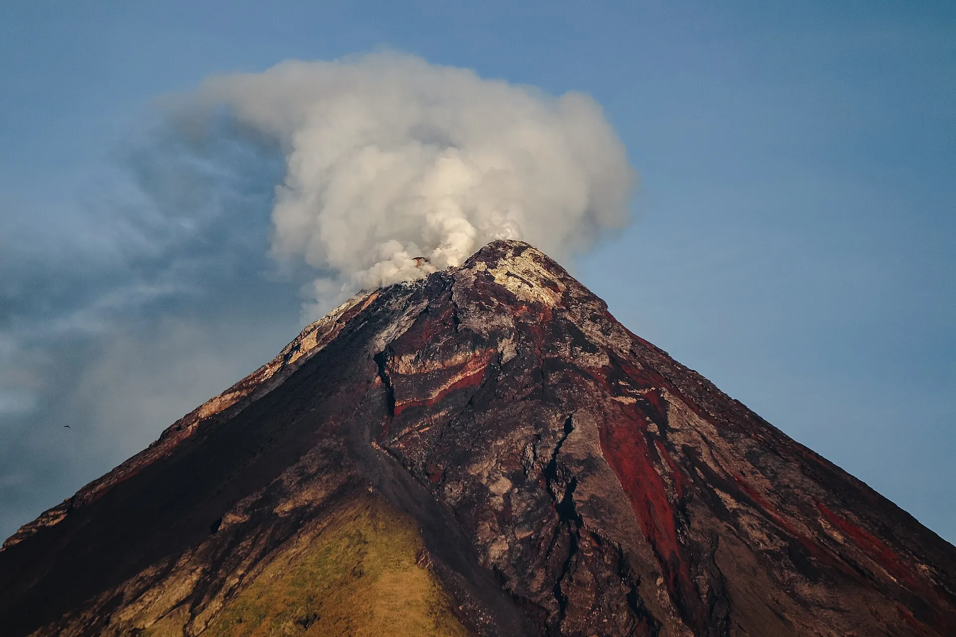
When Mayon erupts, lava runs down the cone at night in glowing bands.

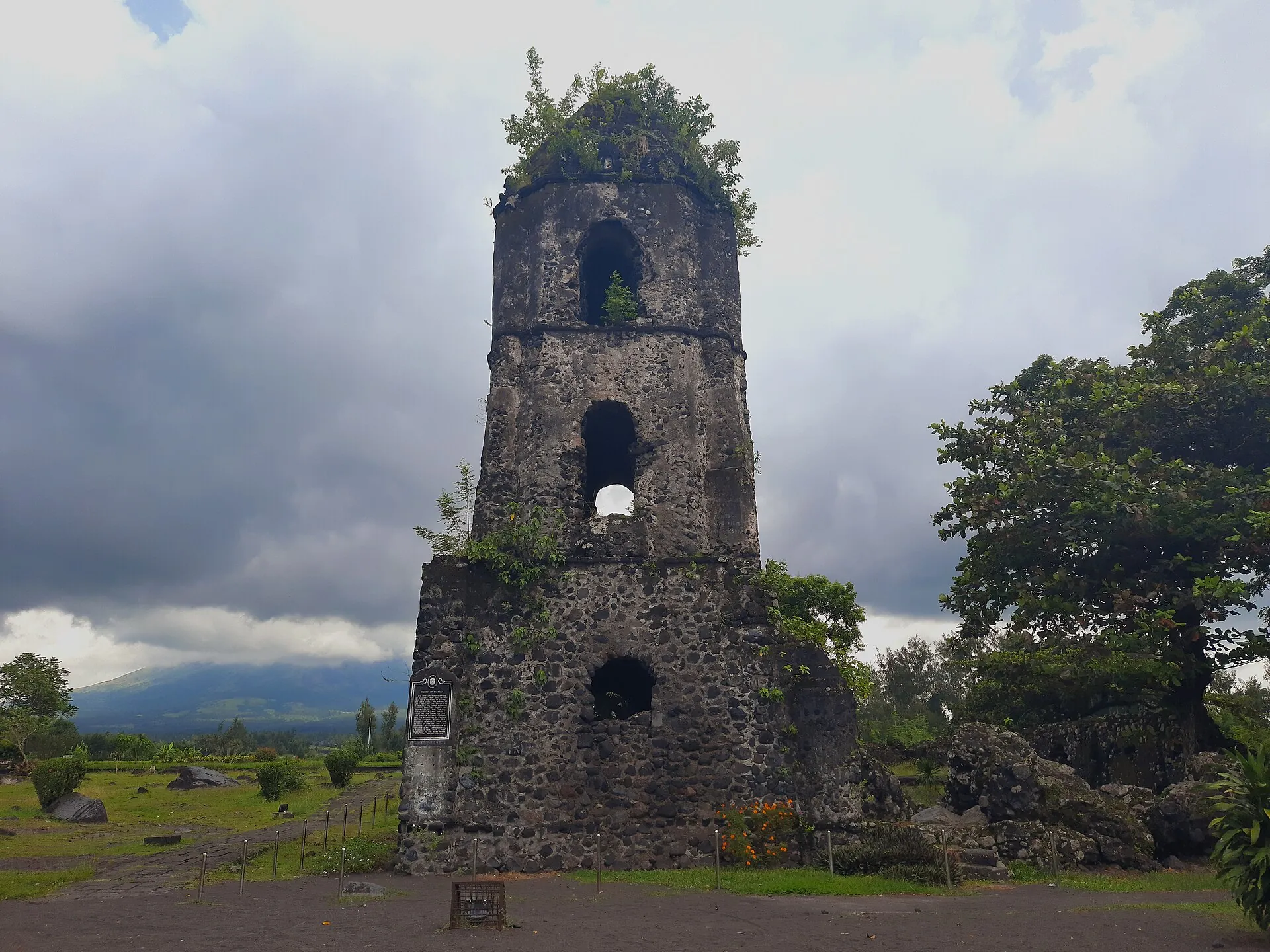
By day the ash stands over Daraga – the church in front of it dates from 1773.

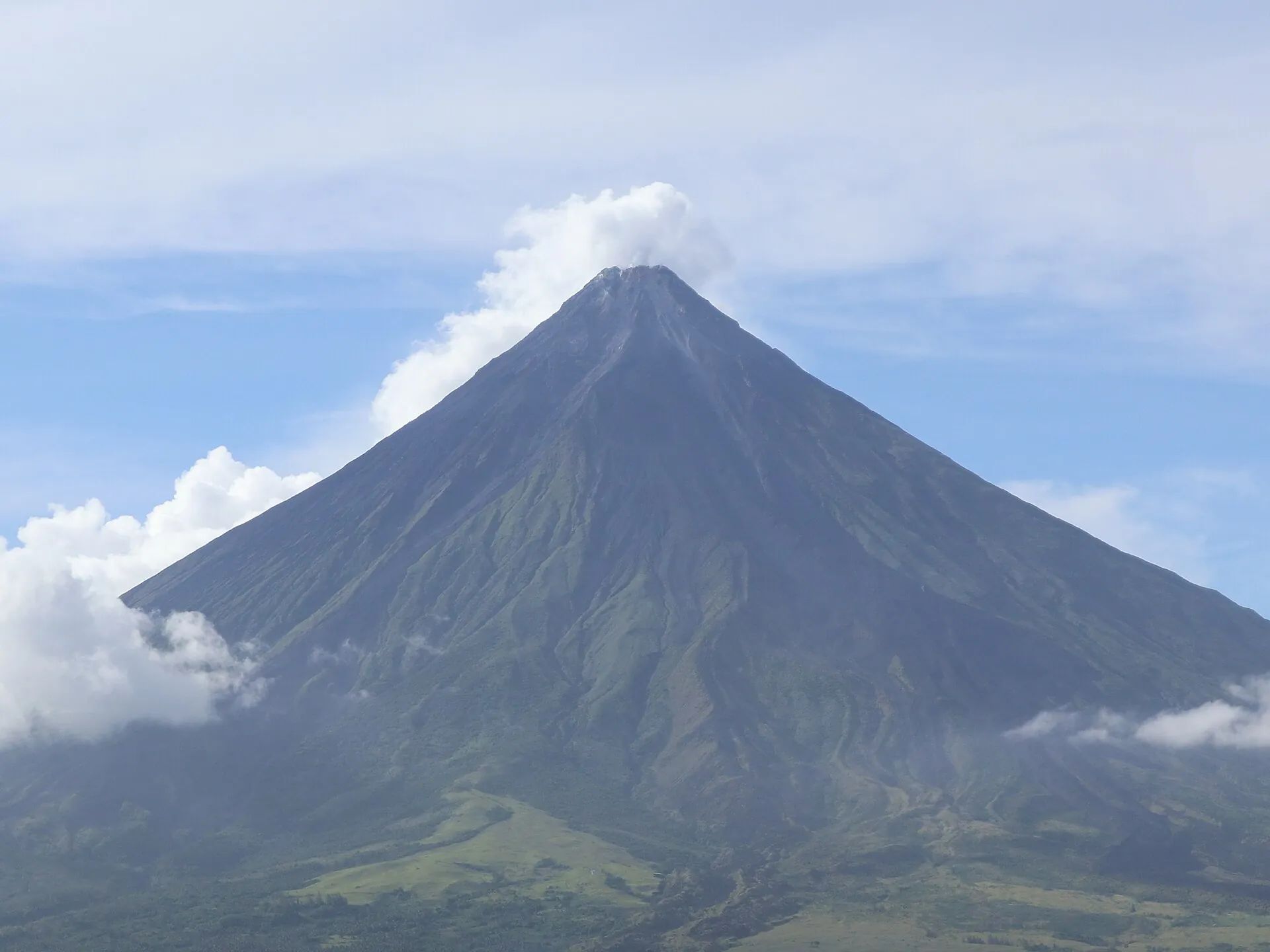
In between it is the mountain on every postcard from Albay: 2,463 m (8,081 ft), almost perfect.

Scroll –
from eruption to postcard cone

As of 23 September 2026What is open at Mayon today – and what is not

Mayon is the most active volcano in the Philippines, and from January to July 2026 it proved the point again: lava flows in the Mi-isi, Bonga and Basud gullies, pyroclastic density currents, ashfall over Camalig and Daraga on 2 May. Since 5 August 2026 it has stood at Alert Level 2 – moderate unrest, activity declining. Climbing it is still not allowed: the 6 km (3.7 mile) zone around the crater is closed at every alert level, and Albay province has banned the summit climb outright since 2016. You experience this mountain from the outside – and that is worth the trip.

Closed
6km

Permanent Danger Zone and summit

The 6 km (3.7 mile) zone around the crater is closed permanently – including at Alert Level 0, because phreatic explosions can happen without warning. The old trekking route via Camp 1 and Camp 2 lies entirely inside it. Police and the provincial safety office run checkpoints on the access roads.

Provincial Ordinance 0023-2016: 5,000 PHP fine and up to one year in jail
Open · 6 am–6 pm
11km

Cagsawa Ruins, Daraga

The bell tower of the church buried in 1814, with the cone behind it – the signature image of Albay. About 11 km (7 miles) from the summit, far outside the danger zone. Early in the morning the peak is still clear.

Private information sites 2025/2026; the town of Daraga publishes no price list45 PHP (approx. $0.70)
Open · 5 am–9 pm
156m

Ligñon Hill, Legazpi

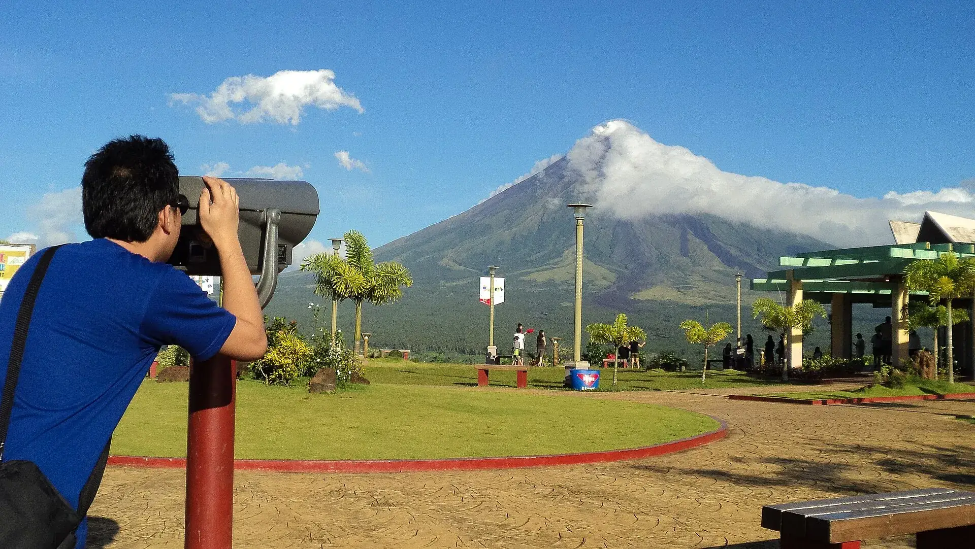
A 156 m (512 ft) viewpoint hill at the edge of the city with a road to the top; the PHIVOLCS observatory sits up here as well. At Alert Level 2 you can see the crater glow from here at night – the safe way to watch the volcano work.

Visit Legazpi lists free entry, travel blogs 20–25 PHP environmental feefree to approx. 25 PHP
Ask first

ATV rides on the lava fields

The trails to the 2006 “lava wall” lie outside the 6 km zone, but they were stopped on 6 January 2026 at Alert Level 3 and were closed in May 2026. Whether they reach the wall again under Level 2 has not been published by any authority – ask the operator.

No official clearance found, as of 23 September 2026from 1,700 PHP (approx. $27)
Sources: DOST-PHIVOLCS, Mayon Volcano Bulletin of 22 September 2026, 12:00 am (Alert Level 2, one ash emission, 17 volcanic earthquakes, crater glow, 1,222 t SO₂/day, steam plume 300 m) · PHIVOLCS advisories of 1 and 4 September 2026 (SO₂ peaks of 7,115 and 8,165 t/day, possible return of the eruption) · downgrade to Alert Level 2 on 5 August 2026 · Provincial Ordinance No. 0023-2016 of Albay province, confirmed by the governor and the provincial tourism office in April 2024. The bulletin is issued every night at midnight; the level can change.
Close view of the summit of Mayon: a steam plume drifts across the crater rim, the flanks cut by gullies
This telephoto view is as close as anyone gets: the last 6 km (3.7 miles) before the crater have been off-limits for decades, at every alert level.

Photo: Erickson Banzuela Balderama · CC BY-SA 4.0

The experienceA cone that looks drawn

Mayon is not a volcano you have to go looking for. It stands over Legazpi like a stage set, 2,463 m (8,081 ft), visible from almost every street – when the clouds allow, which is usually only between 7 and 10 in the morning. That is when the Cagsawa bell tower sits in the backlight with the steam plume rising behind it. At Alert Level 2 the night adds something you get nowhere else for free: a red flicker at the crater, visible from Ligñon Hill or a hotel roof. Hotel owners in Legazpi called it a fireworks show in 2026.

Affiliate links to GetYourGuide: if you book, we earn a commission and the price stays the same. Prices and ratings as of 22.09.2026. The basket is thin: all Mayon tours together carry eleven reviews. That is why none of them is marked as most booked here. The tour with “Mayon Skyline” in the title goes to a viewpoint on the north flank that was closed in May 2026 at Alert Level 3 – ask before booking whether it can be reached again.

The bell tower of the Cagsawa ruins stands among palm trees, with the cone of Mayon rising behind it
All that was left of the church of Cagsawa in 1814: a tower. The survivors founded Daraga a few kilometers further away.

Photo: Helen Hernandez Asuro · CC BY-SA 4.0

The ruleWhy there is no legal trek on Mayon

Two sets of rules interlock here: the danger zone set by the volcanology service and an ordinance of the province. Together they form a ban that no alert level lifts.

1

6 km, always

PHIVOLCS keeps the Permanent Danger Zone closed at every level – explicitly including Alert Level 0. The reason is in the record: on 7 May 2013 a phreatic explosion at Level 0 killed five climbers about 500 m (1,640 ft) below the summit.

2

Summit ban since 2016

Provincial Ordinance No. 0023-2016 bans the summit climb, requires accredited guides and marked trails for any trekking in the natural park, and prohibits overnight stays in the park – including at Camp 1 and Camp 2.

3

No permits at present

Trekking would need clearance from the Provincial Tourism, Culture and the Arts Office in Legazpi. As of September 2026 none is issued: in 2024 the province named Alert Level 0 as the condition, and the volcano is at Level 2. There is no online application.

4

It is enforced

5,000 PHP (approx. $80) per offense and up to one year in jail. When a group of vloggers climbed by a back route at Alert Level 1 in April 2024, the province, the national bureau of investigation and the police opened a case. Checkpoints have been in place on access roads and trails since 3 January 2026.

What Mayon costs · as of 09/2026
Looking at the cone from the road, from Legazpi, Daraga or Camaligfree
Cagsawa Ruins Park, Daraga · seniors/PWD 30 PHP · children and students 10 PHP · car parking 30 PHP45 PHP (approx. $0.70)
Sumlang Lake, Camalig · plus 20 PHP environmental fee · bamboo raft 80 PHP · kayak 100 PHP100 PHP (approx. $1.60)
Ligñon Hill Nature Park, Legazpi · zipline 250–400 PHP according to blogsfree to 25 PHP
ATV Black Lava Trail, single seater 150 cc (operator Your Brother ATV)1,700 PHP (approx. $27)
ATV Black Lava Trail, two seater 250 cc · package with hotel transfer from 2,200 PHP per person3,400 PHP (approx. $54)
Fine under Provincial Ordinance 0023-2016, per offense5,000 PHP + up to 1 year in jail
Entrance fees for Cagsawa, Sumlang Lake and Ligñon Hill come from private information sites (2025/2026) and the city page Visit Legazpi – the town of Daraga publishes no official price list, and older reports give 20 to 35 PHP for Cagsawa. No source mentions a separate foreigner rate. ATV prices are operator figures (as of 09/2026). Converted at 1 PHP = $0.016, rounded.
View from Ligñon Hill Nature Park in Legazpi across paths and viewing decks to the city and the Albay Gulf
Ligñon Hill: 156 m (512 ft), a road to the top, the volcano observatory right next door. At night the best seat for the crater glow.

Photo: Dexbaldon · CC BY-SA 4.0

RoutesThree ways to the mountain – one of them closed

None of them goes up. What is left are the trails at the foot and the hills around it.

Closed

Trek from Buyuan/Bonga via Camp 1 and Camp 2

The classic route from the Legazpi side: Camp 1 after about two hours, Camp 2 after four to five hours beside a dry waterfall gully, then on to the crater rim at 2,463 m (8,081 ft). Two days with one night, formerly from about 5,700 PHP. It lies entirely inside the 6 km zone; summit climbs and overnight stays in the park have been banned since 2016.

No operator, no permit – figures from old tour packages
Depends on the alert level

ATV Black Lava Trail to the lava wall

From the base camp at the Cagsawa Ruins about 18 km (11 miles) across river beds and the debris of the 2006 lahars to the “lava wall”, then five to ten minutes on foot to the so-called helipad. Riding time 1.5 to 2.5 hours, four hours as a package with transfer. Riders from 16, passengers from 8.

Clearance under Alert Level 2 not confirmed by any authority1,700–3,400 PHP
Open

Ligñon Hill Nature Park

156 m (512 ft) above Legazpi, three kilometers (2 miles) from the center. Three to five minutes by car to the top, 15 to 20 on foot. Up there: a viewing deck, a Japanese tunnel from the Second World War, a zipline and the Mayon Volcano Observatory. Open daily 5 am to 9 pm according to the city.

The park is being rebuilt; the state of the zipline is unclearfree to 25 PHP
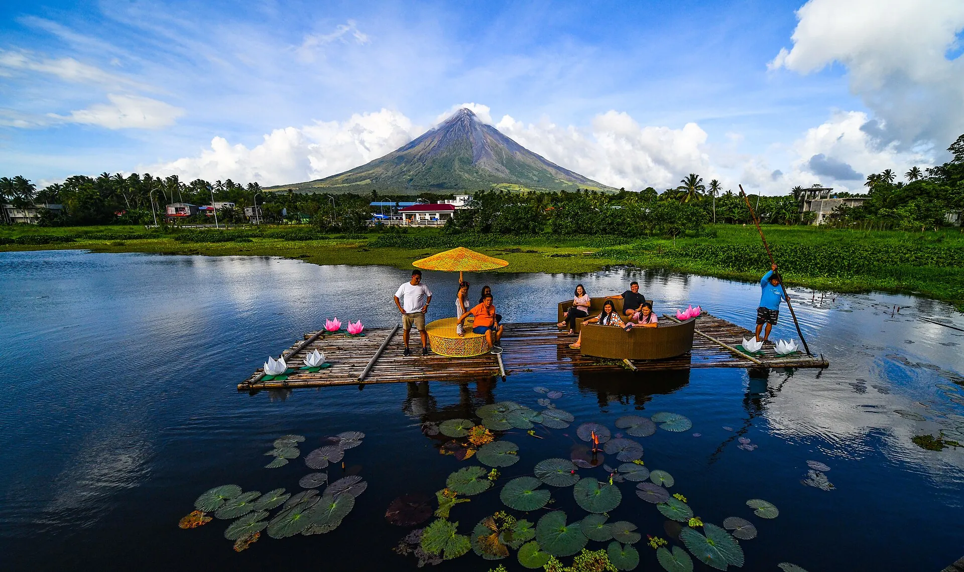
Mayon reflected in the still water of Sumlang Lake near Camalig, bamboo rafts moored at the shore
Sumlang Lake in Camalig: 100 pesos, a bamboo raft, and the mountain stands there twice – as long as there is no wind.

Photo: Ranieljosecastaneda · CC BY-SA 4.0

Good to knowGetting there, best time, ashfall

Getting there

Without a car: Fly to Bicol International Airport (IATA DRP) in Daraga, opened 8 October 2021, about 15 km (9 miles) from Legazpi: Philippine Airlines/PAL Express and Cebu Pacific from Manila (about 47 minutes, from about 1,500 PHP), Cebgo from Cebu and Iloilo (about 1 hour). From the airport, Grab/taxi to Legazpi (about 300 PHP). Bus from Manila (PITX, Cubao, Alabang, Pasay and others) to Legazpi Grand Central Terminal: 339 km (211 miles), 10–13 hours, 1,320 PHP (standard) to 2,700 PHP (sleeper). Locally, jeepneys (Legazpi–Daraga–Guinobatan, Cagsawa junction about 15–25 PHP, then an 8-minute walk), tricycles (80–150 PHP to Cagsawa) and Grab.

By car: Rental car from the airport or Legazpi; Cagsawa Ruins via the Maharlika Highway (AH26) toward Guinobatan, signposted 'Cagsawa Junction'; parking lot at the park (30 PHP per car). Ligñon Hill via the Daraga–Legazpi Diversion Road, with a road up to the platform.

  • From Legazpi City · 15–20 minutes
    Jeepney toward Guinobatan or tricycle to the Cagsawa Ruins
  • From Manila · Flight about 50 minutes (2–3 hours door to door), bus 10–13 hours
    Flight to Daraga (DRP) or bus
  • From Cebu · about 1 hour
    Cebgo flight to Daraga (DRP)

Best time to go

For a clear view of the cone, the drier months of February to May, ideally early in the morning (7–10 am) before clouds hide the peak; travel portals also cite December to May. Bicol lies in a climate zone without a pronounced dry season; most rain falls from November to January, and typhoon season runs from June to December (on average about 20 typhoons a year over the Philippines, according to the German Foreign Office (Auswärtiges Amt)). Typhoon Durian ('Reming') triggered the deadly lahars on 30 November 2006 – during this period, gullies and riverbeds on the volcano are off-limits. At night, at Alert Level 2–3, the crater glow can be seen from Legazpi and Ligñon Hill.

Who it suits

Children
Very good as a sightseeing destination: Cagsawa, Sumlang Lake and Ligñon Hill are flat and short. ATV: Mayon SkyDrive requires a minimum age of 16 to drive; younger children ride as passengers; platform offers list passengers from age 8 on 350 cc machines. During ashfall, keep children indoors and use N95 masks.
Minimum age
ATV driver 16 years (Mayon SkyDrive); passengers from age 8 (platform offer)
Fitness
None needed for the viewpoints. The ATV trails are bumpy (riverbeds, debris from the 2006 lahars) and, according to the operator, not suitable for people with limited mobility. The former summit trek was considered strenuous (2 days, loose volcanic material, steep sections) – in any case prohibited at present.
Heart and lungs
Volcanic ash and SO2 irritate the airways; during ashfall (most recently in May 2026 in Camalig and Daraga), wear a mask and close the windows. The crater glow can be seen at night from a safe distance.
Wheelchair
Cagsawa Ruins Park and Sumlang Lake are at ground level and reachable with assistance; Ligñon Hill has a road to the top. ATV is not possible.
Dogs
no rule published
Clothing
Tropical and humid all year: light, airy clothing, sun protection, rain jacket (Bicol has no true dry season; typhoon season June–December). For ATV: a change of clothes, closed shoes; a helmet is provided. During ashfall, an N95 mask.
Footwear
Sturdy, closed shoes for ATV and the lava fields (sharp-edged rock, mud); sandals are enough for Cagsawa and Ligñon Hill.

Tips you will need on site

  • Before you travel, read the PHIVOLCS daily bulletin (wovodat.phivolcs.dost.gov.ph, daily at 12:00 am) and check the alert level on hazardhunter.georisk.gov.ph – at Level 3 the DOT suspends travel to the surrounding area, and during ashfall the airport in Daraga may close.
  • Photograph the cone early in the morning: from late morning on, the peak is usually in clouds. Cagsawa opens at 6 am, Ligñon Hill at 5 am according to the city.
  • Don't believe any guide who offers a 'sunrise trek' or 'Camp 2': since 2016, trekking has been allowed only with a provincial permit and never to the summit, and the 6 km zone is closed – 5,000 PHP fine, possible prison time, police checkpoints on the trails.
  • Choose an ATV operator with DOT accreditation (Mayon SkyDrive lists its number on its website; Your Brother ATV has been running since 2006) and ask beforehand whether the trail is currently cleared as far as the Lava Wall – that depends on the alert level.
  • Bring cash: admission at Cagsawa and Sumlang Lake and the parking fees are collected in cash; card payment only when booking ATV tours online.
  • At Alert Level 2–3, watch the crater glow at night from Legazpi or Ligñon Hill – in 2026 hoteliers spoke of 'fireworks'; that is the safe way to see the activity.
  • In the rainy and typhoon season (June–December), stay away from riverbeds and gullies on the volcano: PHIVOLCS warns in every bulletin of lahars during heavy rain; in 2006 more than 1,200 people died in them.
  • During ashfall, wear an N95 mask, take out contact lenses, cover water and food – that is what the DOT advises its hotels in Albay; in 2018 the health offices reported mainly respiratory infections.

A short history

  • 1616: First eruption in the written record; since then Mayon has had around 50 to 70 eruptions and is regarded as the most active volcano in the Philippines.
  • 1 February 1814: The most devastating eruption – Cagsawa and neighboring settlements are buried by tephra and lahars, about 1,200 dead (Wikipedia figures range up to 2,000); only the bell tower and remnants of the convent are still standing. The survivors refound Daraga.
  • 1897: Eruption with more than 400 dead, in part from pyroclastic density currents heading toward the coastal settlements.
  • 20 July 1938: Mayon Volcano National Park – the first national park of the Philippines (Proclamation 292); reclassified as a Natural Park on 21 November 2000, enshrined in the ENIPAS Act in 2018.
  • 1984: Major eruption with no fatalities, more than 73,000 people evacuated – evidence that the danger zone and evacuations work.
  • 2 February 1993: Pyroclastic density currents kill 79 people, mostly farmers inside the danger zone on the southeast flank.
  • 30 November 2006: Typhoon Durian ('Reming') mobilizes the material from the 2006 eruption into lahars, at least 1,266 dead in Albay, neighborhoods under 1.5 m (5 ft) of mud – the origin of today's 'Lava Wall' on the ATV trails.
  • 7 May 2013: A phreatic explosion at 8 am at Alert Level 0 kills five climbers about 500 m (1,640 ft) below the summit (four foreigners, including Germans, and the Filipino guide Jerome Berin), seven injured. Governor Salceda announces a permanent climbing ban.
  • 2016: Provincial Ordinance No. 0023-2016 bans summit climbing, requires accredited guides and fixed trails, and prohibits overnight stays in the park; penalty 5,000 PHP and up to one year in prison.
  • 13–22 January 2018: Phreatic explosion, Alert Level 3 (14 January), Level 4 (22 January) with lava fountains; danger zone extended to 8–9 km (5–5.6 miles), up to 86,000 people in evacuation centers (APSEMO); the 8–9 km zone lifted on 3 February 2018.
  • 8 June 2023: Alert Level 3 because of dome growth and rockfall, about 20,000 people evacuated; lowered to Level 2 in December 2023 and to Level 1 in March 2024.
  • 24 April 2024: Illegal 'backdoor' climb by a group of vloggers at Alert Level 1; the province, the NBI and the police investigate, the PTCAO confirms violations of the 2016 ordinance.
  • 1 January 2026: Alert Level 2; 6 January 2026: Alert Level 3 after a dome collapse with pyroclastic density currents in the Bonga gully, evacuation of the 6 km zone (about 3,000 residents), ATV tours beyond Cagsawa halted; 2 May 2026 pyroclastic density currents and ashfall, state of calamity in eight cities/municipalities, Bicol International Airport temporarily closed; peak 11–18 July, lava flows stop 22 July; 5 August 2026 lowered to Alert Level 2.
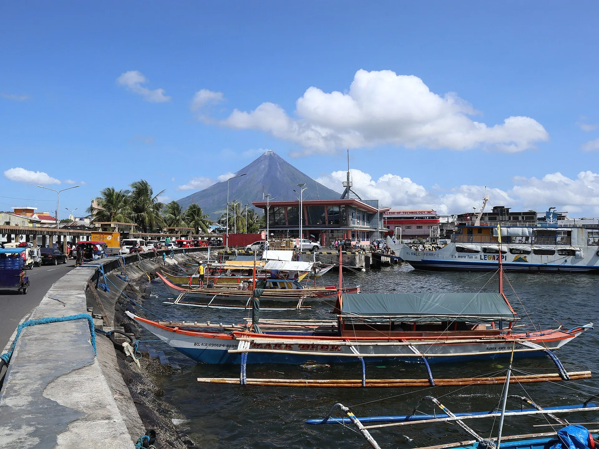
Mayon above the port of Legazpi, fishing boats and a quay wall in the foreground, the summit in thin cloud
From the port in Legazpi it stands over the city as if it had been placed there. Manila is 339 km (211 miles) away.

Photo: Patrickroque01 · CC BY-SA 4.0

On the lava fieldsATV tours at Mayon – the honest status

The quad tours are the best-selling experience in Albay, and they stay outside the 6 km zone. Their status is nevertheless open at the moment: on 6 January 2026 the province stopped all rides beyond the Cagsawa Ruins, and in May 2026 the Black Lava Trail, the Green Lava Trail and Mayon Skyline were closed. Since the downgrade to Alert Level 2 on 5 August 2026 neither the province nor the provincial safety office nor the tourism department has published a clearance that can be retrieved. In other words: the tours are on sale, but official clearance for the full route is not documented. Ask the operator how far they are allowed to ride right now – and pick one with tourism department accreditation.

Affiliate links to GetYourGuide: if you book, we earn a commission and the price stays the same. Prices and ratings as of 22.09.2026. Two or three reviews per tour is no basis for a ranking, which is why nothing here is marked as most booked. Operators at the Cagsawa park also take walk-ins; booking online usually costs more than the 1,700 to 3,400 pesos of the vehicle rental, but includes transfer and guide.

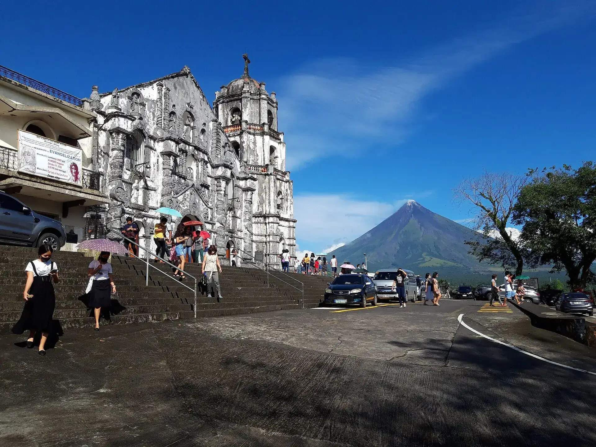
The white baroque church of Daraga on its hill, with the cone of Mayon behind it under a blue sky
Daraga Church, built in 1773 by the refugees from Cagsawa. A National Cultural Treasure since 2007 – and the second best foreground in the province.

Photo: Eugene Alvin Villar (seav) · CC BY-SA 4.0

Out of date onlineWhat other sites get wrong

“You can climb Mayon in two days via Camp 1 and Camp 2.”
Not any more. Provincial Ordinance 0023-2016 bans the summit climb and overnight stays in the park, and the whole route lies inside the 6 km danger zone. In 2024 the province even pursued a climb made at Alert Level 1.
“At Alert Level 0 or 1 you may hike on Mayon.”
The PHIVOLCS scale states for Level 0 that the danger zone should not be entered – phreatic explosions come without warning. One of them killed five climbers at Level 0 on 7 May 2013.
“The danger zone is 4 km.”
Four kilometers applies to Bulusan. Mayon has a 6 km (3.7 mile) Permanent Danger Zone; at Level 2 it can grow to 7 km in the south and southeast sector, at Level 4 to 8 km or more.
“After the 2026 eruption Mayon is quiet again.”
Alert Level 2 means moderate unrest, not normal. PHIVOLCS warned on 1 and 4 September 2026 of SO₂ readings above 7,000 and 8,000 tonnes a day and a possible return of the eruption; the bulletin of 22 September 2026 still reports crater glow and ash emission.
“Cagsawa costs 20 pesos.”
That was the figure in travel reports from 2019. Current private information sites give 45 PHP for adults, 30 PHP for seniors and 10 PHP for children. The town of Daraga has no official price list online.

Quick questionsBefore you travel to Albay

Can you climb Mayon Volcano?

No. Albay province has banned the summit climb outright since 2016, and the whole route lies inside the 6 km danger zone that PHIVOLCS keeps closed at every alert level. Trekking in the park would need a provincial permit, and none is issued at Alert Level 2.

Where is the best view of Mayon?

From the Cagsawa Ruins in Daraga (tower in the foreground), from Ligñon Hill in Legazpi (panorama, plus the crater glow at night), from Sumlang Lake in Camalig (reflection) and from Daraga Church. All four are far outside the danger zone.

Is a tour from Manila worth it?

Not as a day trip: 339 km (211 miles), 10 to 13 hours by bus. The sensible option is the flight to Daraga (Bicol International Airport, about 50 minutes) and at least one night in Legazpi – if only because the cone is clear of cloud only early in the morning.

Are the ATV tours at Mayon allowed?

The trails lie outside the 6 km zone, but the province stopped them in January 2026 and closed them in May 2026. No clearance under Alert Level 2 has been published. Check with the operator how far they may ride before you book.

Is a visit safe at Alert Level 2?

Outside the danger zone the risk is low as long as you follow the daily bulletin and watch for ashfall. If ash falls, wear an N95 mask, close windows and cover food; in the rainy season stay out of river beds and gullies because of lahars.

Is Mayon currently open? What is the alert level?

As of 22 September 2026, Mayon is at PHIVOLCS Alert Level 2 (moderate unrest, activity declining) – since it was lowered from Level 3 on 5 August 2026. The 6 km (3.7 mile) danger zone around the crater remains closed, and flights over the volcano are prohibited. Everything outside it – Cagsawa, Ligñon Hill, Sumlang Lake, Legazpi – is accessible as normal; ask the operator whether the ATV trails to the Lava Wall have been cleared again.

How much does a visit to Mayon cost?

The volcano itself costs nothing. Cagsawa Ruins Park: 45 PHP adults, 10 PHP children (private figures, 2025/2026). Sumlang Lake: 100 PHP plus a 20 PHP environmental fee. Ligñon Hill: free according to the city, blogs cite 20–25 PHP. ATV to the Lava Wall from 1,700 PHP for a single-seater, or 2,200 PHP in a package with transfer.

Can you visit Mayon without a guide?

The viewpoints, yes – Cagsawa, Ligñon Hill, Sumlang Lake and Daraga Church are visited on your own. Not the terrain on the volcano: under the ordinance, trekking requires DOT-accredited guides, and no one may enter the 6 km zone even with a guide.

Are the ATV tours to the Lava Wall allowed?

That depends on the alert level. On 6 January 2026 (Alert Level 3), the province halted all ATV rides beyond the Cagsawa Ruins; in May 2026 the Black Lava Trail, Green Lava Trail and Mayon Skyline were closed. Level 2 has applied since 5 August 2026 – no official clearance of the trails has been published, so ask the operator before booking. Mayon SkyDrive suspends operations during volcanic activity and typhoons.

How long does a visit take?

Half a day is enough for the Cagsawa Ruins and an ATV tour (1.5–2.5 hours of riding, 4 hours as a package). Add Sumlang Lake, Daraga Church and Ligñon Hill and it becomes a full day. The former summit trek took two days – currently prohibited.

Is Mayon suitable for children?

As a day trip, yes: the viewpoints are short and flat. At Mayon SkyDrive, only those aged 16 and over may drive an ATV themselves; younger children ride along; platform offers take passengers from age 8. During ashfall, children belong indoors.

What should you wear?

Light clothing, sun protection and a rain jacket – Bicol is humid all year, and June to December is typhoon season. For ATV, sturdy shoes and a change of clothes; the operator provides a helmet. During ash, an N95 mask.

How do you get to Mayon?

Fly to Bicol International Airport in Daraga (DRP) from Manila (about 50 minutes, PAL/Cebu Pacific) or from Cebu/Iloilo (Cebgo), then Grab to Legazpi (about 300 PHP). Alternatively, bus from Manila, 10–13 hours, from around 1,300 PHP. From Legazpi to the Cagsawa Ruins by jeepney toward Guinobatan or by tricycle, 15–20 minutes.

Is Mayon dangerous?

Outside the 6 km zone the risk is low, as long as you pay attention to the alert level and ashfall. What is dangerous: the danger zone (phreatic explosions without warning – five dead at Alert Level 0 in 2013), pyroclastic density currents in the gullies, and lahars during heavy rain (more than 1,200 dead in 2006). At Level 3 the DOT advises against non-essential travel to the surrounding area.

When can you see the cone without clouds?

Most likely early in the morning (7–10 am) in the months of February to May. In the afternoon and during the rainy season the peak is usually hidden; at Alert Level 2–3 the crater glow can be seen at night from Ligñon Hill.

When was Mayon's last eruption?

From January to July 2026: an effusive eruption with lava flows and pyroclastic density currents, ashfall on 2 May 2026, peak in mid-July, lava came to a halt on 22 July, lowered to Level 2 on 5 August 2026. Before that, 2023/24 (Alert Level 3 from 8 June 2023) and 2018 (Alert Level 4 on 22 January 2018, with up to 86,000 evacuated).
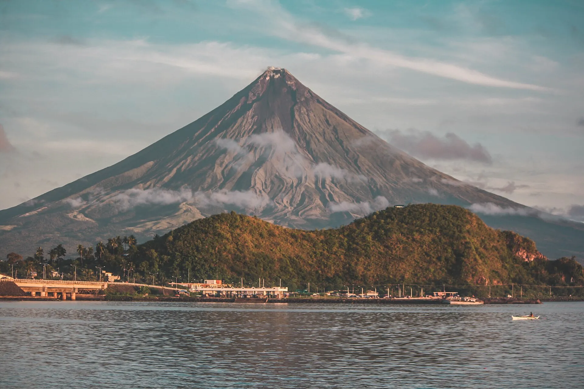
Mayon behind a long forested ridge that looks like a lying lion
In Albay the ridge in front is called the sleeping lion. The mountain behind it is not asleep.

Photo: Chrizluminario · CC BY-SA 4.0

Sources · accessed on 22.09.2026