Volcano·Guide
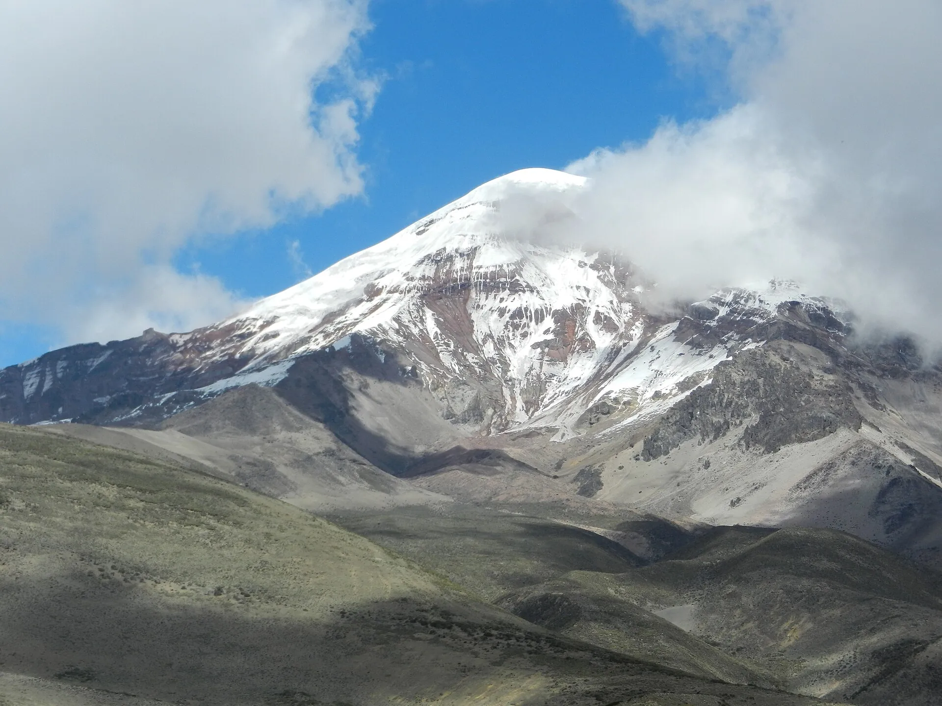
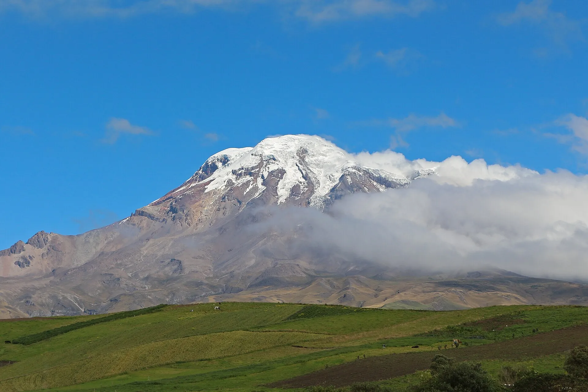
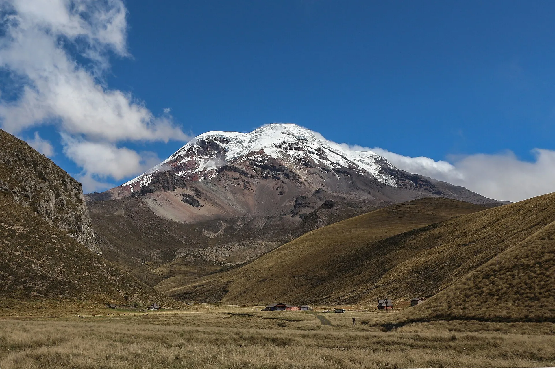
The glaciated Chimborazo behind green fields, clouds clinging to its flank The El Arenal plateau with páramo grass and the access road to Chimborazo, the summit in the background The summit of Chimborazo up close: snow, ice and dark rock ribs under clouds

Chimborazo

From Riobamba it is simply a big white mountain above the fields.

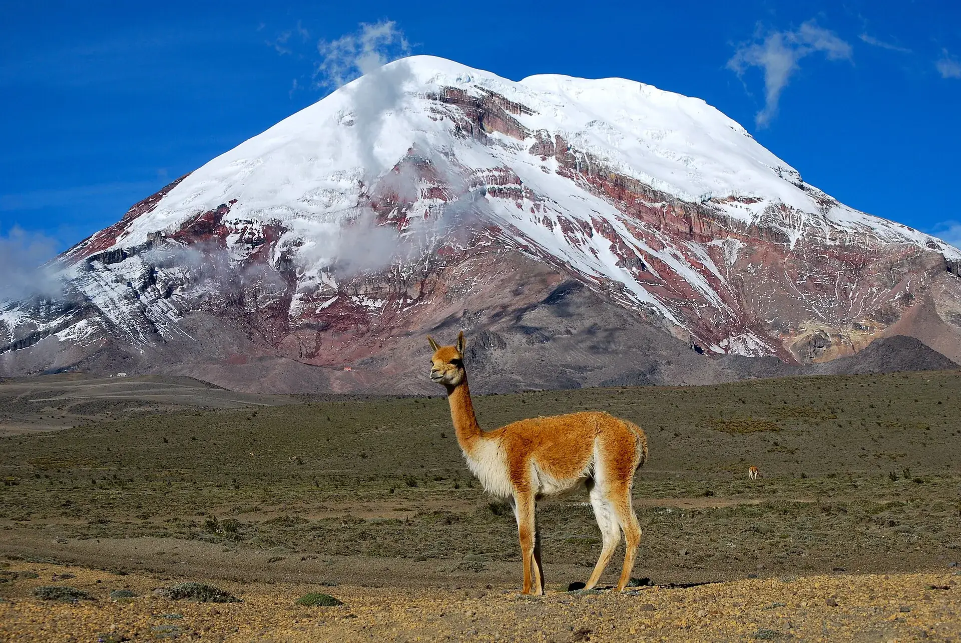
In the Arenal, at 4,300 meters, the landscape turns to desert – and the vicuñas look back at you.

At the Carrel refuge, 4,850 m, the road ends. Above: ice, rockfall, and the point closest to outer space.

Scroll –
up into the reserve

As of September 22, 2026Chimborazo today: reserve open, entry free, summit with a guide

The Reserva de Producción de Fauna Chimborazo is open, the Hermanos Carrel refuge at 4,850 m (15,912 ft) can be reached by car, and anyone may hike to Laguna Cóndor Cocha at 5,100 m (16,732 ft) without a guide. Entry is free – anyone demanding money at the gate is acting without authorization, according to the environment ministry. The glacier and the summit require a certified mountain guide. The volcano itself has been dormant since the first millennium.

Open, by car
4,850m

Reserve and Hermanos Carrel refuge

Register with your name and ID at the El Arenal checkpoint, then 8 km (5 miles) of gravel to the parking lot at the refuge – Ecuador's highest refuge parking lot. Cafeteria, restrooms, 52 beds. Daily 8 a.m. to 4 p.m.

Entry free for everyone since 2012$0
Open, no guide needed
5,100m

Whymper refuge and Laguna Cóndor Cocha

From the Carrel refuge about 1 km and 45 minutes on foot to the closed Whymper refuge (approx. 5,000 m), another 500 m to the lagoon. A guide is mandatory only for groups of 16 or more. Above 5,000 m – acclimatized visitors only.

Whymper hut permanently closed
Guide required
6,263m

Glacier and summit

Above the lagoon the glacier and rockfall terrain begins. Summit climbs go only with an ASEGUIM/IFMGA guide, two clients per guide, departing around 10 to 11 p.m. from the Carrel refuge or the high camp at 5,300 m.

two-day guided climb, operatorsfrom about $400
Sources: Ministerio de Ambiente y Energía (statements in 2025 to La Prensa/Expreso: free entry, guide only from 16 people; complaint filed over unauthorized fees, August 2025) · GAD Municipal Riobamba (opening hours, refuges) · IG-EPN volcano page igepn.edu.ec/chimborazo: no activity level, no SNGR alert. No closure notice as of September 22, 2026.
A vicuña standing in the páramo in front of the snow-covered Chimborazo under a deep blue sky
Reintroduced in 1988 with 200 animals, today estimated at more than 8,000: the vicuñas belong to Chimborazo as much as the ice does.

Photo: David Torres Costales · CC BY-SA 3.0

The experienceBy car to 4,850 meters – and on foot past 5,000

Chimborazo is the only mountain in Ecuador where a car takes you higher than the summit of Mont Blanc. From the parking lot at the Carrel refuge a short trail crosses the 5,000-meter mark – no guide, no fee, but you feel it with every breath.

The access road from the Riobamba–Guaranda highway runs eight kilometers through the Arenal, a sand desert at 4,300 m (14,100 ft). This is vicuña country: reintroduced in 1988 with 200 animals from Chile and Peru, 6,743 counted in 2018, more than 8,000 estimated today. You see them from the car, almost guaranteed, most active in the morning and late afternoon.

The road ends at the Hermanos Carrel refuge. 4,850 m, a cafeteria, a view of the glaciers, and 0 to 12 °C (32–54 °F) with wind and often fog. The trail to the Whymper refuge is only a kilometer long, but it climbs past 5,000 m (16,400 ft) – 45 minutes in which you become very slow. The hut has been closed for years and is decaying; the small Laguna Cóndor Cocha 500 m farther on at 5,100 m is the goal for everyone without a guide.

Above that another world begins: glacier, rockfall, the El Castillo ridge. What looks like a dome from below is a two-day climb with a night ascent and at least a week of acclimatization. And at the very top, at 6,263 m (20,548 ft), the point on the Earth's surface farthest from the center of the planet.

Affiliate links to GetYourGuide: if you book, we earn a commission and the price stays the same. Prices and ratings as of 22 September 2026. The tour market at Chimborazo is small and young – a handful of reviews says little about quality, only about demand. Summit climbs are booked directly with operators using ASEGUIM guides.

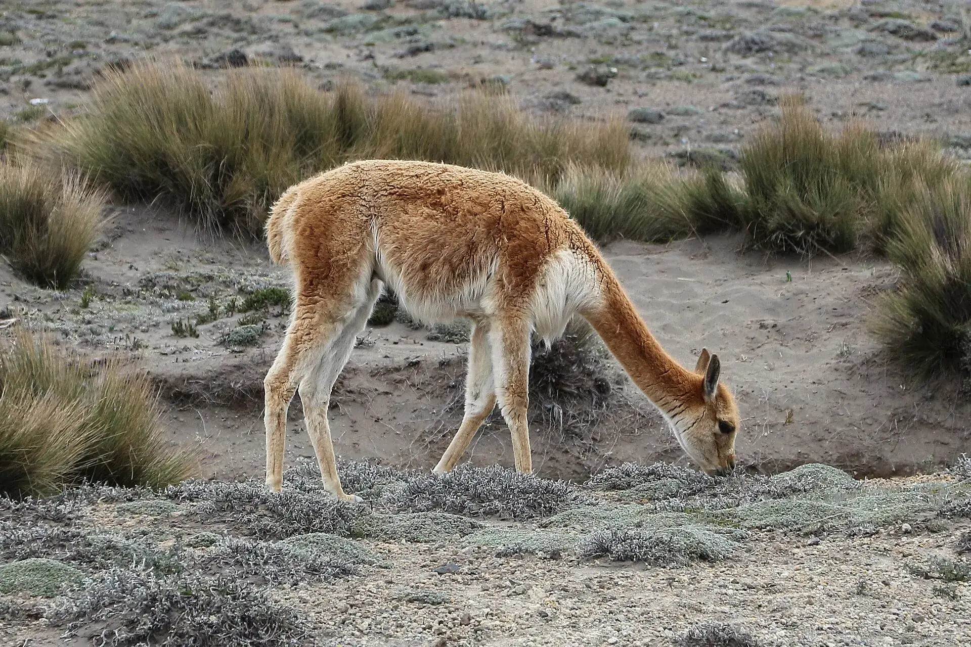
A vicuña grazing between tufts of grass on the sandy ground of the Chimborazo reserve
The Arenal is pasture and desert at once. Keep your distance, do not feed them – feral dogs are the herd's bigger problem.

Photo: Bernard Gagnon · CC BY-SA 3.0

The rulesFree to 5,100 m, guide from the glacier – and no fee at the gate

The rules at Chimborazo are simple, but they are not always respected at the gate: in 2025 people demanded up to $45 for “guiding” or “entry”. The ministry filed a criminal complaint. What actually applies:

1

Registration, no entry fee

At the El Arenal checkpoint you write down your name and ID number. That is it. All of Ecuador's mainland protected areas have been free since 2012 – for locals and foreigners.

2

Money at the gate: decline

Anyone selling “entry” or a “mandatory guide” is not authorized, according to the ministry. Decline politely, register, drive on. What is legitimate: community transport from the checkpoint to the refuge ($25–35 per vehicle) if you have no car of your own.

3

Guide: only from 16 people – and on the glacier

Below Laguna Cóndor Cocha a guide is mandatory only for groups of 16 or more. The Riobamba municipality recommends a nature guide because of fog but does not require one. For the glacier and the summit: certified ASEGUIM/IFMGA guide, two clients per guide.

4

Carrel refuge and high camp

52 beds, reservations via refugioschimborazo@gmail.com or phone 0979084401; according to portals about $15 for a bed, about $30 with meals. The private high camp at 5,300 m is available only through operators. The Whymper refuge is closed.

Official prices · as of 09/2026
Entry to the Reserva de Producción de Fauna Chimborazo, Ecuadorians and foreigners alike (Acuerdo Ministerial 006/2012)free
Registration at the checkpoint (name, ID number)free, mandatory
Hermanos Carrel refuge: bed (portals, not official)approx. $15
Hermanos Carrel refuge: bed with meals (portals, not official)approx. $30
Community transport checkpoint – refuge, per vehicle (not official)$25–35
“Guiding” by people at the gate (up to $45) – unauthorized according to the ministrydo not pay
Sources: La Prensa (Riobamba) and Expreso, 2025, quoting the Ministerio de Ambiente y Energía · the ministry's instructivo for mid- and high-mountain activities in protected areas (October 2020, via press and operators) · GAD Municipal Riobamba (riobamba.com.ec) · Acuerdo Ministerial 006/2012. Refuge and transport prices come from portals and the press, not from the operator. Ecuador uses the US dollar.
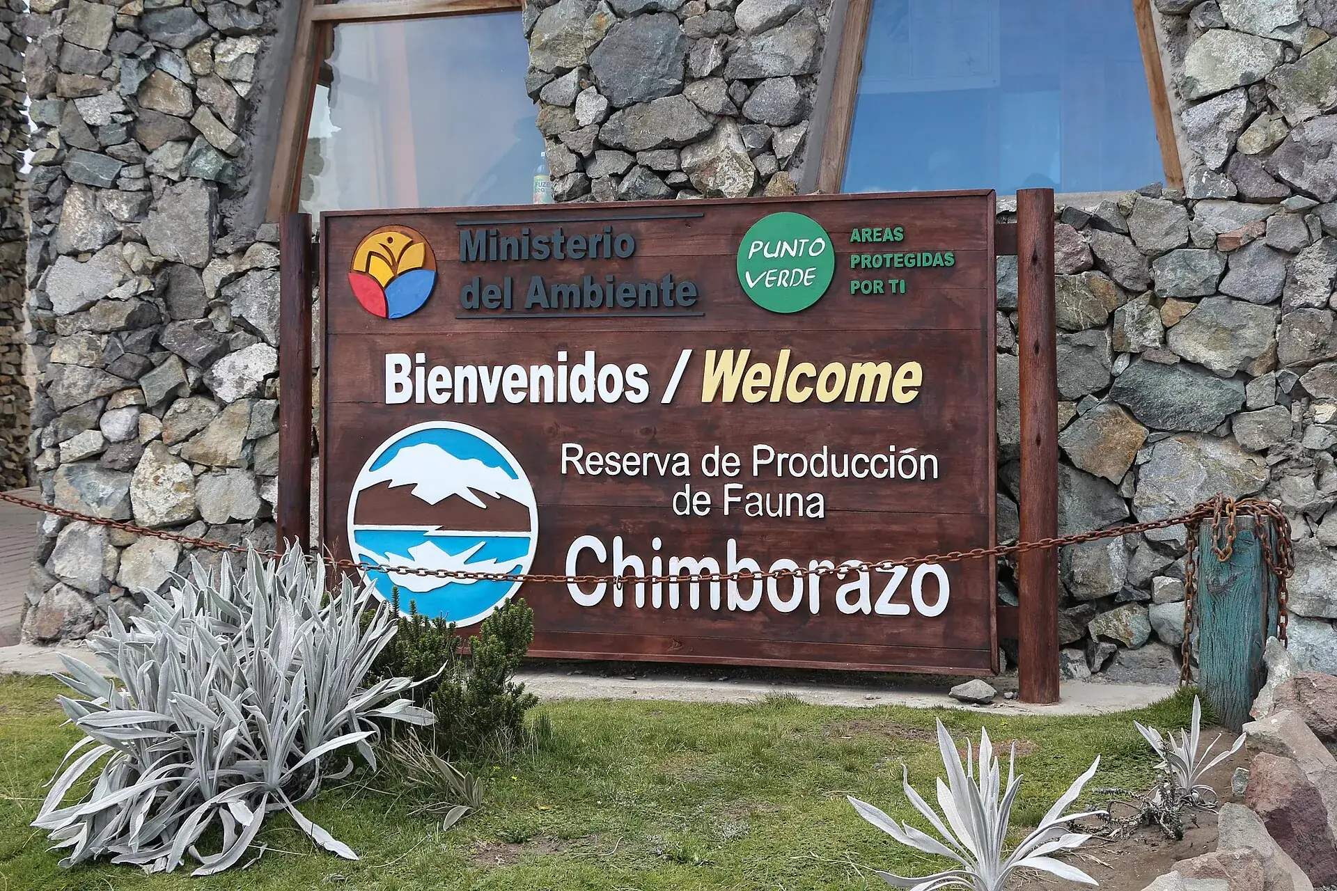
The environment ministry's welcome sign of the Reserva de Producción de Fauna Chimborazo on a stone wall
“Bienvenidos / Welcome” – the ministry's sign at the gate. What applies here: write your name down. What does not: a cash desk.

Photo: Bernard Gagnon · CC BY-SA 3.0

Ways upFrom the Arenal to the Whymper summit

Stages on Chimborazo · as of 09/2026
Road El Arenal (4,300 m / 14,100 ft) – Hermanos Carrel refuge (4,850 m / 15,912 ft)8 km (5 miles) of gravel, 15–20 minutes by car, about 2 hours on foot through vicuña country. Free; community transport $25–35 per vehicle. 8 a.m. to 4 p.m. Snow on the road possible.
Trail Carrel refuge – Whymper refuge (approx. 5,000 m / 16,400 ft) – Laguna Cóndor Cocha (5,100 m / 16,732 ft)About 1 km and 45 minutes to Whymper, another 500 m to the lagoon, 30 minutes back. No guide needed, free. Scree and snow, acclimatized visitors only.
Normal route Arista Occidental / El Castillo – Cumbre Veintimilla – Cumbre Whymper (6,263 m / 20,548 ft)Departure 10–11 p.m. from the Carrel refuge or the high camp (5,300 m); 8–12 hours of ascent, about 5 of them on the glacier; from Veintimilla another hour to the main summit if the snow holds; 3–5 hours down. ASEGUIM/IFMGA guide only, from about $400–600.
Mountain-bike descents Carrel refuge – Talahua / Cruz del Arenal – Yurak Uksha1–3 hours on cycling routes designated by the ministry, 1,000 m (3,300 ft) of descent. Operators from Riobamba from about $45 including transport. Helmet.
The ASEGUIM guides abandoned the old normal route past the Whymper refuge (“El Corredor”) in 2019 because of rockfall. Glacier retreat keeps changing the route and its difficulty; hence the night ascent. On October 24, 2021, six climbers died in an avalanche at about 6,100 m. Best windows: December/January and June/July.
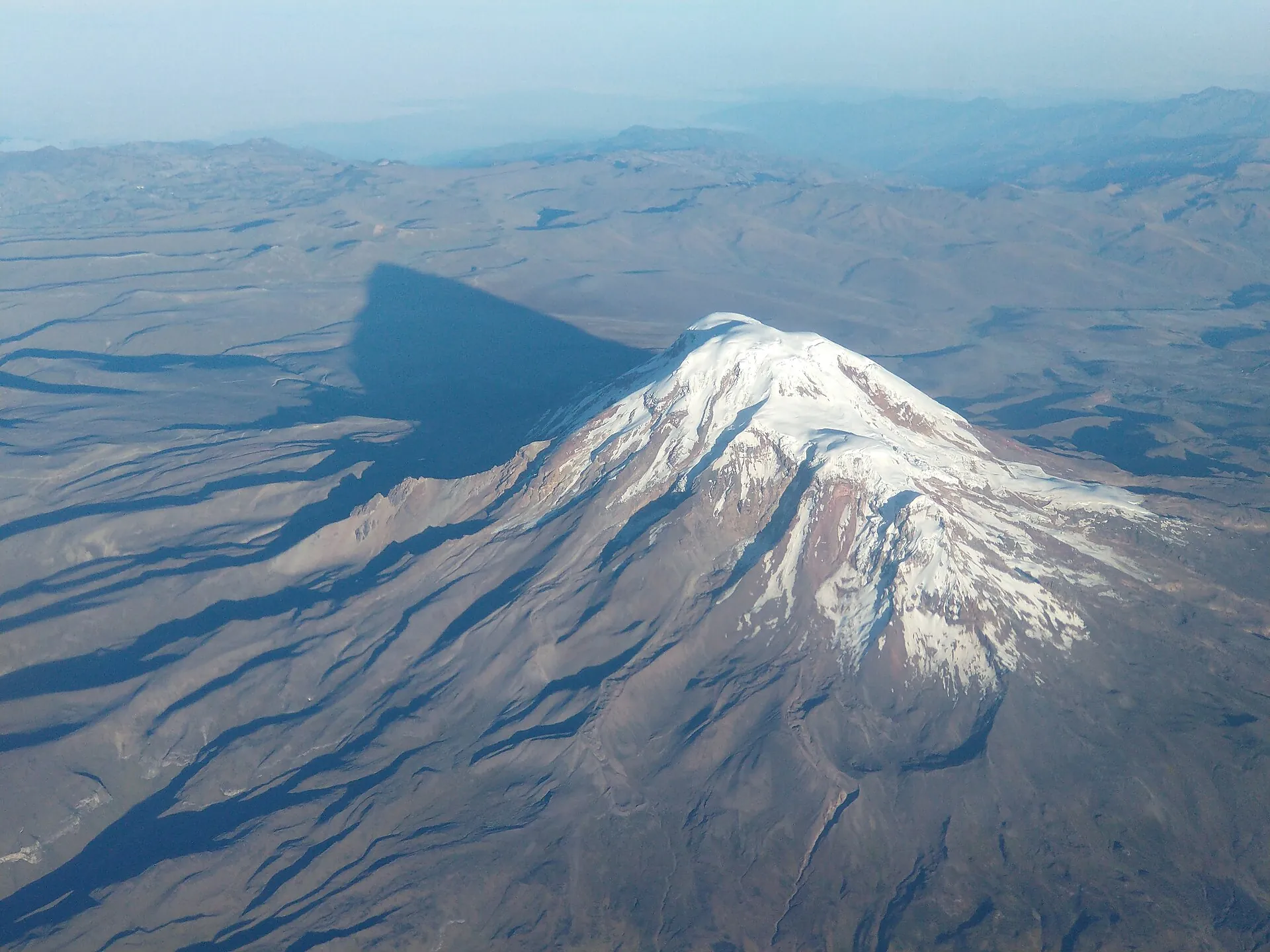
Chimborazo from the air: the glaciated summit dome casts a long shadow across the brown plateau
From above you can see why: the mountain sits almost on the equator, on the bulge of the Earth – and so reaches farther into space than Everest.

Photo: Morgen Mills · CC BY-SA 4.0

Only hereThe point farthest from the center of the Earth

The Earth is not a sphere: at the equator it is about 21 km (13 miles) thicker than at the poles. Chimborazo stands 1.5 degrees south of the equator, Everest almost 28 degrees north. That is why the summit of Chimborazo lies farther from the Earth's center than any other point on the planet's surface – measured, not estimated.

6,263m above sea level

Chimborazo

Distance from the Earth's center: 6,384,415.98 m (± 3 m). Measured by GPS on the summit on February 5, 2016 by a Franco-Ecuadorian mission of the IGM, IRD and IG-EPN – 280 years after the first French geodesic mission of 1735.

Elevation above sea level: 6,263.47 m (20,548 ft)
8,849m above sea level

Mount Everest

2,586 m (8,484 ft) higher above sea level – but about 2.1 km (1.3 miles) closer to the Earth's center. Whoever stands on Chimborazo is closer to outer space than any Everest climber. In 1802 Humboldt still believed Chimborazo to be the highest mountain in the world.

From the Earth's center: about 2.1 km less
Sources: IG-EPN, report on the GPS mission of February 5, 2016 · Ecuadorian Armed Forces, April 7, 2016 (result 6,384,415.98 m ± 3 m; page unreachable on September 22, 2026, figures from the press) · Wikipedia EN. The older elevation of 6,310 m found on many sites is outdated.
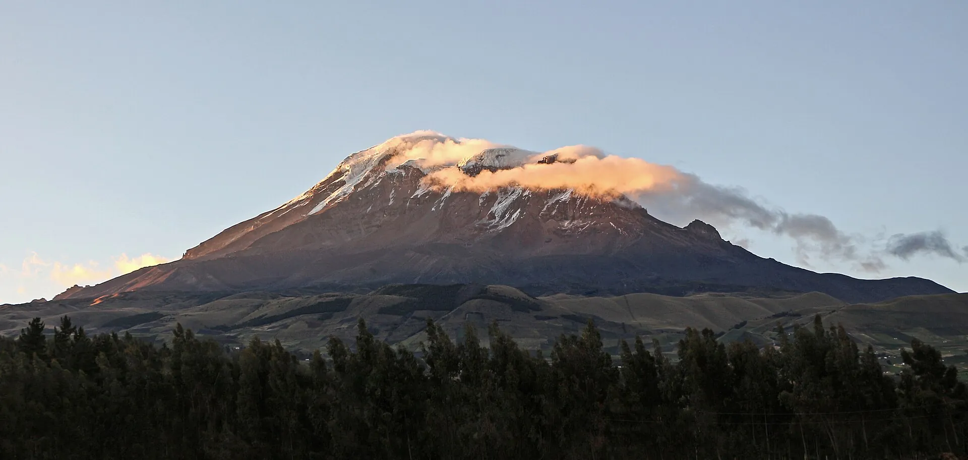
The summit of Chimborazo in pink evening light above dark forests, the rest of the mountain already in shadow
Evening light on the summit: to see the mountain, come early or stay until the end – at midday it usually hides in cloud.

Photo: Bernard Gagnon · CC BY-SA 3.0

Good to knowGetting to Chimborazo, best time, altitude, tips

Getting there

Without a car: From the Riobamba terminal, bus toward Guaranda, get off at the turnoff to the reserve (km 44/45); from there 8 km to the refuge – community vehicles $25–35 per car or about 2 hours on foot. More practical are tours or pickups from Riobamba (day logistics with refuge visit from about $45 per person).

By car: From Riobamba via Calpi and San Juan on the road to Guaranda (E491) to the El Arenal turnoff, then 8 km of gravel to the parking lot at the Carrel refuge (4,850 m). Also reachable from Ambato via the Ambato–Guaranda road. The province plans to rehabilitate the 41 km Calpi–San Juan–El Arenal from 2026; until then the road surface is poor. Parking at the refuge is free.

  • From Riobamba · 1.5–2 hours to the Carrel refuge
    Riobamba–Guaranda road to km 44/45, El Arenal turnoff, 8 km of gravel
  • From Ambato · about 1.5 hours
    Ambato–Guaranda road, turnoff to the reserve
  • From Quito · 3.5–4 hours
    Pan-American Highway to Ambato or Riobamba, then toward Guaranda

Best time to go

Drier windows December–January and June–September; February to May is the wettest. For a view of the summit come early in the day – according to the press the 11 a.m.–2 p.m. window is the most reliable, while mountain guides swear by early morning; fog from the afternoon on. Vicuñas can be seen year-round along the access road in the Arenal.

Who it suits

Children
The drive to the Carrel refuge and vicuña watching are family-friendly; the trail to the Whymper refuge climbs past 5,000 m (16,400 ft) – only with acclimatized children who like walking, and turn back immediately if they feel unwell. Summit: operators usually require an age of 18 (not official).
Minimum age
none official for the reserve and refuges; summit from 18 according to operators
Fitness
Refuge loop: short, but at 4,850–5,100 m. Summit: very strenuous, 8–12 hours, 1,400 m (4,600 ft) of climbing above 4,850 m, crampon and rope experience; the success rate rises with the high camp.
Altitude
The parking lot sits at 4,850 m (15,912 ft) – higher than Mont Blanc. Coming from Riobamba (2,750 m / 9,020 ft) or Guayaquil, you risk headache and nausea; walk slowly, drink plenty, drive down if symptoms appear. Summit only after at least a week of acclimatization (e.g. Cotopaxi, Iliniza, Carihuairazo).
Heart and lungs
With heart, lung or circulatory problems get medical clearance; at the Whymper refuge the partial pressure of oxygen is about 52 % of sea level. Volcanic gases play no role on Chimborazo.
Wheelchair
The road goes to the Carrel refuge; there are a cafeteria, restrooms and the view – trails beyond are not passable.
Dogs
No reserve rule found; in Cotopaxi National Park pets are banned, and in the Chimborazo area feral dogs endanger the vicuñas – better leave dogs at home.
Clothing
Warm and windproof even for the refuge visit: temperatures 0–12 °C (32–54 °F), frequent rain and fog (Primicias). Hat, gloves, sunglasses and sunscreen (UV at 5,000 m). Summit: full glacier equipment (down jacket, helmet, crampons, ice axe, harness), provided by the operator.
Footwear
Sturdy hiking boots to Whymper/Cóndor Cocha (scree, snow); summit: crampon-compatible mountaineering boots.

Tips you will need on site

  • The reserve is free: anyone demanding money for 'entry' or a 'mandatory guide' at the gate is acting without authorization according to the ministry – decline politely, just register.
  • Leave early and walk slowly at 4,850 m; the trail to the Whymper refuge is short, but every meter above 5,000 m counts.
  • For the summit, book only operators with ASEGUIM/IFMGA guides, two clients per guide and access to the high camp – the Whymper hut is closed and the old route is exposed to rockfall.
  • Acclimatize for at least a week (Cotopaxi or Iliniza beforehand) – Chimborazo is Ecuador's highest mountain and no beginner's summit.
  • Warm clothes even for the 'car tour': 0–12 °C, wind and fog are normal at the refuge.
  • Watch the vicuñas only from the trail or the car; feral dogs and farming already put pressure on the population.
  • Cash in small bills for community transport, the cafeteria and the refuge; cards do not work.
  • Check the reserve administration's current notices on Instagram (@rpfchimborazo) and the status of nearby Sangay (ashfall in the province) with the IG-EPN.

A short history

  • Last eruption between the 5th and 7th century AD; with an average interval of about 1,000 years between eruptions, the volcano is considered potentially active (IG-EPN).
  • 1802: Alexander von Humboldt and Aimé Bonpland reach about 5,900 m – a world altitude record at the time; Humboldt believed Chimborazo to be the highest mountain in the world.
  • January 4, 1880: first ascent by Edward Whymper with the mountain guides Jean-Antoine and Louis Carrel – namesakes of the two refuges and the main summit.
  • October 26, 1987: the Reserva de Producción de Fauna Chimborazo is established (Acuerdo Ministerial 437); 1988 reintroduction of 200 vicuñas from Chile and Peru.
  • February 5, 2016: a Franco-Ecuadorian mission (IGM, IRD, IG-EPN) measures by GPS on the summit: 6,263.47 m above sea level, 6,384,415.98 m (±3 m) from the Earth's center – confirmation as the point farthest from the Earth's center, 280 years after the first French geodesic mission of 1735.
  • 2019: ASEGUIM guides abandon the old normal route via the Whymper refuge ('El Corredor') because of rockfall; today Arista Occidental / El Castillo with a high camp at 5,300 m.
  • October 24, 2021: an avalanche at about 6,100 m hits a group of 16; six dead (three recovered, three missing), reserve closed until October 30, 2021.
  • April 14, 2022: reopening of the Hermanos Carrel refuge after two years; handover to the GAD Riobamba and the community pre-cooperative.
  • August 2025: the ministry files a complaint for extortion after reports of unauthorized 'guiding fees' of up to $45 at the gate.
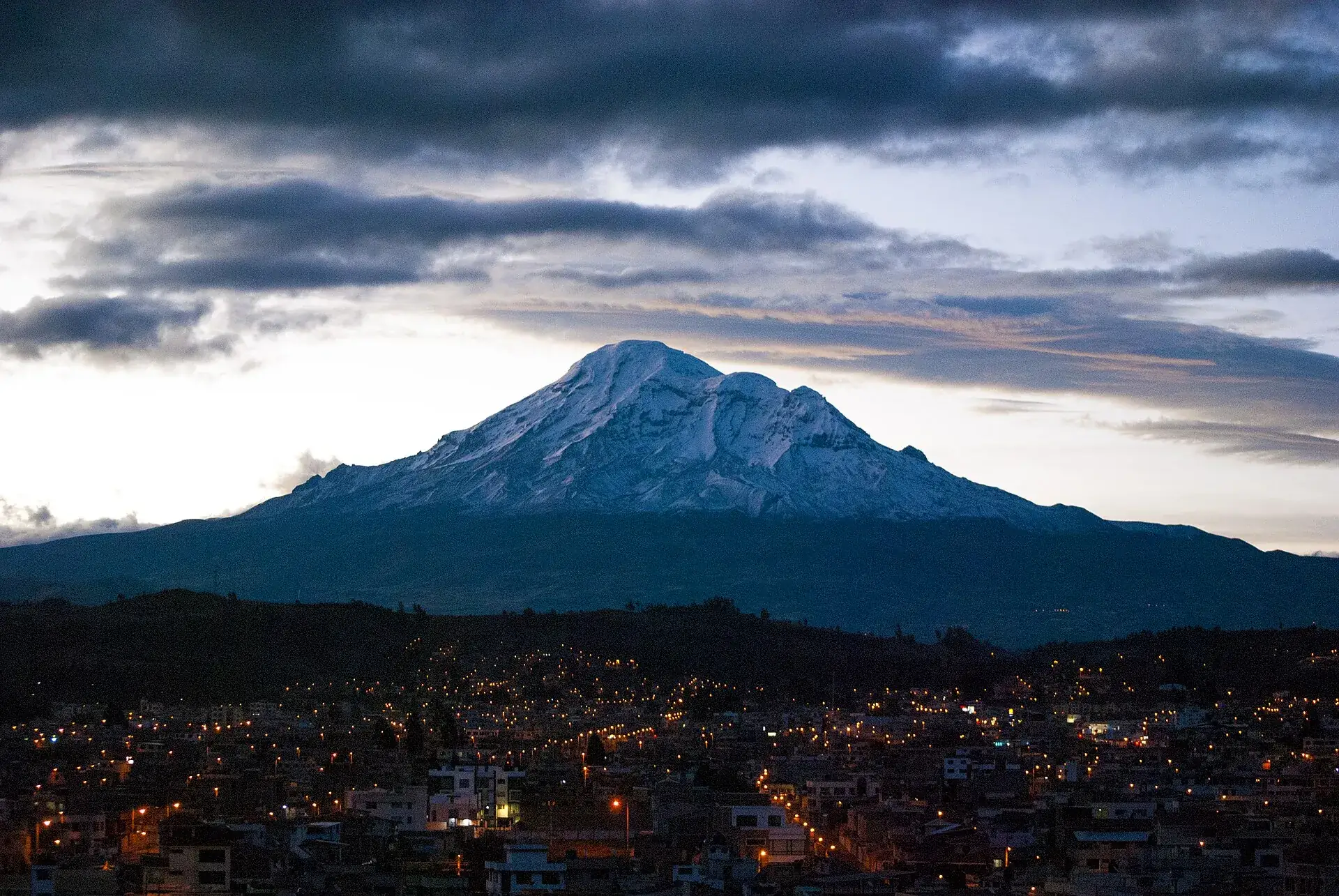
Chimborazo at dusk above the lights of Riobamba, dark clouds in the sky
Riobamba, 2,750 m (9,020 ft): the city at the foot of the mountain, with operators, guide offices and the best view of the Avenue of the Volcanoes.

Photo: David Torres Costales · CC BY-SA 4.0

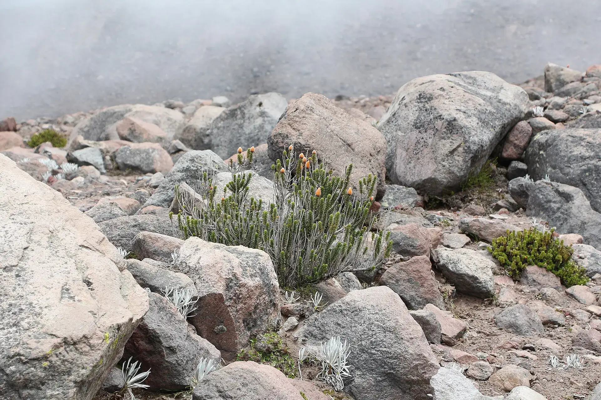
Chuquiraga shrubs with orange flowers between pale rocks on Chimborazo, fog behind
Chuquiraga, the “flower of the Andes”, grows here above 4,000 m – the páramo is alive, even if it looks like a moonscape.

Photo: Bernard Gagnon · CC BY-SA 3.0

Outdated onlineWhat other sites get wrong

“Chimborazo is the highest mountain in the world.”
Measured from the Earth's center, yes (6,384,415.98 m, IGM/IRD 2016); above sea level, at 6,263 m, it is far behind Everest (8,849 m). Many sites mix the two up.
“Elevation 6,310 m.”
Outdated. The GPS measurement of February 5, 2016 gave 6,263.47 m; the IG-EPN and Wikipedia EN list 6,263 m.
“Entry $10, guide mandatory from the parking lot.”
Entry has been free since 2012; according to the ministry a guide is mandatory only for groups of 16 or more and for the summit. The “fees” at the gate were the subject of an extortion complaint in 2025.
“You sleep at the Whymper refuge at 5,000 m.”
The Whymper refuge has been closed and decaying for years. Summit climbs start from the Carrel refuge or the private high camp at 5,300 m.
“Chimborazo is extinct.”
The IG-EPN lists it as potentially active: last eruption in the first millennium, average interval between eruptions about 1,000 years. There is currently no activity level.

Quick answersBefore you drive into the reserve

Can you visit Chimborazo without mountaineering experience?

Yes. By car you reach the Carrel refuge at 4,850 m, and on foot it is 45 minutes to the Whymper refuge and Laguna Cóndor Cocha at 5,100 m – no guide, no fee. Only the glacier requires mountaineering experience.

Do you have to pay to enter Chimborazo?

No. Like all of Ecuador's mainland protected areas, the reserve has been free since 2012; there is only the registration at the checkpoint. Anyone demanding money there for “entry” or “mandatory guiding” is not authorized, according to the ministry.

How high can you drive?

To the parking lot at the Hermanos Carrel refuge at 4,850 m (15,912 ft) – higher than Mont Blanc. 8 km of gravel from the El Arenal checkpoint, 15 to 20 minutes. Without your own car, community vehicles run for $25–35 per vehicle.

Do you need a permit for the summit?

The operator registers summit climbs with the reserve administration and provides the certified guide; a formal quota like at Cotopaxi is not documented for Chimborazo. Without an ASEGUIM/IFMGA guide it is not possible.

Is the trip worth it if the summit is in cloud?

Yes – you almost always see the vicuñas in the Arenal, and the walk past 5,000 m is an experience in itself. For a view of the summit, come early; according to the press the 11 a.m. to 2 p.m. window is the most reliable, while mountain guides swear by early morning.

Is Chimborazo open right now?

Yes, as of September 22, 2026, the reserve, the Carrel refuge and the summit route are open; there is no alert level and no closure notice. The volcano itself has been quiet since the first millennium. The last short closure followed the avalanche of October 2021.

How much is the entrance fee for the Chimborazo reserve?

Nothing – all of Ecuador's mainland protected areas have been free since 2012. At the checkpoint you register with your ID. Anyone demanding money at the gate for 'entry' or 'mandatory guiding' is not authorized, according to the ministry; a complaint was filed in 2025.

How far can you go without a guide?

By car to the Hermanos Carrel refuge at 4,850 m, on foot to the closed Whymper refuge (approx. 5,000 m) and to Laguna Cóndor Cocha (5,100 m). Below the glacier a guide is mandatory only for groups of 16 or more; for the glacier and the summit you need a certified ASEGUIM/IFMGA guide.

How long does the summit climb take?

Two days: travel to the Carrel refuge or the high camp (5,300 m), departure around 10–11 p.m., 8–12 hours to Cumbre Veintimilla, another hour to the Whymper main summit if the snow holds, 3–5 hours of descent. Before that at least a week of acclimatization.

Is Chimborazo suitable for children?

The drive to the Carrel refuge and the vicuñas are family-friendly; the trail to the Whymper refuge climbs past 5,000 m and makes sense only with acclimatized children – turn back at the first headache. The summit is reserved for adults with mountaineering experience.

What should you wear?

Winter clothing even for the refuge visit: 0–12 °C (32–54 °F), wind, often rain or snow. Fleece, windproof jacket, hat, gloves, sunglasses and sunscreen, sturdy shoes. Glacier equipment for the summit is provided by the operator.

How do you get from Riobamba to Chimborazo?

About 50 km (30 miles), 1.5–2 hours: via Calpi and San Juan on the road to Guaranda to the El Arenal turnoff (km 44/45), then 8 km of gravel to the refuge. Without a car: bus toward Guaranda to the turnoff and a community vehicle ($25–35 per car), or a day tour from Riobamba from about $45.

Is Chimborazo dangerous?

Volcanically, no – no activity for more than 1,300 years. The risks are altitude (parking lot at 4,850 m), weather and, on the glacier, avalanches and rockfall: in October 2021 six climbers died in an avalanche, and the old route via Whymper has been considered too dangerous since 2019. Hence the night ascent and the guide requirement.

Is Chimborazo really the point farthest from the center of the Earth?

Yes. Because the Earth is about 21 km 'thicker' at the equator, the summit lies 6,384,415.98 m (±3 m) from the Earth's center – about 2.1 km farther than Everest. A Franco-Ecuadorian GPS mission (IGM, IRD, IG-EPN) measured it on February 5, 2016.

How high is Chimborazo?

6,263 m (20,548 ft; GPS measurement 2016: 6,263.47 m). The older figure of 6,310 m is still found on many sites. The main summit is called Whymper, the fore-summit Veintimilla; in all the mountain has four summits.

Can you stay overnight at the refuge?

At the Hermanos Carrel refuge (4,850 m, 52 beds, cafeteria), yes – reservations via refugioschimborazo@gmail.com, phone 0979084401, according to portals about $15 for a bed or $30 with meals; in 2025 mountain guides criticized the facilities (water, electricity, heating). The Whymper refuge is closed.

When can you see the vicuñas?

Year-round and almost guaranteed along the 8 km access road through the Arenal, most active in the morning and late afternoon. The population grew from 200 animals in 1988 to more than 6,700 (2018 count) and an estimated 8,000-plus (2023).
Sources · accessed on 22 September 2026