Volcano·Guide
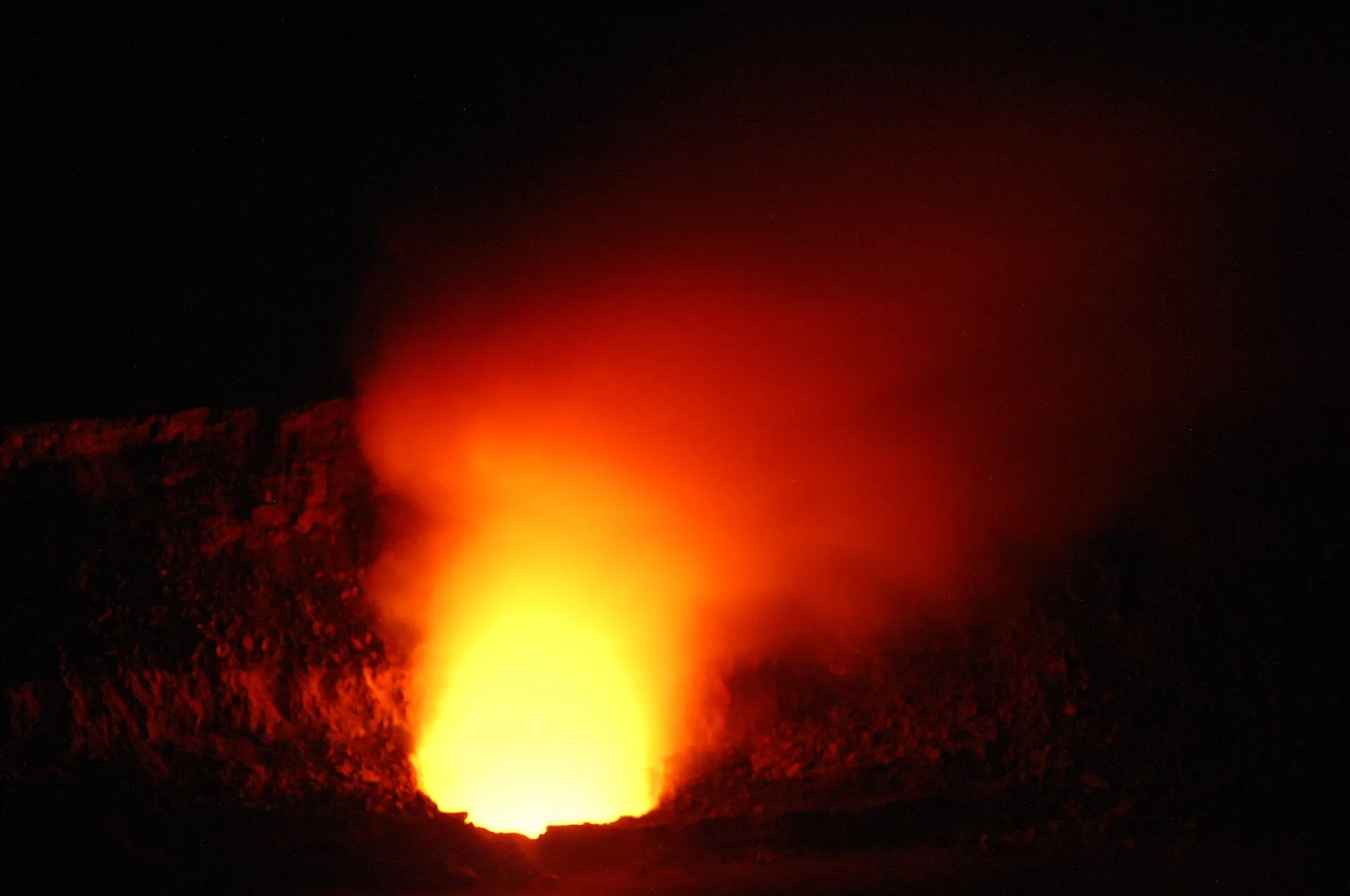
Red glow from lava inside Halemaʻumaʻu crater at night, seen from the caldera rim in Hawaiʻi Volcanoes National Park

Kīlauea today

The most-watched volcano in the United States erupts in episodes: a few hours of fountains, then weeks of glow. Whether today is one of the loud days, the USGS says – we fetch its answer every morning.

Photo: NPS · Public domain

As of October 2, 2026

Is Kīlauea erupting right now?

Officially yes, visibly mostly no. The eruption that began on December 23, 2024 is still listed as ongoing by the USGS Hawaiian Volcano Observatory (HVO), but it runs in episodes: 54 lava-fountain events so far, each generally shorter than 12 hours, separated by pauses of two weeks or more. Between episodes the two vents in Halemaʻumaʻu glow, steam and occasionally spatter – and that is all you will see. The three questions below are answered from the HVO daily update and the park's own notices; the alert level further down is fetched automatically every morning.

Paused

Is Kīlauea erupting right now?

Not fountaining. The HVO daily update of October 2, 2026 (9:45 am HST) reports no overflows and no spattering at the north or south vent in the past 24 hours, but strong glow and flames overnight. Episode 54 ended on August 25, 2026. A shallow intrusion of magma beneath Halemaʻumaʻu on the night of September 30 to October 1 did not reach the surface; 59 small earthquakes followed within a day, the largest magnitude 3.5. Episode 55 "remains a possibility" – but HVO can no longer model a forecast window for it. Alert level WATCH, aviation color code ORANGE.

Glow only

Can I see lava today – from where?

During a pause you see steam by day and an orange glow above the vents after dark – from any open overlook on Crater Rim Drive. Lava fountains and flowing lava appear only during an episode. The best-parking viewpoints according to the NPS (eruption-viewing page, updated September 8, 2026) are the Welcome Center at Kīlauea Military Camp, Kīlauea Overlook and Uēkahuna, all on Crater Rim Drive West. Details per overlook below.

Open

Is the park open – what is closed?

Open, 24 hours a day. After Hurricane Nolo the park reopened most of the Kīlauea summit and the Kahuku Unit on September 27, 2026. Still closed according to that notice: Hilina Pali Road beyond the Mauna Iki trailhead, Mauna Loa Road beyond the second cattle guard, the Kīpukapuaulu Trail and the Sulphur Banks bridge. The Kīlauea Visitor Center has been closed for renovation since February 18, 2025. Permanently closed: the caldera rim around Halemaʻumaʻu, since late 2007.

WATCH – Orange
Kīlauea alert levelUSGS Volcano Alert Level (Normal/Advisory/Watch/Warning) + Aviation Color Code · No overflows or spattering at north or south vents over the past day; strong glow and flames continue. No reactivation of intrusion emplaced two nights ago. Earthquake activity continues underneath Halemaʻumaʻu. No anomalous activity outside the summit. (update of 2026-10-02) · checked on 2026-10-03 · USGS Hawaiian Volcano Observatory (gemeinfrei)

What WATCH / ORANGE means

The USGS uses two linked scales. The Volcano Alert Level describes hazards on the ground: NORMAL, ADVISORY, WATCH (heightened unrest or an eruption under way with limited hazards), WARNING (a hazardous eruption is imminent or under way). The Aviation Color Code – GREEN, YELLOW, ORANGE, RED – addresses aircraft. Kīlauea has sat at WATCH / ORANGE throughout the episodic eruption. For visitors it means: the park is open, all lava stays inside the closed crater, and the hazards that matter are gas, tephra and Pele's hair downwind, and unstable crater rims.

How to read the status before you drive

The word that matters in the HVO update is in the first line: "paused" or "episode … began". Episodes 44 to 54 all came from the north vent, with fountains of roughly 500 ft (150 m) in episode 54 and about 1,300 ft (400 m) in episode 43 on March 10, 2026. Between daily updates, HVO posts short observatory messages when something changes. Read them, then check the webcams – if the picture shows a dark crater floor, you are driving to a glow, not to fountains.

Sources: USGS Hawaiian Volcano Observatory, Kīlauea daily update of October 2, 2026 (HANS notice DOI-USGS-HVO-2026-10-02, fetched by us every morning through the HANS API, public domain); HVO status report of October 1, 2026 on the summit intrusion; USGS definitions of Volcano Alert Levels and Aviation Color Codes. How we check is explained on How we check.
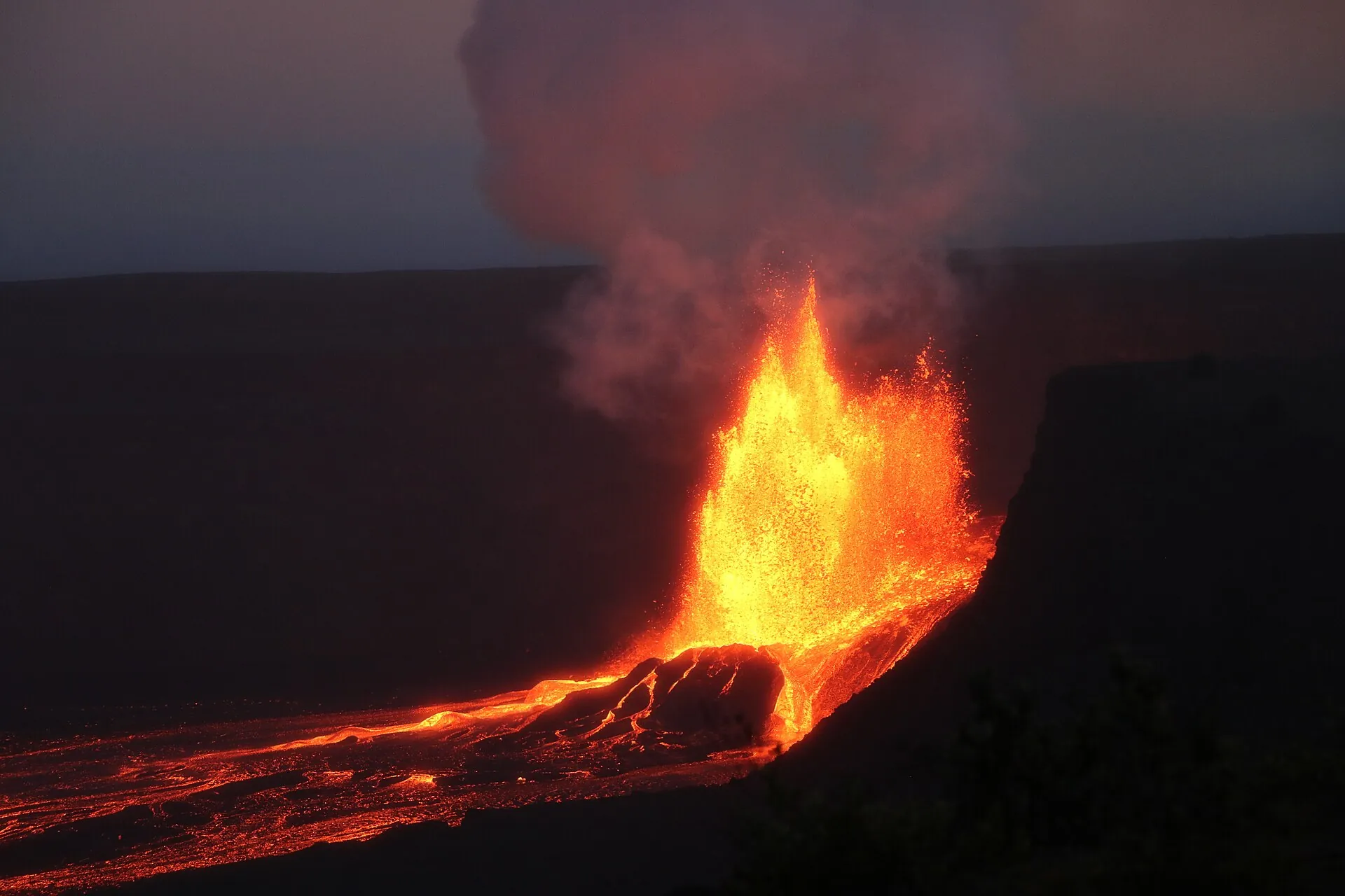
A lava fountain rising from Kīlauea's Halemaʻumaʻu crater during an eruption episode, steam and red glow over the gray caldera floor
Episode 20, May 2025: this is what the overlooks show on an episode day. Episode 54 on August 25, 2026 lasted nine hours and reached about 500 ft (150 m).

Photo: USGS / K. Mulliken · Public domain

Where to look

Can you see lava at Kīlauea today – and from which overlook?

Everything erupting since December 2024 lies inside Halemaʻumaʻu, in an area closed to the public since late 2007. So nobody walks to the lava; everyone watches it from the caldera rim, across the gray floor of Kaluapele. The NPS lists the overlooks along Crater Rim Drive as the safe viewpoints and warns that fog, rain and a change in activity can cancel the view at any time. The entrance fee covers all of them: $30 per vehicle for seven days, cards only.

Open

Kīlauea Overlook

Crater Rim Drive West, the classic view across the caldera to Halemaʻumaʻu. Named by the NPS (September 8, 2026) as one of three stops – with the Welcome Center and Uēkahuna – that usually still have parking when the lots fill after 10 am. A short walk from the parking lot; good for the night glow.

Open

Uēkahuna

The highest point on the rim, at roughly 4,000 ft (1,200 m), where the Jaggar Museum stood until the 2018 collapse damaged it beyond repair. Viewing platform and restrooms; vehicles longer than 25 ft are not allowed up here. Reopened with the rest of the summit on September 27, 2026 after Hurricane Nolo.

On foot only

Keanakākoʻi

The overlook closest to the vents, on the east side. The stretch of Crater Rim Drive between the Chain of Craters Road junction and Keanakākoʻi is closed to cars (Superintendent's Compendium of November 14, 2025) and used as a walking route from the Devastation parking lot, about 1 mile (1.6 km) each way. Rangers clear this side first during heavy tephra fall – as on March 10, 2026.

Sources: National Park Service, Eruption Viewing (updated September 8, 2026), Construction Closures and Superintendent's Compendium (November 14, 2025); NPS releases of September 27, 2026 (reopening after Hurricane Nolo) and March 10, 2026 (summit closure during episode 43). The walking distance to Keanakākoʻi is approximate.

Open or closed

Is Hawaiʻi Volcanoes National Park open today – and what is closed?

The park never closes for the night and has no timed entry, so the question is only ever about parts of it. Three things close them: storms, tephra, and construction. In 2026 all three happened.

Open

Open around the clock

Entrance: $30 per private vehicle, $25 per motorcycle, $15 per person on foot or by bicycle (under 16 free), all valid seven days; cashless only. Welcome Center at Kīlauea Military Camp 9 am to 4:45 pm. Kahuku Unit Thursday to Sunday 8 am to 4 pm – reopened September 27, 2026, trails as assessments finish. Fee-free days left in 2026: October 27 and November 11.

Closed

Closed after Hurricane Nolo (September 27, 2026)

Hilina Pali Road beyond the Mauna Iki trailhead, Mauna Loa Road beyond the second cattle guard, the Kīpukapuaulu Trail, and the Sulphur Banks (Haʻakulamanu) bridge. Separately, the NPS reported on October 1, 2026 that the 90-foot Hōlei Sea Arch at the end of Chain of Craters Road collapsed between September 23 and 27 – the road is open, the arch is gone, the cliff edge there is closed.

Closed

Closed for good or for construction

The caldera rim around Halemaʻumaʻu – the eruption zone – since late 2007. The Kīlauea Visitor Center since February 18, 2025, for a full renovation; reopening is announced for late 2026. Crater Rim Drive between Chain of Craters Road and Keanakākoʻi for vehicles. Entering a closed area is not a formality: in 2017 thirteen visitors caught inside the Halemaʻumaʻu closure were each cited $100 plus a $30 fee.

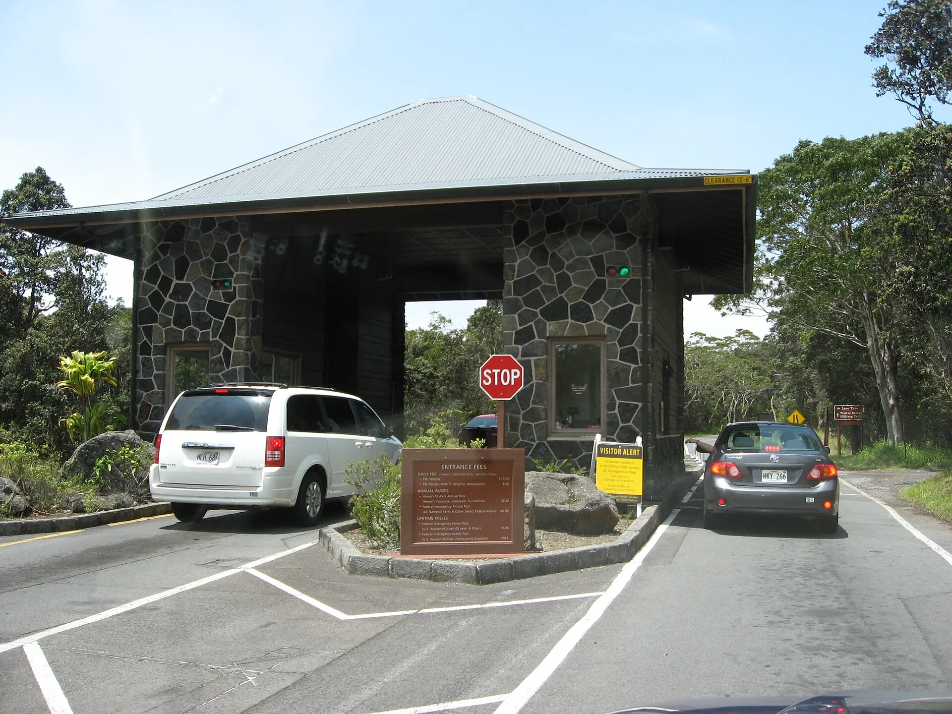
The entrance station of Hawaiʻi Volcanoes National Park on Highway 11, a car waiting at the fee booth
The entrance station is staffed by day and open by night: $30 per car, seven days, no cash. Nothing here tells you whether lava is fountaining – that is the webcams' job.

Photo: Ken Lund from Reno, Nevada, USA · CC BY-SA 2.0

The eruption so far

Kīlauea eruption episodes 2024–2026

The current eruption started on December 23, 2024, from two vents in Halemaʻumaʻu. The USGS counts 54 lava-fountain episodes through August 25, 2026; the north vent produced the last eleven. Listed here are the dates the USGS and the park have published – not every episode, but the ones that changed the rules or the picture.

  1. December 23, 2024The eruption begins

    Lava returns to Halemaʻumaʻu from two vents, north and south. From the first weeks the pattern is episodic: fountains for hours, then a pause.

  2. March 10, 2026Episode 43 – summit closed

    Fountains of roughly 1,300 ft (400 m). Tephra reaches Highway 11; the park clears the summit and the highway is closed between mile markers 24 and 40 (NPS release of March 10, 2026).

  3. July 29, 2026Episode 52

    Listed by the USGS on its eruption-information page; by episode 50 the lava had filled Halemaʻumaʻu by an average of 295 ft (90 m), up to 560 ft (170 m) at the thickest point.

  4. August 25, 2026Episode 54 – the last one so far

    10:30 am to 7:33 pm HST, nine hours of continuous fountaining from the north vent, up to about 500 ft (150 m); plume to 17,000 ft (5,200 m). Most tephra fell inside the closed area southwest of the vents; trace Pele's hair was reported in the Kaʻū district.

  5. September 7–15, 2026Precursors to episode 55

    Sluggish overflows at the north vent from September 7; from September 14 several new small vents on the northwest crater wall. HVO's status report of September 15 lays out the scenarios.

  6. September 30 – October 1, 2026Summit intrusion

    From 2 pm HST on September 30, earthquakes beneath Halemaʻumaʻu and rapid tilt changes show magma intruding in an east–west direction; the largest quake is magnitude 3.4. The intrusion ends around 4 am on October 1 without reaching the surface. HVO notes that a fissure east of the crater – as in September 2023 – remains possible.

  7. October 2, 2026Status: paused, WATCH / ORANGE

    No overflows or spattering, strong glow overnight, 59 small quakes, about 4.9 microradians of inflation in a day. Forecast windows for episode 55 can no longer be modeled. Episode 55 has not begun – whatever a headline may say.

Sources: USGS Hawaiian Volcano Observatory, daily update of October 2, 2026, status reports of September 15 and October 1, 2026, and the summary of episode 54 (status report of August 25, 2026); USGS, Kīlauea eruption information (episode 50 lava thickness, episode 52); NPS release of March 10, 2026. Episode 55: as of October 2, 2026 the USGS has not reported a start – we only list what the observatory confirms.

Air

Vog and air quality at Kīlauea today

Vog is volcanic smog: sulfur dioxide from the vents reacting in the atmosphere to a haze of fine sulfate particles. HVO puts summit emissions during pauses at 1,000 to 5,000 tonnes of SO₂ per day; during a fountaining episode they are far higher. Where it goes depends on the wind. With trade winds from the east – the forecast for October 2 – the gas is pushed over the closed southwest part of the caldera and toward the Kaʻū and Kona side of the island; when the wind drops or turns, it can sit in the summit area.

The NPS counts infants, children, pregnant women and anyone with heart or respiratory conditions among the sensitive groups and asks all visitors to check air quality before and during the visit, and to leave an area when you smell sulfur or feel your eyes and throat sting. Two bookmarks do the job: the vog dashboard of the International Volcanic Health Hazard Network, which combines forecasts with the Hawaiʻi Department of Health's monitors, and the live air-quality map of the Hawaiʻi Department of Health. On episode days add tephra and Pele's hair – strands of volcanic glass carried downwind and remobilized for days: long sleeves, eye protection, a dust mask, and do not touch the strands.
Sources: USGS Hawaiian Volcano Observatory, daily update of October 2, 2026 (SO₂ emission rates, wind forecast, tephra guidance); National Park Service, Air Quality and Safety pages; International Volcanic Health Hazard Network, vog dashboard; Hawaiʻi Department of Health, Clean Air Branch. Which coast the vog reaches on a given day is a forecast, not a fact.

Plan B

When no lava is flowing: what is still worth the drive

Most days at Kīlauea are pause days. The park was designed for them: a trail across a crater floor, a lava tube you walk through, and a road that drops 3,700 ft (1,100 m) to the ocean. None of them needs an episode, and all are covered by the same seven-day pass.

Kīlauea Iki Trail

Across the lava lake of 1959, when a fountain here reached about 1,900 ft (580 m). Loop of 3.3 to 6 miles (5.3–9.7 km) depending on the variant, 2 to 5 hours, about 400 ft (122 m) down and back up. The NPS rates it moderate to challenging: steep, rocky, with cracks and sharp lava on the crater floor. The overlook lot is tiny; the Devastation trailhead is the alternative start.

Nāhuku – Thurston Lava Tube

A lit lava tube five minutes from its parking lot on Crater Rim Drive East, walkable for anyone, open again since 2020. Together with Kīlauea Iki it makes the east side of the rim a half-day even when the crater is dark. Lighting hours are not published on the NPS pages we checked – bring a headlamp if you come late.

Chain of Craters Road

18.8 miles (30.3 km) each way from the rim down to the coast, past pit craters and the flows that buried almost 9 miles (14.5 km) of the old road. No food, water or fuel along the way; restrooms only at the Maunaulu lot and at the end. Since late September 2026 the end of the road has lost its landmark: the Hōlei Sea Arch collapsed, the NPS reported on October 1. Stay behind the ropes – the coast is unstable.

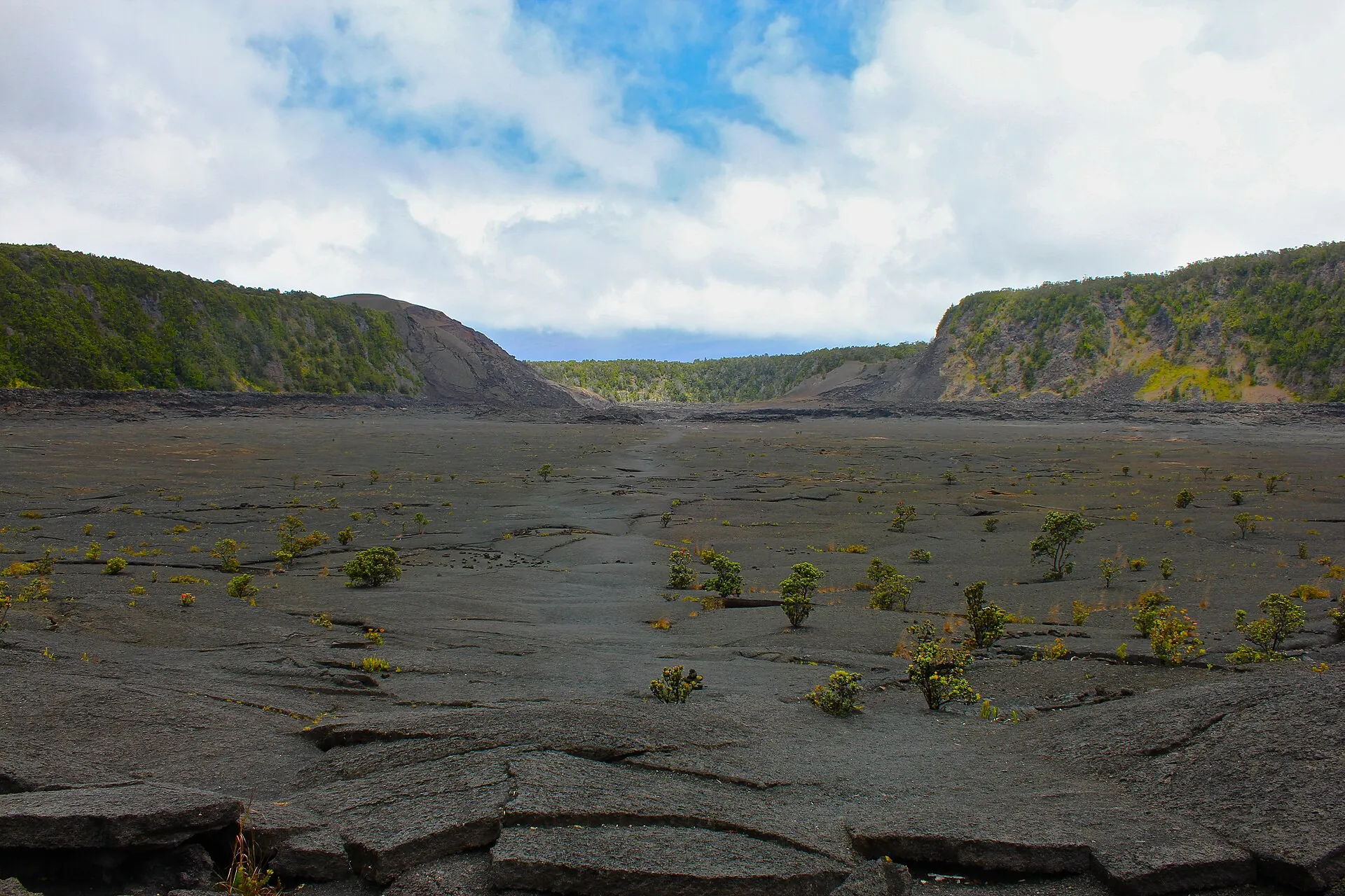
The hardened lava lake on the floor of Kīlauea Iki crater, cracked black ground with the first plants and forested crater walls behind
Kīlauea Iki: the 1959 lava lake as a trail. On a pause day this is the best thing in the park – and it does not depend on the HVO status.

Photo: Navin Rajagopalan · CC BY-SA 2.0

Live

Kīlauea webcams and livestreams

The USGS runs the cameras that answer the only question that matters before you drive: is the crater floor dark or orange? The images are public domain and refreshed every few minutes; three livestreams run on the USGS YouTube channel during fountaining. We do not embed them – the pictures should load from the observatory's servers, not ours – so here are the links, plus the two pages where HVO posts changes between daily updates.

Quick answers

Kīlauea today: the questions people ask

Is Kīlauea erupting right now?

The eruption that began on December 23, 2024 is officially ongoing, but as of the HVO daily update of October 2, 2026 it is paused: no overflows or spattering, only strong glow at the vents. The last fountaining was episode 54 on August 25, 2026. Alert level WATCH, aviation color code ORANGE. Our status box above is refreshed every morning from the USGS.

Has episode 55 started?

Not according to the USGS. On October 2, 2026 HVO wrote that episode 55 "remains a possibility" and that forecast windows can no longer be modeled after the intrusion of September 30 to October 1. A confirmed start appears first in the daily update and the observatory messages.

Can I see lava at Kīlauea today?

During a pause you can see a glow above the vents after dark and steam by day, from the overlooks on Crater Rim Drive. Fountains and flowing lava are visible only during an episode. Nobody can walk to the lava: everything is inside the closed caldera rim around Halemaʻumaʻu.

Is Hawaiʻi Volcanoes National Park open today?

Yes, 24 hours a day. Most of the Kīlauea summit and the Kahuku Unit reopened on September 27, 2026 after Hurricane Nolo; still closed per that notice are Hilina Pali Road beyond the Mauna Iki trailhead, Mauna Loa Road beyond the second cattle guard, the Kīpukapuaulu Trail and the Sulphur Banks bridge. The Kīlauea Visitor Center stays closed until late 2026; the Welcome Center at Kīlauea Military Camp is the replacement.

How much does it cost to get in?

$30 per private vehicle, $25 per motorcycle, $15 per pedestrian or cyclist aged 16 and over, each valid for seven days. The park is cashless. A Hawaiʻi Tri-Park annual pass is $55; the America the Beautiful pass costs $80 for US residents and $250 for non-residents since January 1, 2026.

Is the vog dangerous for me?

For sensitive groups it can be: the NPS lists infants, children, pregnant women and people with heart or respiratory conditions. Everyone is advised to check the vog dashboard (vog.ivhhn.org) and the Hawaiʻi Department of Health air-quality map before and during the visit and to leave an area if the air smells of sulfur. During pauses the summit emits 1,000 to 5,000 tonnes of SO₂ a day.

Can I take a boat or hike to see lava enter the ocean?

No. There is no ocean entry in this eruption; all lava is confined to Halemaʻumaʻu at the summit. Lava-boat tours and hikes to active lava belong to the 2016–2018 Puʻuʻōʻō eruption and do not exist today.

Sources · accessed on October 2, 2026