Volcano·Guide
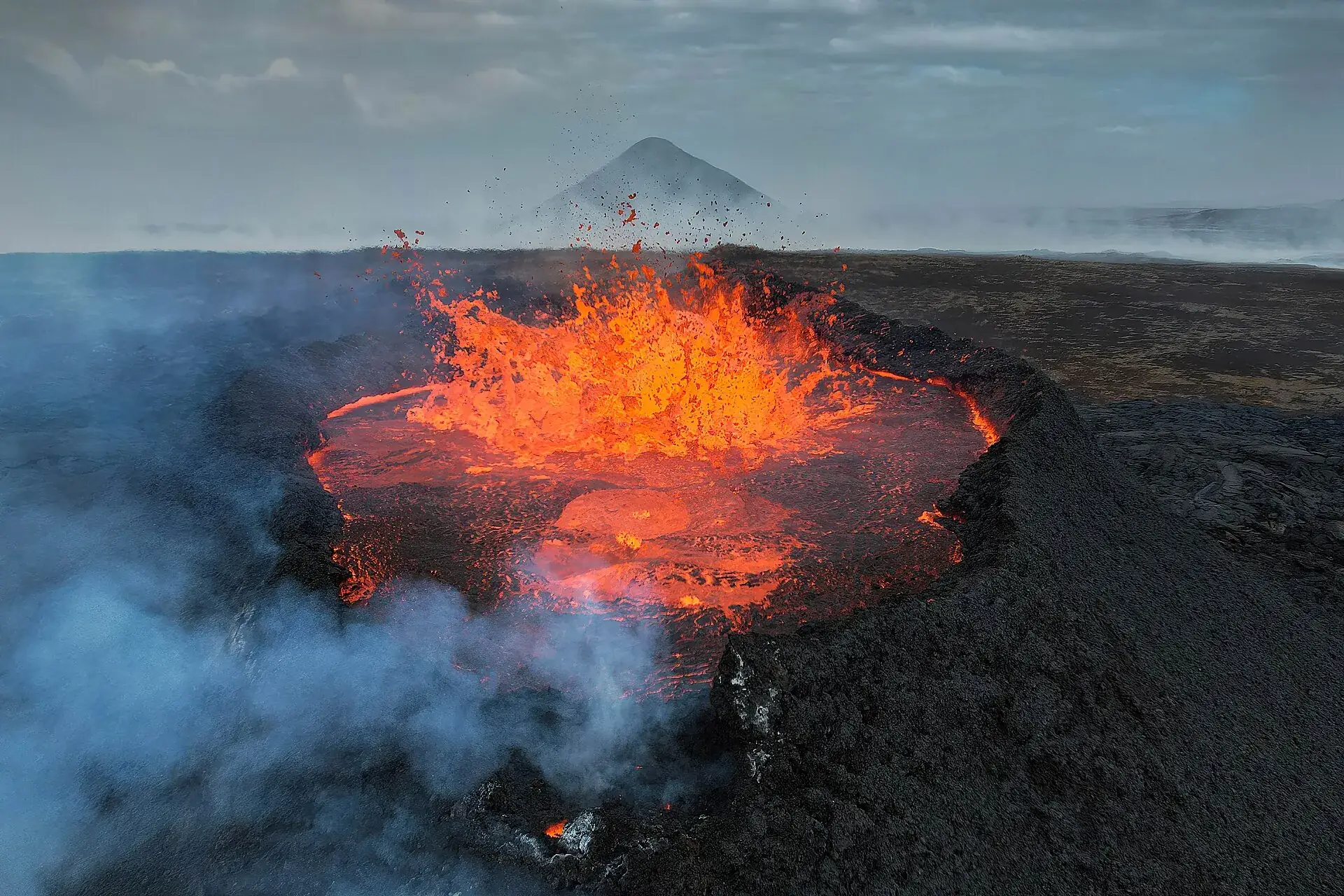
The 2023 Litli-Hrútur eruption on Iceland's Reykjanes peninsula: a crater brimming with glowing lava

Iceland volcano today

Twelve eruptions since 2021, the last in summer 2025. Whether the next one is under way is for the Met Office to say – we fetch its assessment every morning.

Photo: Giles Laurent · CC BY-SA 4.0

As of today

Is a volcano erupting in Iceland right now?

The Icelandic Meteorological Office (Veðurstofa Íslands, IMO) monitors the country's volcanoes and publishes its assessment through an open API. Two ratings matter: the VALS alert level, which describes how restless the volcano is, and the aviation colour code for air traffic. Reykjanes is the system around Svartsengi, Grindavík and the Sundhnúkur crater row; Fagradalsfjall is the older eruption area next door, the one you can visit.

no eruption

Is a volcano erupting right now?

Not as of our last check. Reykjanes has been at VALS level 2, orange, since 15 October 2025: magma is accumulating under Svartsengi, the ground is rising, but no fissure has opened. Level 3 would be an eruption in progress. The live rating from the Met Office is in the table below, fetched every morning.

open

Can I hike at Fagradalsfjall?

Yes. The marked trails from car parks P1 and P2 on road 427 to the 2021–2023 lava fields are open, no guide and no entrance fee required, parking 1,000 ISK a day. The young Sundhnúkur craters north of Grindavík are a different matter: that area is closed to the public.

operating

Is Keflavík airport affected?

No. Every Reykjanes eruption since 2021 has been a lava eruption without a significant ash cloud, and Keflavík, 20 km (12 miles) away, stayed open each time. Even an orange aviation colour code does not mean cancelled flights.

Level 2 – Orange
Reykjanes / Svartsengi – alert levelIMO Volcano Alert Level System (0 green, 1 yellow, 2 orange, 3 red) · Heightened volcanic unrest · since 2025-10-15 · checked on 2026-10-03 · Icelandic Meteorological Office (CC BY 4.0)
Yellow
Reykjanes / Svartsengi – aviation colour codeAviation color code · since 2025-08-05 · checked on 2026-10-03 · Icelandic Meteorological Office (CC BY 4.0)
Level 0 – Green
Fagradalsfjall – alert levelIMO Volcano Alert Level System (0 green, 1 yellow, 2 orange, 3 red) · Normal background · since 2025-01-01 · checked on 2026-10-03 · Icelandic Meteorological Office (CC BY 4.0)
Met Office weekly report on Reykjanes of 2026-09-30

Ground uplift continues at a slow and steady rate beneath Svartsengi. In the past 3 months about 5 cm of uplift has been measured. Seismic activity along the dike region is low. The most likely scenario continues to be that a magmatic dike will propagate from Svartsengi towards the Sundhnúkur crater row, which can result in an eruption. The Icelandic Met Office hazard assessment is valid until 5 January 2027 and remains unchanged. The earthquake swarm recorded in the Reykjanes Ridge in the previous weeks has now died out.

fetched automatically every morning · Icelandic Meteorological Office – Weekly volcano report (CC BY 4.0)

What level 2, orange, means

Clearly heightened unrest, but no eruption: magma is collecting beneath Svartsengi and the ground is rising. Level 3 would be the eruption itself. Reykjanes has been on orange since 15 October 2025 – the level does not say when it will start, only that the Met Office considers a new dyke intrusion with a possible eruption the most likely scenario.

How much warning there is

In the eruptions so far, between 20 minutes and a little over four hours passed between the first earthquake swarm and the fissure opening. That is the window in which Grindavík and the Blue Lagoon are evacuated, the sirens sound and roads 43 and 427 are closed. Anyone in the area follows police instructions – and does not drive towards the plume.

What the aviation colour code does not mean

Yellow or orange on the aviation colour code does not mean flights are cancelled. The Reykjanes eruptions since 2021 have been lava eruptions without a large ash cloud; Keflavík airport, 20 km (12 miles) away, stayed open every time. The image of ash-induced flight chaos comes from Eyjafjallajökull in 2010 – a different volcano, a different type.

Sources: Icelandic Meteorological Office, Volcanoes API (VALS and Aviation Colour Code, CC BY 4.0), weekly report and situation update of 15 September 2026; the IMO hazard map is issued for a limited period and reissued at intervals. How we check is explained on How we check.

What is open

Grindavík, Fagradalsfjall, Blue Lagoon: what is open today

Closures are ordered by the police commissioner of Suðurnes together with civil protection, based on the Met Office hazard map. They are not available through any API; we check this status by hand, most recently on 21 September 2026. If the alert level above changes, something here has probably changed too.

open

Fagradalsfjall – the trails to the 2021–2023 lava fields

Marked trails from car parks P1 and P2 on road 427, no guide, no entrance fee. From the Nátthagi trail (2 km / 1.2 miles) to the full-day hike to Litli-Hrútur. Parking 1,000 ISK per day, camera-monitored, paid through Parka. Never walk onto the lava – the crust can be thin.

open

Grindavík

Accessible without checkpoints since 21 October 2024, at your own risk. There are fissures in the ground beneath the town, so stay on the roads and note the exits. If the sirens sound, leave immediately. The police commissioner does not consider the town a safe environment for children.

operating

Blue Lagoon

Open, but sitting in the middle of the Svartsengi hazard zone. With every new magma intrusion it is evacuated as a precaution – several times in 2024. If you have a booking, check the alert level above and the operator's notices on the morning of your visit.

closed

Sundhnúkur crater row

The area of the nine eruptions since December 2023, north of Grindavík, is closed to the public. There is no trail to the young craters; anyone who wants to see glowing lava will currently only find it at the Lava Show in Reykjavík.

Checked on 21 September 2026: Safetravel (Landsbjörg), “Eruption in Reykjanes”; Visit Reykjanes, Eruption Information and Grindavík; Parka (parking tariff); notice of the police commissioner of Suðurnes of 31 July 2024 (legal basis: Art. 23 Civil Protection Act). On the morning of your visit, also open safetravel.is.
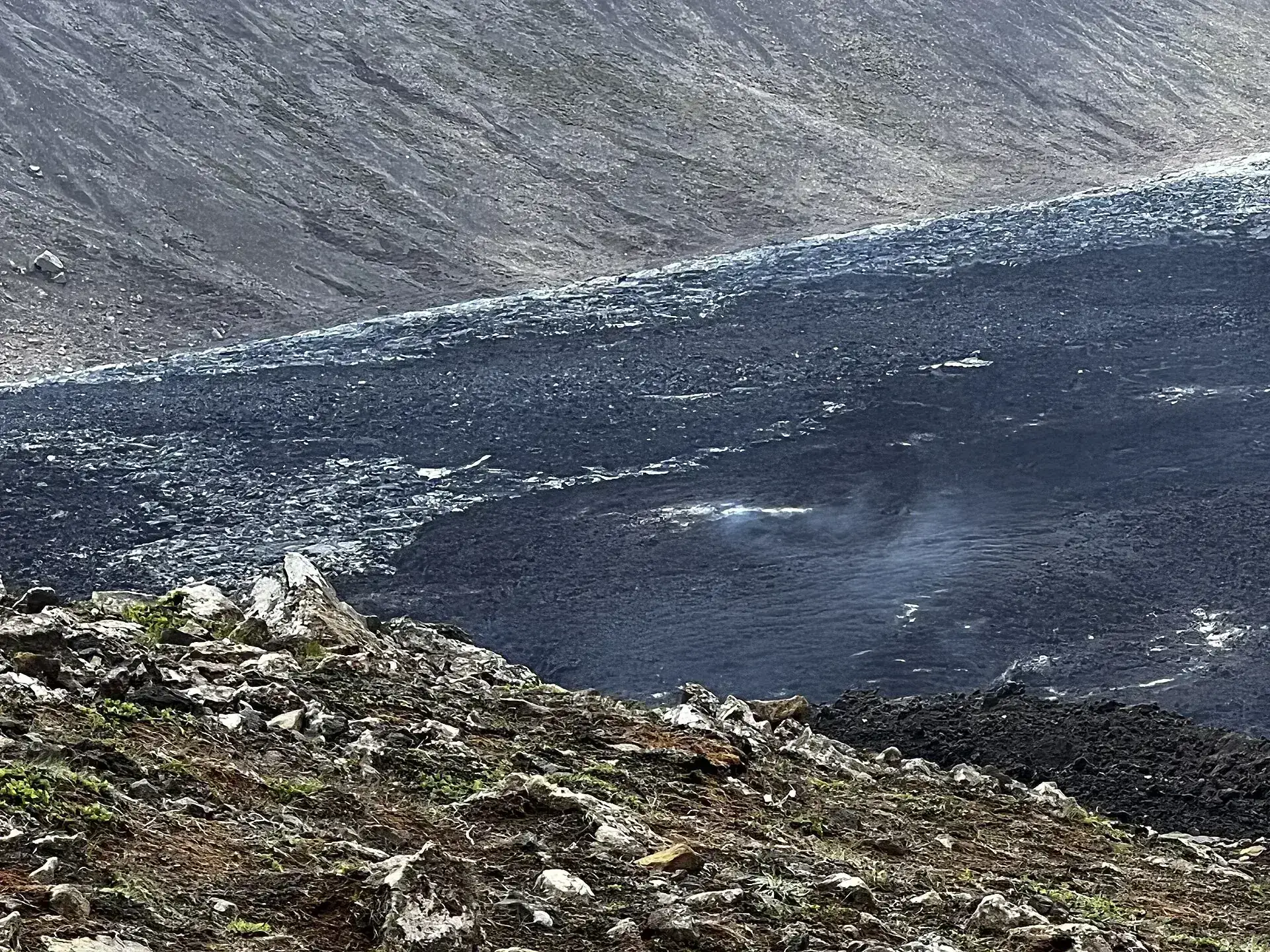
Fresh lava flows at Fagradalsfjall, glowing beneath a dark crust
The 2021 lava at Geldingadalir. Today it is black and cold – but still not safe to walk on; it can be hot underneath.

Photo: Stefan mohanu · CC BY-SA 4.0

The series

Iceland volcano eruptions: every Reykjanes eruption since 2021

For eight hundred years the peninsula was quiet. Since 2021 the ground has torn open every few months – first at Fagradalsfjall, where tens of thousands came to watch, then at the Sundhnúkur crater row, where the lava reached a town. The timeline in brief.

  1. 19 March 2021Geldingadalir – the first eruption

    After some 800 years, a volcano erupts again at Fagradalsfjall. It lasts six months, with hiking trails right up to the crater rim; the lava fields from then are today the destination of trails A and C.

  2. 3 August 2022Meradalir

    The second eruption at Fagradalsfjall, three weeks long, in the valley next door.

  3. 10 July 2023Litli-Hrútur

    The third and so far last eruption at Fagradalsfjall, a good three weeks. Afterwards the activity shifts west, beneath Svartsengi.

  4. 10 November 2023Grindavík is evacuated

    A magma dyke pushes beneath the town, roads and houses crack. 3,700 people leave Grindavík in a single night. Most do not return permanently.

  5. 18 December 2023Sundhnúkur – the first of nine

    A four-kilometre (2.5-mile) fissure opens north of Grindavík. On 14 January 2024 lava reaches the edge of town and destroys three houses; further eruptions follow in February, March, May, August and November 2024.

  6. 21 October 2024Grindavík reopens

    The checkpoints come down and the town is open to everyone – at your own risk. The Blue Lagoon keeps operating between evacuations.

  7. 1 April 2025The fissure reaches the town

    The eleventh eruption of the series begins with a fissure that runs right up to the protective barrier in front of Grindavík. Town and lagoon are evacuated once more.

  8. 16 July to 5 August 2025The most recent eruption

    Twelfth eruption since 2021, ninth on the Sundhnúkur row. Afterwards the aviation colour code drops back to yellow; the uplift beneath Svartsengi starts over.

  9. 15 October 2025Alert level orange

    The Met Office sets Reykjanes to level 2 in the new VALS system. In September 2026 it puts the magma accumulated since July 2025 at around 29 million cubic metres – enough for another eruption. Whether it has come to that is shown in the alert level above.

Sources: Icelandic Meteorological Office, situation update of 15 September 2026 and Volcanoes API; Visit Reykjanes, Eruption News; Safetravel; eruption dates of the series from the chronology of the Sundhnúkur eruptions (secondary source, cross-checked against IMO announcements). Number of evacuees and destroyed houses from press reports of November 2023 and January 2024.

Quick questions

The most common questions about Iceland's volcanoes today

Is a volcano erupting in Iceland right now?

The answer is in the first line at the top, updated every morning: level 3 would be an eruption in progress, level 2 is heightened unrest without an eruption. The most recent eruption lasted from 16 July to 5 August 2025; since then magma has been accumulating beneath Svartsengi again.

Can I hike to the volcano?

To the cooled lava fields at Fagradalsfjall, yes – on marked trails and without a guide. To the young Sundhnúkur craters, no; the area is closed. If an eruption is under way, the police and civil protection decide day by day whether and where watching is allowed – during the Sundhnúkur eruptions so far, it has not been.

Is Grindavík open?

Yes, since 21 October 2024, without checkpoints and at your own risk. The town is largely abandoned and there are fissures in the ground. With a new magma intrusion it is evacuated within minutes.

Will my flight be affected?

Going by everything the series since 2021 has shown: no. These have been lava eruptions without significant ash, and Keflavík stayed open every time. It would be different with an eruption beneath a glacier such as Katla – but that is a separate volcanic system, which the Met Office rates separately.

Are there webcams?

We do not show our own images from Iceland; unlike the INGV at Etna, there are no freely reusable official cameras. During an eruption the broadcaster RÚV and mbl.is stream live pictures, and the Met Office shows its hazard map on vedur.is.

How up to date is this page?

We fetch the alert levels and aviation colour code daily at 6 am; the Met Office weekly report is published on Wednesdays and taken over the next morning. The status of Grindavík, the trails and the lagoon we check by hand, most recently on 21 September 2026. An eruption can begin in the hours between two fetches – so also check safetravel.is on the morning itself.
Sources · accessed on 25 September 2026